Foxes Lair
  • Home
  • About
    • About Foxes Lair
    • History
    • Landscape and Soils
  • Things To Do
    • Picnic Spots
    • Walk Trails
    • Visit the Arboretum
    • Ride Your Bicycle
    • Scavenger hunt
    • Geocaching and Orienteering
  • Things To See
    • Wildflowers
    • Trees in the Narrogin district
    • Birds
    • Vertebrates
    • Narrogin spiders scorpions ticks
    • Fungi and lichens
  • Foxes Lair seasonal guide
    • December to March
    • April - May
    • June-July
    • August
    • September
    • October
    • November
  • Other great reserves
    • Railway Dam
    • Yilliminning Rock
    • Old Mill Dam
    • Yornaning Dam
    • Contine Hill
    • Highbury Reserve
    • Boyagin Rock
    • Barna Mia
    • Toolibin Lake
    • Newman Block
    • Harrismith Nature Reserve
    • Candy Block
    • Tutanning Nature Reserve
  • 1Foxypress
    • Foxypress
    • Vanishing Farms
  • Contact

Trecarne Farm HIghbury

11/9/2018

0 Comments

 
​Trecarne Farm was initiated by Charles Henry Hoffman who was born in Bonn Germany in1863. In 1904 he purchased a 500 acre bush block from the family of his wife (Anne May Oliver) at 2/6 an acre. As Charles had been a greengrocer in Germany, the family started to grow vegetables while the land was being cleared. The market garden remained their chief livelihood, and son, Bill was well known in Narrogin for his fine quality fresh vegetables. The farm remained in the Hoffman family until the 1990’s.
The house is built in 1906 from mud bricks with bush timber poles in the roof. Many later additions and repairs followed and it was intact when listed in the Municipal Heritage Inventory in 1995.
Further information can be found in ‘Wolwolling’ Reflections by Gwen Warren and ‘The Way Through’ by Ossie Pustkuchen.
 
For a photo tour of this site see Google Photo images on https://photos.app.goo.gl/KgNsZZP5NAnUhc8k9
Click first image to open and then go forward/backward 
Picture
1995
Picture
2018
Picture
Picture
Picture
Picture
Picture
0 Comments

ALDINGA FARM STRATHERNE

25/8/2018

1 Comment

 
At a Glance:
  • Aldinga was one of the first farms developed in this area.​
  • Lovely old house and sheds. Note private property.
  • The Aldinga/Stratherne school was situated in the reserve on the opposite side of the road. It took four attempts to get approval for the school.
Aldinga is a historic farm that is located in the intersection of the Cuballing, Pingelly, and Wickepin shires. 
The property was named by John and Margaret McBurney who travelled across from Aldinga South Australia in 1902. They initially leased land from a Mr (John?) Snow, which may have been Aldinga. They established a house and for a while, a little retail store on the farm that supplied canned food, tobacco and tools of trade to sandalwood cutters, teamsters, kangaroo hunters, surveying teams and Noongars. This closed later as roads became available to the various centres
.
​
The original Aldinga house has been flattened and a fine new one built that is now also empty. Keith McBurney told me that the present car port covers the old Stratherne telephone exchange,  which even had a cellar.
The house and shed area has a crumbling splendour with a particularly fine granite stone shed. A well in the creek by the house would have been the reason a house was built here.
For a photo tour of this site see Google Photo images on https://photos.app.goo.gl/qev2q4RMKLiBRgbP6

Picture
Granite block shed
Picture
Collapsed mud brick shed
Picture
Unoccupied second house, which was built over the original
 In 1905 the Aldinga school was established on a reserve over the road.
It took four attempts to make a successful application to the government. ('Numbat Country: The Story of the History of Cuballing from Early Times to 1997' page128)
  1. The first application was lost in a house fire
  2. The scond one was being taken to Perth by Rev. Gillet when he took ill and died.
  3. The third was delivered, approved, signed but not acted on
  4. The fourth was successful
  In 1928 the named was changed to Stratherne school, which  operated until 1936. Today all that remains is a plaque and a mound with a few jonquils.

Picture
Picture
Red loam 'long padddock' over weathered dolerite dyke through a granite ridge
Picture
Rock vein in granite
​​ John’s son Amos built a separate fine house further east at the base of Woodebulling Hill. An exceptionally good spring in the hill provided an abundant water supply that is evident by the numerous water tanks around the house.

The hill is impressive with interesting geology. Granite is fractured and intruded by veins and a huge east-west dolerite dyke, which has weathered to a line of fertile red brown loam soil that has been cleared to make a “long paddock". Elsewhere springs and salt patches frequently occur from water flowing through fractured granite being brought to the surface by impervious dolerite.
PictureAmos McBurney's house

  The house was relatively intact until relatively recently, but termites and the wind have reduced it to a shell. Nearby is another picturesque ruin of a shed complex, which indicates that this is was once the site of an earlier farm.
John Forest walked through this area. The survey team would place a survey peg at the camp site at the end of each day. Amos found one, which was held by Bill Butler before he died.
 
For a photo tour of this site see Google Photo images on
https://photos.app.goo.gl/kupPuzDZvEWBGVLN6

Picture
Picture
Picture
Picture
Picture
Picture
1 Comment

Boondyne Spring

3/8/2018

1 Comment

 
Picture
Greetings fellow Foxies,
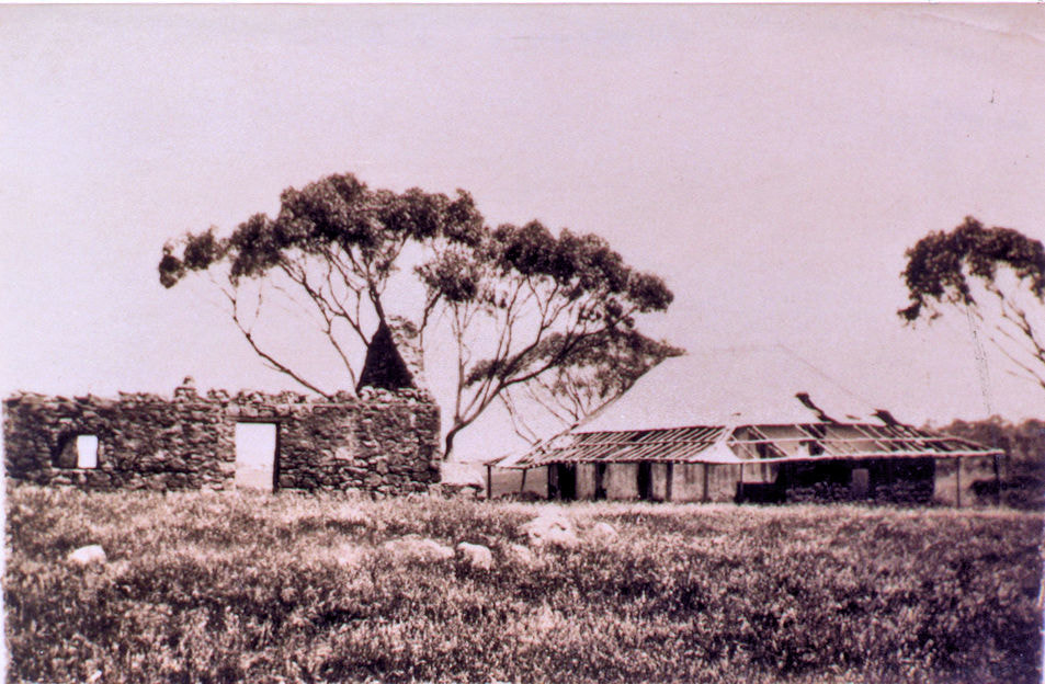
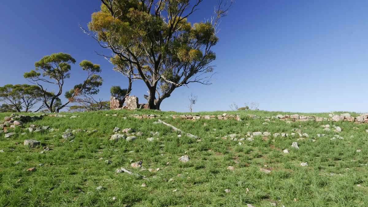
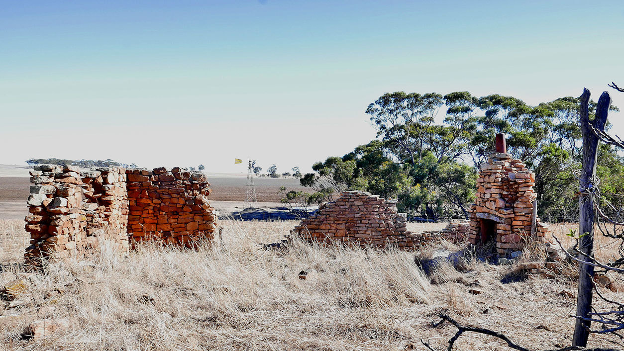
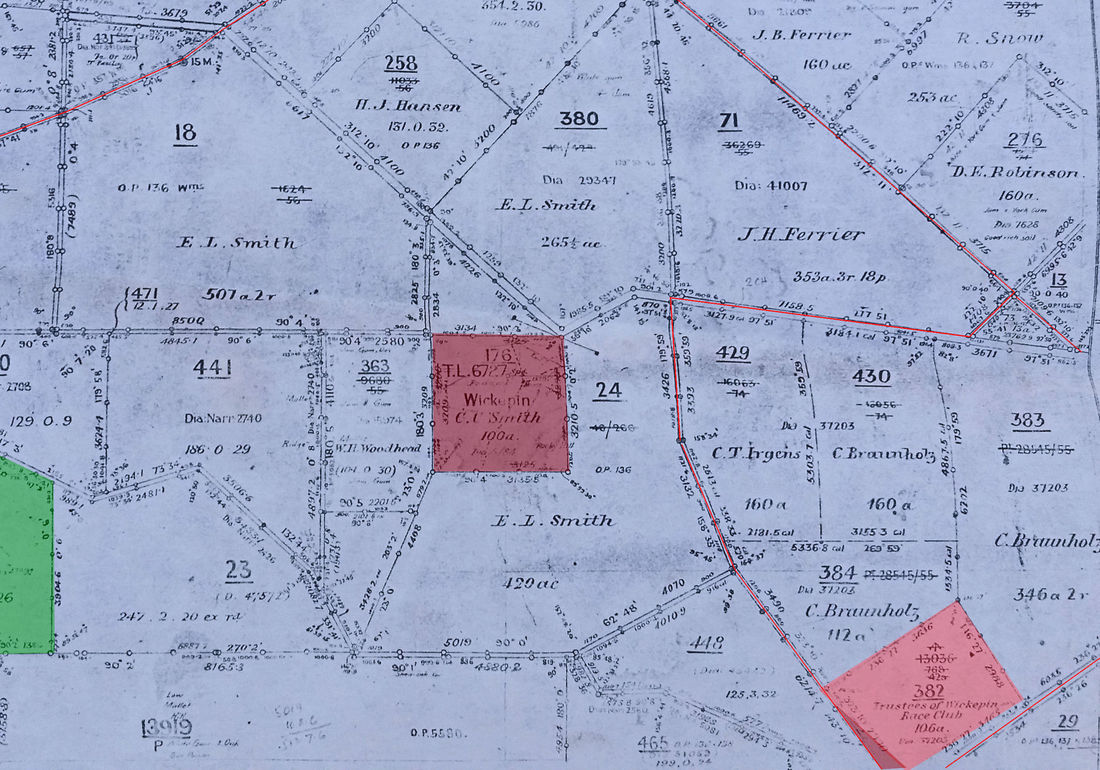
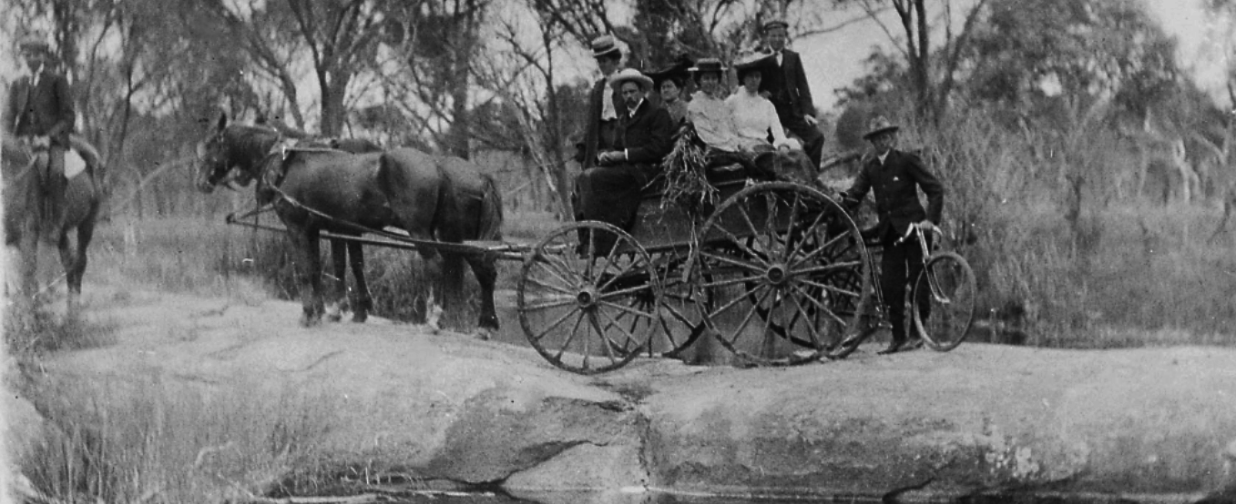
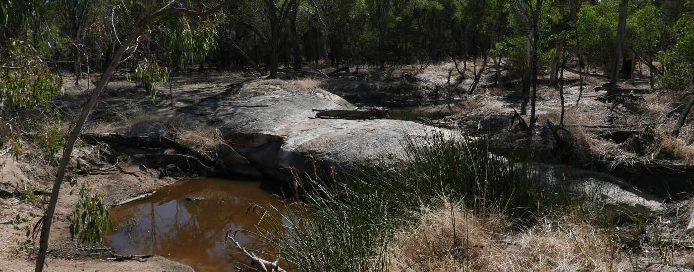
This picturesque ruin can be seen from the road on private property upslope of the creek containing Boondyne Spring (one of the earliest known springs east of Narrogin). In Ossie Pustkuchen’s book “The Way Through’, Michael Brown (“the father of Narrogin”) purchased a 4,000 acre (1600 ha) property Boondyne around 1890 to add to his extensive land empire. The 1894 lithograph shows it as Boundyne spring, and the Boundain railway siding was apparently named after the spring/farm.
I’m not sure who built the house. There is an intriguing mention of a shepherd Thos. Pennyfather at the spring in 1885, which predates the house, and may account for a quaint one-room building at the back. Neither Michael Brown nor his son Jack (who farmed the property) lived there. I suspect it was built for the next owners, the Leyden brothers.
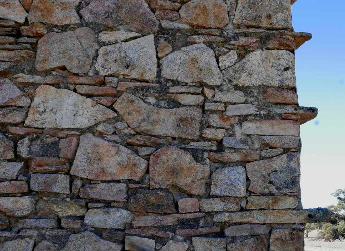
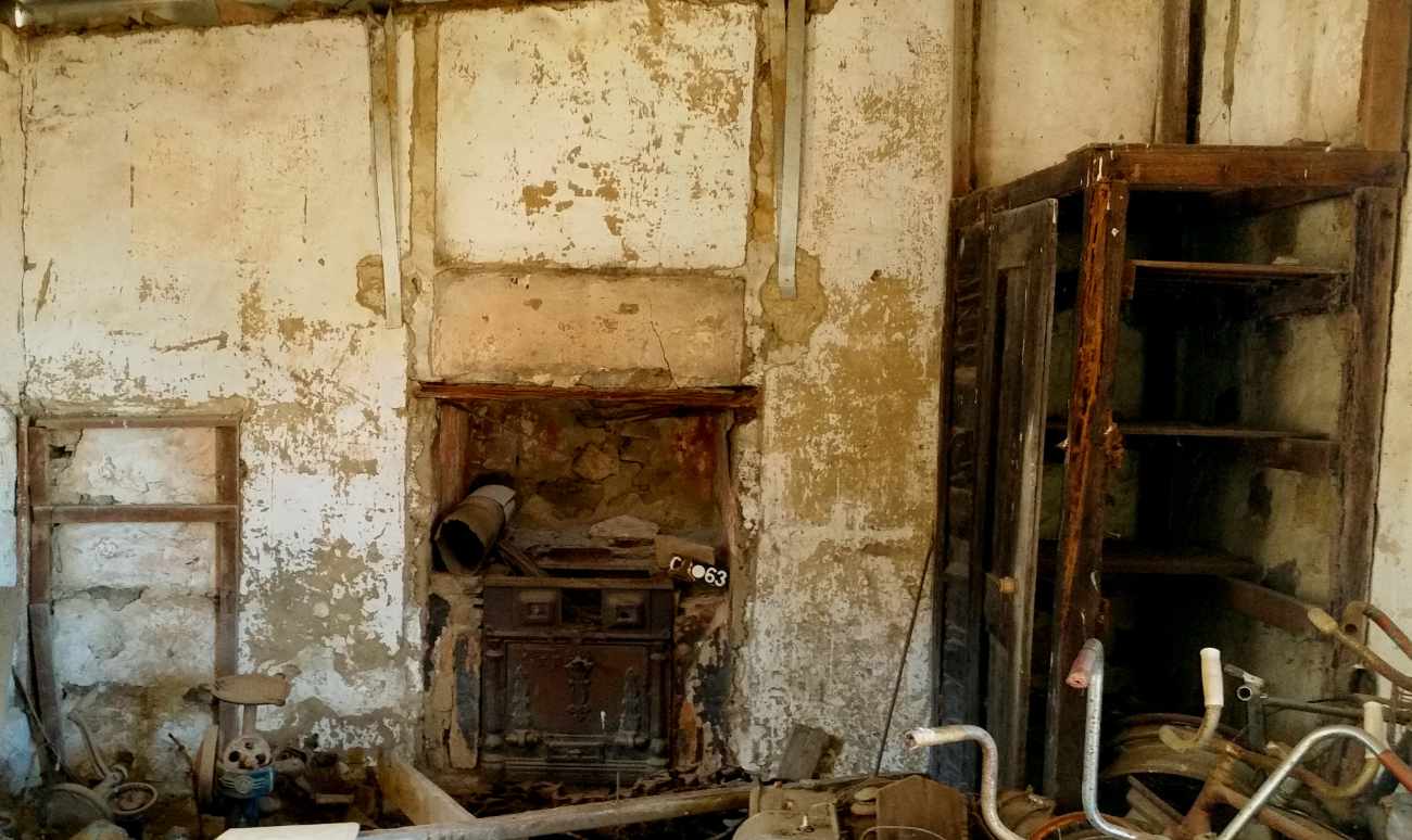
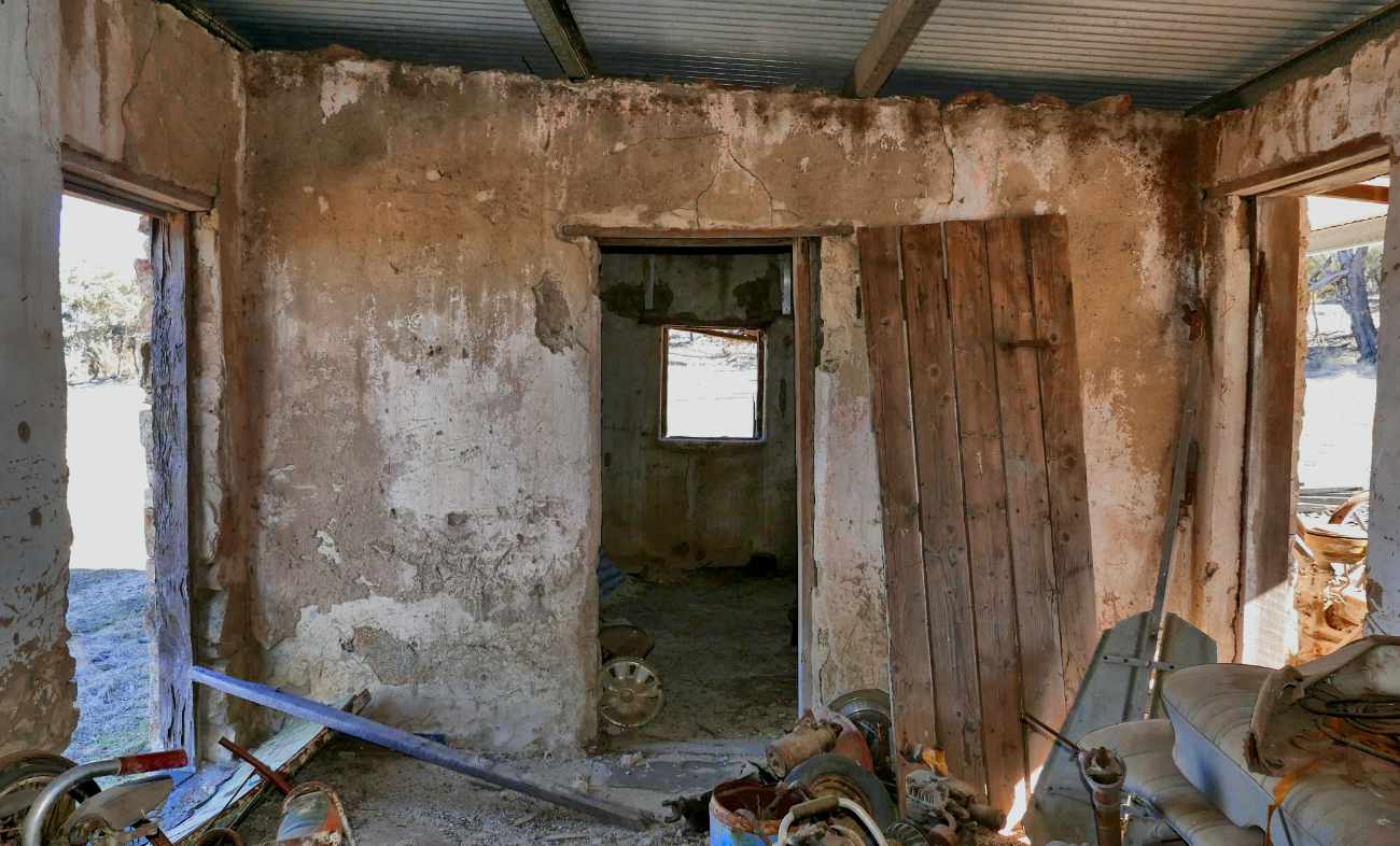
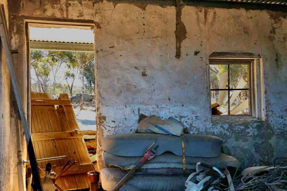
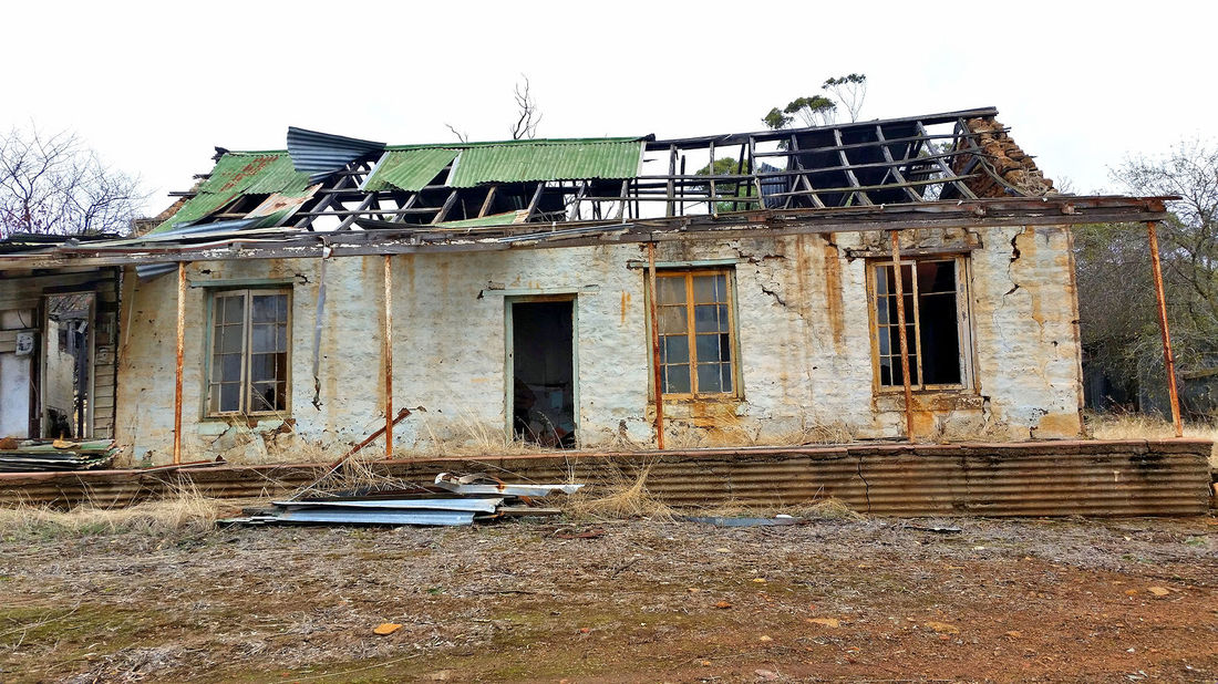
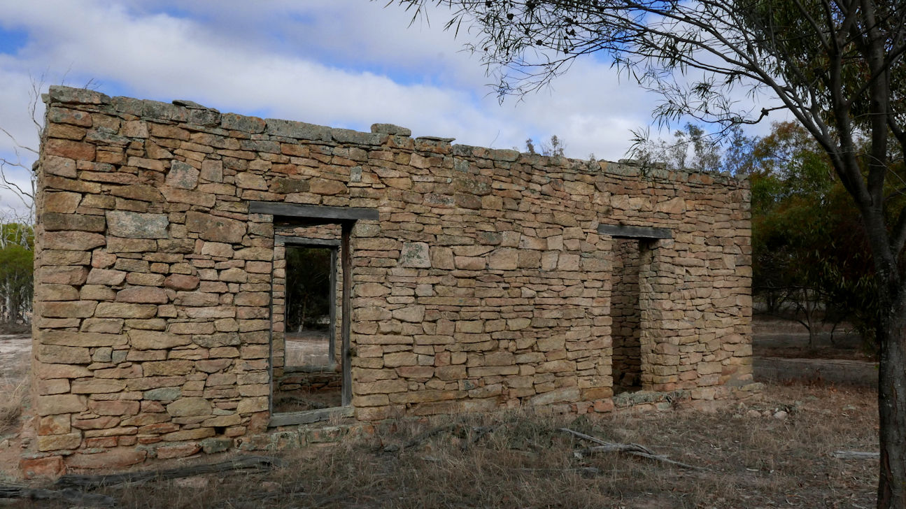
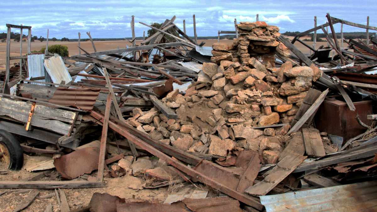
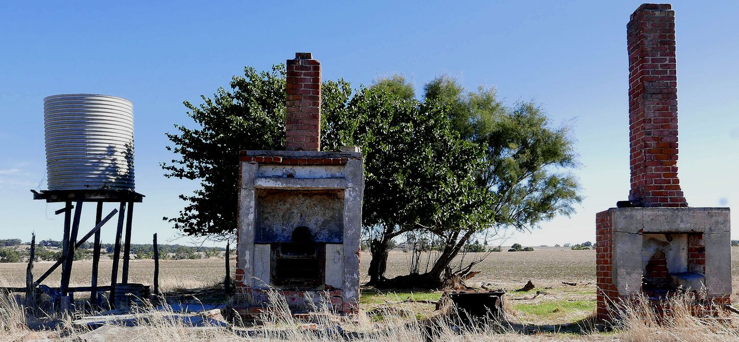
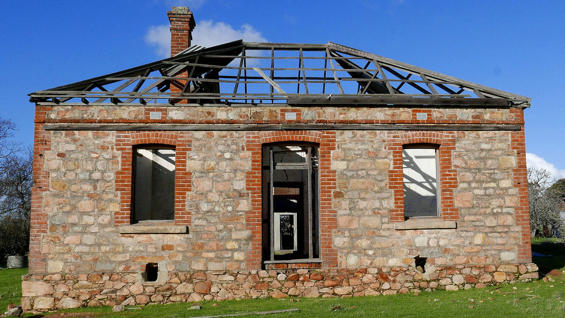
The main house is a beautiful three-bedroom granite and brick place that would have been a fine house in its heyday. Wooden floors have mainly rotted away, but most walls are still intact and retain traces of attractive pastel kalsomine colours. The soil under the floorboards had an interesting layer of fossilised rat poo

Picture
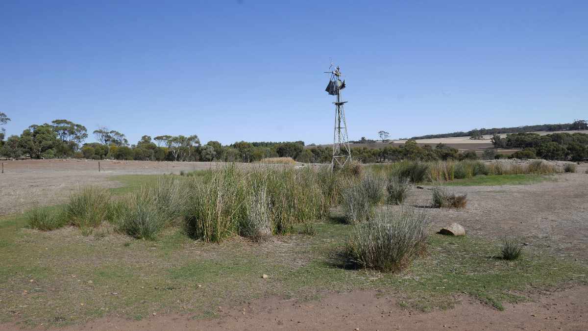
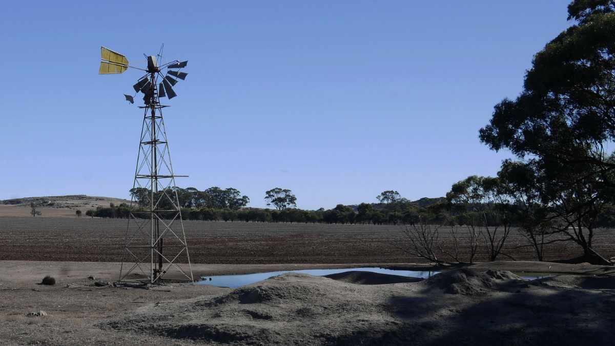
On one side is a large rock-lined well, and downslope are ancient survivors of an extensive orchard.
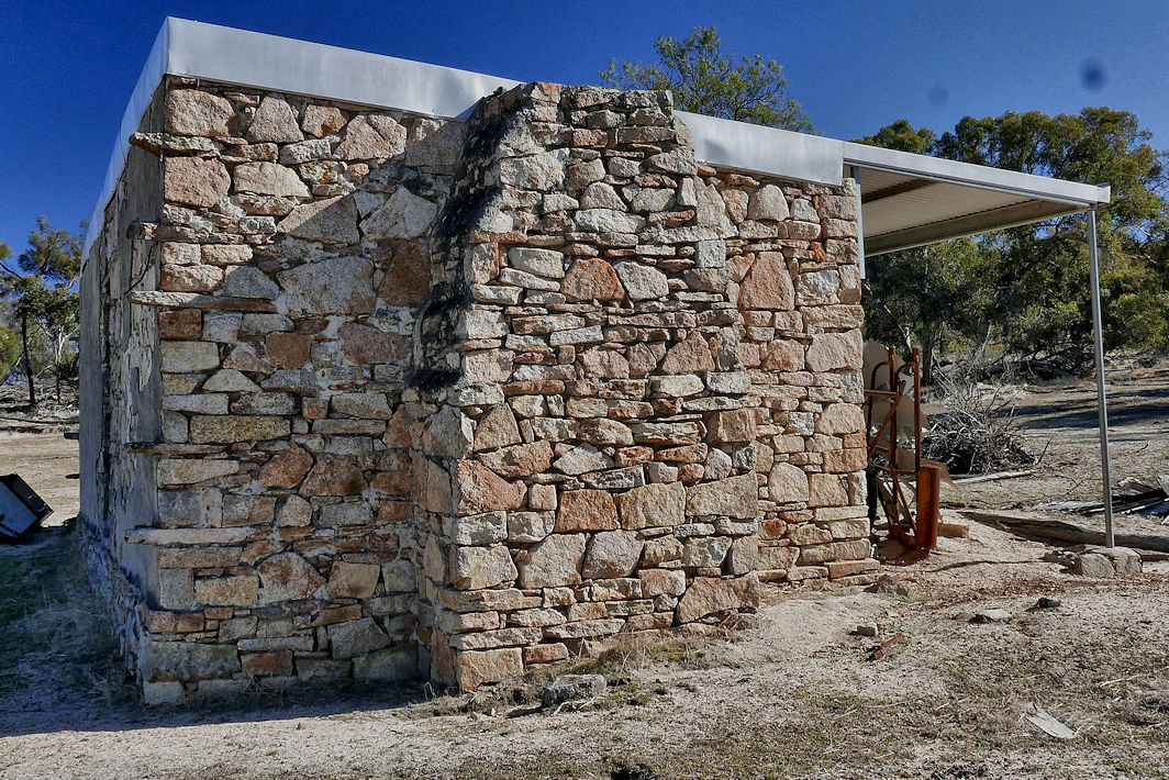
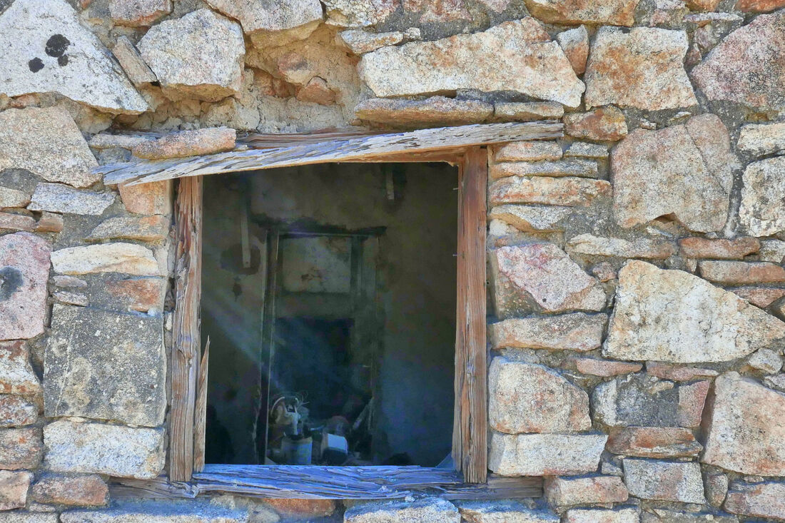
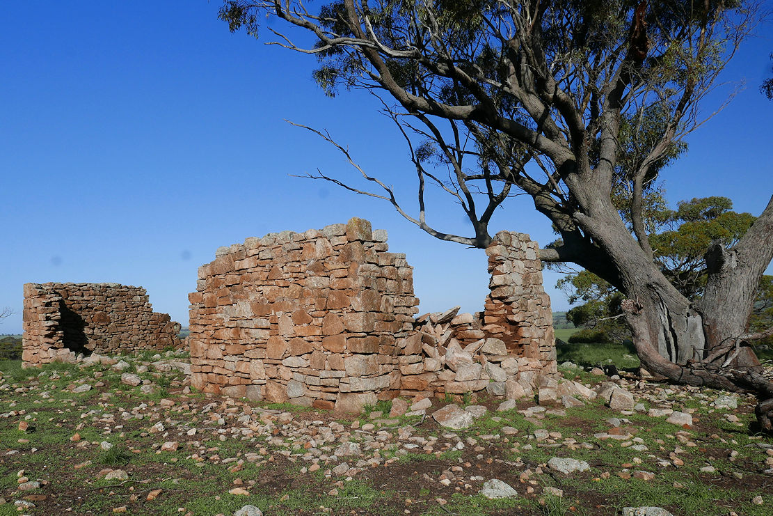
At the rear is a quaint, low, partially-collapsed, one- room, granite block structure. The carefully built windows lead me to think that it was a cottage, but the end that may have contained a fireplace has collapsed.
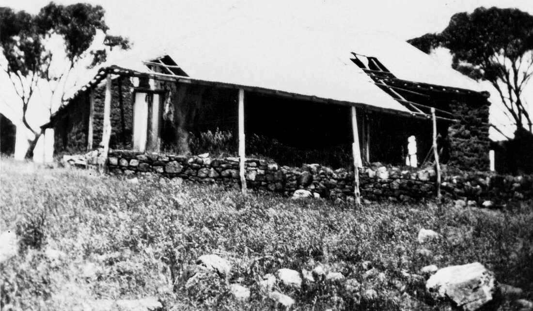
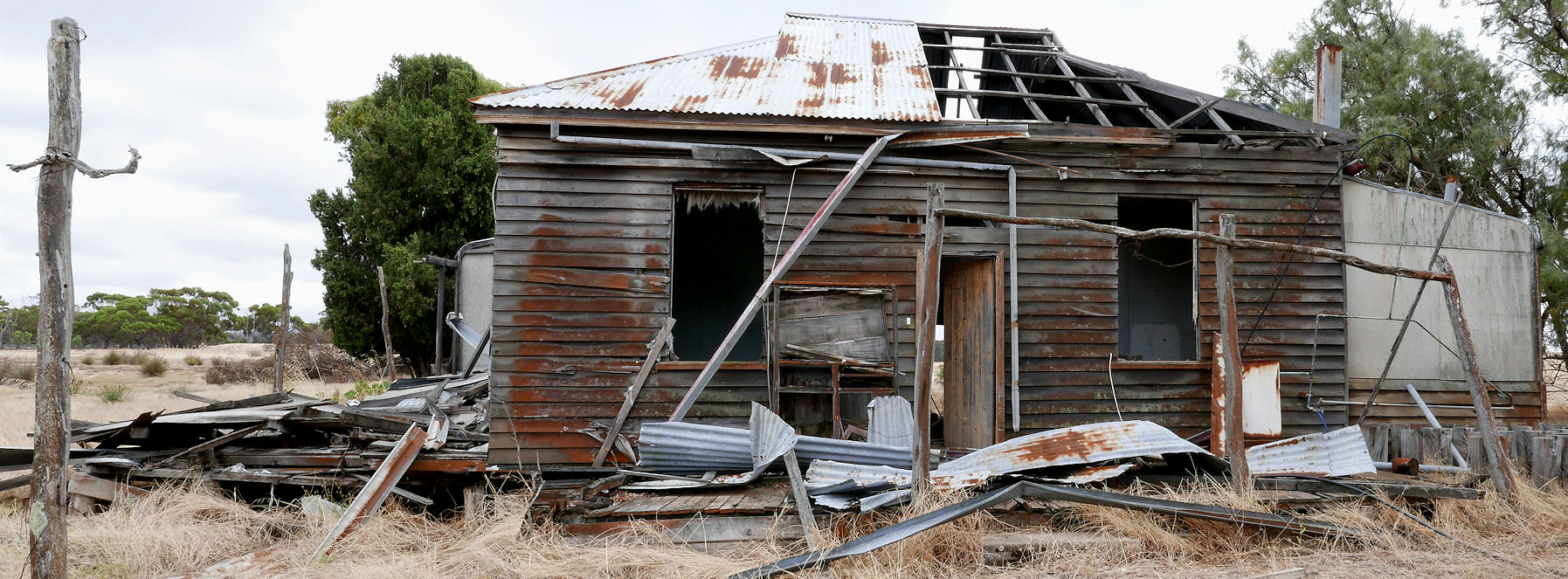
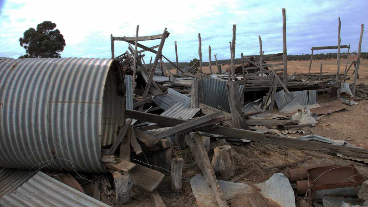
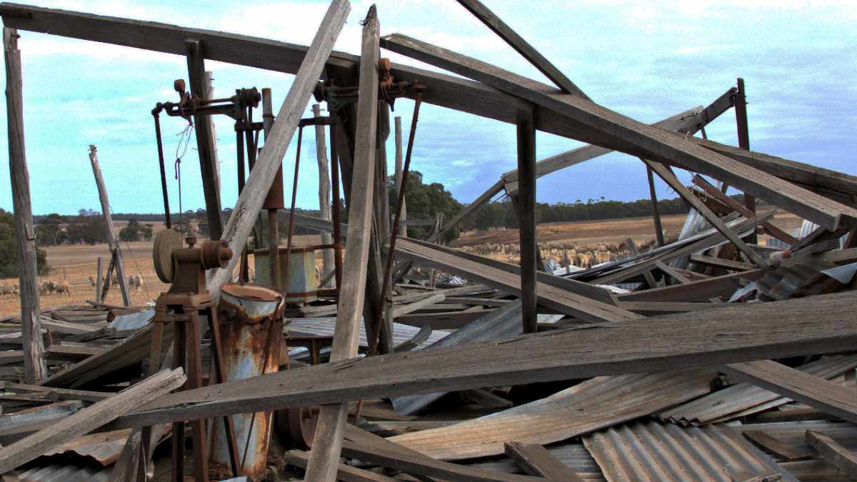
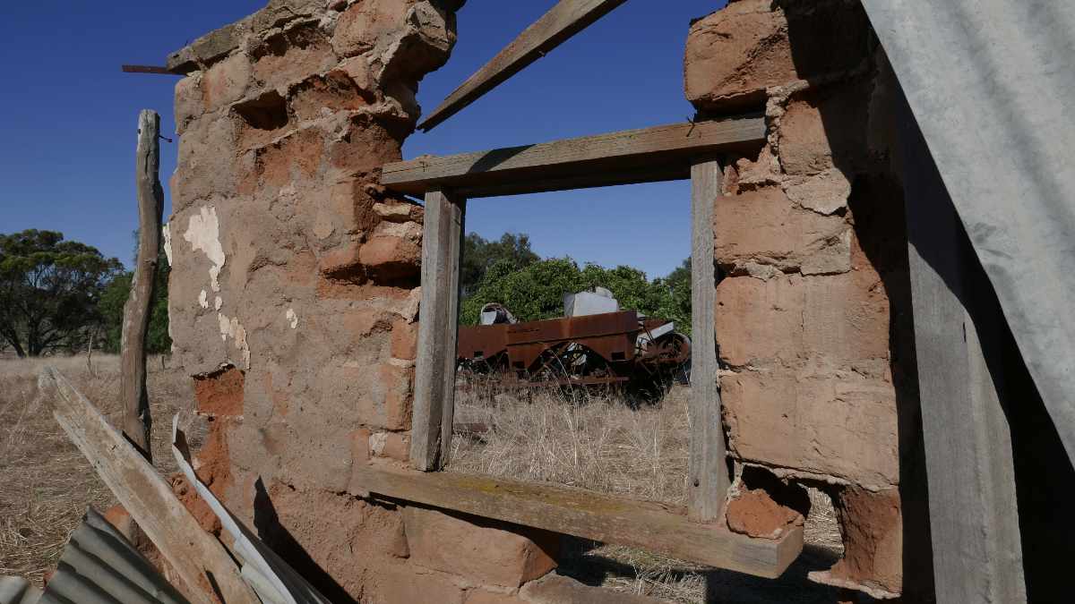
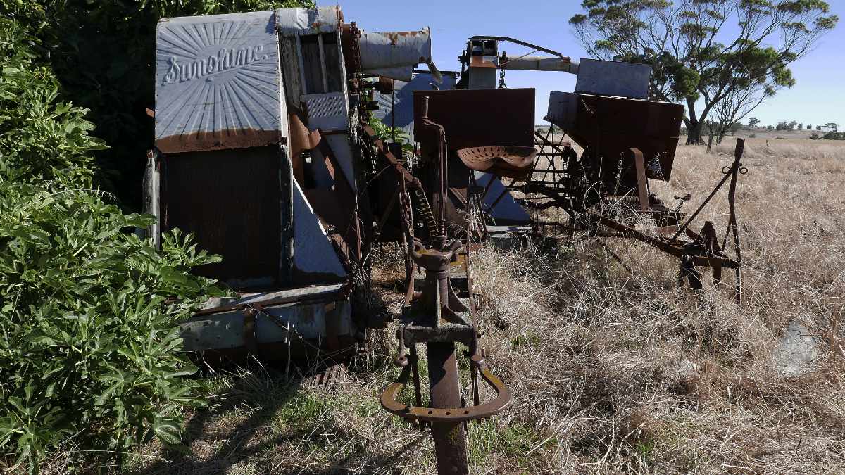
About 200 metres away is the remains of a very early shearing/ machinery shed built from forked wandoo log uprights  supporting long log rafters that are wired on without nails.

Picture
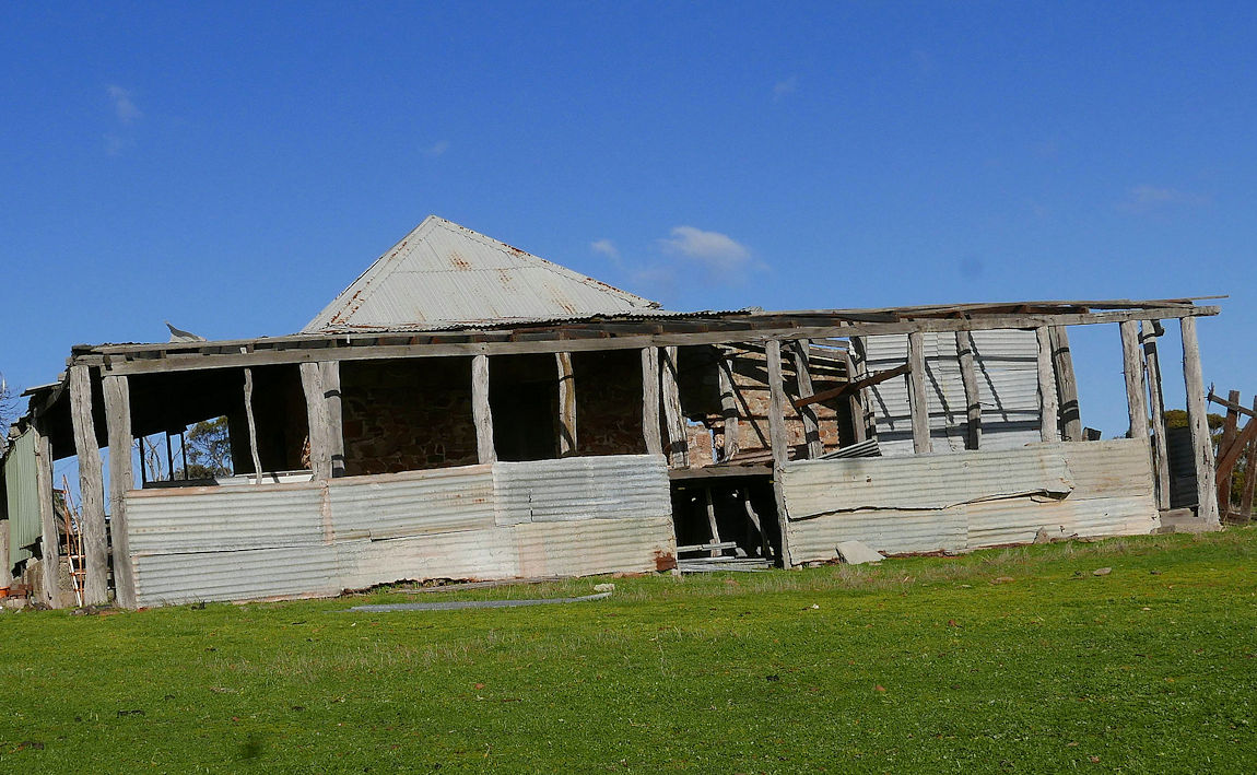
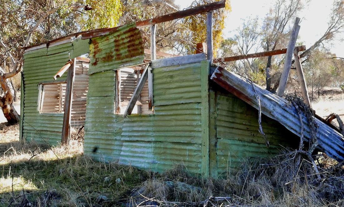
Another building further along is a mystery. A granite central room that still has its roof has no windows and a door normally found on a barn. Wood and corrugated iron extensions are intriguing.
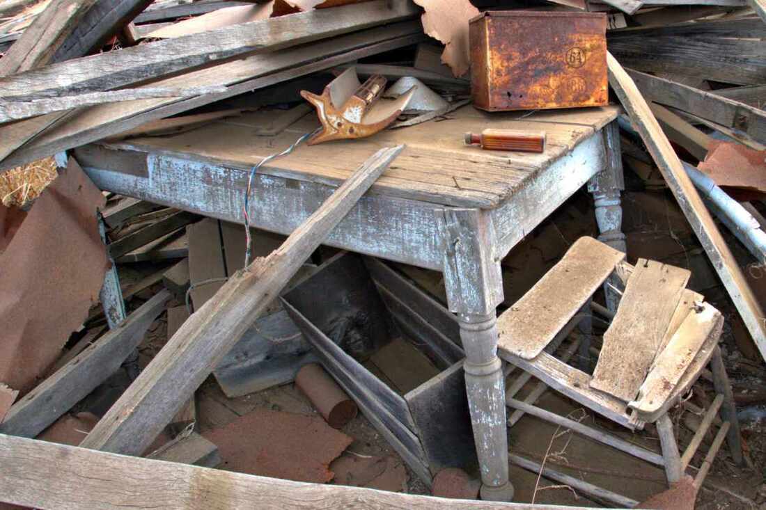
On the north side a cement floored area contain signs of more recent occupation by a rather versatile person. Some innovations include a bicycle wheel TV antenna and a shower inside a corrugated iron water tank.
The western annexe has a raised area used as a sheep pen that led to a hole in the wall to an open cement floored area facing south. Traces of a long bench make me think that it may have been used for butchering.


I hope that more information comes forward to unlock the mysteries of this fascinating place.
 For a photo tour see  Google Photo images on https://photos.app.goo.gl/4vPq9ov6EQzmFjj39

1 Comment

Knowles Cottage East Yornaning

21/7/2018

0 Comments

 
This unassuming two room mud and granite cottage has a fascinating but sad history. The present owners call it “Lovers Cottage” after a couple who never occupied it together.
​
​Rabbit trapper Danny Townsend lived in the cottage during the Second World War, but apart from that it remained as a memento of a remarkable story. It is on private land and is not available for viewing.
To their credit, the existing owners have reroofed the cottage so that it will still be standing for another 100 years.
​Alfie Knowles was born in Southampton England in 1895. He bought Location 5420 from farmer John Nowke. Alfie was a fine figure of a man (5 foot 4 inches tall just like me!).

​He enlisted in the Australian army in 1916, and was awarded the Military Medal, and Medaille D’Honneur in France in 1918. 
Here is an extract from his army records in the National Archives of Australia.
​

Alfie was hospitalised in England with Trench Foot and met a lady who became his fiancé.
​He was discharged on 4th November 1919, returned to the farm and built the cottage. Tragically he was kicked by a horse on 7th April 1921, and died from a ruptured spleen
​28th Battalion AIF
8391 Pte William Robinson
4465 Pte A. Knowles

During the attack East of Villiers Brettonneux near Amiens, on the morning of 8th August 1918, an enemy strongpoint was encountered, and the advance was held up. These two men on their own initiative, rushed forward with their Lewis Gun, opened fire and inflicted heavy casualties, causing the garrison of 20 to surrender. Their action enabled the advance to continue.
Picture
 His fiancé was on a ship from England to Australia, at this time and did not learn of his death until she arrived at Cuballing. The poor woman stayed in Cuballing for some months before returning home.
The government eventually sent Alfie’s medals to his mother in the Isle of Wight in 1924. Many years later a letter was sent to the Postmaster: Cuballing Western Australia by a person who found his military medal on an Isle of Wight beach.
The family portrait was taken in England of the Sloper family into which one of Alfie's sisters (bottom right) married. Top right is another sister then Alfie.
Picture
Picture
Picture
​For a visual exploration of the cottage ctrl+ click  https://photos.app.goo.gl/FkFWS49upWTKX2Zg2
Picture
Picture
Picture
0 Comments

Chuggamunny House

21/7/2018

0 Comments


 The name Chuggamunny refers to the evocative ruin on the hill to the left of the Great Southern Highway just before the Chuggamunning Road turnoff, but there are a range of names relating to the property. The earliest lithograph I could find shows a Jugominning Spring, and Ossie Pustkuchen refers to Shuggamony Spring, and the infamous hill that tested locomotives is Chuggamunning Hill.
Elijah Quartermaine junior sailed out from England with his family in 1838, and received title to a plot of land containing Chuggamunning spring. His house (Chuggamunny) was built on the hill about 200 metres upslope from the spring, and the family shepherded sheep on surrounding land. In 1866, two escaped convicts surprised them one night and stole a double barrelled gun, a revolver, ammunition and rations, and left them unharmed.
In 1868, the house and property was sold to William Farrah Lukin, a remarkable district pioneer. William had extensive sheep leases with JH Monger and William Shaddick around Narrogin out to Toolibin. A restless and ambitious man, he took up a pastoral lease east of Derby that ended disastrously when a flood killed all 14,000 of his sheep. He then went to the Klondyke Goldfields in the Yukon in hope of regaining his fortune and disappeared from history (possibly killed in the 1906 San Francisco earthquake).
A neighbour James Doust leased the property and moved into the house in the 1880’s.
James and wife Elizabeth built a mud-batt building to the north of their house that Elizabeth ran as a boarding house for railway workers, farm hands and teachers from the Cuballing School. Only a few foundation walls remain, which indicate that the 5 bedrooms were tiny. The house looks much larger in the historic images supplied by the Narrogin Library, so I suspect that other rooms had a dirt floor.
There are rumours of much rum drinking and wild gambling at the boarding house. Elizabeth was a kindly soul and also the local midwife. I wonder how the Doust household coped with rowdy dissolute behaviour less than 20 metres away from their house.
There are even rumours of a ghost but hooooo knows
The Google Photo album of old and new images shows the stone house’s deterioration. The ancient York gum by the house has a huge split in its trunk with one half threatening to complete the destruction.


See the images on https://photos.app.goo.gl/UqDi87SutkeDFuHa6
References
'The Way Through: The Story of Narrogin' O.E Pustkuchen
'Numbat Country: The Story of the shire of Cuballing from Earliest Times until 1997' E. Roots.
Picture
Ruined house and guesthouse
Picture
House in 2018
Picture
Derelict guesthouse
Picture
Guesthouse foundations 2018
0 Comments

Gillimanning Townsite and Riley's Cottage

21/7/2018

0 Comments

 
​Gillimanning is a townsite and reserve on the Pingelly-Wickepin Road. The town was established in 1905 and never grew more than a school, hall, and race track although it had an active progress association. Now there is just a memorial rock in a parking bay. Apart from a closed gravel pit the reserve itself has interesting and good condition bush.
I wonder how they got water here as the site is on the top of a rise. Gillimanning Well is on private property a few km to the north.
I was intrigued to see the name "Cliffordville" along side the townsite on the lithographs. This refers to the manual telephone exchange operated by the Clifford family. It was initially on their farm north of Gillimanning, and then shifted to the farm on the east side of the townsite. 
Picture
Picture
On the side of a slope along Gillimanning Road I found an interesting sight on the side of a steep slope. A cottage with a car-tree!
The tiny galvanised iron wall and roofed cottage was the home of George Riley, A Noongar farm worker. With no power or water it must have been freezing in winter and baking hot in summer.
George owned the (Dodge?) ute downslope, that rested there after an accident. The old rock she-oak growing out of the engine bay is a testament to the decades that it has been immobile.
For a visual exploration of the site on Google Photos click 
https://photos.app.goo.gl/YMRjoewU62UHmLFS7
Picture
Picture
0 Comments

Wickepin Springs

21/7/2018

0 Comments

 
Picture
This edition is almost entirely based on word of mouth; I hope that it stimulates discussion that reveals more information.
 A colleague took me to a remarkable high point on his family farm between Yornaning and present Wickepin called Wickepin Springs. It is labelled Wickepin on the old lithographs and having permanent spring water, was apparently targeted as a town along a railway line from Cuballing to Kalgoorlie.

Sometime around the turn of the 20th century, there was a plan to construct a railway line to transport coal from Collie to Kalgoorlie. Cuballing was initially selected as the junction with the Northam-Albany line. Businesses and fine buildings sprung up, and farmers flocked to settle land east of Cuballing to have close access to a siding.
Neighbouring Narrogin was a serious rival (what’s new), despite a disadvantage of the steep section the existing railway at Chugamunning Hill between Narrogin and Cuballing where two locomotives were required to get up the slope ( if the junction was at Cuballing, Perth-bound freight from east and west could avoid the hill).
​

Narrogin representatives wined and dined the relevant minister, which started a petitioning war to government with rumours of false signatures. In 1906 Narrogin was declared the winner, ostensibly because a Collie-Narrogin line was in construction. However a Cuballing resident told me that the minister had bought land east of Narrogin. (Hmm!)
So instead of a line from Cuballing Wickepin Springs, Gillimanning Yealering, We have Narrogin, Wickepin, Yealering.

The Mungerungcutting race track named after the adjoining Mungerungcutting Soak, remained in use for many years after the present Wickepin townsite was established.

The name Wickepin  originated  from Wickepin Spring, which according to A.B. McCracken was derived from a Noongar name Wikabing. Another possibility is Woorkabing Hill, a large granite rock with the  tower on Gillimanning Road.
Wickepin Spring is at the base of a large rocky outcrop.
We found remnants of an old mud and granite general store and a loading ramp, and with another spring up near the top of the Wickepin Springs rock.
 
For a visual exploration of the site on Google Photos click  https://photos.app.goo.gl/VJPr7HwiefHCJBTd6

Picture
General store
Picture
Picture
Upland spring
Picture
Lower spring
0 Comments

Bannister Parsonage

21/7/2018

0 Comments

 
Picture
Greetings fellow Foxies,
When I came to Narrogin in 1986, I noticed an interesting abandoned cottage on the Williams-Kulin Road on the curve opposite the road to Macco Feeds with one sheet of the galvanised iron roof missing. I wish I had visited it then, as most of the roof has now gone and weather has attacked the whole structure.
The building is the old Anglican parsonage, and the only building in the abandoned Bannister (Williams) township, that was surveyed in by Augustus Charles Gregory in 1844 as one of two townships selected on the Williams River. It is also the site of the original police barracks to protect the first settler J.R. Phillips. Another townsite called Williamsburgh 30km to the west near Boraning Bridge had been established in 1836 with a military base (10 soldiers?) to protect new settlers.
Bannister is situated below a defensible high point (Kondinning Katta: an outcrop of the Binneringie Dyke that passes through Foxes Lair) at a strategic track crossing. From here one track follows 14 Mile Brook north-west to Mourambine, and another along the Williams River to Kunderning pool and on to Wolwolling Pool.
At this time the existing Williams town site did not exist. That occurred after 1855 when the Albany Highway was constructed by convicts supervised by Lieutenant Crossman
The site was the first religious base in Williams and the home of a notable preacher and church builder Joseph (Holey Joe) Withers, who packed his bags and rode across from Bunbury in 1880.
Down from the parsonage closer to the road, is a plaque that states that it was used by the Reverend Gillett from Mourambine, who replaced Withers in 1889. In 1890 Gillett was replaced by Rev William Marshall who took up residence in Arthur River as it was more central to the far flung parish. The house became a farm homestead before being abandoned.
The house ad been modified and extended, but the original mud-cemented granite stone walls show where erosion has stripped away overlying wallpaper and lime render. It is on private land and not available for viewing without permission.
The plaque also mentions two graves that are at the parking area downslope at the well on the river.
A sad story is associated with the graves. Settler Henry Grainger and his wife had three children on a nearby property. The youngest girl died when her clothes caught fire, and her mother became seriously ill and died two years later. Consider the plight of women in those days. Voluminous petticoats were a real fire risk; cripes they must have been hot stuck in hot little shacks cooking meals and wearing layers of tight fitting clothes. The pong must have been eye watering (men too).

The Google photos album below contains
  • two lithographs showing the town site. The earliest (about 1870) shows that adjoining land was in large blocks, mainly grazing leases. By the time of the second (1894) lithograph, locations had been surveyed for Anglican and Catholic churches, but none were built. Note that most large grazing leases had been replaced by numerous small freehold farm and homestead blocks that followed better soils along the rivers.
  • Williams shire heritage listing records with much more information.
  • Images of the house and surroundings
 To see these click   https://photos.app.goo.gl/D3vg1KLkM9V6Ta8v1.
0 Comments

Pustkuchen Ruin south west Dumberning

21/7/2018

0 Comments

 
Greetings fellow Foxies,
Recently I was invited to see a wonderful stone structure on a private property that has a sad story. Below is a quote from Gwen Warren’s book “Wolwolling Reflections”
Pustkuchen (Two sons and their mother“Family, had cleared 150 acres (60ha) and fenced and poison grubbed the rest, about 500 acres in all. They were in the process of building an excellent stone cottage along the creek in a beautiful setting when the country was burnt out by one of the many fires that escaped in those hot summers. This brought up such a dense growth of Heart–leaf poison that they were forced to abandon it”.
This was one of many family setbacks at a time when many local men experienced World War 1 and the 1930’s great depression. Most new settlers in the area went broke and walked off leaving a debt to the Agricultural Bank. Those that hung on gradually bought out the debts and built up many of the farms we see today.
The house consists of nearly complete stone walls of carefully placed granite blocks and smaller pieces cemented by local mud. A wonderful example of German precision, but the structure is weakening as mud washes out.
The family lived in a smaller bush structure alongside, of which, only a stone chimney remains.
Unfortunately, the once attractive river terrace site with fresh water soak, has now become saline.

Update: It is likely that the house was built by Kurt Pustkuchen (D.O.B. 30/07/1908), (Ossie's brother)  before he married Marion Knox in 1934. and moved to another farm further north on Dumberning Rd.
Clues to the family’s connection with South Australia are the Sugar Gum (Eucalyptus cladocalyx), and Kurrajong (Brachychiton populneus Vic, NSW Qld) trees.
.
 For a visual exploration Crtl+click this link
Picture
0 Comments

Virgo Homestead south east Highbury

21/7/2018

0 Comments

 
Greetings fellow Foxies,
While scouring the countryside for titbits of information to satisfy my readers, I often come across remnant sheds, farm houses and machinery that are slowly returning to the soil.
It is clear to me that a BIG AUSTRALIA with megacities of multicultural people who have no interest in the heritage of a depopulated rural area is inevitable.
I am fascinated by rural history; People led a tough but usually rewarding life. I am posting images of places I find on Google Photos to leave a record of their existence.
This link contains images of the abandoned Virgo family farmhouse south east of Highbury. Private property.
https://photos.app.goo.gl/QeeQKxvgjZj1N6w33
The house, probably built in the early 20th century is mainly weatherboard with a corrugated iron roof and printed metal ceilings. It would have been hot in summer and freezing in winter, but a great advance on earlier mud batt and mud brick places. Earliest dwellings consisted of calsomine painted hessian walls with a tin or brush roof. Imagine the privations of an English wife who came to this with only a camp oven for cooking and water carted from a nearby soak.
I was privileged to find historic undergarments!
Picture
0 Comments
<<Previous
Forward>>

    Categories

    All
    Cuballing Shire
    Narrogin Shire
    Pingelly Shire
    Wickepin Shire
    Williams Shire

© 2015 All Rights Reserved. Doug Sawkins, Australia.