Why are the Plants and Soils in the Narrogin Area so Diverse?
Summary
The world's most productive agricultural soils are generally on relatively new soils,with deep sediments from rivers, glaciers, wind deposits, or rapid breakdown of new fertile rock from volcanos.
Our area has been a fairly flat upland plain over granite bedrock for hundreds of millions of years, without any mountains, glaciers or large rivers to deposit fertile sediments. Sandy soils formed from granite, have became poorer when laterite formed in them. Gradual climate variations and mild geological uplift caused the land to become dissected by rivers and variable, which created new habitats for plants and wildlife. However the changes were gradual enough to allow them to evolve and create the many species we have now.
Our plant diversity has resulted from a combination of rock types, plate tectonics, climate, and plants and microbes.
Geology
This region is a very stable piece of continental rock called the Yilgarn Craton that is mainly composed of light (silica-rich, felsic) granite rocks, which form sandy surfaced soils., which is criss crossed by dark mafic rocks that form red brown loam to clay soils. Dolerite is a common mafic rock.
Although geological plates collided around it to form the Gondwana supercontinent, the Yilgarn Craton stayed largely unaffected above sea level. Being in the middle of a geological plate, it has remained above sea level. Over the last 200 million years there have been no fertile sediments deposited by large rivers, volcanoes, or glaciers.Soils slowly formed and were eroded and transported into surrounding basins and seas. However stresses in the rock caused cracks in the craton and liquid mafic rock squirted up from depth to fill the cracks that form lines of heavy black rock called mafic dykes. Foxes Lair straddles the huge Binneringie Dyke, which ranges from Quindanning to Coolgardie. Red soils from this dyke are exposed on the southern edge of Foxes Lair.
When Australia separated from adjoining India and Antarctica, parts of WA rose or fell, which changed climate and river direction.
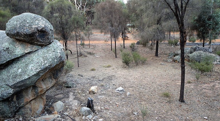
Granitic sandy soil at Arboretum picnic area
|
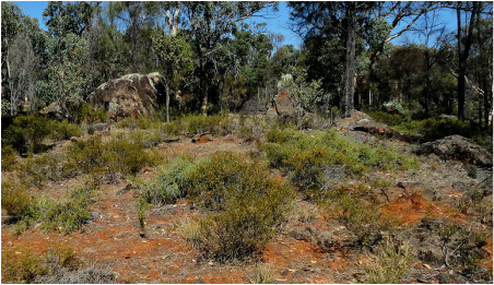
Mafic red brown loam near claypit
|
Biology
Vegetation is a good indicator of the soil underneath. For example, marri (Corymbia calophylla) grows on sands and gravels, brown mallet (Eucalyptus astringens) on mottled clays around ironstone ridges, wandoo (Eucalyptus wandoo) on the sand over clay (and other soils), and York gum (Eucalyptus loxophleba) prefers fertile soils that have formed from fresh granite and dolerite bedrock.
Recent research has shown that most soils in the reserve have been created by distinctive native vegetation through root secretions These stimulate microbes and fungi to form clays and laterites, which favour the host plants and restrict competitors.
Two examples are:-
Lateritic gravels. Many upland soils in Foxes Lair are lateritic (gravelly or sandy) with brown round stones, which are high in iron and aluminium. These soils are underlain by bauxite, which is mined in the Darling Range futher west.
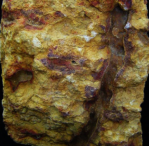
Laterites have diverse and colourful wildflowers, particularly the Proteaceae (banksias, hakeas, grevilleas etc) and Casuarinaceae (tammas, sheoaks) families. These plants are dominant here because they can extract phosphorus (a scarce nutrient), which is unavailable to most plants on these infertile soils. They do this with special cluster roots, which release an organic acid in to the soil in winter. The acid releases phosphorus from soil particles for the plants to use. Iron that causes the red and brown colours in soil, and aluminium are also released. Soil bacteria then use the remaining acid for food, and in doing so, cause the iron and aluminium to become solid again (precipitate), on gravel stones in the topsoil or down plant root channels. If you look inside gravel stones, you will often see the deposited iron layers.
Laterites have diverse and colourful wildflowers, particularly the Proteaceae (banksias, hakeas, grevilleas etc) and Casuarinaceae (tammas, sheoaks) families. These plants are dominant here because they can extract phosphorus (a scarce nutrient), which is unavailable to most plants on these infertile soils. They do this with special cluster roots, which release an organic acid in to the soil in winter. The acid releases phosphorus from soil particles for the plants to use. Iron that causes the red and brown colours in soil, and aluminium are also released. Soil bacteria then use the remaining acid for food, and in doing so, cause the iron and aluminium to become solid again (precipitate), on gravel stones in the topsoil or down plant root channels. If you look inside gravel stones, you will often see the deposited iron layers.
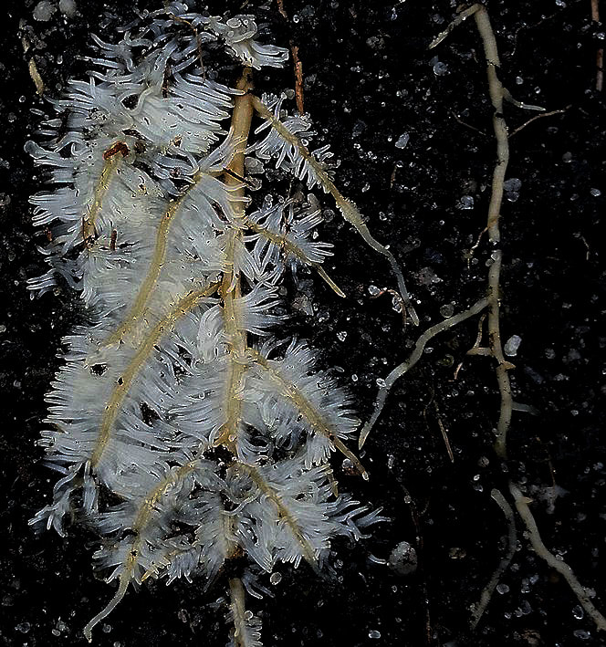
closeup of a cluster root
|
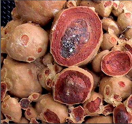
iron layers in gravel
|
Iron deposited in root channels
|
Over thousands of years, a deep laterite profile forms. This is often a gravelly topsoil underlain by ironstone, a mottled iron rich clay (mottled zone), a white clay (pallid zone), and finally the crystalline rock (light coloured granite or dark dolerite).
Laterites vary greatly. They range from those with dark heavy gravel stones and red-brown soil to others with pale light sandy gravels, and even ironstone pipes.
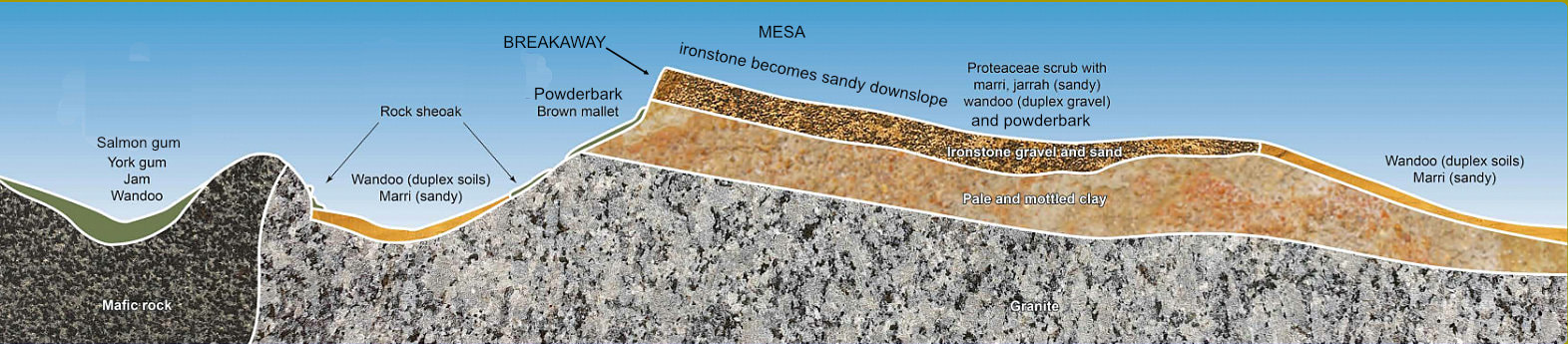
Mesas are lateritic gravel flat-topped hills with steep sided slopes on one or all sides called breakaways.
Mesas have a dense ironstone cap that is underlain by pink to white clay that erodes rapidly, causing ironstone blocks to be undercut and fall down the slope. Mallet or powderbark eucalypts often grow on these slopes
Laterites vary greatly. They range from those with dark heavy gravel stones and red-brown soil to others with pale light sandy gravels, and even ironstone pipes.
Mesas are lateritic gravel flat-topped hills with steep sided slopes on one or all sides called breakaways.
Mesas have a dense ironstone cap that is underlain by pink to white clay that erodes rapidly, causing ironstone blocks to be undercut and fall down the slope. Mallet or powderbark eucalypts often grow on these slopes
 Reddish clay nodules formed around roots Reddish clay nodules formed around roots
Clay subsoils
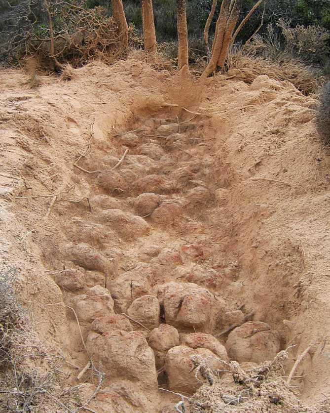
Many eucalypts secrete organic chemicals from their roots, which stimulate microbes and fungi to produce clay subsoils. The image from Chillinup shows sandy topsoil, which has been blown away to show nodules of reddish clay that has formed around the mallee roots. Most eucalypt tree and mallee soils are duplex, with a sand or loam topsoil overlying a clay subsoil. |
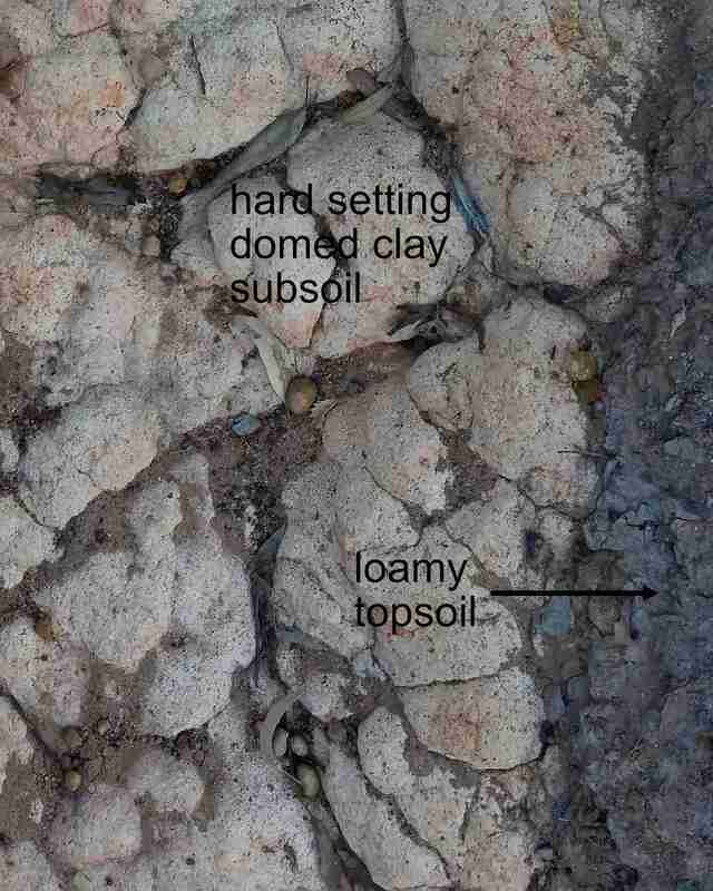
Exposed domed clay subsoil near the claypit
|
Climate and geological uplift
The final separation of Western Australia from India led to the gradual uplift of the Darling Range, which blocked some west-flowing rivers and reduced inland rainfall. This led to our present broad valleys in the east, and more active valleys to the west where rivers have forced their way through the Darling Range.
These events have coincided with alternating warm wet and cold dry climates over the past two million years
Wet cycles favour gentle landscapes and laterites. Dry cycles coincide with cold weather. barer soils, infrequent flash floods and very strong winds that cause salt lakes and adjoining dunes. The steep valleys and lateritic mesas and breakaways seen on the Breakway Walk formed then.
We are currently in a wetter geological period (excluding man-made climate change).
Further Reading
|
| ||||||