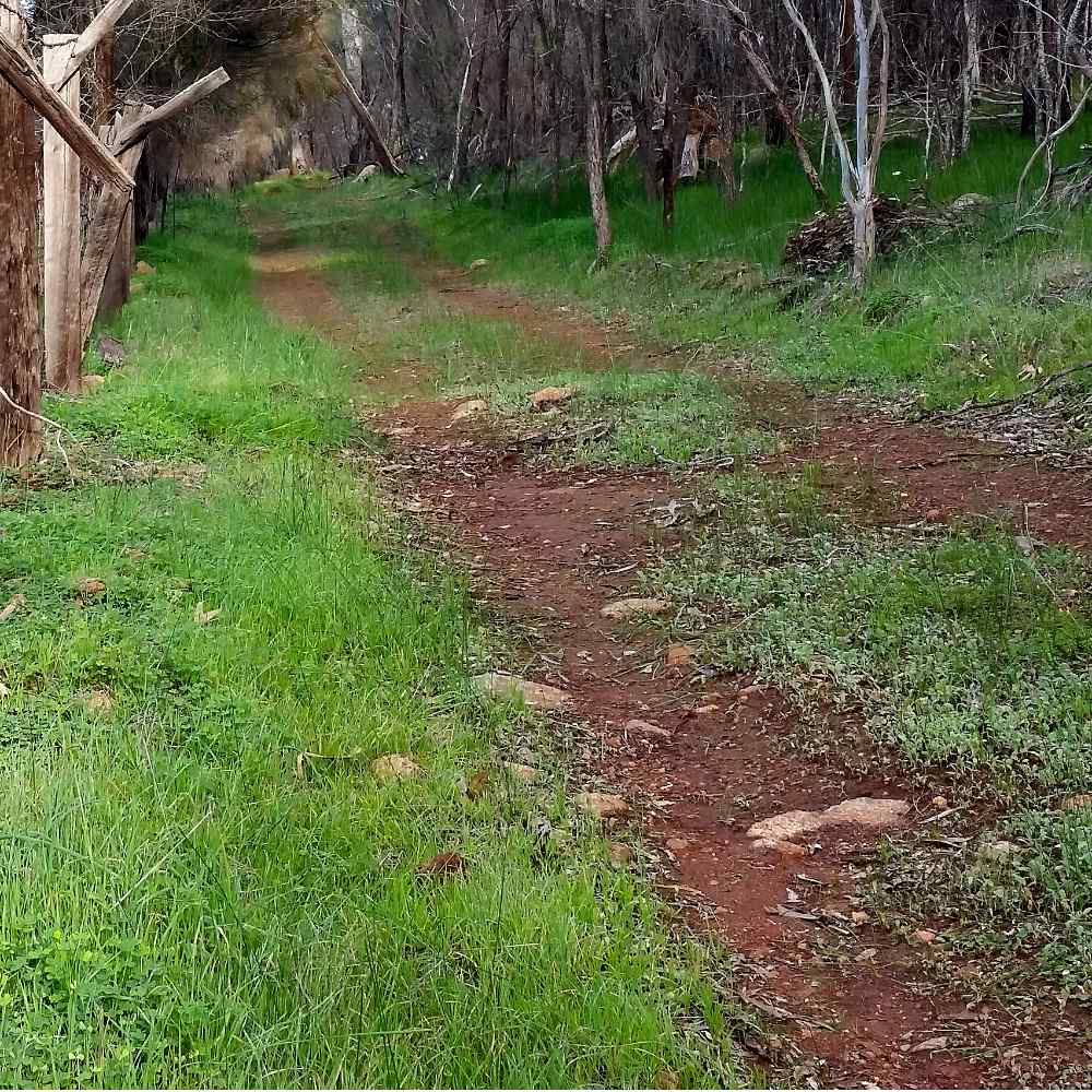
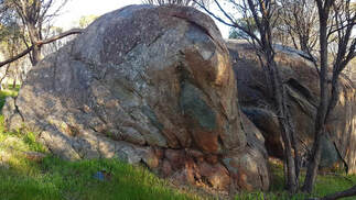
 Gabbro outcrop on Commonage slope
 We are lucky to have a wide range of soils, landscapes and wildflowers in Foxes Lair.
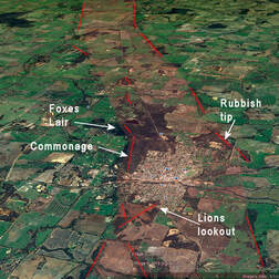
A major reason is the Binneringie Dyke that runs through it. Dykes are lines of mostly dark iron-rich (mafic) rock that have intrude the underlying granite, and which break down to form reddish loam and clay soils. They often coincide with ridges as stony gravels and mesas or red rocky red brown soils with steep slopes down to surrounding sandy granite laterites and soils. Mafic rocks weather faster than granites, but laterites formed on them are much more resistant to erosion. About a hundred millions of years ago most of our uplands were covered with laterite. Over time as the whole land surface has gradually eroded down, mafic areas have tended to become relatively higher, until the protective laterite cap was removed and underlying mafic soils fromed directly from rock eroded rapidly forming very hilly areas.
 Binneringie South Dyke east-west ridge near Williams
 - Subduction of colliding geological plates causes larger continental land masses, mountain ranges and granites.
- Upwelling magma from hotspots under continental rock, causes the overlying crust to weaken, stretch, split and move away as the magma cools to make new intruded rock. mafic magma under continental rock fills the cracks to form dykes. If a crack widens as the underlying plastic continental rock stretches and thins, rift valleys and basins form, and the continent may split and separate.
There are numerous dykes in the Narrogin region that are often beneath fertile York gum/jam loams and reddish mallet breakaways.
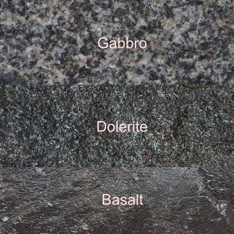
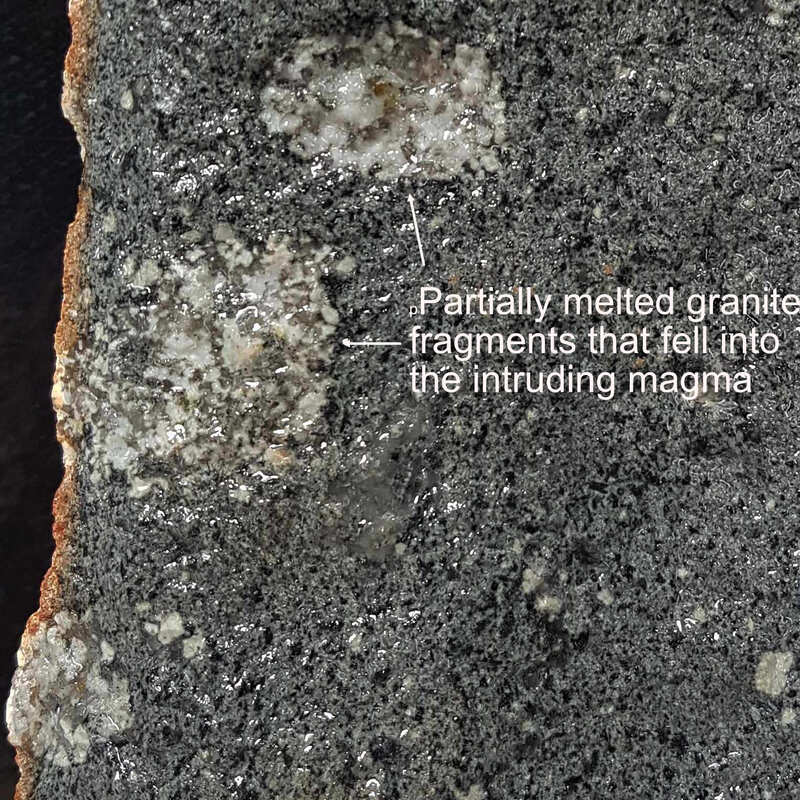
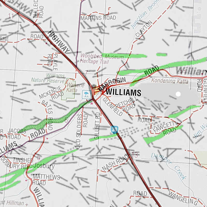
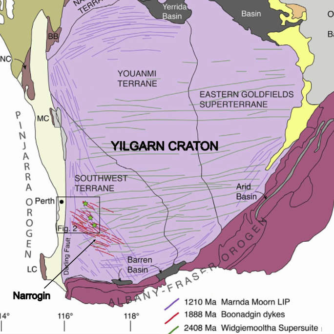
- An east-west trending series called the Widgimooltha Supersuite. The huge Binneringie Dyke (600 km long and up to 3km wide roughly aligns with the road from Quindanning to Williams and then the Williams Kondinin Road through Narrogin.This outcrops as discontinuous lines of red loam and clay, rock outcrops and ridges and stony laterite breakaways. It comprises a high east-west rocky ridge through the Commonage and southern Foxes Lair that mainly consists of gabbro. After reading about a parallel Binneringie South dyke 6km south of Williams containing migmatite rock I whipped out to see it. Migmatites fascinate me as they contain partially melted bits of the host rock that cracked and fell into the intruding magma (I have a vivid imagination).These dykes intruded 2408 million years ago when the Western Australian craton was still separate from the rest of Australia, and the Binneringie dyke continued into Zimbabwe (called the Great Dyke) that was attached to the west coast at that time.
- About 1888 million years ago, India was joined to the west coast (for the first of two times when a hostspot upwelled somewhere north and west of Perth. As the hotspot forced India away, cracks radiating out from it caused the formation of the northwest-southeast Boonadgin dolerite dyke group. For the next billion years or so, WA joined other Australan cratons that in turn became part of the Nuna supercontinent.
- 1210 million years ago as Nuna was breaking up, underground magma movement stressed the Yilgarn craton and caused thousands of dolerite dykes (north-south and north east/ south west Brookton dyke suite.
Surrounding areas like Dryandra are mainly on granites crossed by smaller dolerite dykes (often as ridges such as on Candy Block).
Granite is an interesting rock. Here it formed by the collision of continental blocks. As one block slides under another it melts and huge “pools” of granite rise up and solidify as large domes like Yilliminning rock up to 2 kilometres below the surface of the plate above.
You can climb Yilliminning Rock now because over the hundreds of millions of years the overlying kilometres of bedrock have weathered and the soil washed away into the ocean.
References
| newly_found_yilgarn_craton_dykes.pdf |
| williams_dykes_c.pdf |
