Foxes Lair
  • Home
  • About
    • About Foxes Lair
    • History
    • Landscape and Soils
  • Things To Do
    • Picnic Spots
    • Walk Trails
    • Visit the Arboretum
    • Ride Your Bicycle
    • Scavenger hunt
    • Geocaching and Orienteering
  • Things To See
    • Wildflowers
    • Trees in the Narrogin district
    • Birds
    • Vertebrates
    • Narrogin spiders scorpions ticks
    • Fungi and lichens
  • Foxes Lair seasonal guide
    • December to March
    • April - May
    • June-July
    • August
    • September
    • October
    • November
  • Other great reserves
    • Railway Dam
    • Yilliminning Rock
    • Old Mill Dam
    • Yornaning Dam
    • Contine Hill
    • Highbury Reserve
    • Boyagin Rock
    • Barna Mia
    • Toolibin Lake
    • Newman Block
    • Harrismith Nature Reserve
    • Candy Block
    • Tutanning Nature Reserve
  • 1Foxypress
    • Foxypress
    • Vanishing Farms
  • Contact

Hotham River Reservoir

21/11/2024

1 Comment

 
​Remains of the reservoir and associated works in the Hotham River Nature Reserve are all that remains of the ill-fated Pingelly Water Scheme. 
A critical shortage of potable water in Pingelly (and most wheatbelt towns), spurred a project to build the dam and pump water to an underground tank on the southern edge of Pingelly at a cost of $14,000-$15,000 in 1911.
Picture
PictureSteam pump base
The reservoir in the river channel was 100 feet (about 40 metres) wide and 15 feet (6 metres) deep at its deepest point.
Water was pumped by a wood-fired steam pump, which operated until 1957. The pump and associated pump operator’s house have gone, with only a concrete pump base and patch of weeds remaining. Operators mentioned are Harry Tate, Harry Pope, Jimmy ‘Leatherjacket’ Whitmore, and Jazeps Savickis. 
​
When the dam was built, the river ran for about four months a year and water was fresh with a brownish colour. Exotic carp and perch fish placed in the reservoir thrived, and the Pingelly Angling Club was formed. Thank heavens those destructive carp didn’t persist further downstream!

Picture Dry river upstream
The dam site is accessed via a dirt track, which is described in this blog. The old dam is about 450 metres west of the point where the track ends. There is no path and one has to scramble through uneven weedy land unless the river is dry and one can walk along the river bed.
​
The site is marked by  a line of posts across the river, which is all that remains of the reservoir's front bank. The former tank in front is merely a silt filled-depression.

Picture
Looking downriver
Picture
July
Picture
Looking upriver
PicturePosts in old dam wall
There are two high earth banks on either side of the river. On the north side the bank forms the western side of the reservoir and diverts any water entering from a prior river channel on the northern side of the river. On the southern side of the river another high bank stops fresh water flowing from dunes via an extinct river channel. Judging by the height of this bank and a depression on the upside, I suspect that  there may have been another smaller excavated tank here.

Picture
Picture
Northern bank, dam to left
Picture
Southern bank
Picture
Upstream from southern bank
After four years there were complaints about the amount of water supplied and in 1923, $1032 was spent on extensions. No maps remain, but the extensions may have included a drain on the eastern side of the reserve between Power Street (a track now) and the Great Southern Highway.

Alas, no one was to know that the wheatbelt contained billions of tonnes of salt, which had been transported from the ocean in rainfall over millennia and stored in the subsoil. As bush was cleared for agriculture, groundwater levels rose dissolving the salt, and causing soil salinity and saltier water. In 1923 a dam water test (probably in summer) was double the acceptable level for drinking water and was too salty for irrigation.

‘Saxon Myrtle’, a witty correspondent in the Pingelly-Brookton Leader wrote ‘ Pingelly scheme water is not just water. It is far more than that. It is suitable for motor spirit.  … It is better than hyposulphate for photography….excellent in kerosene lamps….wonderful tonic for neuralgia, rheumatism, consumption…keeps away mosquitos’
The scheme limped along (to the annoyance of ratepayers) until the arrival of pumped water from Wellington (later Harris) Dam near Collie in 1956.

A sobering thought is the total reliance of our towns on the Harris Dam pipeline at a time of increased temperatures and declining rainfall due to climate change.
​
Information for this blog came from a book ‘Pingelly and her Progress’ 1981 by Sylvia Lange, and Lost Pingelly Heritage Group Facebook page entries.
1 Comment

Knowles Cottage East Yornaning

21/7/2018

0 Comments

 
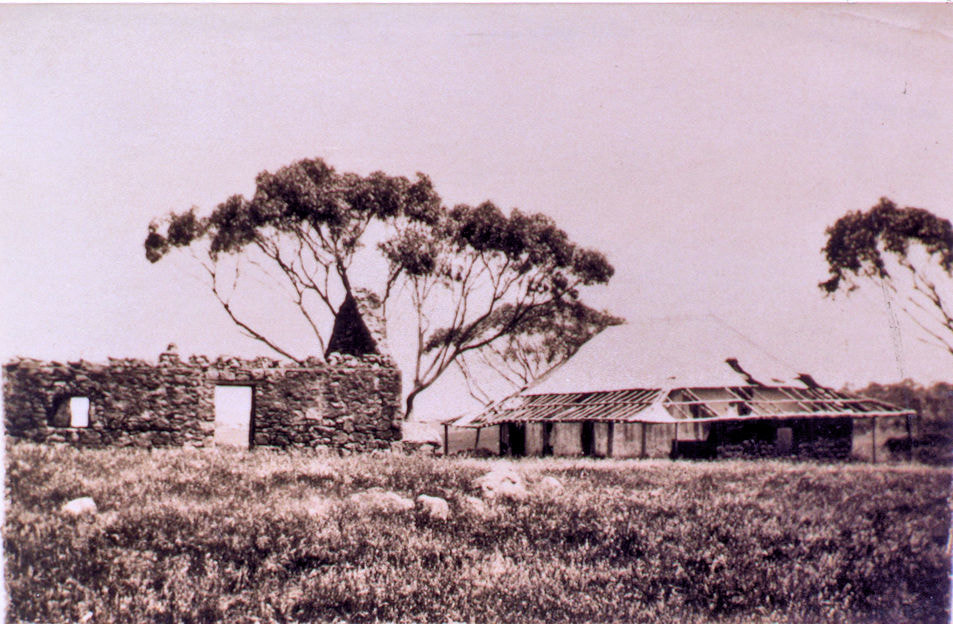
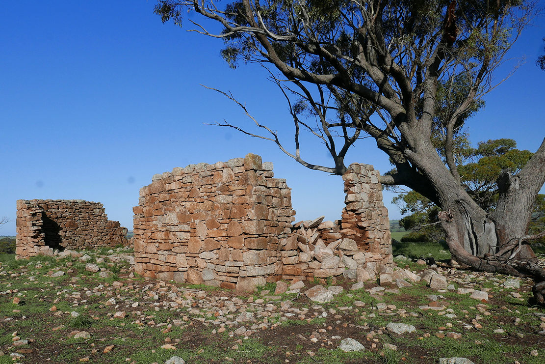
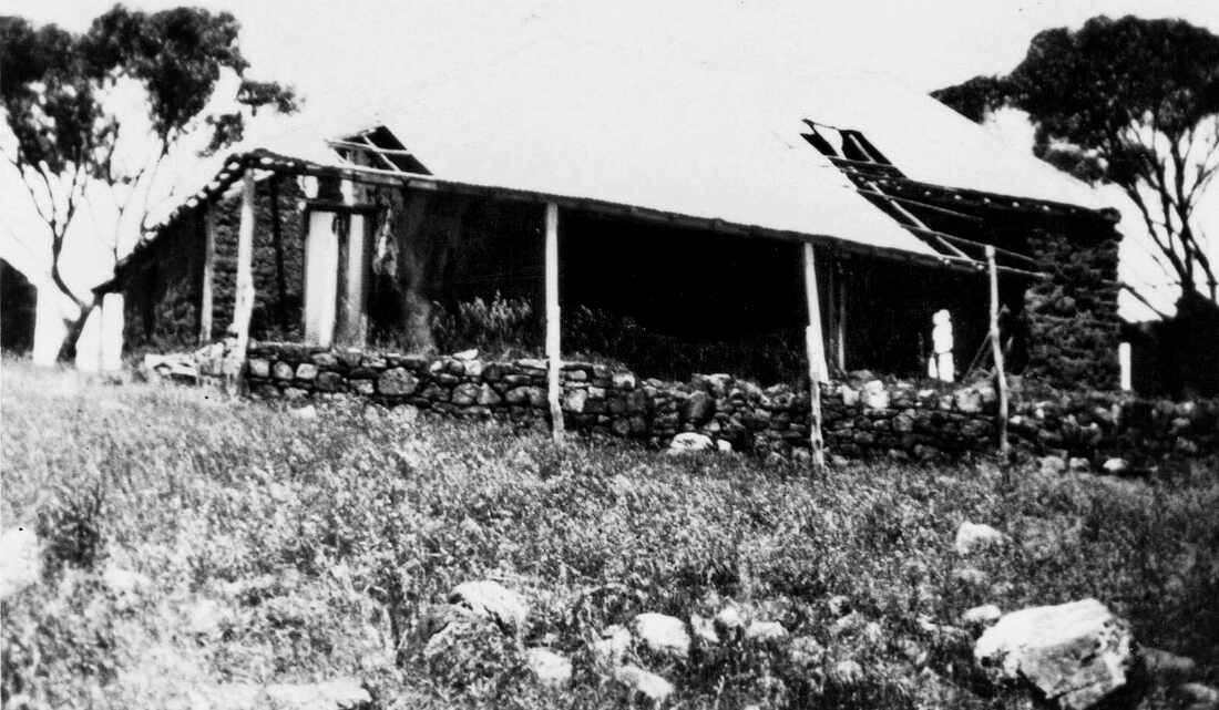
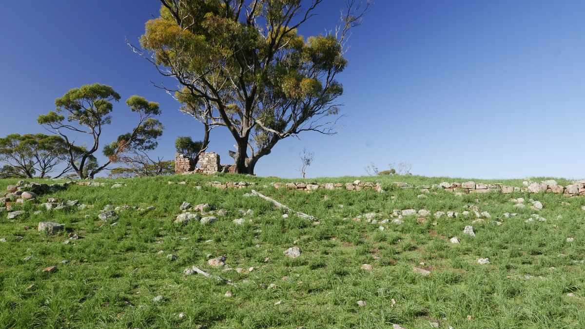
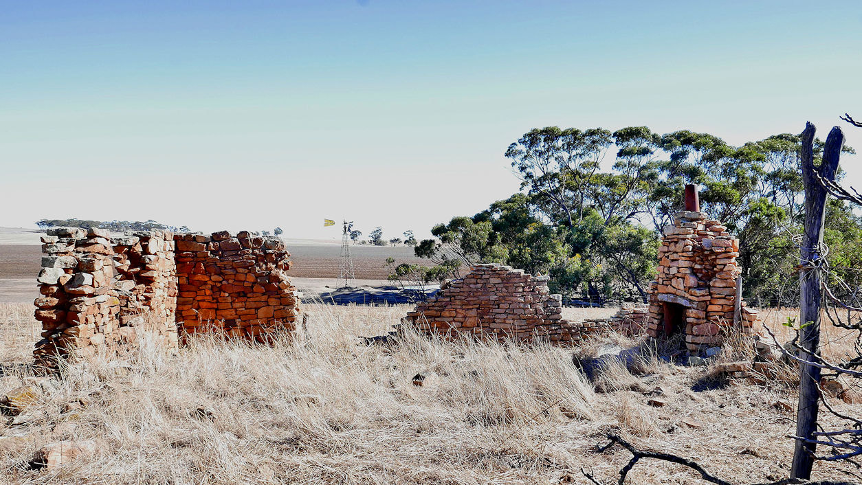
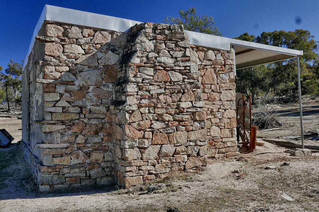
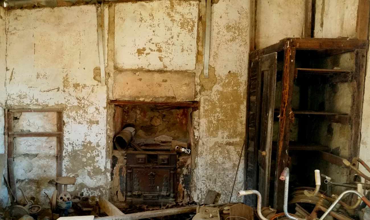
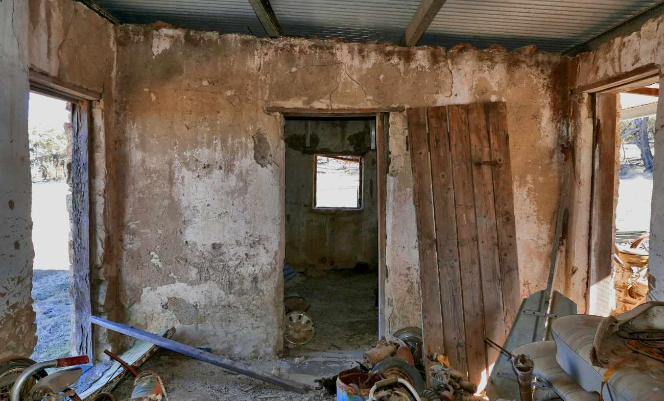
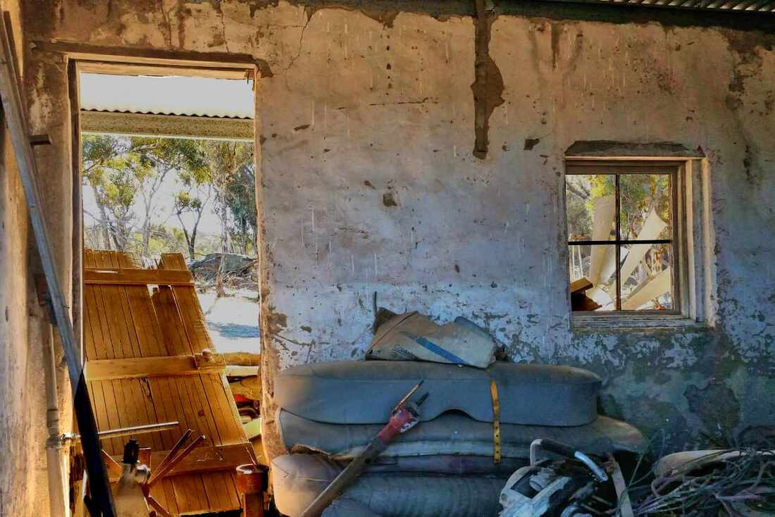
This unassuming two room mud and granite cottage has a fascinating but sad history. The present owners call it “Lovers Cottage” after a couple who never occupied it together.
​
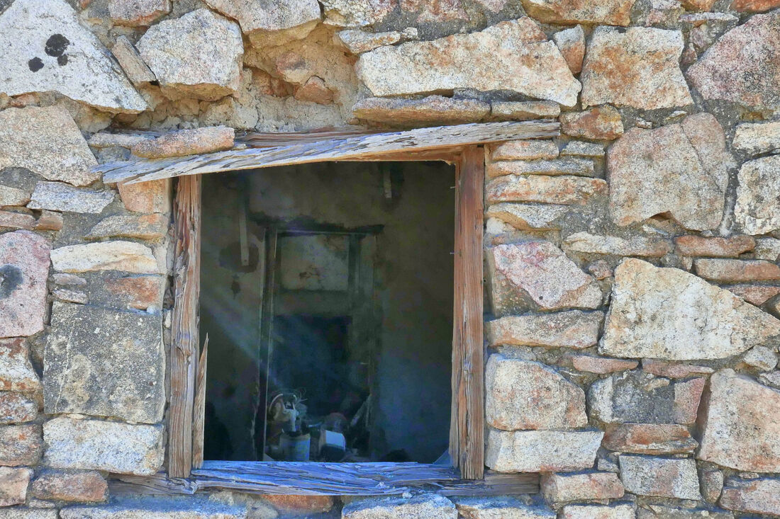
​Rabbit trapper Danny Townsend lived in the cottage during the Second World War, but apart from that it remained as a memento of a remarkable story. It is on private land and is not available for viewing.
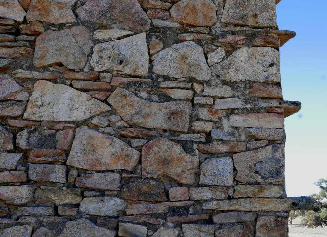
To their credit, the existing owners have reroofed the cottage so that it will still be standing for another 100 years.
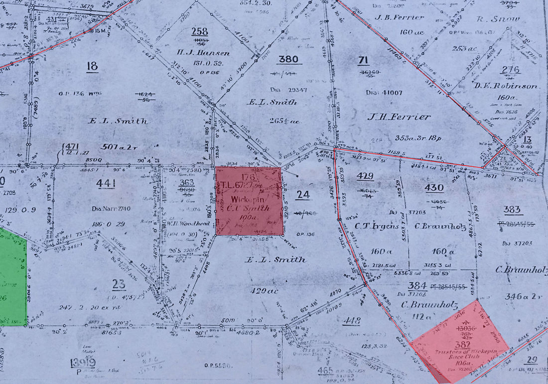
​Alfie Knowles was born in Southampton England in 1895. He bought Location 5420 from farmer John Nowke. Alfie was a fine figure of a man (5 foot 4 inches tall just like me!).

​He enlisted in the Australian army in 1916, and was awarded the Military Medal, and Medaille D’Honneur in France in 1918. 
Here is an extract from his army records in the National Archives of Australia.
​

Alfie was hospitalised in England with Trench Foot and met a lady who became his fiancé.
​He was discharged on 4th November 1919, returned to the farm and built the cottage. Tragically he was kicked by a horse on 7th April 1921, and died from a ruptured spleen
​28th Battalion AIF
8391 Pte William Robinson
4465 Pte A. Knowles

During the attack East of Villiers Brettonneux near Amiens, on the morning of 8th August 1918, an enemy strongpoint was encountered, and the advance was held up. These two men on their own initiative, rushed forward with their Lewis Gun, opened fire and inflicted heavy casualties, causing the garrison of 20 to surrender. Their action enabled the advance to continue.
Picture
 His fiancé was on a ship from England to Australia, at this time and did not learn of his death until she arrived at Cuballing. The poor woman stayed in Cuballing for some months before returning home.
The government eventually sent Alfie’s medals to his mother in the Isle of Wight in 1924. Many years later a letter was sent to the Postmaster: Cuballing Western Australia by a person who found his military medal on an Isle of Wight beach.
The family portrait was taken in England of the Sloper family into which one of Alfie's sisters (bottom right) married. Top right is another sister then Alfie.
Picture
Picture
Picture
​For a visual exploration of the cottage ctrl+ click  https://photos.app.goo.gl/FkFWS49upWTKX2Zg2
Picture
Picture
Picture
0 Comments

Chuggamunny House

21/7/2018

0 Comments


 The name Chuggamunny refers to the evocative ruin on the hill to the left of the Great Southern Highway just before the Chuggamunning Road turnoff, but there are a range of names relating to the property. The earliest lithograph I could find shows a Jugominning Spring, and Ossie Pustkuchen refers to Shuggamony Spring, and the infamous hill that tested locomotives is Chuggamunning Hill.
Elijah Quartermaine junior sailed out from England with his family in 1838, and received title to a plot of land containing Chuggamunning spring. His house (Chuggamunny) was built on the hill about 200 metres upslope from the spring, and the family shepherded sheep on surrounding land. In 1866, two escaped convicts surprised them one night and stole a double barrelled gun, a revolver, ammunition and rations, and left them unharmed.
In 1868, the house and property was sold to William Farrah Lukin, a remarkable district pioneer. William had extensive sheep leases with JH Monger and William Shaddick around Narrogin out to Toolibin. A restless and ambitious man, he took up a pastoral lease east of Derby that ended disastrously when a flood killed all 14,000 of his sheep. He then went to the Klondyke Goldfields in the Yukon in hope of regaining his fortune and disappeared from history (possibly killed in the 1906 San Francisco earthquake).
A neighbour James Doust leased the property and moved into the house in the 1880’s.
James and wife Elizabeth built a mud-batt building to the north of their house that Elizabeth ran as a boarding house for railway workers, farm hands and teachers from the Cuballing School. Only a few foundation walls remain, which indicate that the 5 bedrooms were tiny. The house looks much larger in the historic images supplied by the Narrogin Library, so I suspect that other rooms had a dirt floor.
There are rumours of much rum drinking and wild gambling at the boarding house. Elizabeth was a kindly soul and also the local midwife. I wonder how the Doust household coped with rowdy dissolute behaviour less than 20 metres away from their house.
There are even rumours of a ghost but hooooo knows
The Google Photo album of old and new images shows the stone house’s deterioration. The ancient York gum by the house has a huge split in its trunk with one half threatening to complete the destruction.


See the images on https://photos.app.goo.gl/UqDi87SutkeDFuHa6
References
'The Way Through: The Story of Narrogin' O.E Pustkuchen
'Numbat Country: The Story of the shire of Cuballing from Earliest Times until 1997' E. Roots.
Picture
Ruined house and guesthouse
Picture
House in 2018
Picture
Derelict guesthouse
Picture
Guesthouse foundations 2018
0 Comments

Wickepin Springs

21/7/2018

0 Comments

 
Picture
This edition is almost entirely based on word of mouth; I hope that it stimulates discussion that reveals more information.
 A colleague took me to a remarkable high point on his family farm between Yornaning and present Wickepin called Wickepin Springs. It is labelled Wickepin on the old lithographs and having permanent spring water, was apparently targeted as a town along a railway line from Cuballing to Kalgoorlie.

Sometime around the turn of the 20th century, there was a plan to construct a railway line to transport coal from Collie to Kalgoorlie. Cuballing was initially selected as the junction with the Northam-Albany line. Businesses and fine buildings sprung up, and farmers flocked to settle land east of Cuballing to have close access to a siding.
Neighbouring Narrogin was a serious rival (what’s new), despite a disadvantage of the steep section the existing railway at Chugamunning Hill between Narrogin and Cuballing where two locomotives were required to get up the slope ( if the junction was at Cuballing, Perth-bound freight from east and west could avoid the hill).
​

Narrogin representatives wined and dined the relevant minister, which started a petitioning war to government with rumours of false signatures. In 1906 Narrogin was declared the winner, ostensibly because a Collie-Narrogin line was in construction. However a Cuballing resident told me that the minister had bought land east of Narrogin. (Hmm!)
So instead of a line from Cuballing Wickepin Springs, Gillimanning Yealering, We have Narrogin, Wickepin, Yealering.

The Mungerungcutting race track named after the adjoining Mungerungcutting Soak, remained in use for many years after the present Wickepin townsite was established.

The name Wickepin  originated  from Wickepin Spring, which according to A.B. McCracken was derived from a Noongar name Wikabing. Another possibility is Woorkabing Hill, a large granite rock with the  tower on Gillimanning Road.
Wickepin Spring is at the base of a large rocky outcrop.
We found remnants of an old mud and granite general store and a loading ramp, and with another spring up near the top of the Wickepin Springs rock.
 
For a visual exploration of the site on Google Photos click  https://photos.app.goo.gl/VJPr7HwiefHCJBTd6

Picture
General store
Picture
Picture
Upland spring
Picture
Lower spring
0 Comments

Brooklyn

21/7/2018

0 Comments

 
Picture
Brooklyn Farm Williams location 3177 ( 680 acres 275ha) is one of the early farms in the Lol Gray area, which were established at the turn of the 20th century by ‘enthusiastic pioneers who soon found it impossible to make a living on these very small holdings. These people were mainly English settlers who had been convinced by the government propaganda of the time, that they would be successful farmers’ (source Numbat Country - The story of Cuballing shire - from earliest times to 1997).
Lol Gray was an English immigrant in the 1800’s who was a shepherd and sandalwood cutter, and who dug the (now buried) Lol Gray soak on the Lol Gray Road/ Narrogin Wandering Road intersection. The flooded gum hollow here would have been a wonderful cool place for students of the Lol Gray School on the other side of the road.
Brooklyn Farm was originally owned by Clem Marwick of York, followed by a number of succeeding inhabitants. The building shown here was a brick and iron combined house, shearing shed, and machinery shed. Surrounded by bits of historic machinery, it was still being used to crutch sheep when a storm blew it down. Fascinating spot (private property not available to visitors).
For a visual exploration Crtl+click this link https://photos.app.goo.gl/7LmfwJh3EFGolVWc2

Picture
Picture
Picture
Picture
0 Comments

    Categories

    All
    Cuballing Shire
    Narrogin Shire
    Pingelly Shire
    Wickepin Shire
    Williams Shire

© 2015 All Rights Reserved. Doug Sawkins, Australia.