I recently visited a couple of ruined dwellings on a farm south-west of Williams that has an interesting history. Both are on private property.
Cameron Spragg kindly provided access to the information below.
In 1902 after mining and prospecting in the goldfields, John and Edwin isbister decided to become farmers. using a litho in the Lands & Surveys Department in Perth they selected a block of 4,200 acres of virgin bush between Williams and Narrogin . The new block was named “Glenorkney” in memory of their island home, however the registrar misspelled it as ‘Glenorchy” and so it remained.
In company with the surveyor, they left Narrogin heading west for twelve miles along a bush track (now the Williams-Narrogin road), at which point they turned south - blazing the bark on the marri and wandoo trees as they went in order to find their way on the return journey. After three miles they arrived to see a few survey lines, some pegs and a dense forest of trees and almost impenetrable scrub.
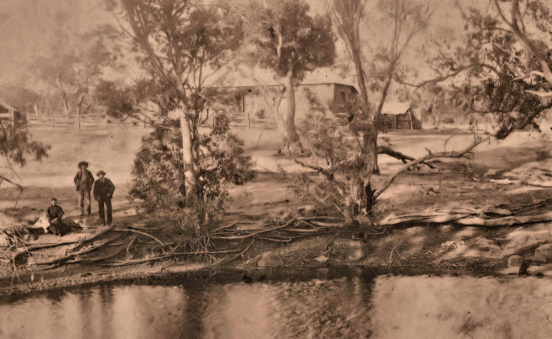
Finalising the land purchase they returned to Kalgoorlie and railed a wagon, cart, tools, etc to Narrogin, where Jack James a cartage contractor took part in the movement to the selection - later he was to become a close family friend and carted the furniture to the first house built in 1903/4 for Edwin and his wife, Henrietta. Only the base of this house remains.
On the day of their arrival they pitched their tents and that evening they selected a large green tree around which they piled bushes and sticks and set them alight. That night they had very little sleep because of the dingoes howling, probably disturbed or attracted by the fire. Next morning they expected to see the tree burnt down, its trunk was blackened but otherwise it was unscarred. Disappointed, Edwin said that he would at least get one down to mark their arrival, and taking a grubber and axe and after a half-day’s work felled the first tree. Little did they realise the hard work that lay ahead to clear the land.
This marked the beginning of more than 30 years of back-breaking work on land that was difficult to clear. For some years after clearing, suckers came from green tree roots still in the ground, and as these were from large trees the new shoots grew very rapidly and had to be knocked off with an axe. Poison was a similar problem which, after grubbing, suckered from the roots, or when grass was burnt the hard seed would germinate for up for to 20 years later. During the first 20 years they carried out almost all improvements with their own hands, clearing, sucker bashing, poison grubbing, well sinking, fencing, and invariably they would arrive home after dark in the evening weary and often wet, to be out again the next morning shortly after sunrise. The first sheds were built from bush timber and roofed with straw and brushwood, the horses’ mangers were fashioned from hollow wandoo logs. After a few years they were able to run a small flock of sheep which were often harassed by dingoes. At night the sheep were yarded and if a wild dog was known to be in the area a watch was kept. One night John walked home and changed watch with Edwin, and during that short period a dingo entered the yard and mauled several sheep.
Chudichs, or native cats as they were called, attacked the poultry at night and continued to return and kill until they were caught. One night the dog treed a cat in an old sheoak so Edwin lit a fire underneath and shot it. Torches had not been invented at that time.
Early memories of the uncleared land on Glenorchy and of the Government reserve on the South East side of the farm (Borgey Block) were of the natural unspoiled native bushland.
The native bushland teemed with birdlife and provided shelter and food for kangaroos, brush wallabies, tamars, numbats and possums. In the timbered country the numbats or “ant-eaters” as they were called, could be seen running about or sitting on top of hollow logs into which they would dive at the first sign of danger.
A colony of tamar wallabies lived in tunnels under the bushes in a large thicket of dyrandra scrub on Borgey Block.
During the first few years there were hundreds of small marsupials known as kangaroo rats, (burrowing bettongs) which lived in warrens like rabbits. After a few years they appeared to contract a disease and disappeared quite suddenly.
During the summer, the small creeks were dry except for a few odd pools, but in winter they ran with fresh water in which there were small fish and gilgies. As the creeks dried up the gilgies burrowed into the sides and remained until the next winter, the fish would reappear with the following winter rains. As there were no foxes, the black duck and teal nested on the banks in rushes or on other debris although they still had their natural predators, “native cats”, hawks and crows.
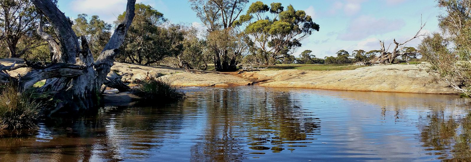
In a creek running through the North East of the property there was a large water hole around which were remnants of an old fence about eight feet high. In earlier days it had been used to catch brumbies when they came to water.
When clearing the land for cultivation and pasture, apart from leaving the rough hills uncleared, the Isbister Brothers had left beautiful bands of eucalyptus along the water courses to prevent erosion and provide shelter for livestock. Many years later, as a result of salt encroachment, most of the trees died and those that survived lost their bloom. The pools that watered stock in the early summer are no longer suitable for animals to drink.
Their first implements were a single furrow plough and harrows that were made from a forked tree with spiked pieces of wood driven through holes. For the first crops, seed and fertiliser were sown from a bag hung from the neck and scattered by hand. As time went by they acquired horses, a three-furrow mouldboard plough, a twelve-run hoe drill, a five foot McKay harvester, a six-foot Deering binder and a chaff-cutter.
In 1916 they purchased a T-model Ford (WL.14) and in 1919 a Wolseley three-stand shearing plant, which was one of the first in the district.
Edwin organised the cropping and machinery maintenance and teamwork, while John concentrated on livestock husbandry and teamwork.
The first cereal crop was grown on an area known as the Well Paddock, so named as it contained the well that they had dug for their first permanent water. The crop was a complete failure, new land, unsuitable fertiliser (probably basic slag), a very wet winter, kangaroos, bettongs and birds all contributed to its destruction. It was not until the mid1930s that the benefits of superphosphate and subterranean clover increased crop yields from 9 to 15 bushels an acre to 40 to 60 bushels an acre.
As the clearing of the property progressed, paddocks were named after the people who had cleared them, such as Fitz’s Gully, Reid Paddock, Bird Paddock and Clegg Paddock.
In those very early days life on the farm at Williams was hard - no recreation and very little money. The soils of Glenorchy were poor, giving low yields, and with uneconomic prices for produce, it meant a struggle to survive, which provided no time for public, sporting or social activities, although Edwin was an active member of the Masonic Lodge and in earlier days John was a member of the Williams Road Board or the Narrogin Road Board. John was a lover of nature and planted several avenues of trees on Glenorchy.
Narrogin became their main shopping and business centre as Williams did not have a bank or rail service at that time. A block of land was held in Narrogin to provide shelter and to feed and water the horses. Annually one or two wagon loads of wheat made the 16-mile journey to the Great Southern Roller Flour Mill at Narrogin where it was exchanged for flour, bran, pollard and semolina - less a portion of the load to cover the cost of gristing. Most of the food for the families was produced on the property as each homestead had its own fruit trees and grape vines which provided fresh fruit during the summer months and the surplus was made into preserves, jams and chutneys. Today almost all the orchards in the district have disappeared or are neglected due to the raids on the fruit by the increased numbers of Port Lincoln and Regent parrots. During the winter vegetables were grown, but not in summer as no piped water was available. Due to the lack of green vegetables in summer, it was not uncommon for people to develop sores, known as Barcoo, mostly on the back of the hands. However, in a patch of damp sand many varieties of pumpkins, water melons and rock melons were grown successfully.
About 1922, the first rabbit was found on the property - a dead one. John Isbister remarked, “they will never live here, there are too many poisonous bushes in the uncleared country.” Ten years afterwards they were in the district in thousands and a few years later the foxes arrived. This was a disaster for the native wildlife. Although originally the foxes’ main food source was the rabbit, they also ate the eggs and young of ducks, ground larks, plovers, curlews, quails, bustards (the latter they would catch before they could take off in flight) and as rabbits became scarce they killed and ate joey kangaroos, young brush wallabies, tamars, numbats, possums, lizards, frogs, as well as the farmers lambs and poultry. Many of the rough hills that were left for shelter became devoid of native wildlife except the tree nesting birds. Feral cats were rarely seen at the time.
In 1932 Edwin bought out John’s half interest in “Glenorchy” and continued to farm the whole property. In 1934 John bought “Homewood”, the property of J.A. Roberts at Moora, and moved with his family to that centre.
Edwin continued farming on Glenorchy until his death in 1940, and his wife Henrietta then passed in 1943. Both buried in the Narrogin Cemetery.
His obituary in the Narrogin Observer is a good example of values at this time. "He was particularly welcome because of his many outstanding qualities and genial disposition. In every sense of the word he was a gentleman of the type which does so much to keep alive the best characteristics of the British race."
Daughter Jessie Smith (née Isbister) was then the sole owner of Glenorchy of which was leased out up until 1957 where her daughter , Maxine and her husband Edwin (Ted) Spragg took over the property .
Jessie passed away in Nedlands in August, 1989.
Ted & Maxine Spragg and son Ian ran Glenorchy until it was sold at Auction in November 1997.
Additional land was purchased over the journey, holdings known as the “Clegg “ paddocks - eastern side of the property and a further 1200 acres known as “ Stockers” , SW side of the property .
600 acres also purchased, known as “Moore’s “north side of Glenorchy made up the total of 5,400 acres on a total of 36 locations .
Ted Spragg was a well respected farmer, and long serving councillor at the Williams shire. He was an elected member of the Shire from 1969 to 1990 and President from 1972 to 1987.
This link contains an account of early history of the WA branch of the Isbister family.
Cameron Spragg kindly provided access to the information below.
In 1902 after mining and prospecting in the goldfields, John and Edwin isbister decided to become farmers. using a litho in the Lands & Surveys Department in Perth they selected a block of 4,200 acres of virgin bush between Williams and Narrogin . The new block was named “Glenorkney” in memory of their island home, however the registrar misspelled it as ‘Glenorchy” and so it remained.
In company with the surveyor, they left Narrogin heading west for twelve miles along a bush track (now the Williams-Narrogin road), at which point they turned south - blazing the bark on the marri and wandoo trees as they went in order to find their way on the return journey. After three miles they arrived to see a few survey lines, some pegs and a dense forest of trees and almost impenetrable scrub.
Finalising the land purchase they returned to Kalgoorlie and railed a wagon, cart, tools, etc to Narrogin, where Jack James a cartage contractor took part in the movement to the selection - later he was to become a close family friend and carted the furniture to the first house built in 1903/4 for Edwin and his wife, Henrietta. Only the base of this house remains.
On the day of their arrival they pitched their tents and that evening they selected a large green tree around which they piled bushes and sticks and set them alight. That night they had very little sleep because of the dingoes howling, probably disturbed or attracted by the fire. Next morning they expected to see the tree burnt down, its trunk was blackened but otherwise it was unscarred. Disappointed, Edwin said that he would at least get one down to mark their arrival, and taking a grubber and axe and after a half-day’s work felled the first tree. Little did they realise the hard work that lay ahead to clear the land.
This marked the beginning of more than 30 years of back-breaking work on land that was difficult to clear. For some years after clearing, suckers came from green tree roots still in the ground, and as these were from large trees the new shoots grew very rapidly and had to be knocked off with an axe. Poison was a similar problem which, after grubbing, suckered from the roots, or when grass was burnt the hard seed would germinate for up for to 20 years later. During the first 20 years they carried out almost all improvements with their own hands, clearing, sucker bashing, poison grubbing, well sinking, fencing, and invariably they would arrive home after dark in the evening weary and often wet, to be out again the next morning shortly after sunrise. The first sheds were built from bush timber and roofed with straw and brushwood, the horses’ mangers were fashioned from hollow wandoo logs. After a few years they were able to run a small flock of sheep which were often harassed by dingoes. At night the sheep were yarded and if a wild dog was known to be in the area a watch was kept. One night John walked home and changed watch with Edwin, and during that short period a dingo entered the yard and mauled several sheep.
Chudichs, or native cats as they were called, attacked the poultry at night and continued to return and kill until they were caught. One night the dog treed a cat in an old sheoak so Edwin lit a fire underneath and shot it. Torches had not been invented at that time.
Early memories of the uncleared land on Glenorchy and of the Government reserve on the South East side of the farm (Borgey Block) were of the natural unspoiled native bushland.
The native bushland teemed with birdlife and provided shelter and food for kangaroos, brush wallabies, tamars, numbats and possums. In the timbered country the numbats or “ant-eaters” as they were called, could be seen running about or sitting on top of hollow logs into which they would dive at the first sign of danger.
A colony of tamar wallabies lived in tunnels under the bushes in a large thicket of dyrandra scrub on Borgey Block.
During the first few years there were hundreds of small marsupials known as kangaroo rats, (burrowing bettongs) which lived in warrens like rabbits. After a few years they appeared to contract a disease and disappeared quite suddenly.
During the summer, the small creeks were dry except for a few odd pools, but in winter they ran with fresh water in which there were small fish and gilgies. As the creeks dried up the gilgies burrowed into the sides and remained until the next winter, the fish would reappear with the following winter rains. As there were no foxes, the black duck and teal nested on the banks in rushes or on other debris although they still had their natural predators, “native cats”, hawks and crows.
In a creek running through the North East of the property there was a large water hole around which were remnants of an old fence about eight feet high. In earlier days it had been used to catch brumbies when they came to water.
When clearing the land for cultivation and pasture, apart from leaving the rough hills uncleared, the Isbister Brothers had left beautiful bands of eucalyptus along the water courses to prevent erosion and provide shelter for livestock. Many years later, as a result of salt encroachment, most of the trees died and those that survived lost their bloom. The pools that watered stock in the early summer are no longer suitable for animals to drink.
Their first implements were a single furrow plough and harrows that were made from a forked tree with spiked pieces of wood driven through holes. For the first crops, seed and fertiliser were sown from a bag hung from the neck and scattered by hand. As time went by they acquired horses, a three-furrow mouldboard plough, a twelve-run hoe drill, a five foot McKay harvester, a six-foot Deering binder and a chaff-cutter.
In 1916 they purchased a T-model Ford (WL.14) and in 1919 a Wolseley three-stand shearing plant, which was one of the first in the district.
Edwin organised the cropping and machinery maintenance and teamwork, while John concentrated on livestock husbandry and teamwork.
The first cereal crop was grown on an area known as the Well Paddock, so named as it contained the well that they had dug for their first permanent water. The crop was a complete failure, new land, unsuitable fertiliser (probably basic slag), a very wet winter, kangaroos, bettongs and birds all contributed to its destruction. It was not until the mid1930s that the benefits of superphosphate and subterranean clover increased crop yields from 9 to 15 bushels an acre to 40 to 60 bushels an acre.
As the clearing of the property progressed, paddocks were named after the people who had cleared them, such as Fitz’s Gully, Reid Paddock, Bird Paddock and Clegg Paddock.
In those very early days life on the farm at Williams was hard - no recreation and very little money. The soils of Glenorchy were poor, giving low yields, and with uneconomic prices for produce, it meant a struggle to survive, which provided no time for public, sporting or social activities, although Edwin was an active member of the Masonic Lodge and in earlier days John was a member of the Williams Road Board or the Narrogin Road Board. John was a lover of nature and planted several avenues of trees on Glenorchy.
Narrogin became their main shopping and business centre as Williams did not have a bank or rail service at that time. A block of land was held in Narrogin to provide shelter and to feed and water the horses. Annually one or two wagon loads of wheat made the 16-mile journey to the Great Southern Roller Flour Mill at Narrogin where it was exchanged for flour, bran, pollard and semolina - less a portion of the load to cover the cost of gristing. Most of the food for the families was produced on the property as each homestead had its own fruit trees and grape vines which provided fresh fruit during the summer months and the surplus was made into preserves, jams and chutneys. Today almost all the orchards in the district have disappeared or are neglected due to the raids on the fruit by the increased numbers of Port Lincoln and Regent parrots. During the winter vegetables were grown, but not in summer as no piped water was available. Due to the lack of green vegetables in summer, it was not uncommon for people to develop sores, known as Barcoo, mostly on the back of the hands. However, in a patch of damp sand many varieties of pumpkins, water melons and rock melons were grown successfully.
About 1922, the first rabbit was found on the property - a dead one. John Isbister remarked, “they will never live here, there are too many poisonous bushes in the uncleared country.” Ten years afterwards they were in the district in thousands and a few years later the foxes arrived. This was a disaster for the native wildlife. Although originally the foxes’ main food source was the rabbit, they also ate the eggs and young of ducks, ground larks, plovers, curlews, quails, bustards (the latter they would catch before they could take off in flight) and as rabbits became scarce they killed and ate joey kangaroos, young brush wallabies, tamars, numbats, possums, lizards, frogs, as well as the farmers lambs and poultry. Many of the rough hills that were left for shelter became devoid of native wildlife except the tree nesting birds. Feral cats were rarely seen at the time.
In 1932 Edwin bought out John’s half interest in “Glenorchy” and continued to farm the whole property. In 1934 John bought “Homewood”, the property of J.A. Roberts at Moora, and moved with his family to that centre.
Edwin continued farming on Glenorchy until his death in 1940, and his wife Henrietta then passed in 1943. Both buried in the Narrogin Cemetery.
His obituary in the Narrogin Observer is a good example of values at this time. "He was particularly welcome because of his many outstanding qualities and genial disposition. In every sense of the word he was a gentleman of the type which does so much to keep alive the best characteristics of the British race."
Daughter Jessie Smith (née Isbister) was then the sole owner of Glenorchy of which was leased out up until 1957 where her daughter , Maxine and her husband Edwin (Ted) Spragg took over the property .
Jessie passed away in Nedlands in August, 1989.
Ted & Maxine Spragg and son Ian ran Glenorchy until it was sold at Auction in November 1997.
Additional land was purchased over the journey, holdings known as the “Clegg “ paddocks - eastern side of the property and a further 1200 acres known as “ Stockers” , SW side of the property .
600 acres also purchased, known as “Moore’s “north side of Glenorchy made up the total of 5,400 acres on a total of 36 locations .
Ted Spragg was a well respected farmer, and long serving councillor at the Williams shire. He was an elected member of the Shire from 1969 to 1990 and President from 1972 to 1987.
This link contains an account of early history of the WA branch of the Isbister family.

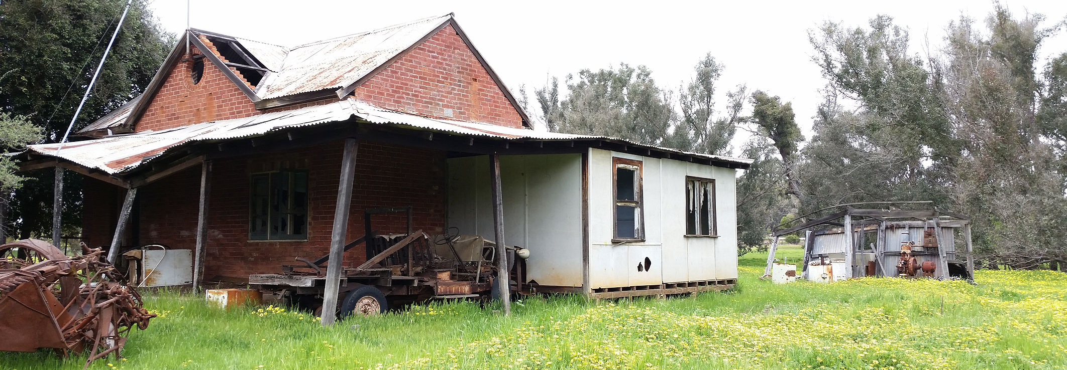
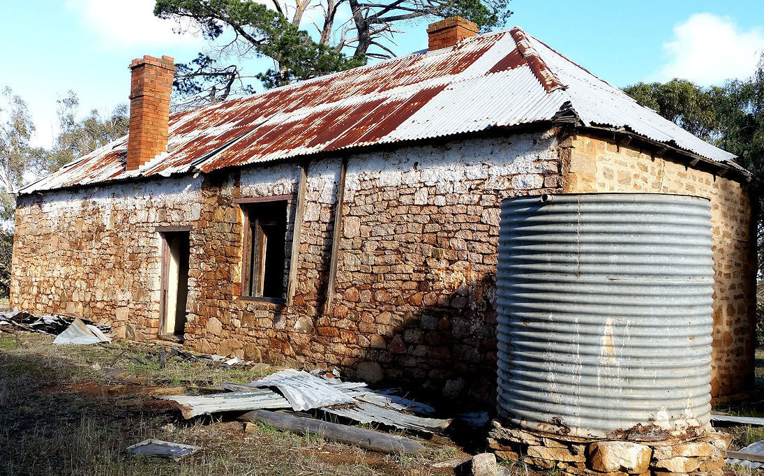
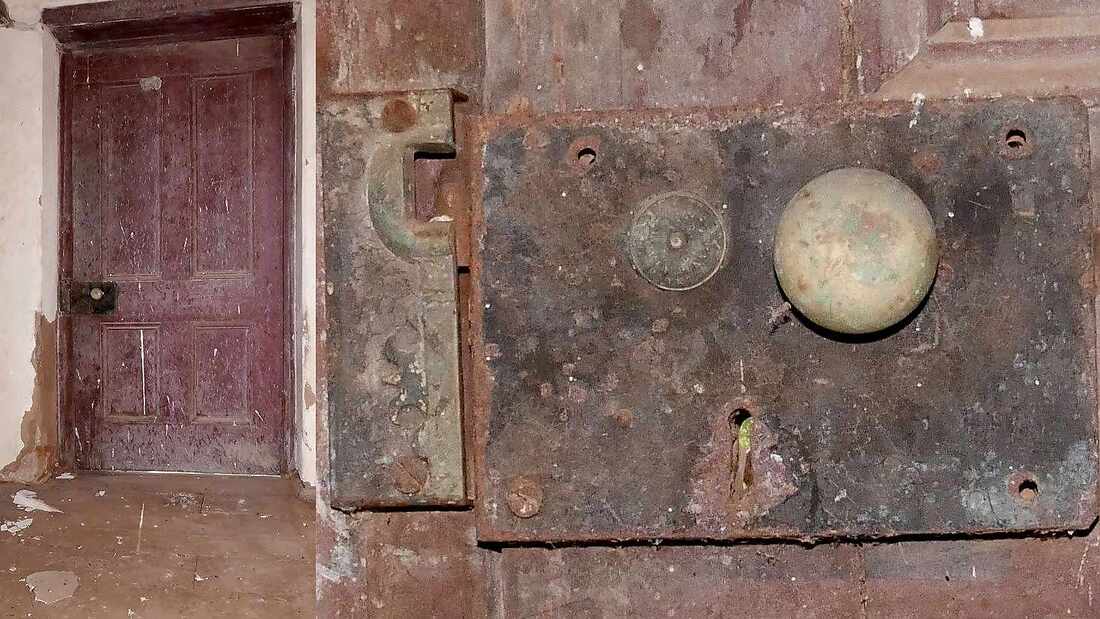
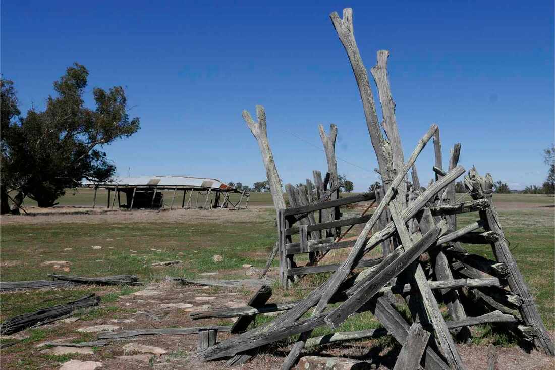
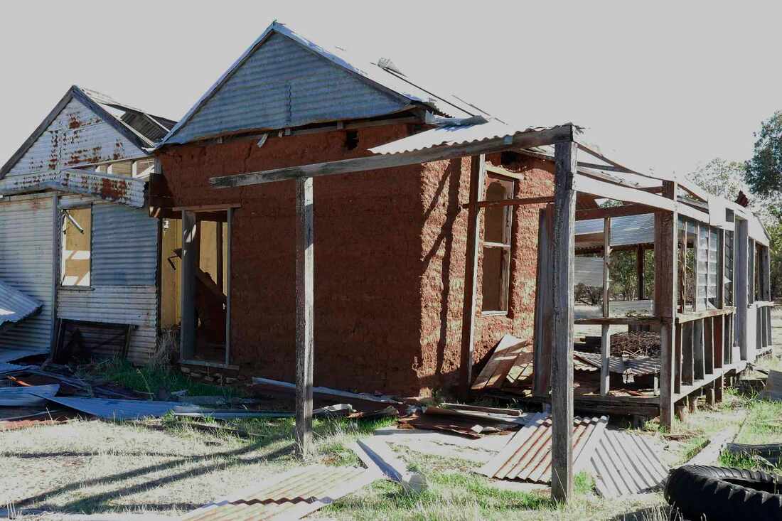
I was shown two abandoned houses.
The first house was the Stocker family home, which was later used by the local pony club. Like many early houses it has a higgly piggly design, probably due to additions as more children arrived in the family.
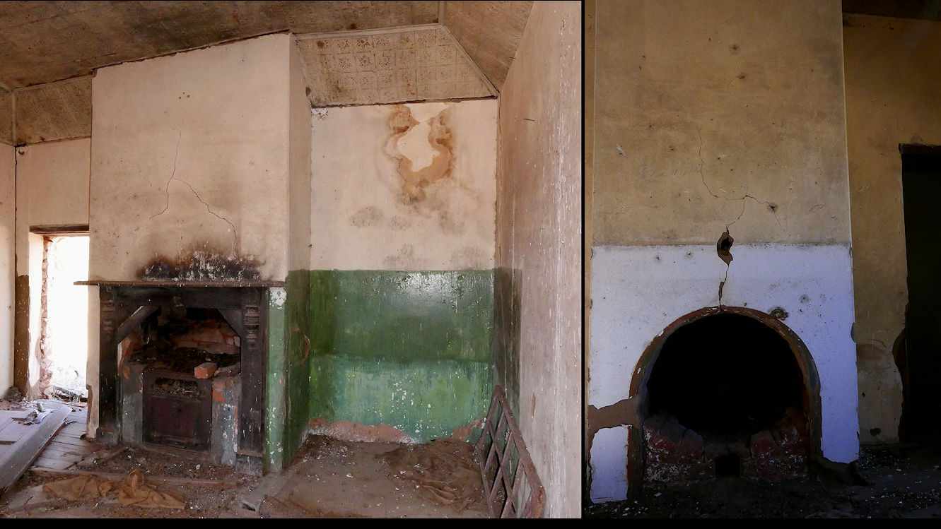
The centre of the house is a single room with rammed earth walls on a local granite foundation. The wooden board formwork for the walls can still be seen on one side. This may have been the original cottage The rest of the house is constructed of sawn beams clad with corrugated iron and jarrah slats for the ceiling. The house must have been searingly hot in summer days, but cooling down quickly in the evening, and freezing in winter. Judging by the refrigerator the house was occupied until the 1950s-1960’s. Of particular interest is a ceiling mounted gas or kerosene light.
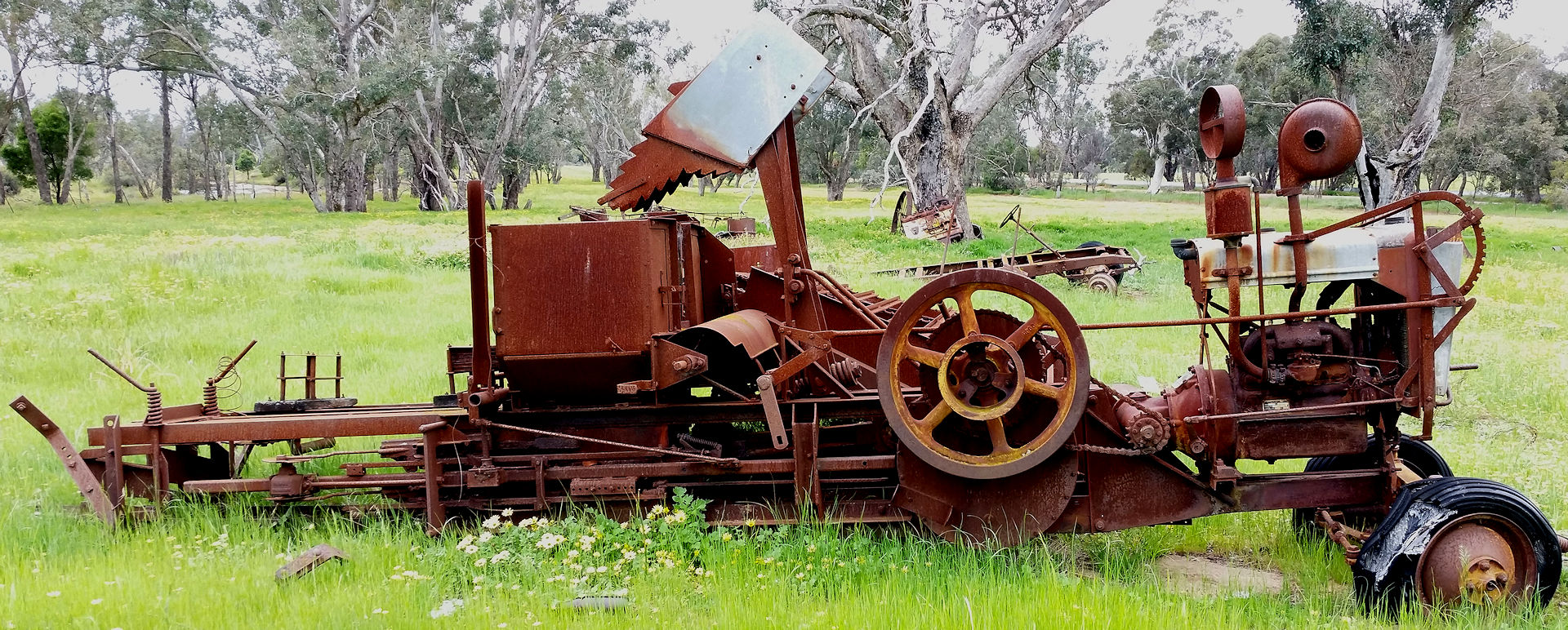
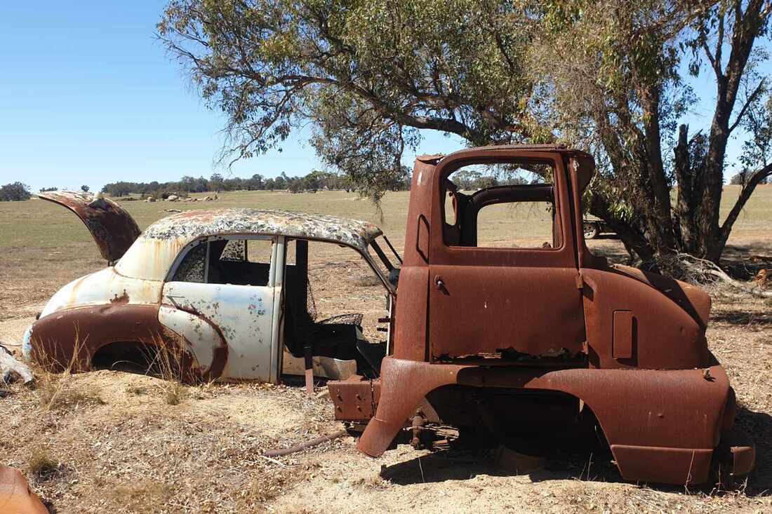
A couple of vehicle shells remain further downslope; an FX Holden and half a truck. The truck is a Thames Trader. These were manufactured by the British arm of the Ford Motor Company between 1957 and 1965.
The first house was the Stocker family home, which was later used by the local pony club. Like many early houses it has a higgly piggly design, probably due to additions as more children arrived in the family.
The centre of the house is a single room with rammed earth walls on a local granite foundation. The wooden board formwork for the walls can still be seen on one side. This may have been the original cottage The rest of the house is constructed of sawn beams clad with corrugated iron and jarrah slats for the ceiling. The house must have been searingly hot in summer days, but cooling down quickly in the evening, and freezing in winter. Judging by the refrigerator the house was occupied until the 1950s-1960’s. Of particular interest is a ceiling mounted gas or kerosene light.
A couple of vehicle shells remain further downslope; an FX Holden and half a truck. The truck is a Thames Trader. These were manufactured by the British arm of the Ford Motor Company between 1957 and 1965.
 |  |  |
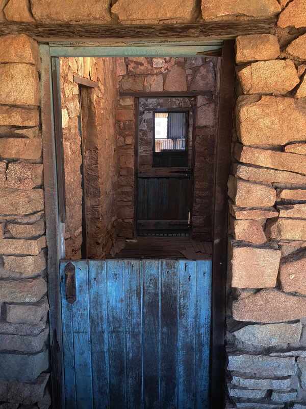
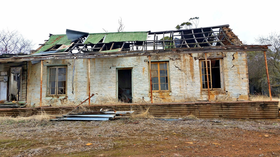
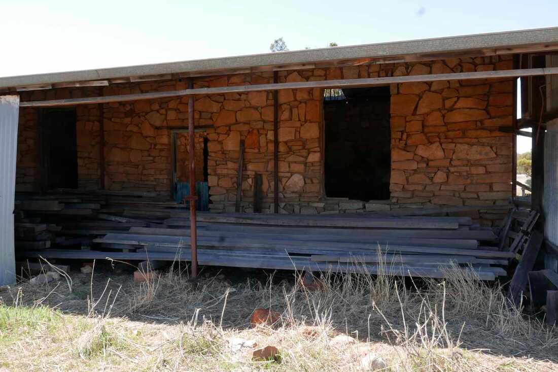
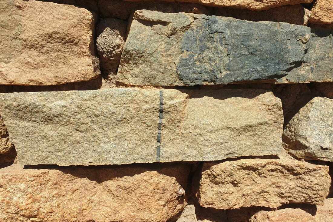
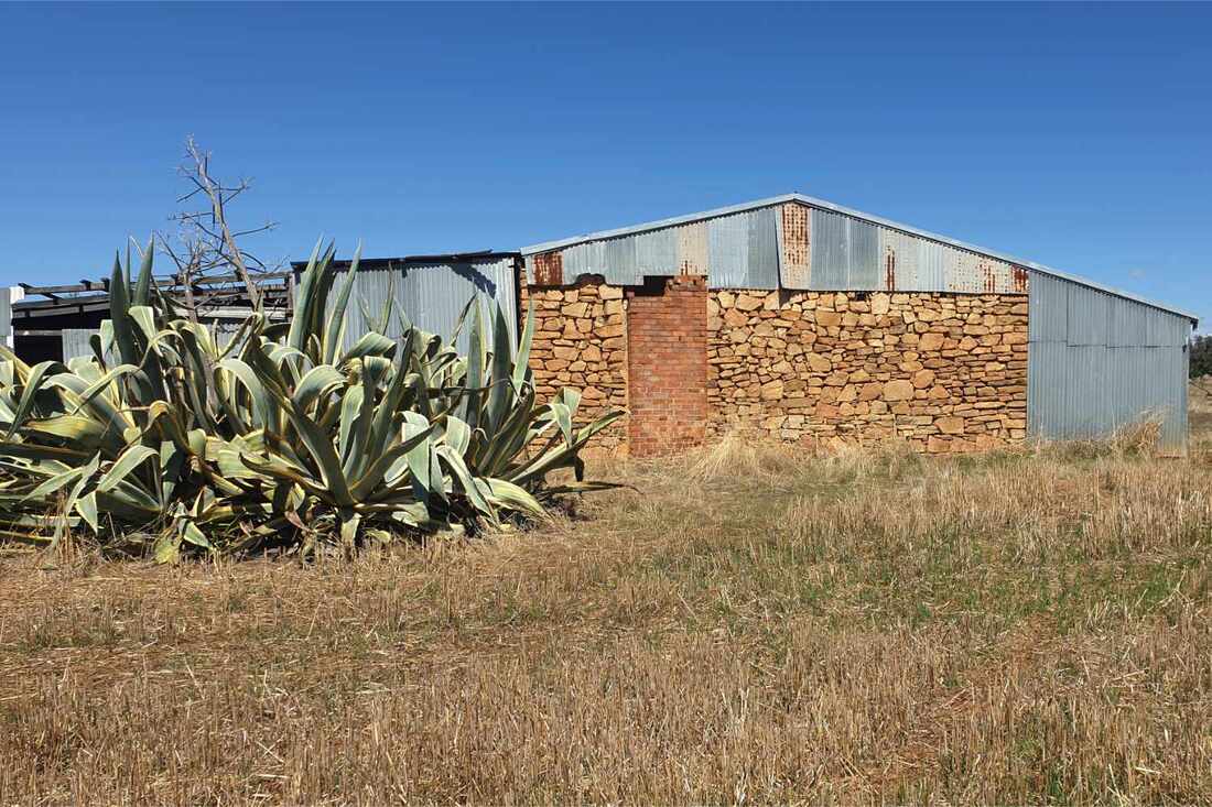
A block that Ted Spragg bought from George Moore has an old house with walls of granite blocks and mud mortar. The beautiful and precise construction indicates it had been built by a professional builder in the early 1900s. The intact galvanised iron roof erected when the house was converted to a shearing shed has protected the mud mortar from weather damage.
For a visual tour of these houses, click this Google photos link
 |  |  |