Foxes Lair
  • Home
  • About
    • About Foxes Lair
    • History
    • Landscape and Soils
  • Things To Do
    • Scavenger hunt
    • Picnic Spots
    • Walking Tracks
    • Visit the Arboretum
    • Geocaching and Orienteering
    • Ride Your Bicycle
  • Things To See
    • Birds
    • Wildflowers
    • Trees in the Narrogin district
    • Narrogin spiders scorpions ticks
    • Vertebrates
    • Fungi and lichens
  • Other Places to Visit
    • FAMILY bush attractions
    • WILDLIFE bush attractions
    • WILDFLOWER bush attractions
    • all reserves
  • 1Foxypress
    • Foxypress
    • Vanishing Farms
  • Foxes Lair seasonal guide
  • Contact

COWCHER SHEARING SHED

28/1/2019

 
Picture
Greetings fellow Foxies,
 
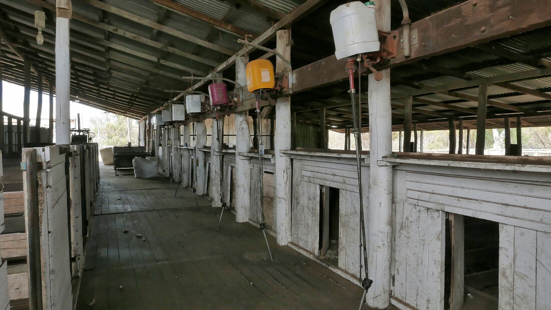
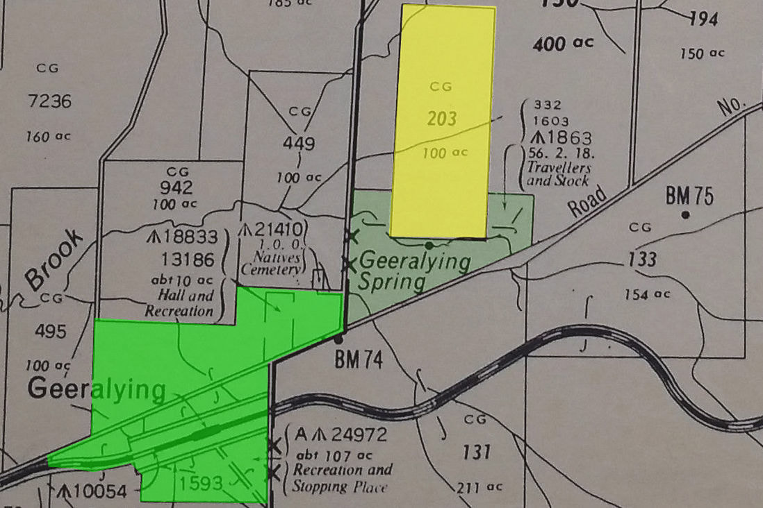
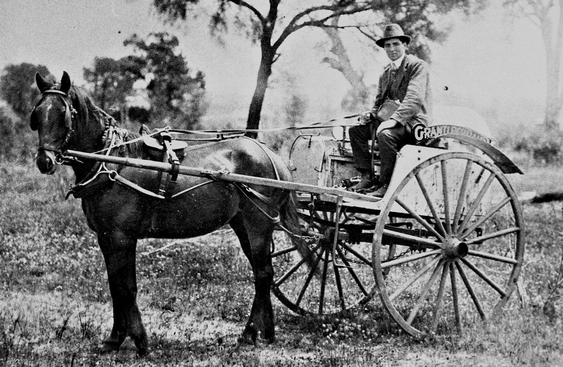
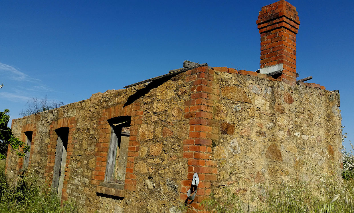
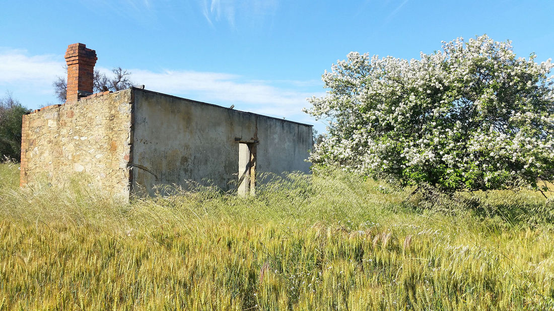
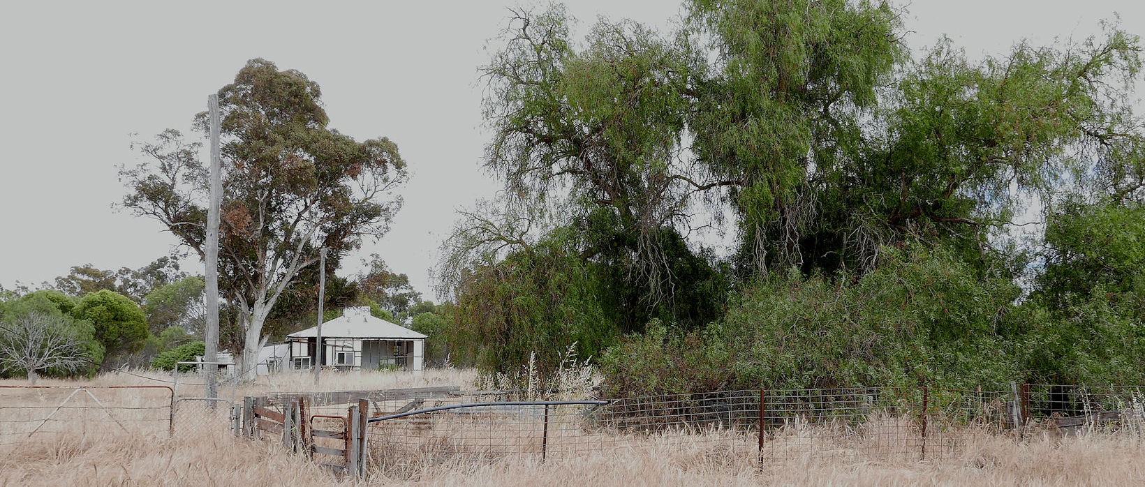
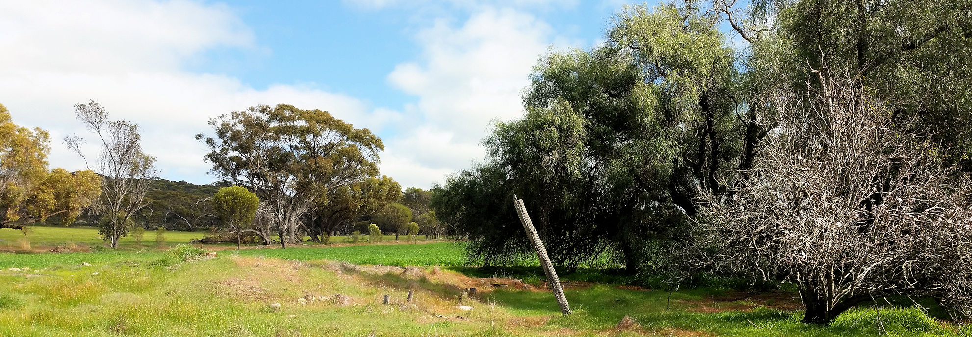
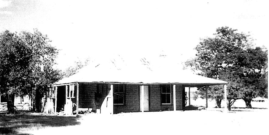
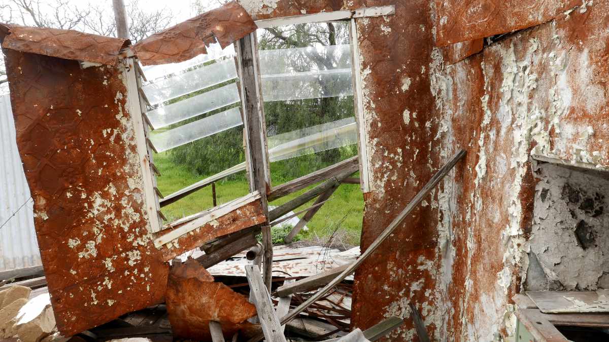
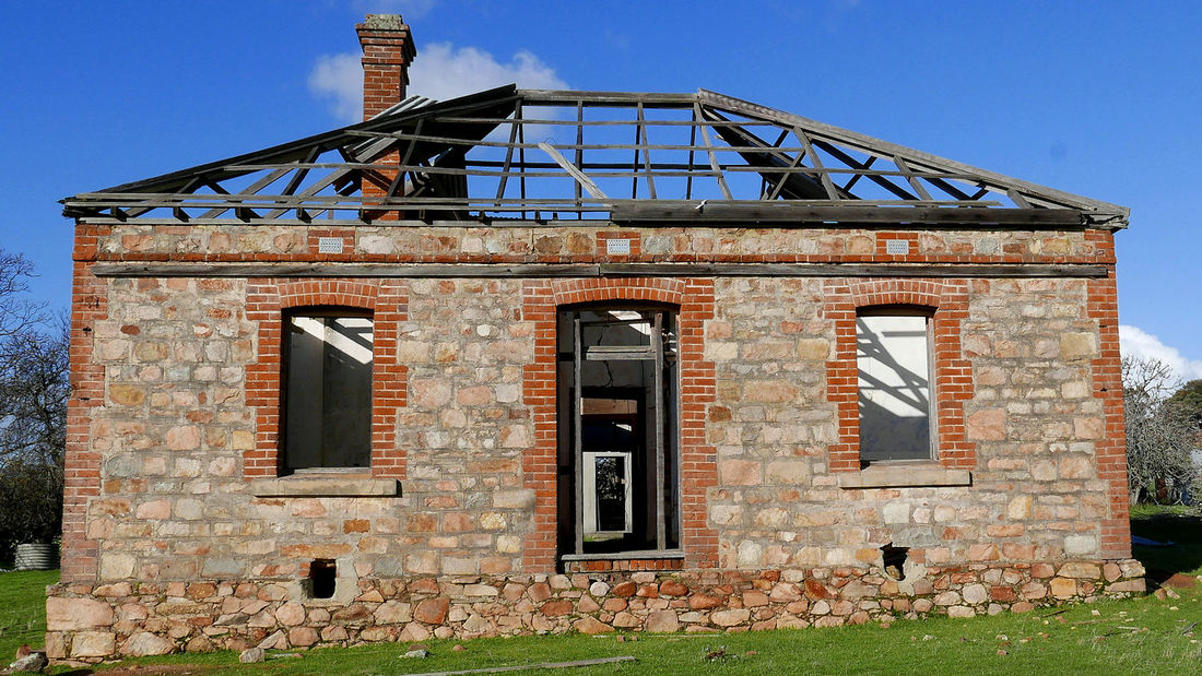
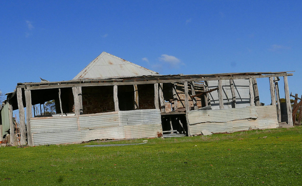
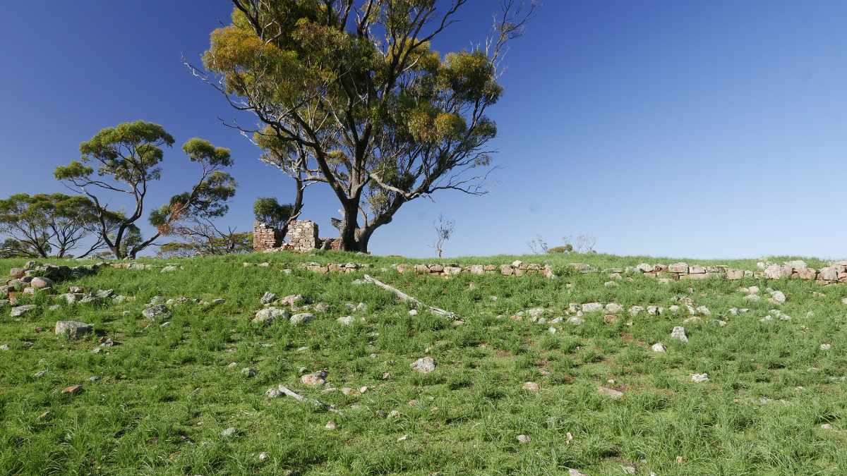
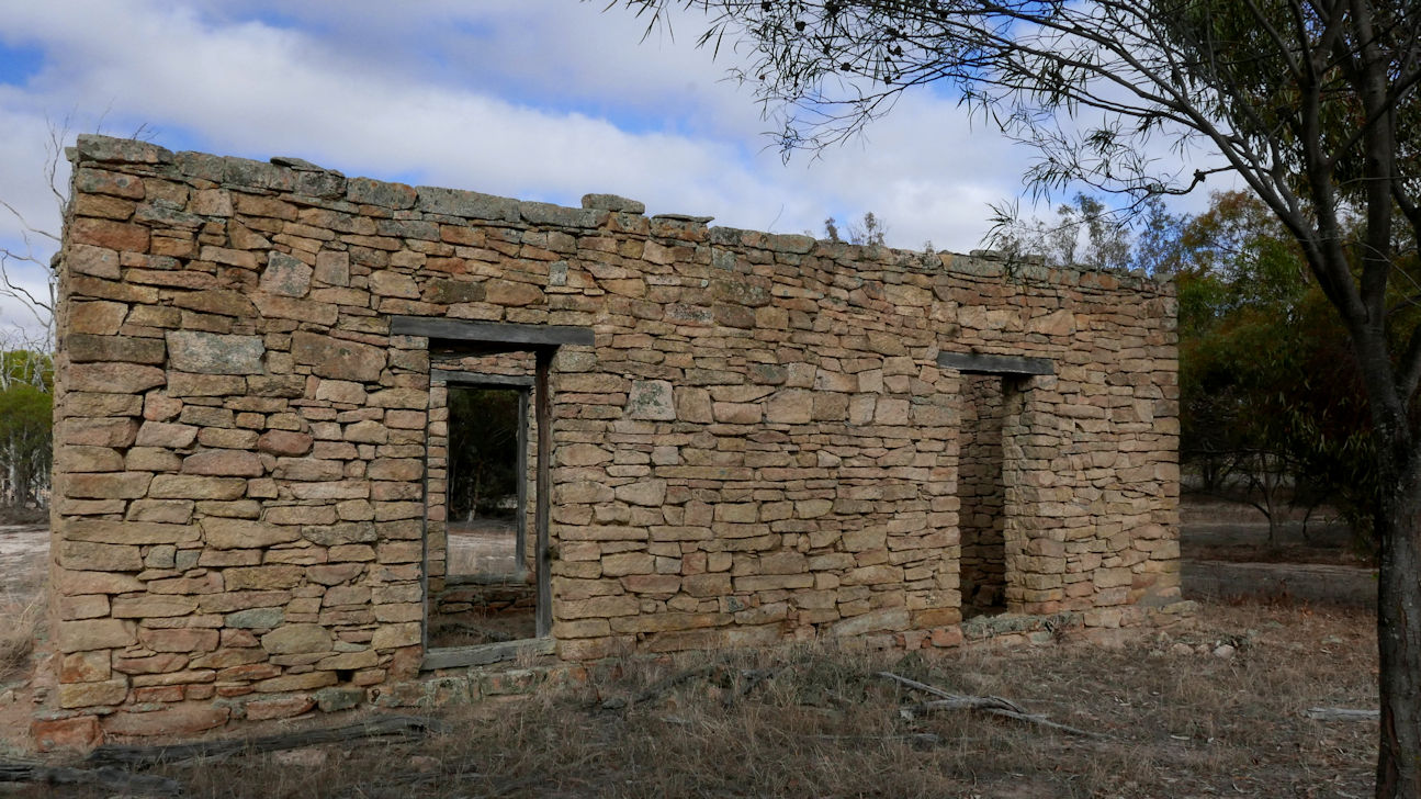
This is a large historic shearing shed on the farm that adjoins Geeralying Reserve. It was established by Stanyford Cowcher a grazier who shepherded sheep between Pinjarra and Williams, and established a homestead farm north of Geeralying spring in 1893.

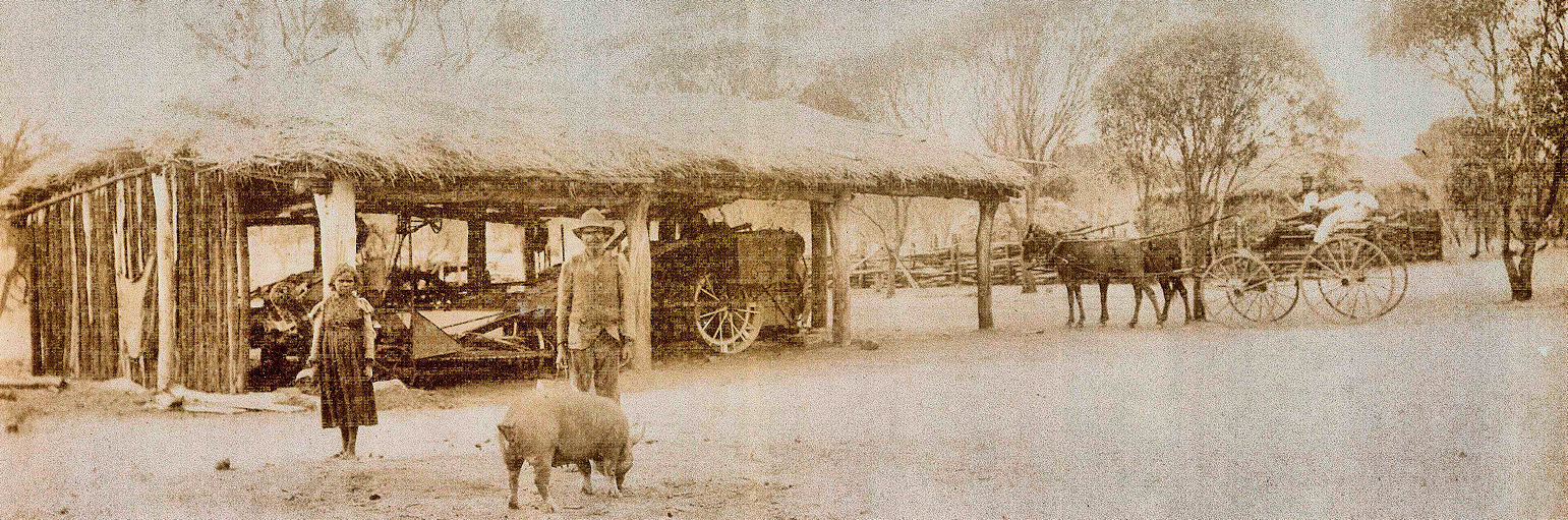
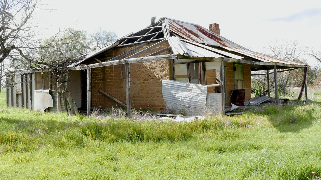
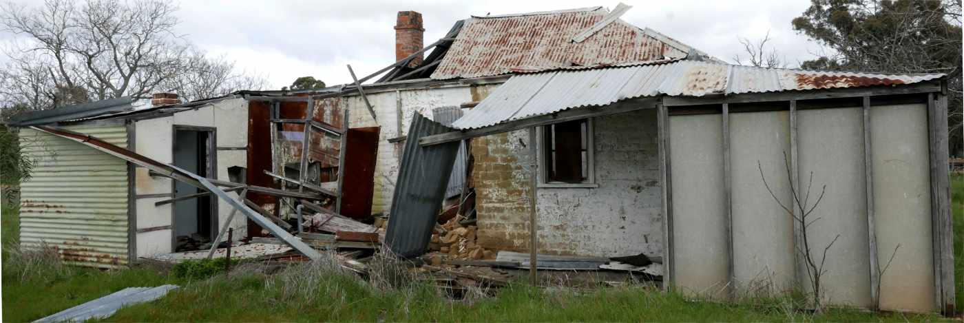
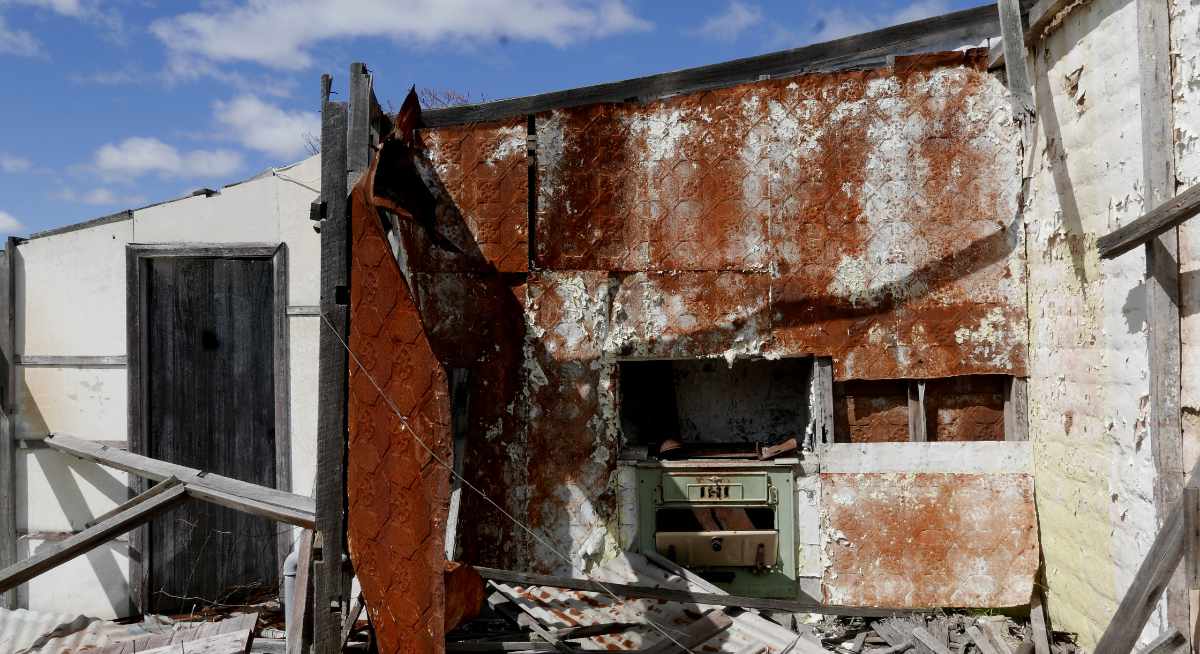
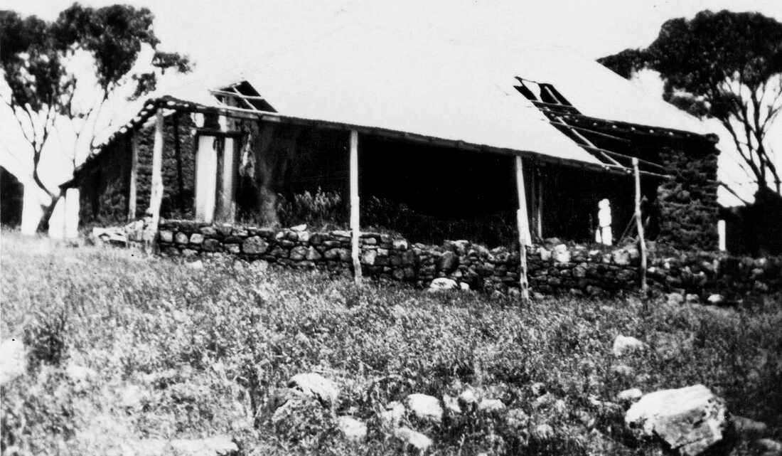
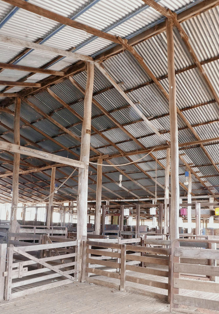
The shearing shed was built between 1900 and 1920. Initially a 4 stand shed, it was expanded to 6 then 10 stands as the Cowcher farm increased.
A stand refers to a shearing platform where the shearer stood as he pulled a sheep from a holding pen in front of him, sheared it  (initially with a blade), then pushed it out down a ramp behind him. When mechanical shearing was introduced each handpiece used by a shearer was powered by an overhead drive axle, which was driven by an engine outside. Today each handpiece is driven by an electric motor.
 
​A 10 stand shed is very large.
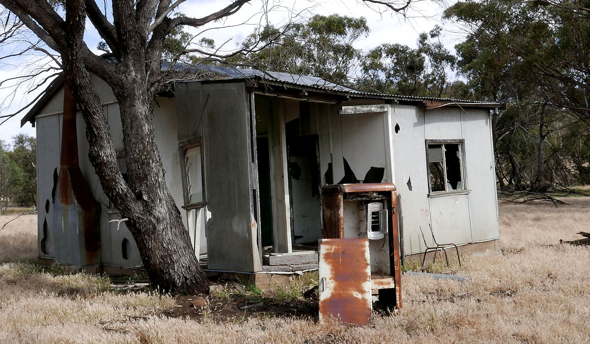
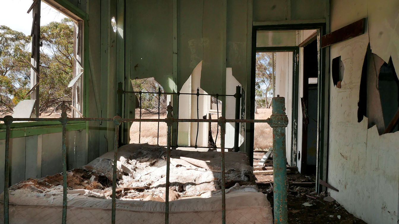
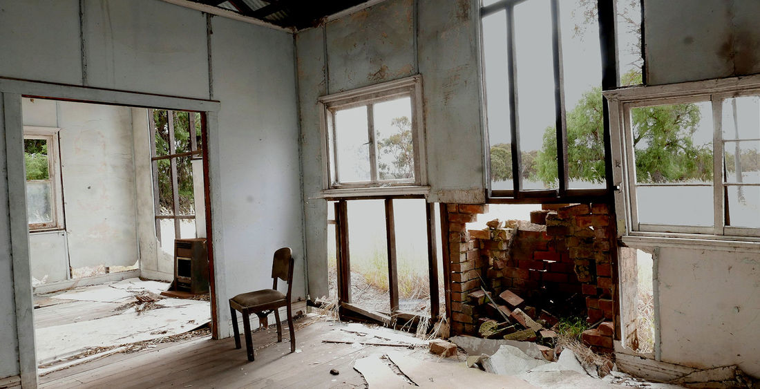
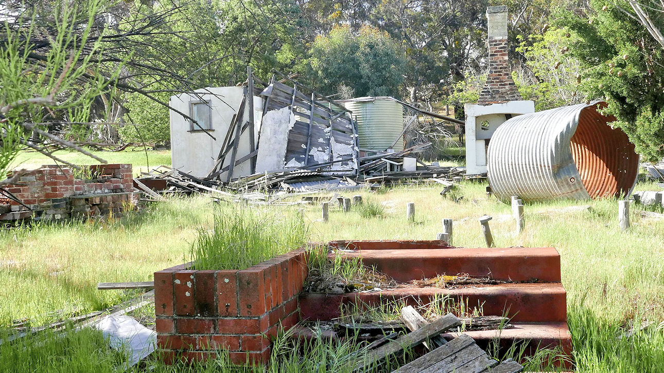
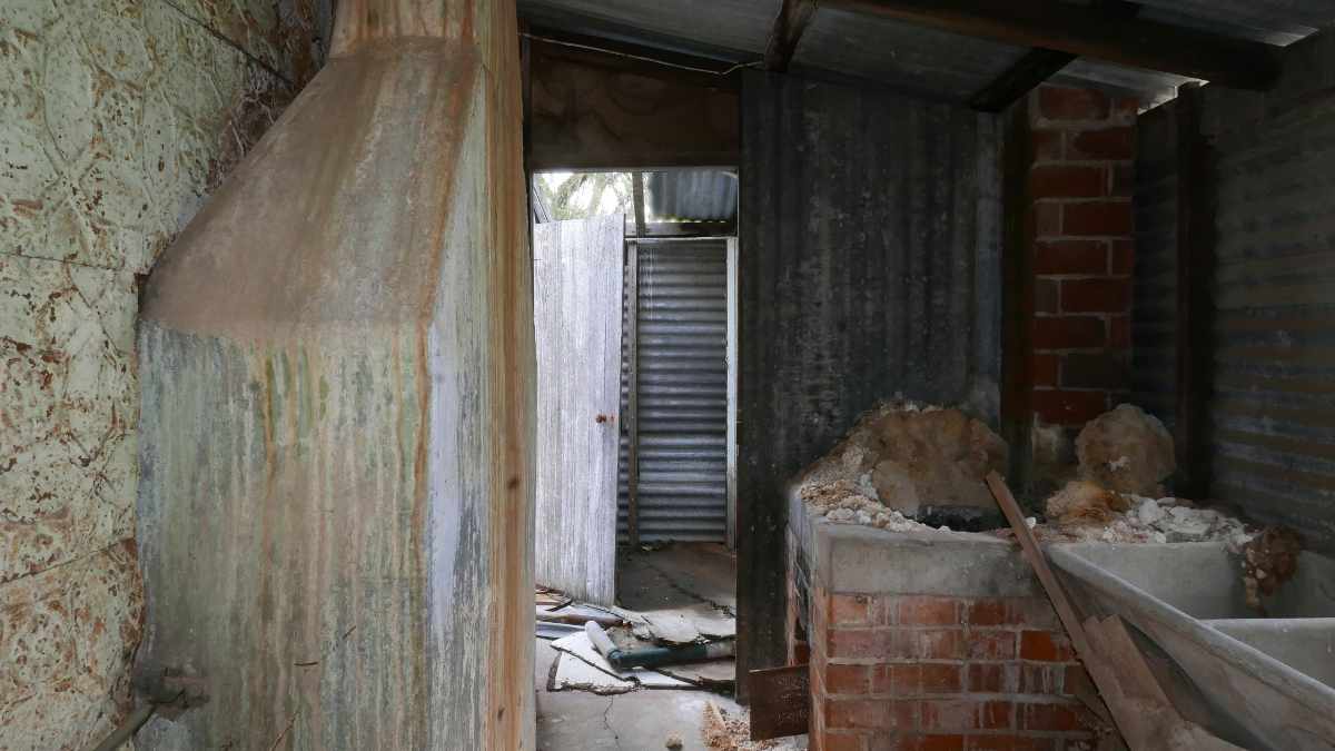
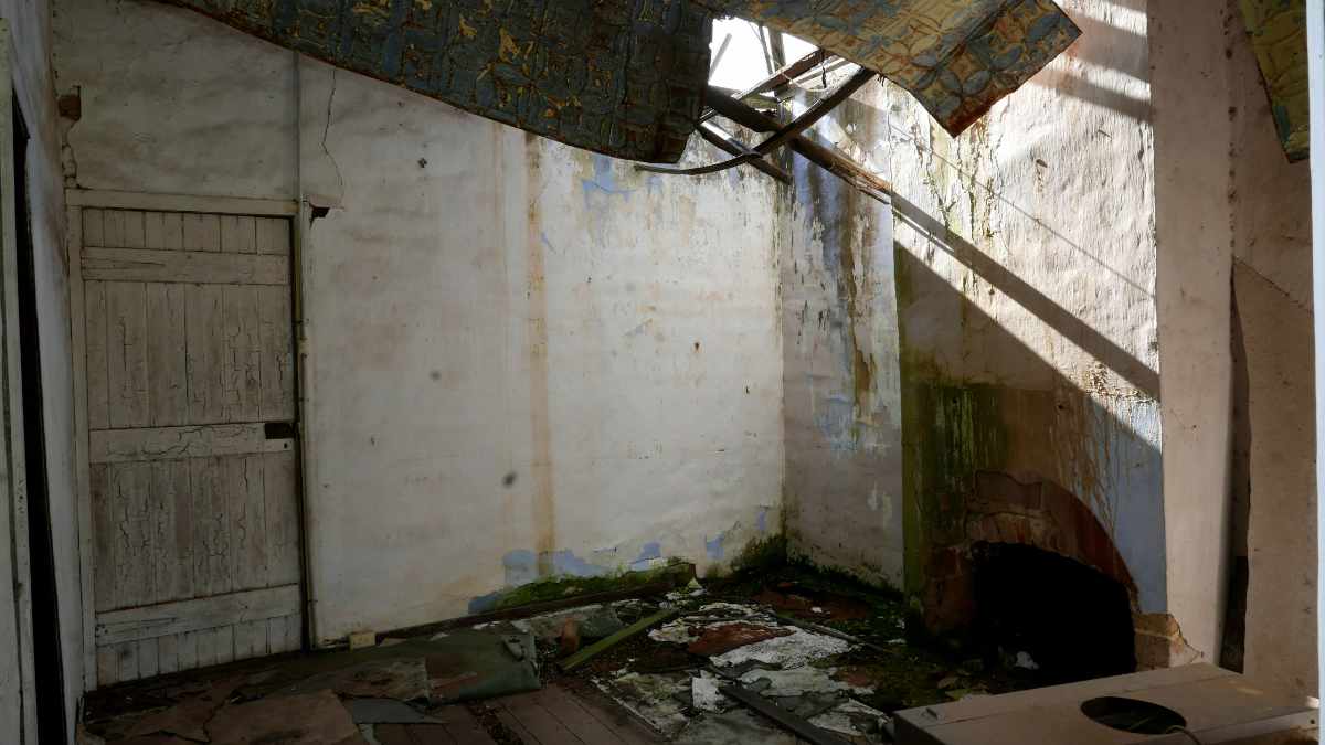
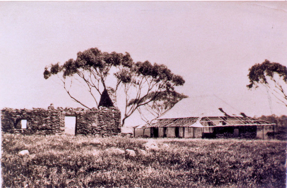
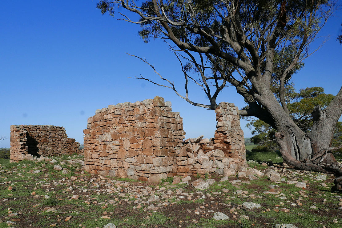
Apparently at the rear of the shed there were once stables with a long watering trough, which were destroyed in a storm, and the shed was partially rebuilt.
More modern shearing sheds have the shed holding pens and shearing stand raised above the ground to allow easier sheep movement and dung and urine to fall through the slatted floor. This shed is all on ground level (harder work).
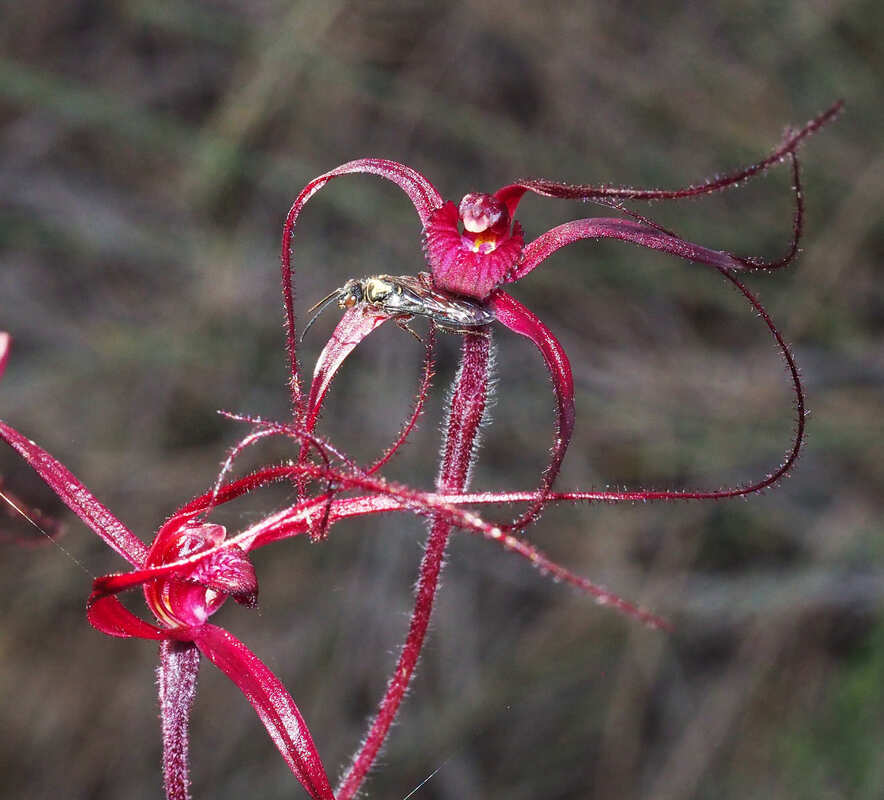
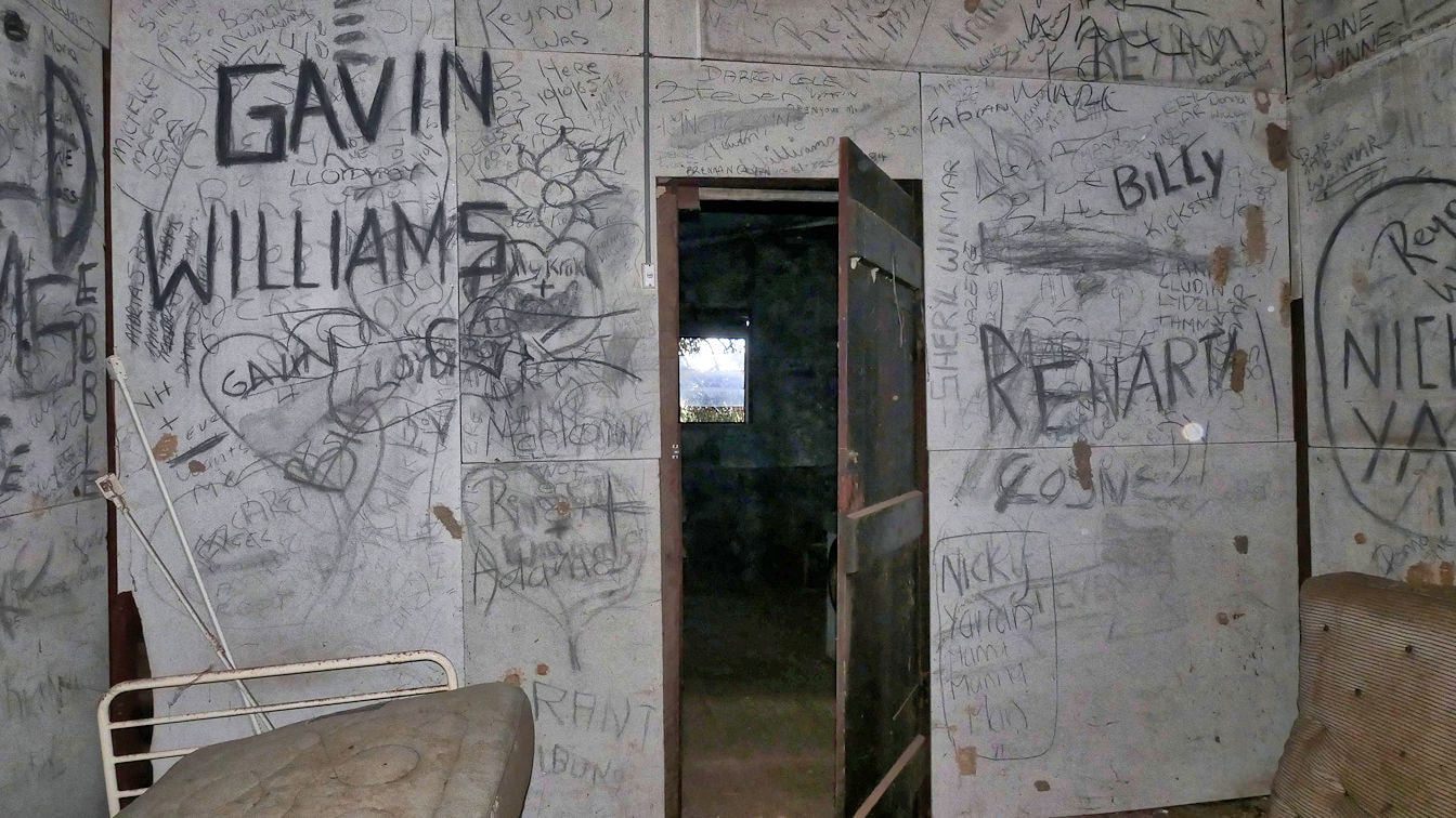
Noongar shearers were common in the early/mid twentieth century, and there were many Noongar families camped in Geeralying Reserve (see this blog).
An elderly Narrogin resident recalled an incident in Narrogin Primary School, when the children were asked where they were born. Most said Vailema Maternity Hospital (in east Narrogin), until a Noongar boy piped up “Cowcher shearing shed at shearing time”
The shed is on private land and is not available to the public without consent

​For a visual exploration of the shed see this   Google Photo album 
Click individual images for information
Picture

GEERALYING RESERVE NARROGIN

13/1/2019

 
PictureGreen=reserve, pale green former reserve, yellow Cowcher home block
​Greetings fellow Foxies,
 
Geeralying Reserve is a patch of sheoak wandoo woodland that once surrounded Gearlin/Geeralying Spring. The spring was an important permanent water supply which, with Kunderning Pool to the south and Kondenning Pool at Bannister to the west was an essential water supply along travel routes for the Noongar people, then sandalwood cutters, shepherds and early settlers.
Stanyford Cowcher a grazier who shepherded sheep between Pinjarra and Williams, established a homestead farm north of the spring in 1893.
In 1897, William Lefevre Graham, selected a property on the south east side of the reserve.
In 1906 the Narrogin-Williams railway was built with a siding on the south side of the reserve. Unfortunately for the Graham family, the railway passed right through the home orchard and they decided to move house further south.

Picture
​Other farmers established farms in the area and a one-teacher school was built on the Graham property adjoining Manaring Road in 1916. The school was ‘the canvas, sliding shutter type, airy in summer and more airy in winter’ (The Way Through p287). Contrast that with what we have now!
A hall and a tennis court were also built on the reserve but nothing remains of all three except a few plaques.
Over the years, Stanyford’s son Thomas (Tom) Spurling Cowcher, bought out adjoining farms, and part of the reserve east of Cowcher Road.

Picture
Geeralying school
​There was a significant Aboriginal population in the reserve until changes initiated by the 1967 referendum that gave the Commonwealth government sole powers for Aboriginal-related legislation. Wendy Mcdonald,( a Cowcher before marriage) recalls numerous families living in humpys on the reserve.
According to Stuart Graham, the Ugle family group moved to Geeralying Reserve from Beverley in1922 to work as shearers and farm workers.
A small fenced area to the north/north-west of the bush is all that remains of an aboriginal cemetery. Apparently the cemetery contains numerous still-born and young babies, two ‘Feather Feet’ (these were aboriginal spirit men/witchdoctors who did not belong to any clan), and Lyla Ugle.
Two vacant asbestos houses on reserve land adjoining Tom Cowcher’s house were apparently built by Tom for aboriginal shearers. I think that the one that contains evidence of relatively recent occupation was the home of John and Lyla Ugle. When Lyla died, John was granted permission to have her buried in the cemetery plot opposite his house so he could see her grave when he got up each morning. He was the last occupant of the reserve to my knowledge. Other inhabitants include Neddy Isaacs and Shirley Hume.
Picture
John Ugle's house?
Picture
Bedroom
August 2022
I had dismissed the nature value of Geeralying reserve because it has been very disturbed and weedy, but was amazed to find a patch of orchids near the parking bay. I discovered the (uncommon) blood spider orchid and cowslip, jug, snail and dark banded greenhood orchids.
​ 
​For a visual exploration of the reserve and house see this   Google Photo album
 
Click individual images for information
Picture

HANSEN DAIRY NARROGIN

17/12/2018

 
PictureGrantleigh Dairy milk cart
Greetings fellow Foxies,
 
I was recently shown ruins of the Hansen dairy that is close to Clayton road near Narrogin. I was told that this was the second Narrogin dairy. The original was Grantleigh Dairy operated by Edward Wiese on Quarry Road.
​I was lucky enough to talk Hans Hansen’s last surviving daughter Edith, who related a tale of a remarkable and well-loved man. There is a great book to be written on this family, but here are a few snippets.

Hans originally migrated out from Denmark to rescue his sister who was married to an abusive Norwegian drunkard, and took up a farming block near Jilakin rock with 3 other Danes. He was a member of the Narrogin 10th Light Horse, and with two of his colleagues volunteered for military service at the outbreak of the World War 1. They were rejected because “Danes like Germans too much” (untrue), but were called up after the Gallipoli disaster. (Amazing the change mass casualties can make). Hans met his future wife Isabell at the Blackboy Hill training camp at Northam.
Edith has his wartime diary, and here is his military record . He fought on the Western Front.
After the war he and now-wife Isabell, briefly farmed the Pustkuchen ‘Sylvania’ farm before buying the 400 ha ‘Lawndale’ farm from early settler John Edward Clayton. The onset of the Great Depression and the rabbit plague (Edith remembers skinning and gutting wild rabbits), forced Hans to find more income. Initially he worked on the Dryandra mallet plantations and started a dairy that became his main occupation.
Hans and Edith had 6 daughters and a son, but only the central core of their house, consisting of two fine brick built rooms remain. Other structures included parents’ bedroom, dining room, kitchen, front and back verandahs, and 2 adjoining buildings, of which one was used for cooling and separating the milk.
Isabell died of a stroke when Edith was 11, and the two eldest daughters had to stay home from school for a while to look after the rest of the children.
 ​Cows were originally milked in a  long gone shed near a line of ancient Cape Lilac trees by the creek before the existing dairy was built. You can still see remains of the feeding trough in the second building’s milking room. Cream was separated from the milk, and placed into containers in water to cool overnight before delivery. No pasteurisation in those days, but as Hans and children lived to their nineties, it was clearly good stuff.
His day started at 3am for house to house delivery in Narrogin by 6am. He was frequently found asleep while doing the accounts in the afternoon.
He eventually retired to Narrogin and died at the age of 93.  Hans and Isabell’s gravestones are in the Narrogin cemetary.
For a visual exploration of the house and dairy see this   Google Photo album
Click individual images for information

Picture
Picture
House

BROADLEY HOUSE QUINNS POOL TARWONGA

29/11/2018

 
​Greetings fellow Foxies,
 
I found this house on a property adjoining Quinns Pool near Tarwonga.
The pool was named after Michael Quinn, one of the pioneering pastoralists in the district. Michael took up several grazing leases in the Williams east district that may have been up to 40,000 hectares. His sheep were looked after by Noongar shepherds who moved around with the sheep, and largely lived off the land. By purchasing small homestead leases at vital waterholes, pastoralists delayed the release of land for farmers to establish farms.
Picture
Picture
​Michael Quinn was an important Williams identity, but transferred his grazing further south as farming increased in the district. He lost a well-documented dispute with George Dyson who obtained a tillage lease at Kunderning Pool that denied Quinn’s sheep access to the pool.
Quinn moved south to an 8,000 hectare grazing lease between Wolwolling and Ballagin Pools. Quinn’s pool further west would have been an important staging point for moving his sheep and horses to market.
Over time the land was surveyed into farming blocks by the state government and sold for farming.

This house is later than the original on this World War 1 soldier settlement property that was allocated to Douglas Broadley. A search of the AIF Project website revealed that he was a reinforcement in the 15th Light Horse Field Regiment who was overseas from 30/6/1917 to 26/7/1919. His brother George was a private in the 12th Field Artillery Brigade who died of wounds on 23/3/1918.
Like most soldier settlement blocks, this property would have been too small to be viable. Douglas most likely sold out to a neighbour and disappeared from local history.
The asbestos house is a health hazard today today, but was a comfortable home at the time in a nice location.
On the eastern side of the property is the wonderfully diverse and wildflower-rich Quinns Block reserve that will be described in a Foxypress.
 
For a visual exploration of the place see this Google Photo album

Picture
Picture

Marramucking Well

14/11/2018

 
Marramucking well can be found about 30km from Narrogin, 5km north of the intersection of Marramucking Road and Boundain North Road. It is worth visiting as part of a loop with Yilliminning townsite and Yilliminning Rock that is described in another Foxypress. The meaning of the name is lost but it was one of an east/south east line of important watering places for aborigines, early settlers and sandalwood cutters.
An aerial view shows the reason for the well’s location.
Rocks on either side of the well are granite that has weathered to sandy surfaced soils. In the image below you can see a raised line passing below the well that represents a ‘dolerite dyke’. This dark rock is a part of the Binneringie dyke suite that goes from Quindanning to Coolgardie and includes the southern rocky red soil ridge in Foxes Lair.
O.E. Pustkuchen, author of ‘The Way through; The Story of Narrogin’ writes of playing in sticky red clay below the Marramucking Well. This red clay, formed from dolerite acts as an underground wall that interrupts groundwater passing down the sandy slope, and forces it to the surface as seepage. The water goes down again after crossing the dyke back to granite. This is a very common cause of seepages, wells and lakes in the district that were once fresh but are now generally saline.
Picture
Well is where dolerite dyke crosses the road. Note red clay road section
There is a concrete picnic table and the Historical Society renovated the area many years ago, but the style placed for crossing the fence has rotted away.
Picture
The well a standpipe and the remains of a water trough can still be seen with the ubiquitous pepper tree.
Have you ever noticed that these trees occur on a great many historical sites in the wheatbelt to the goldfields?
With or without a commemorative stone they are the only trace of many schools, houses and sheds from a time when most WA inhabitants lived in the country (a pox on big cities!).
I thought that Schinus molle was called the Japanese pepper, but it is actually the Peruvian pepper, an amazingly drought tolerant tree from the Andes. So shady and soft, it is apparently listed as an aggressive weed, but I haven’t noticed them seed or sucker.
Picture
Schinus molle Peruvian Pepper
Picture
Old well and trough
Fruit and almond trees are also seen around old homesteads as many farmers at the turn of the century had orchards to supplement their income, with some fruit being exported to England.
Further to the north is a heap that is all that remains of a mud-bat house that had a single divided room with a narrow addition on each end.
Picture

Minabbie 5 Farmhouses

1/11/2018

 
​Greetings fellow Foxies,
                                    
‘Minabbie’ was the name of the farm occupied by William Lefevre Graham and his descendants. William was a noted local farmer whose farming fortunes waxed and waned. His original block adjacent to Geeralying reserve contained the Geeralying School. According to his grandson Stuart, the Narrogin-Collie railway line was built through the orchard next to the house prompting William to rebuild further south.
The image below shows William’s permanent Noongar farm worker Ben and his diminutive wife (about 4 ft 6 inches tall) at the first Minabbie with William and Stanyford Cowcher in the background. At this time and earlier, Noongar workers were highly valued by settlers.
Picture
 Extensive public activities took a toll on Williams’s farm income and he shifted homes three more times in the Geeralying area (including Rocky Crossing). His extensive farm holdings were so heavily mortgaged that they were sold after his death. His son Leo purchased a part of the farm that is the present ‘Minabbie’.
This edition shows two ruined Graham houses on the Narrogin property.
A standing clapboard and iron house built in 1927 was closer to the road, before being shifted to its present location and refurbished for Noongar shearers before becoming vacant. The first shearers were Ugles, then Eric Krakouer.
The interior is a living history of graffiti that I hope is preserved. No doubt some locals would recognise their work.
In 1945 Leo Graham had a house transported from Bullfinch and reassembled on its present site. Bullfinch is a deserted spot North West of Southern Cross that was once a thriving town associated with a gold mine. When the mine closed, Bullfinch houses were relocated to many areas in the agricultural area.
I also found the cow shed. Apparently, Leo was putting the cow in the shed when he was nearly struck by lightning. He eventually found his way back home dazed and glowing, and took several days to recover.
 
The Google Photo album shows the remains of both houses.
See the images on
https://photos.app.goo.gl/pcfeBTGKJLHiMt9F9
​
Picture
1945 house ruin
Picture
1927 house

Trecarne Farm HIghbury

11/9/2018

 
​Trecarne Farm was initiated by Charles Henry Hoffman who was born in Bonn Germany in1863. In 1904 he purchased a 500 acre bush block from the family of his wife (Anne May Oliver) at 2/6 an acre. As Charles had been a greengrocer in Germany, the family started to grow vegetables while the land was being cleared. The market garden remained their chief livelihood, and son, Bill was well known in Narrogin for his fine quality fresh vegetables. The farm remained in the Hoffman family until the 1990’s.
The house is built in 1906 from mud bricks with bush timber poles in the roof. Many later additions and repairs followed and it was intact when listed in the Municipal Heritage Inventory in 1995.
Further information can be found in ‘Wolwolling’ Reflections by Gwen Warren and ‘The Way Through’ by Ossie Pustkuchen.
 
For a photo tour of this site see Google Photo images on https://photos.app.goo.gl/KgNsZZP5NAnUhc8k9
Click first image to open and then go forward/backward 
Picture
1995
Picture
2018

Boondyne Spring

3/8/2018

 
Picture
Greetings fellow Foxies,
This picturesque ruin can be seen from the road on private property upslope of the creek containing Boondyne Spring (one of the earliest known springs east of Narrogin). In Ossie Pustkuchen’s book “The Way Through’, Michael Brown (“the father of Narrogin”) purchased a 4,000 acre (1600 ha) property Boondyne around 1890 to add to his extensive land empire. The 1894 lithograph shows it as Boundyne spring, and the Boundain railway siding was apparently named after the spring/farm.
I’m not sure who built the house. There is an intriguing mention of a shepherd Thos. Pennyfather at the spring in 1885, which predates the house, and may account for a quaint one-room building at the back. Neither Michael Brown nor his son Jack (who farmed the property) lived there. I suspect it was built for the next owners, the Leyden brothers.
The main house is a beautiful three-bedroom granite and brick place that would have been a fine house in its heyday. Wooden floors have mainly rotted away, but most walls are still intact and retain traces of attractive pastel kalsomine colours. The soil under the floorboards had an interesting layer of fossilised rat poo

Picture
On one side is a large rock-lined well, and downslope are ancient survivors of an extensive orchard.
At the rear is a quaint, low, partially-collapsed, one- room, granite block structure. The carefully built windows lead me to think that it was a cottage, but the end that may have contained a fireplace has collapsed.
About 200 metres away is the remains of a very early shearing/ machinery shed built from forked wandoo log uprights  supporting long log rafters that are wired on without nails.

Picture
Another building further along is a mystery. A granite central room that still has its roof has no windows and a door normally found on a barn. Wood and corrugated iron extensions are intriguing.
On the north side a cement floored area contain signs of more recent occupation by a rather versatile person. Some innovations include a bicycle wheel TV antenna and a shower inside a corrugated iron water tank.
The western annexe has a raised area used as a sheep pen that led to a hole in the wall to an open cement floored area facing south. Traces of a long bench make me think that it may have been used for butchering.


I hope that more information comes forward to unlock the mysteries of this fascinating place.
 For a photo tour see  Google Photo images on https://photos.app.goo.gl/4vPq9ov6EQzmFjj39

Chuggamunny House

21/7/2018

 
Greetings fellow Foxies,
 The name refers to the evocative ruin on the hill to the left of the Great Southern Highway just before the Chuggamunning Road turnoff, but there are a range of names relating to the property. The earliest lithograph I could find shows a Jugominning Spring, and Ossie Pustkuchen refers to Shuggamony Spring, and the infamous hill that tested locomotives is Chuggamunning Hill.
Elijah Quartermaine junior sailed out from England with his family in 1838, and received title to a plot of land containing Chuggamunning spring. His house (Chuggamunny) was built on the hill about 200 metres upslope from the spring, and the family shepherded sheep on surrounding land. In 1866, two escaped convicts surprised them one night and stole a double barrelled gun, a revolver, ammunition and rations, and left them unharmed.
In 1868, the house and property was sold to William Farrah Lukin, a remarkable district pioneer. William had extensive sheep leases with JH Monger and William Shaddick around Narrogin out to Toolibin. A restless and ambitious man, he took up a pastoral lease east of Derby that ended disastrously when a flood killed all 14,000 of his sheep. He then went to the Klondyke Goldfields in the Yukon in hope of regaining his fortune and disappeared from history (possibly killed in the 1906 San Francisco earthquake).
A neighbour James Doust leased the property and moved into the house in the 1880’s.
James and wife Elizabeth built a mud-batt building to the north of their house that Elizabeth ran as a boarding house for railway workers, farm hands and teachers from the Cuballing School. Only a few foundation walls remain, which indicate that the 5 bedrooms were tiny. The house looks much larger in the historic images supplied by the Narrogin Library, so I suspect that other rooms had a dirt floor.
There are rumours of much rum drinking and wild gambling at the boarding house. Elizabeth was a kindly soul and also the local midwife. I wonder how the Doust household coped with rowdy dissolute behaviour less than 20 metres away from their house.
There are even rumours of a ghost but hooooo knows
The Google Photo album of old and new images shows the stone house’s deterioration. The ancient York gum by the house has a huge split in its trunk with one half threatening to complete the destruction.


See the images on https://photos.app.goo.gl/UqDi87SutkeDFuHa6
References
'The Way Through: The Story of Narrogin' O.E Pustkuchen
'Numbat Country: The Story of the shire of Cuballing from Earliest Times until 1997' E. Roots.
Picture
ruined house and guesthouse
Picture
house in 2018

Pustkuchen Ruin south west Dumberning

21/7/2018

 
Greetings fellow Foxies,
Recently I was invited to see a wonderful stone structure on a private property that has a sad story. Below is a quote from Gwen Warren’s book “Wolwolling Reflections”
Pustkuchen (Two sons and their mother“Family, had cleared 150 acres (60ha) and fenced and poison grubbed the rest, about 500 acres in all. They were in the process of building an excellent stone cottage along the creek in a beautiful setting when the country was burnt out by one of the many fires that escaped in those hot summers. This brought up such a dense growth of Heart–leaf poison that they were forced to abandon it”.
This was one of many family setbacks at a time when many local men experienced World War 1 and the 1930’s great depression. Most new settlers in the area went broke and walked off leaving a debt to the Agricultural Bank. Those that hung on gradually bought out the debts and built up many of the farms we see today.
The house consists of nearly complete stone walls of carefully placed granite blocks and smaller pieces cemented by local mud. A wonderful example of German precision, but the structure is weakening as mud washes out.
The family lived in a smaller bush structure alongside, of which, only a stone chimney remains.
Unfortunately, the once attractive river terrace site with fresh water soak, has now become saline.

Update: It is likely that the house was built by Kurt Pustkuchen (D.O.B. 30/07/1908), (Ossie's brother)  before he married Marion Knox in 1934. and moved to another farm further north on Dumberning Rd.
Clues to the family’s connection with South Australia are the Sugar Gum (Eucalyptus cladocalyx), and Kurrajong (Brachychiton populneus Vic, NSW Qld) trees.
.
 For a visual exploration Crtl+click this link
Picture
<<Previous

    Categories

    All
    Cuballing Shire
    Narrogin Shire
    Wickepin Shire
    Williams Shire

© 2015 All Rights Reserved. Doug Sawkins, Australia.