Greetings fellow Foxies,
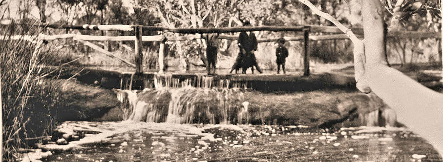
By chance I was shown an old image titled “Booran Pool” that features three boys with one astride a sheep or dog, on a pool/crossing that resembles Rocky Crossing/Kunderning Pool.
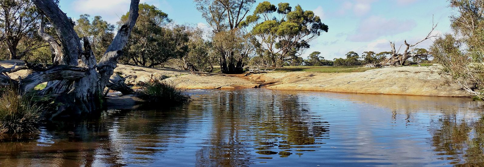
A bit of research led to a small reserve containing a granite shelf across the creek – the Booran Pool crossing. It is another link in the chain of pools that were essential stops on the earliest trail from Perth/Williams that connected settlements at Narrakine Gully and Wolwolling Pool. They were also vital for Noongars, shepherds and sandalwood transporters. A few homesteaders had quite large grazing leases in the district, and employed shepherds to tend flocks of sheep that grazed in natural grassland. Shepherds (Noongars, free settlers, and ticket of leave convicts) lived a hard and lonely life in the bush, returning to the homesteads only at shearing. Before shearing, sheep had to be washed (apparently a terrible job) in pools of water.
By chance I was shown an old image titled “Booran Pool” that features three boys with one astride a sheep or dog, on a pool/crossing that resembles Rocky Crossing/Kunderning Pool.
A bit of research led to a small reserve containing a granite shelf across the creek – the Booran Pool crossing. It is another link in the chain of pools that were essential stops on the earliest trail from Perth/Williams that connected settlements at Narrakine Gully and Wolwolling Pool. They were also vital for Noongars, shepherds and sandalwood transporters. A few homesteaders had quite large grazing leases in the district, and employed shepherds to tend flocks of sheep that grazed in natural grassland. Shepherds (Noongars, free settlers, and ticket of leave convicts) lived a hard and lonely life in the bush, returning to the homesteads only at shearing. Before shearing, sheep had to be washed (apparently a terrible job) in pools of water.
There was even a Booran Pool cricket team!
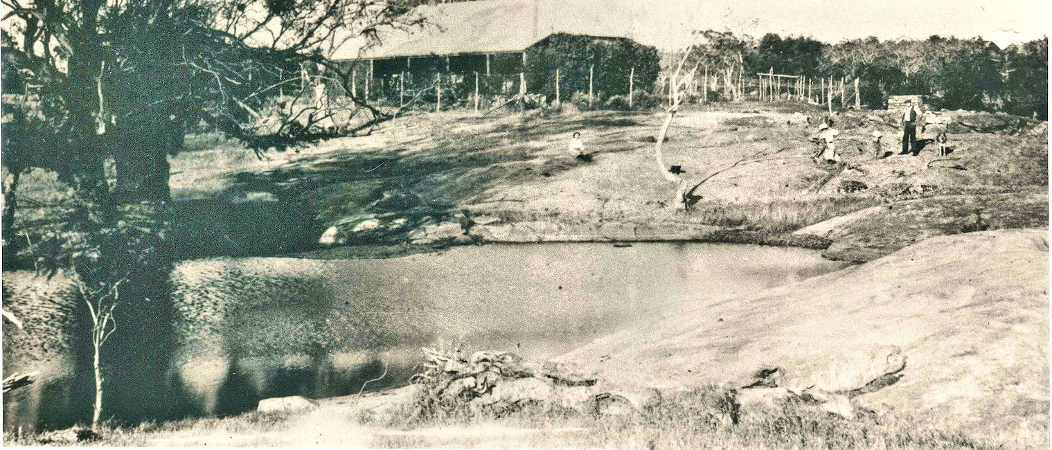
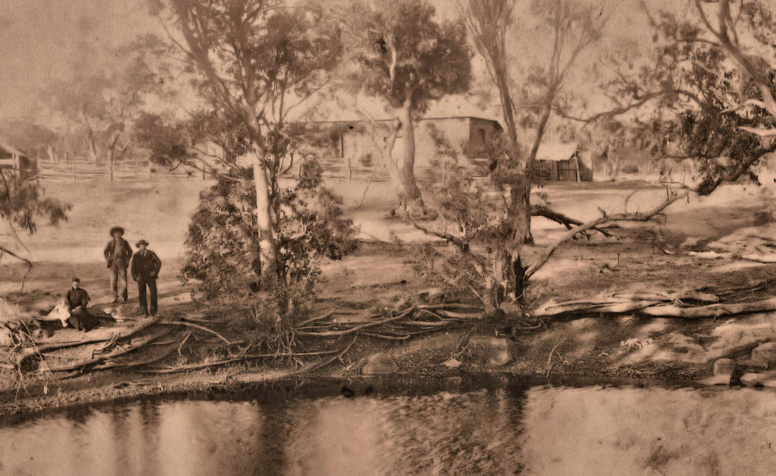
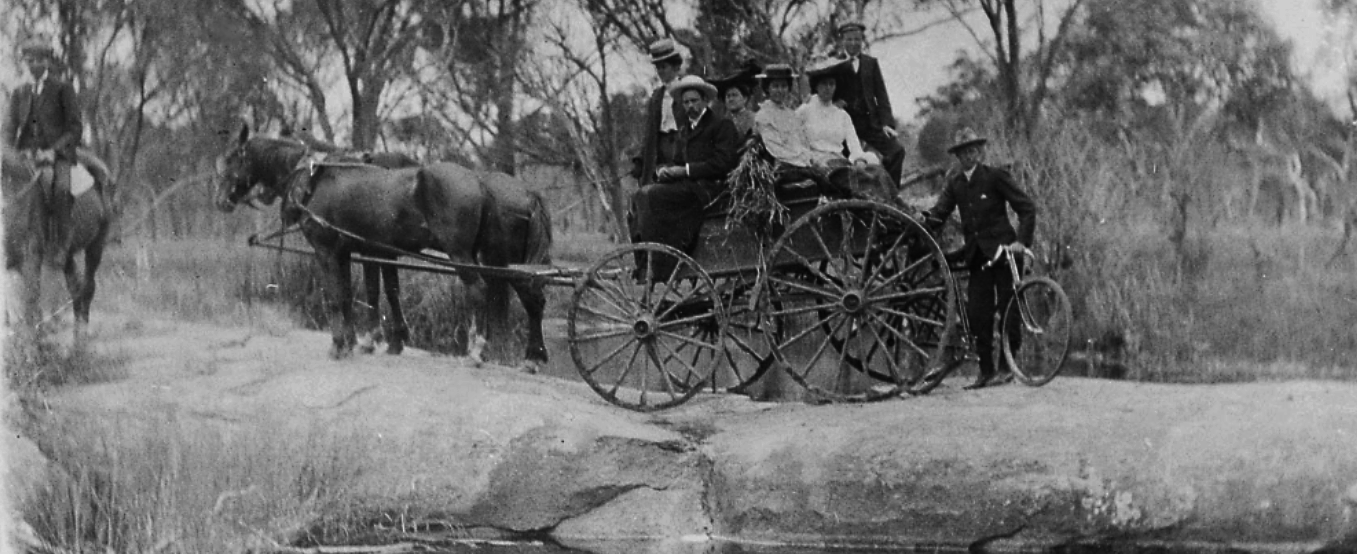
The pool is on the edge of the Dumberning estate grazing lease, which was progressively converted to freehold farms. Here is a 1910 image of a picnic group at the pool.
The pool is on the edge of the Dumberning estate grazing lease, which was progressively converted to freehold farms. Here is a 1910 image of a picnic group at the pool.
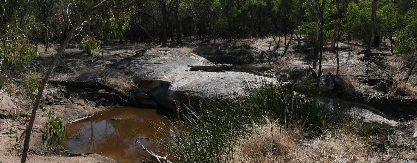
Crossing in 2023
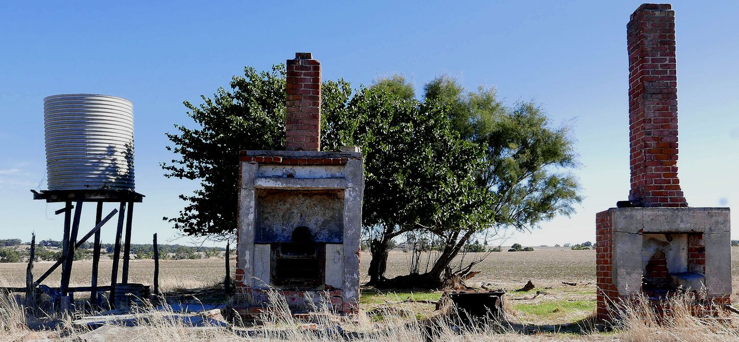
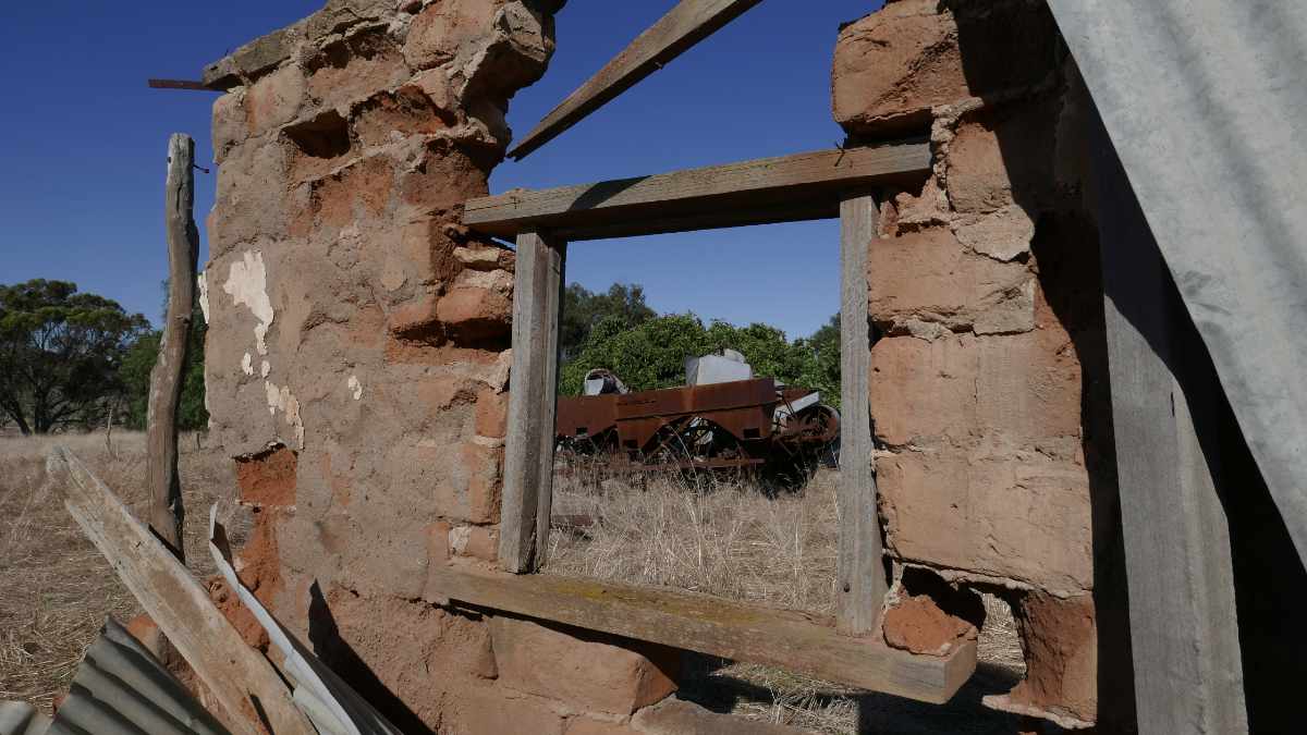
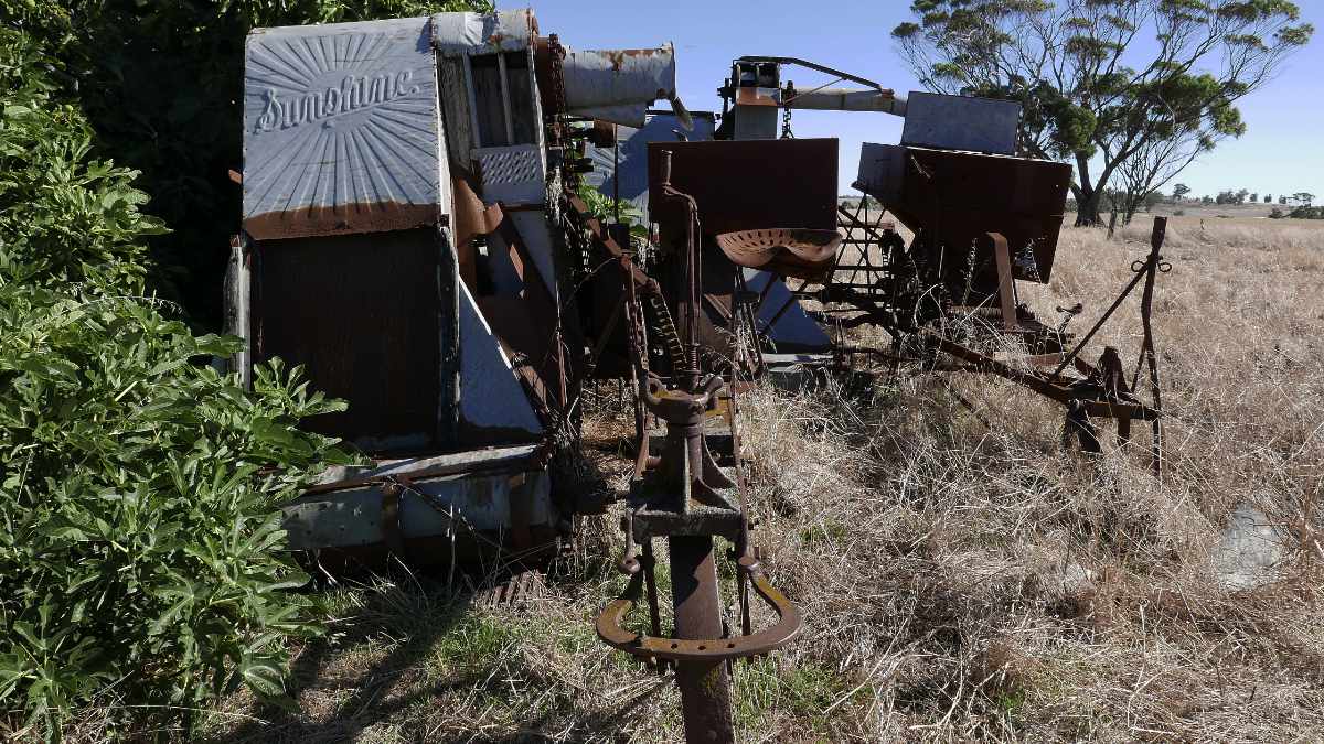
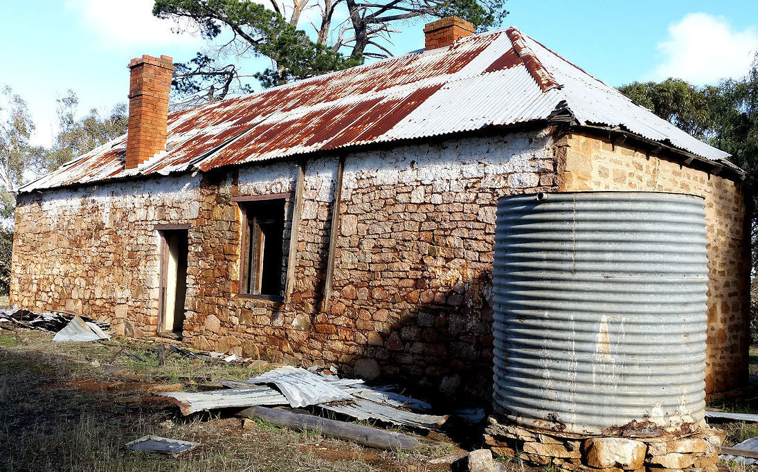
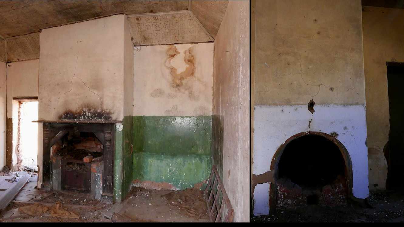
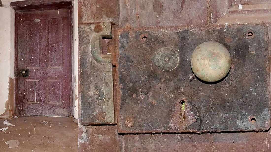
I was lucky enough to visit nearby ruins on private land. Two houses once stood here. The more recent is now two fine chimneys and a water tank. Nearby is an almost melted mud batt cottage and the skeleton of a wooden barn that would have had a bush thatch roof. The jewels at this site are two Sunshine harvesters adjoining a massive fig tree. It was pretty hot when I visited, but so cool under the fig. Early farms were almost self-sufficient. Besides sheep farming, farmers sold pigs, fruit, dairy products, hay and grain, and often collected sandalwood and brown mallet bark in hard times.
Edith Darby who lived here wrote "My father Kenneth Darby purchased this property consisting of 429 acres in April 1946 and farmed it until December 1959. It was purchased from Jack (John?) Stevens. From O. Pustkuchen's records it seems his father, also John, had property further north (up on the rise).
We lived in the mud batt house until the timber framed/asbestos house was completed in about July 1954. There was a well very close to the rear of the batt house on which Dad erected a windmill and overhead tank. Unfortunately after a number of years the water became too salty for the poultry and garden.
When we moved to the new house Dad had a dam just north of this house enlarged. Dad removed the well windmill and re-erected it on this dam for the house garden. He erected an overhead tank close to this house. I don't know who built the batt house. It had no ceilings in the 5 rooms.
There were a couple of bough sheds/stables/chaff room then Dad erected an iron shed for machinery and shearing. He put in the sheep dip by the yards. I seem to remember another "dip" in the creek immediately due west of these sheds where there was bit of a stone "causeway"/crossing and a rather deep pool." ( Booran Pool?).
Below is a link to a folder of images of the ruins in Google Photos.
Click on the first image after opening the link https://photos.app.goo.gl/QMBfrVQgf0ilHpB32