Marramucking well can be found about 30km from Narrogin, 5km north of the intersection of Marramucking Road and Boundain North Road. It is worth visiting as part of a loop with Yilliminning townsite and Yilliminning Rock that is described in this Foxypress. The meaning of the name is lost but it was one of an east/south east line of important watering places for aborigines, early settlers and sandalwood cutters.
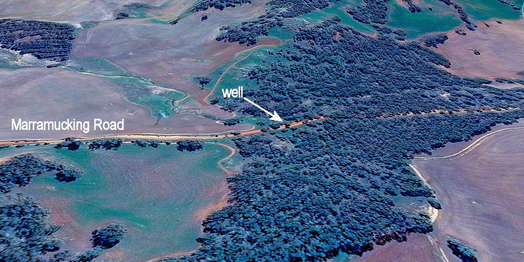
An aerial view shows the reason for the well’s location.
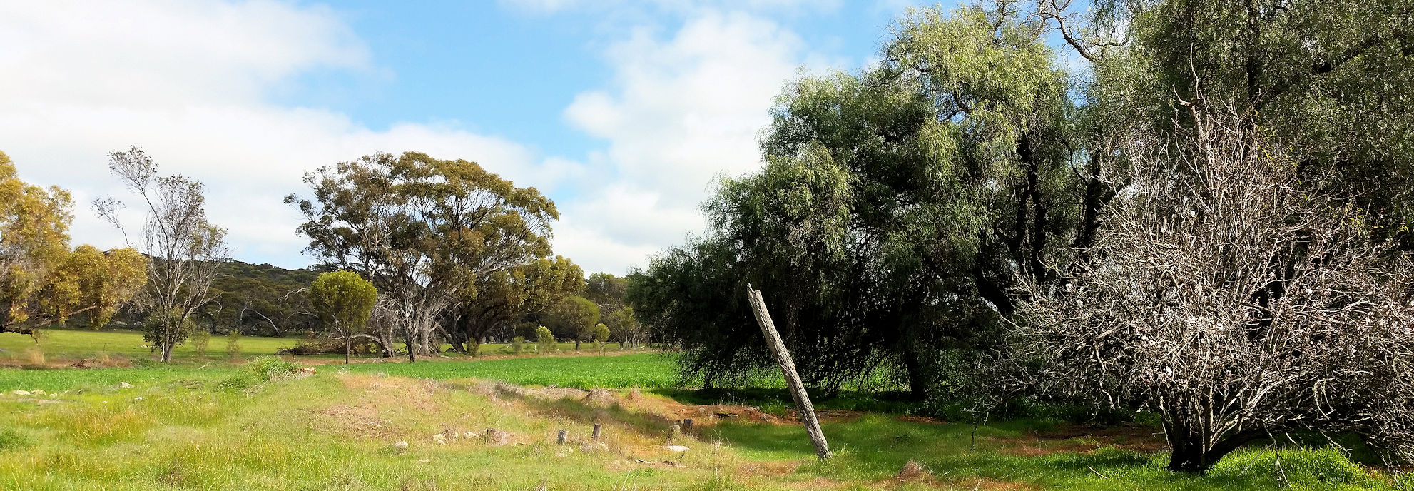
Rocks on either side of the well are granite that has weathered to sandy surfaced soils. In the image below you can see a raised line passing below the well that represents a ‘dolerite dyke’. This dark rock is a part of the Binneringie dyke suite that goes from Quindanning to Coolgardie and includes the southern rocky red soil ridge in Foxes Lair.
O.E. Pustkuchen, author of ‘The Way through; The Story of Narrogin’ writes of playing in sticky red clay below the Marramucking Well. This red clay, formed from dolerite acts as an underground wall that interrupts groundwater passing down the sandy slope, and forces it to the surface as seepage. The water goes down again after crossing the dyke back to granite. This is a very common cause of seepages, wells and lakes in the district that were once fresh but are now generally saline.
An aerial view shows the reason for the well’s location.
Rocks on either side of the well are granite that has weathered to sandy surfaced soils. In the image below you can see a raised line passing below the well that represents a ‘dolerite dyke’. This dark rock is a part of the Binneringie dyke suite that goes from Quindanning to Coolgardie and includes the southern rocky red soil ridge in Foxes Lair.
O.E. Pustkuchen, author of ‘The Way through; The Story of Narrogin’ writes of playing in sticky red clay below the Marramucking Well. This red clay, formed from dolerite acts as an underground wall that interrupts groundwater passing down the sandy slope, and forces it to the surface as seepage. The water goes down again after crossing the dyke back to granite. This is a very common cause of seepages, wells and lakes in the district that were once fresh but are now generally saline.
Well is where dolerite dyke crosses the road. Note red clay road section
There is a concrete picnic table and the Historical Society renovated the area many years ago, but the style placed for crossing the fence has rotted away.
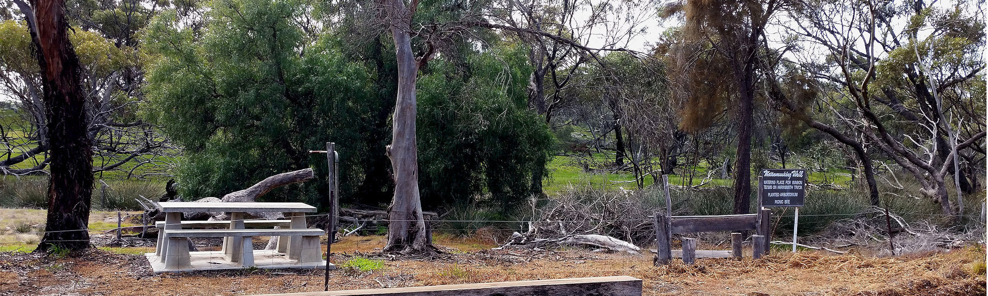
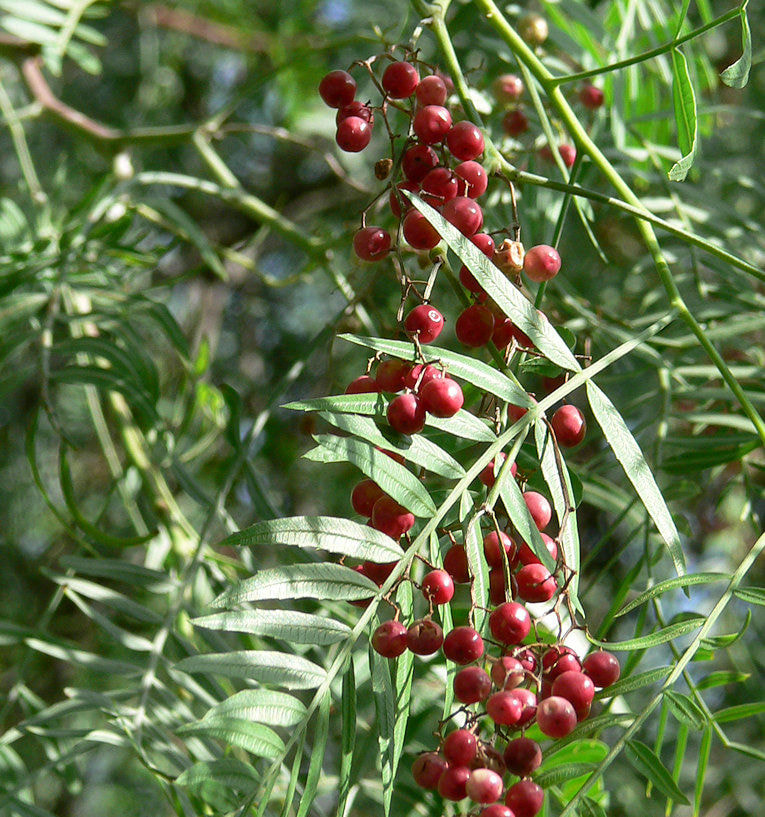
The well a standpipe and the remains of a water trough can still be seen with the ubiquitous pepper tree.
Have you ever noticed that these trees occur on a great many historical sites in the wheatbelt to the goldfields?
With or without a commemorative stone they are the only trace of many schools, houses and sheds from a time when most WA inhabitants lived in the country (a pox on big cities!).
I thought that Schinus molle was called the Japanese pepper, but it is actually the Peruvian pepper, an amazingly drought tolerant tree from the Andes. So shady and soft, it is apparently listed as an aggressive weed, but I haven’t noticed them seed or sucker.
 Schinus molle Peruvian Pepper | 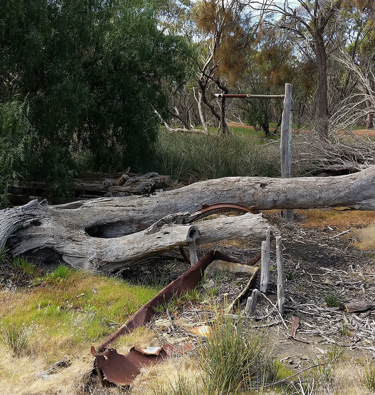 Old well and trough |
Fruit and almond trees are also seen around old homesteads as many farmers at the turn of the century had orchards to supplement their income, with some fruit being exported to England.
Further to the north is a heap that is all that remains of a mud-bat house that had a single divided room with a narrow addition on each end.
Further to the north is a heap that is all that remains of a mud-bat house that had a single divided room with a narrow addition on each end.