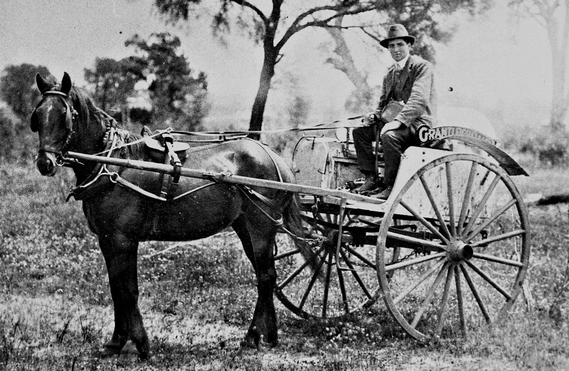
 Grantleigh Dairy milk cart
 Greetings fellow Foxies,
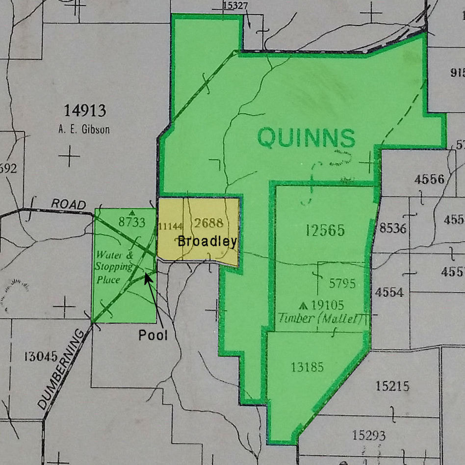
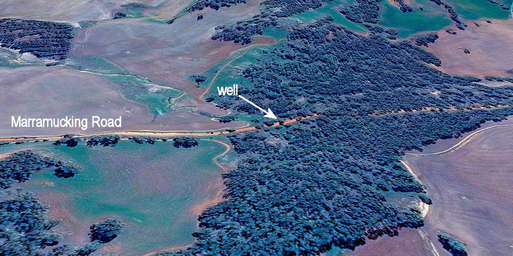
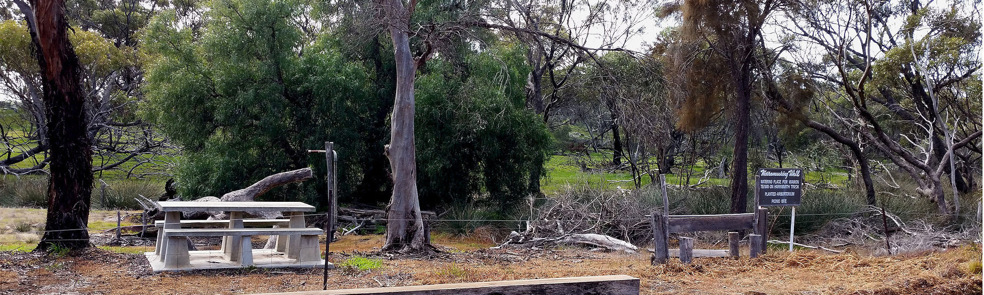
I was recently shown ruins of the Hansen dairy that is close to Clayton road near Narrogin. I was told that this was the second Narrogin dairy. The original was Grantleigh Dairy operated by Edward Wiese on Quarry Road.
I was lucky enough to talk Hans Hansen’s last surviving daughter Edith, who related a tale of a remarkable and well-loved man. There is a great book to be written on this family, but here are a few snippets.
Hans originally migrated out from Denmark to rescue his sister who was married to an abusive Norwegian drunkard, and took up a farming block near Jilakin rock with 3 other Danes. He was a member of the Narrogin 10th Light Horse, and with two of his colleagues volunteered for military service at the outbreak of the World War 1. They were rejected because “Danes like Germans too much” (untrue), but were called up after the Gallipoli disaster. (Amazing the change mass casualties can make). Hans met his future wife Isabell at the Blackboy Hill training camp at Northam.
Edith has his wartime diary, and here is his military record . He fought on the Western Front.
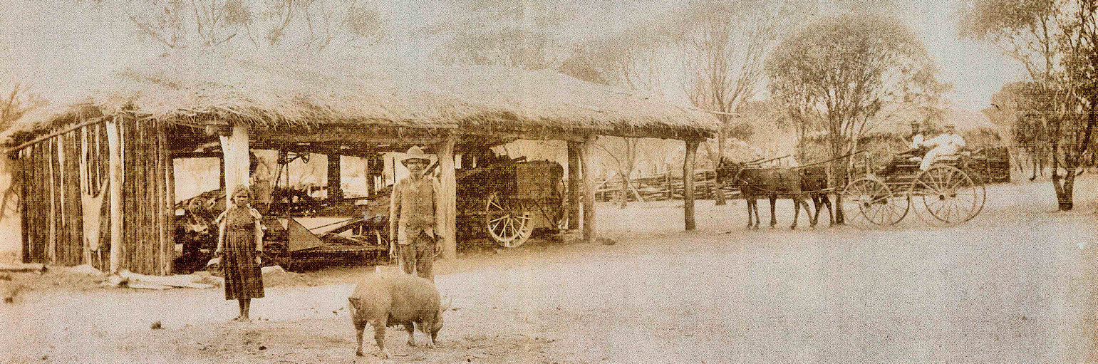
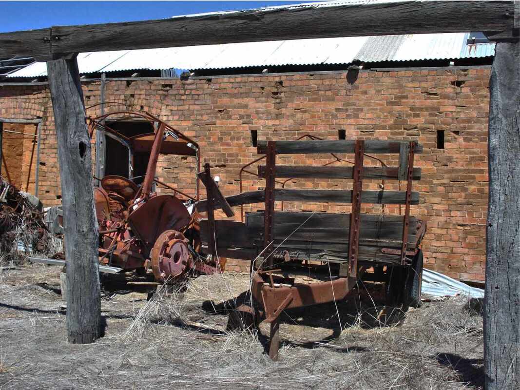
After the war he and now-wife Isabell, briefly farmed the Pustkuchen ‘Sylvania’ farm before buying the 400 ha ‘Lawndale’ farm from early settler John Edward Clayton. The onset of the Great Depression and the rabbit plague (Edith remembers skinning and gutting wild rabbits), forced Hans to find more income. Initially he worked on the Dryandra mallet plantations and started a dairy that became his main occupation.
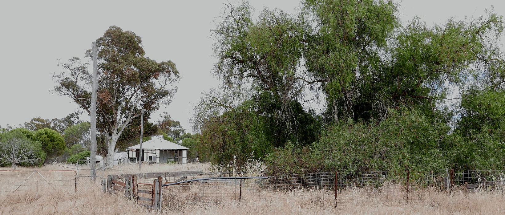
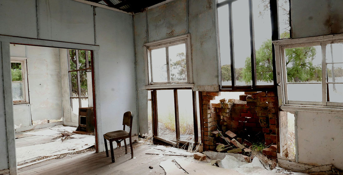
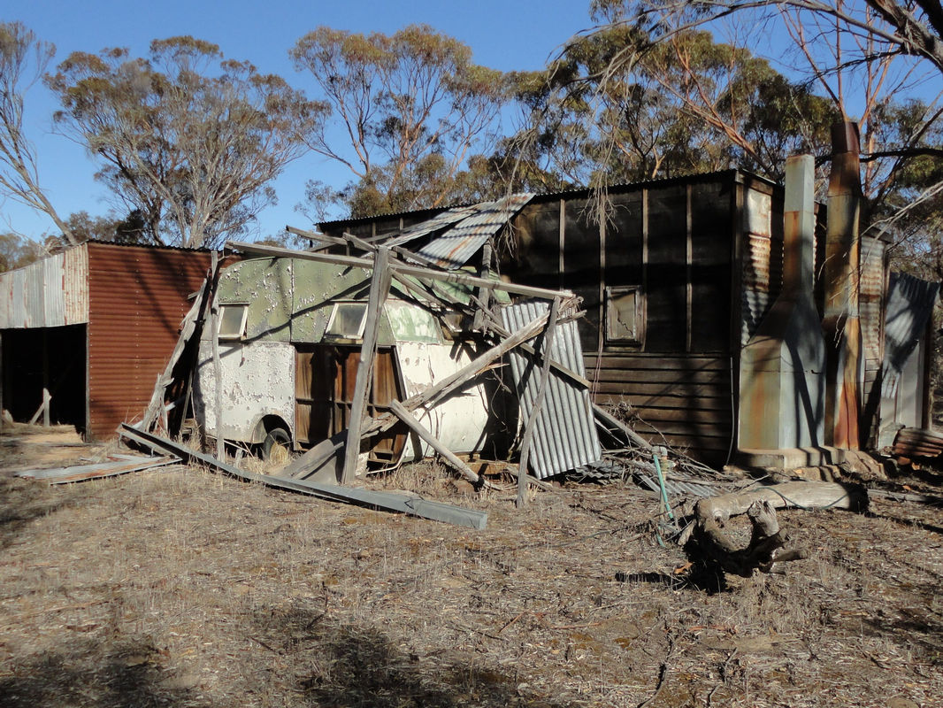
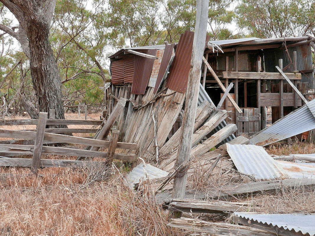
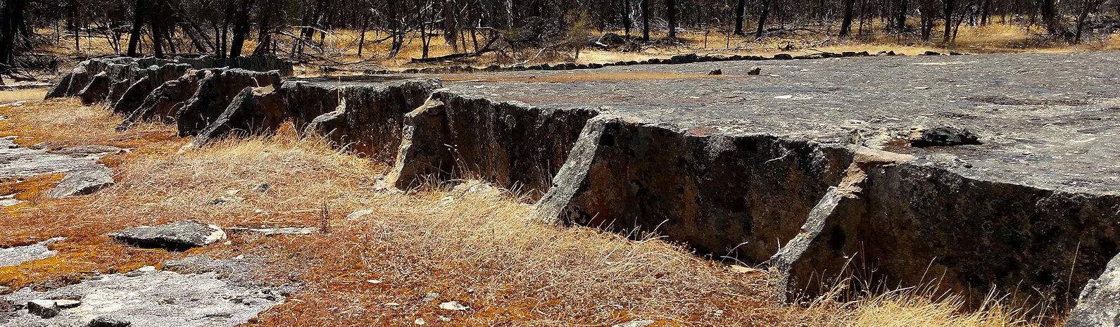
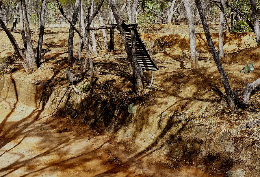
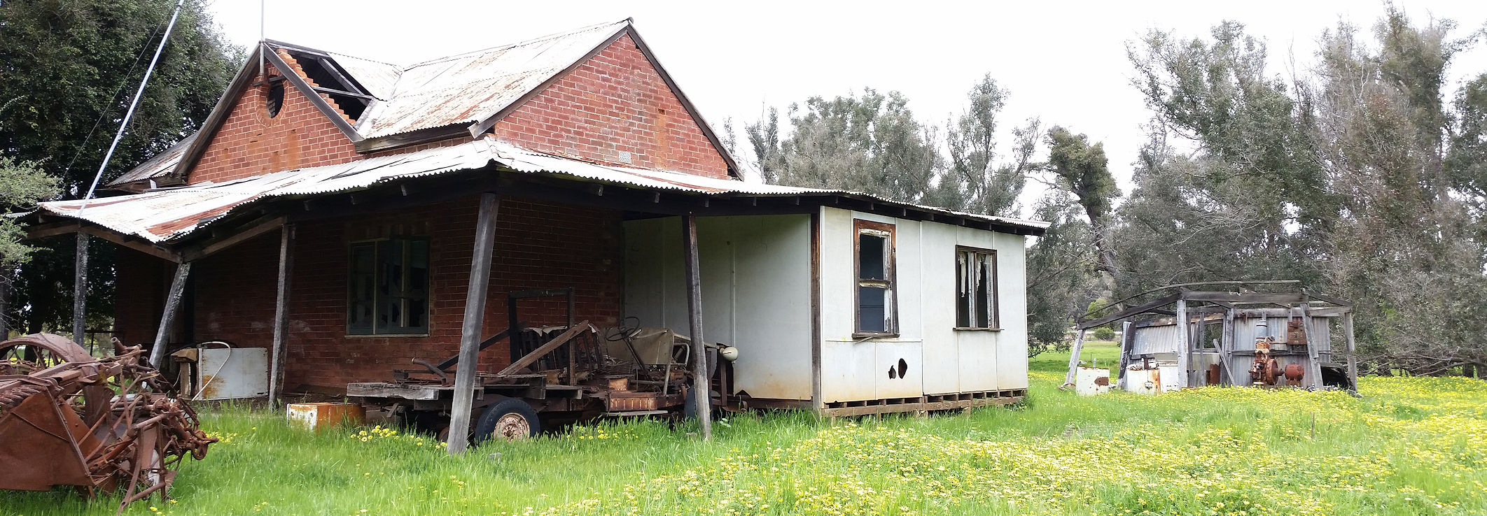
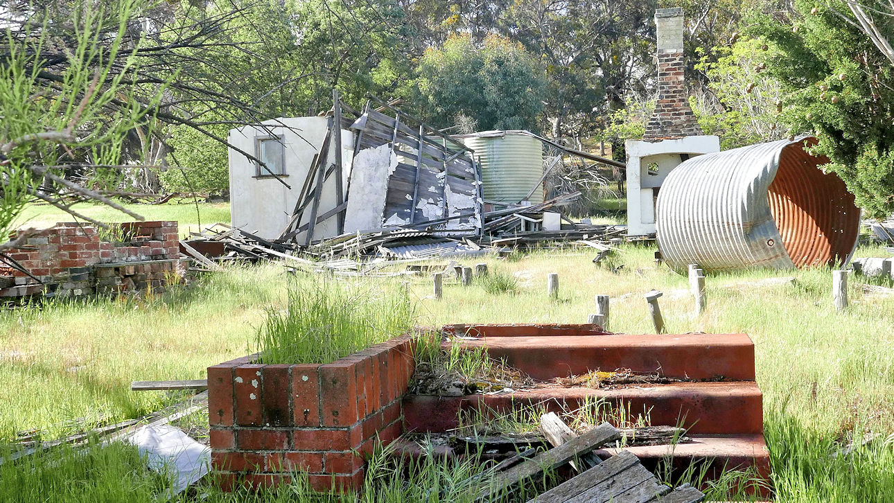
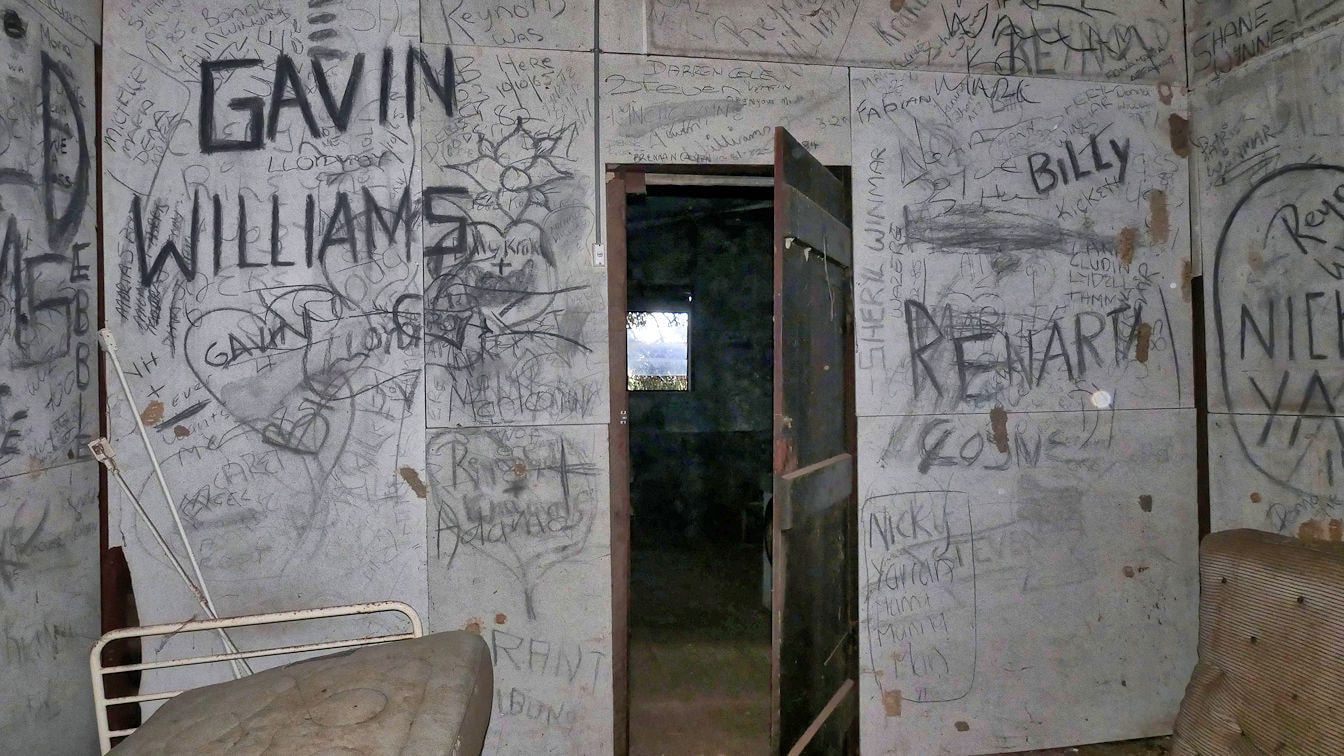
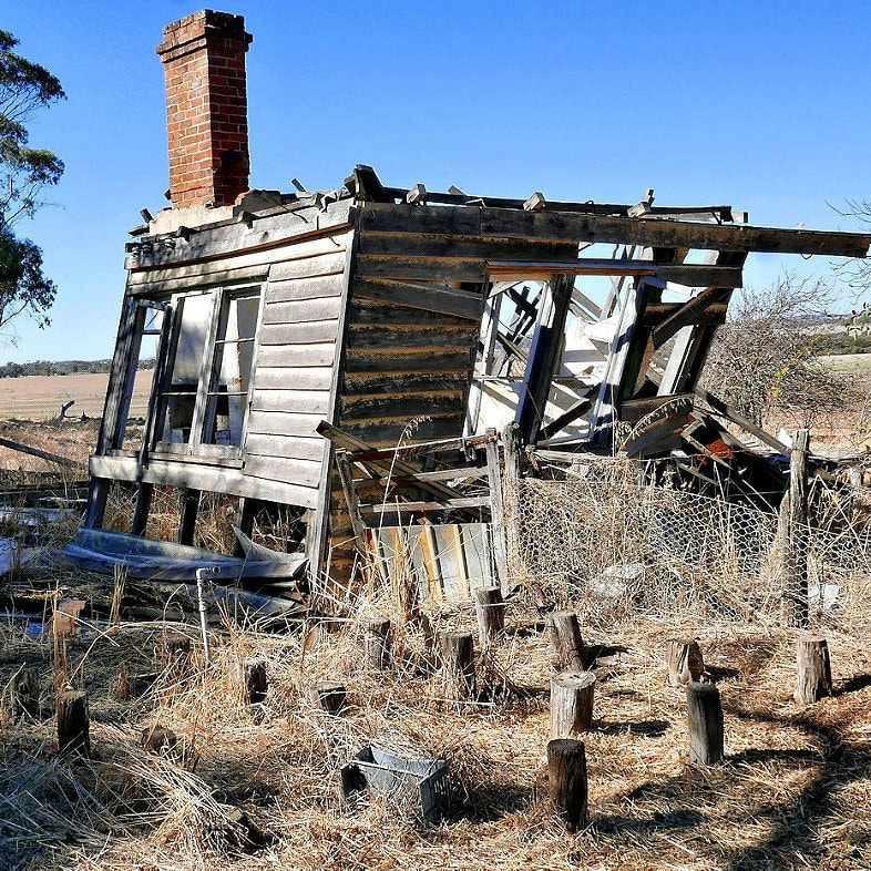
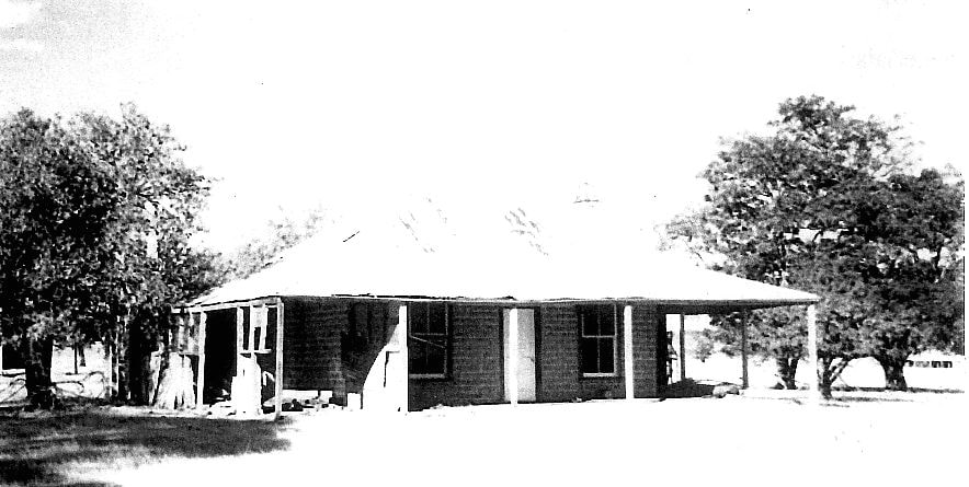
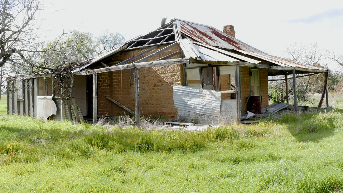
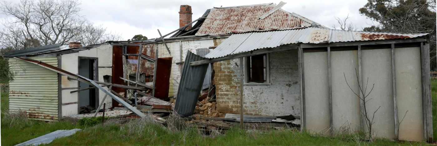
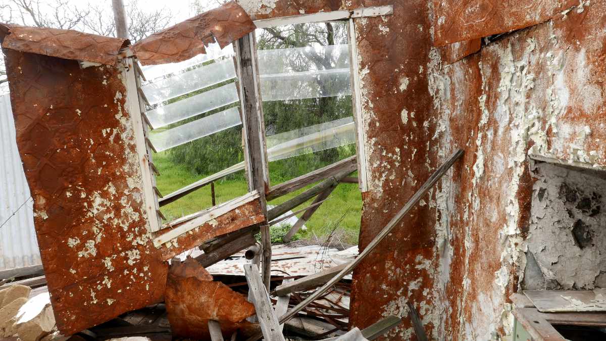
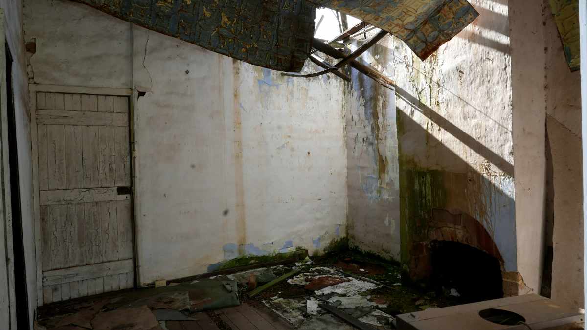
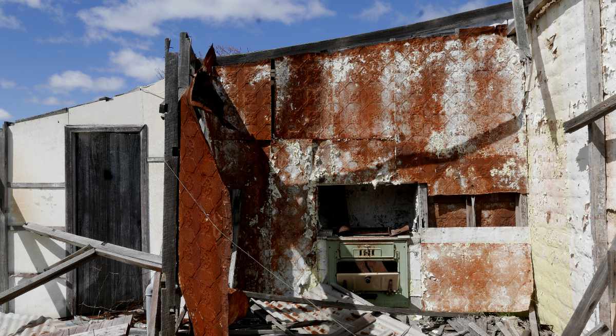
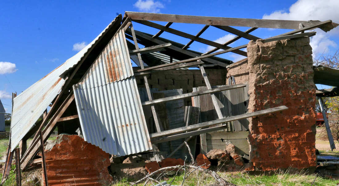
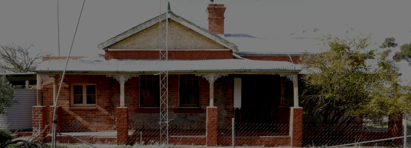
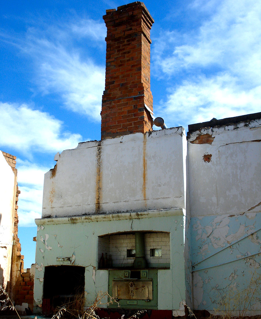
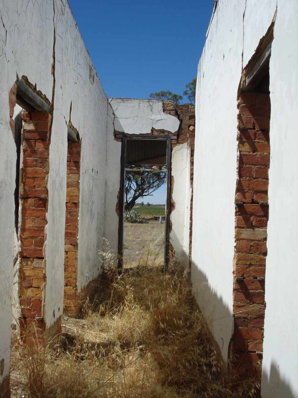
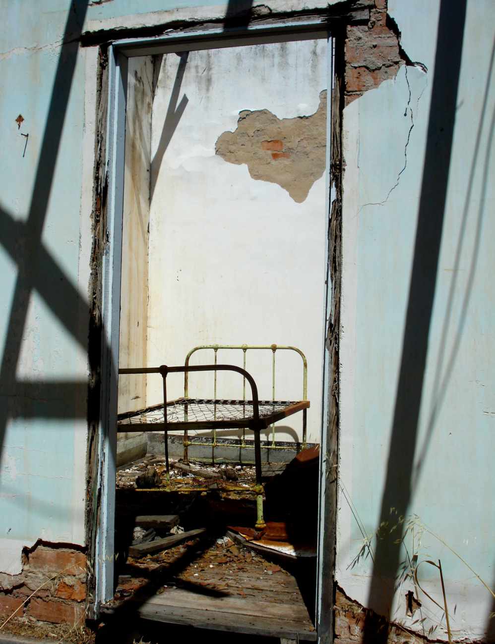
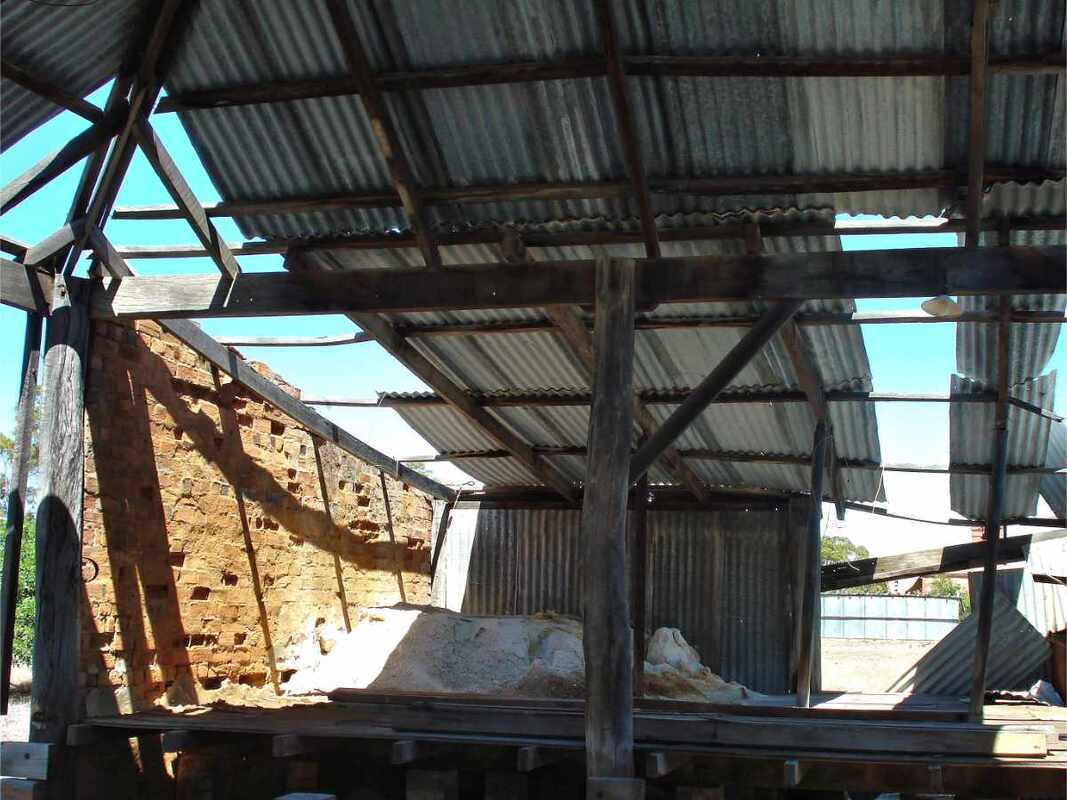
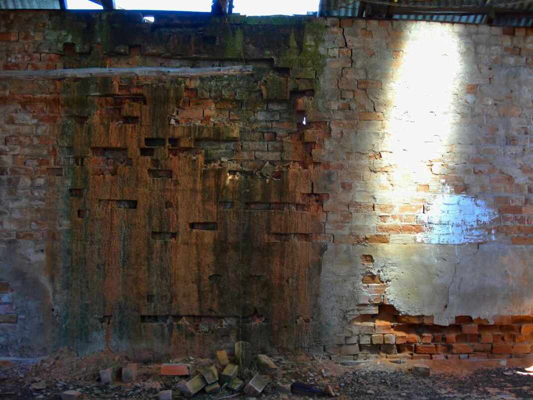
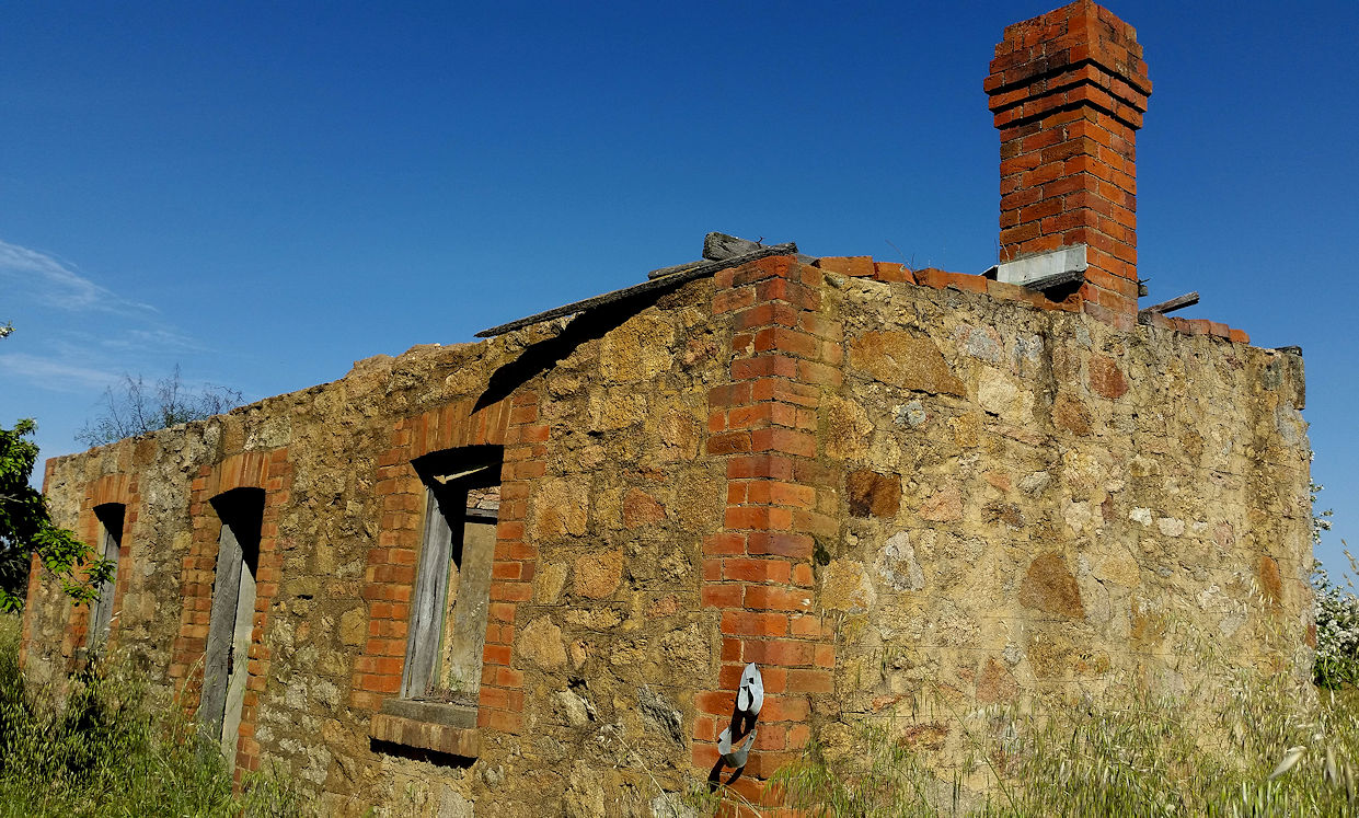
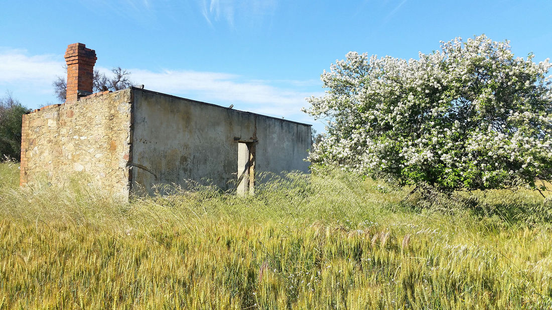
Hans and Edith had 6 daughters and a son, but only the central core of their house, consisting of two fine brick built rooms remain. Other structures included parents’ bedroom, dining room, kitchen, front and back verandahs, and 2 adjoining buildings, of which one was used for cooling and separating the milk.
Isabell died of a stroke when Edith was 11, and the two eldest daughters had to stay home from school for a while to look after the rest of the children.
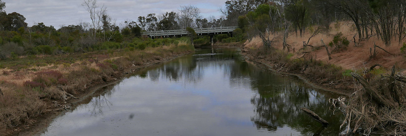
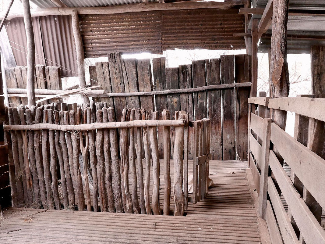
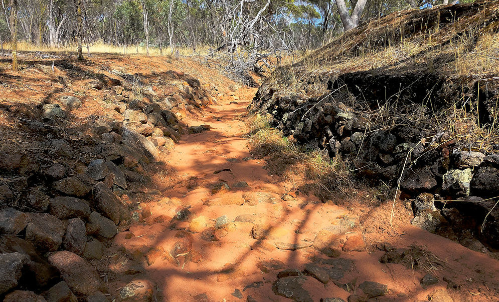
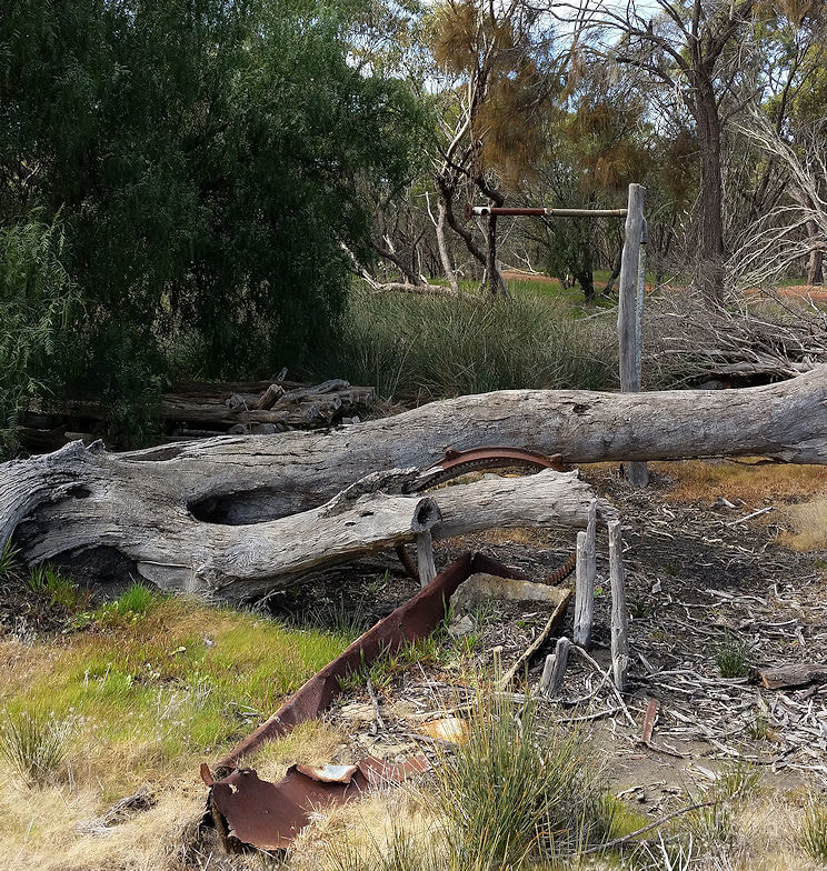
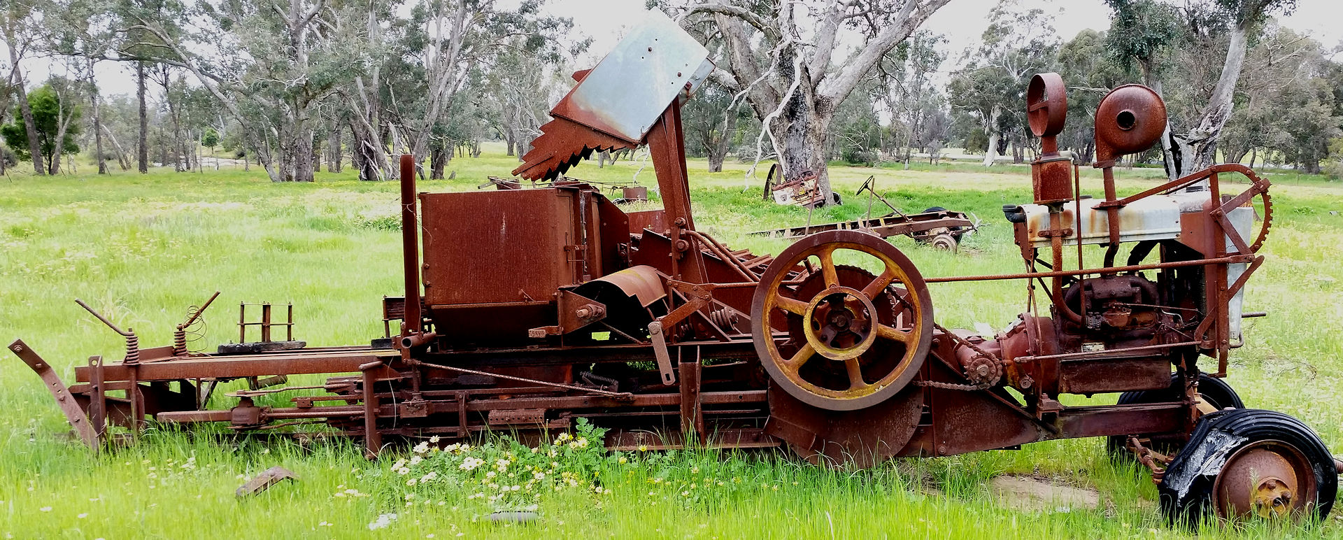
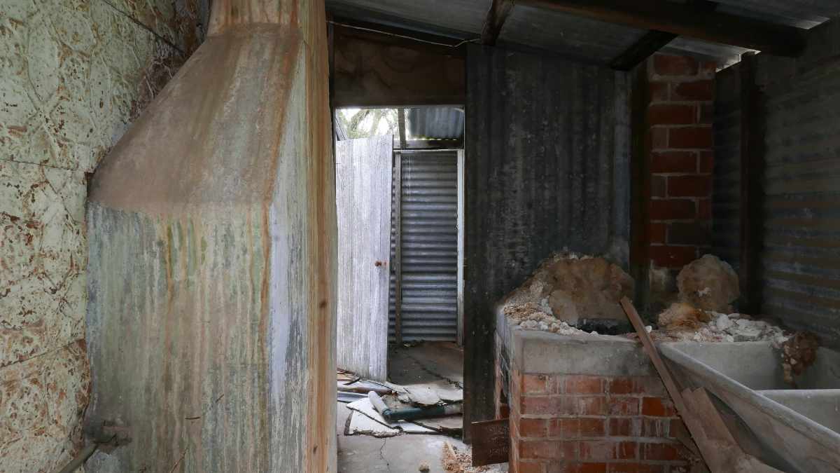
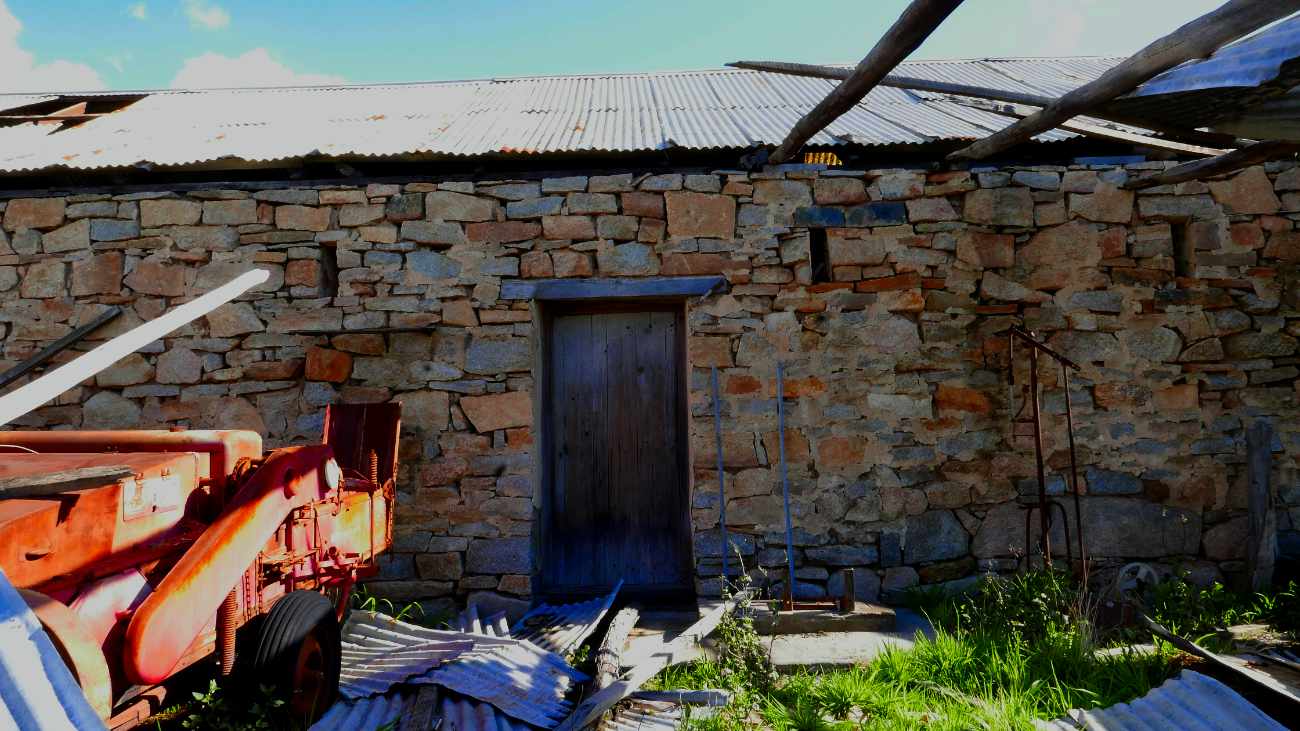
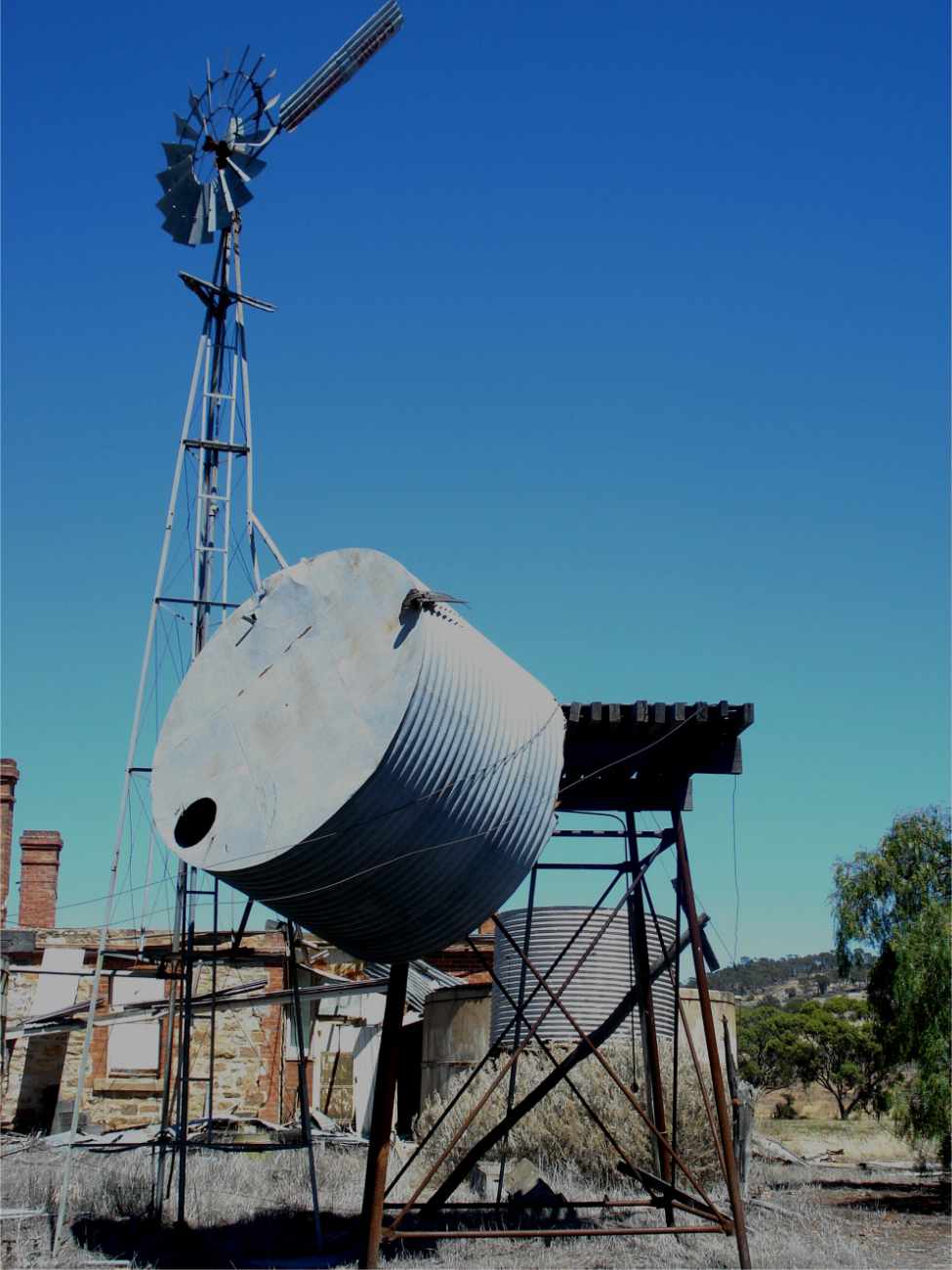
Cows were originally milked in a long gone shed near a line of ancient Cape Lilac trees by the creek before the existing dairy was built. You can still see remains of the feeding trough in the second building’s milking room. Cream was separated from the milk, and placed into containers in water to cool overnight before delivery. No pasteurisation in those days, but as Hans and children lived to their nineties, it was clearly good stuff.
His day started at 3am for house to house delivery in Narrogin by 6am. He was frequently found asleep while doing the accounts in the afternoon.
He eventually retired to Narrogin and died at the age of 93. Hans and Isabell’s gravestones are in the Narrogin cemetary.
For a visual exploration of the house and dairy see this Google Photo album
Click individual images for information
Edith has his wartime diary, and here is his military record . He fought on the Western Front.
After the war he and now-wife Isabell, briefly farmed the Pustkuchen ‘Sylvania’ farm before buying the 400 ha ‘Lawndale’ farm from early settler John Edward Clayton. The onset of the Great Depression and the rabbit plague (Edith remembers skinning and gutting wild rabbits), forced Hans to find more income. Initially he worked on the Dryandra mallet plantations and started a dairy that became his main occupation.
Hans and Edith had 6 daughters and a son, but only the central core of their house, consisting of two fine brick built rooms remain. Other structures included parents’ bedroom, dining room, kitchen, front and back verandahs, and 2 adjoining buildings, of which one was used for cooling and separating the milk.
Isabell died of a stroke when Edith was 11, and the two eldest daughters had to stay home from school for a while to look after the rest of the children.
Cows were originally milked in a long gone shed near a line of ancient Cape Lilac trees by the creek before the existing dairy was built. You can still see remains of the feeding trough in the second building’s milking room. Cream was separated from the milk, and placed into containers in water to cool overnight before delivery. No pasteurisation in those days, but as Hans and children lived to their nineties, it was clearly good stuff.
His day started at 3am for house to house delivery in Narrogin by 6am. He was frequently found asleep while doing the accounts in the afternoon.
He eventually retired to Narrogin and died at the age of 93. Hans and Isabell’s gravestones are in the Narrogin cemetary.
For a visual exploration of the house and dairy see this Google Photo album
Click individual images for information
 |  House |