Contine Hill is a great place in the Dryandra Woodland between Narrogin and Williams to visit for a picnic and a walk in all but the hottest part of the year. The site is a laterite mesa that gives a commanding view of the countryside, picnic tables, BBQ plates (May to September use), information bay, and two walks. Much of this was achieved by the Narrogin Lions Club. Cars with caravans can reach the spot but camping is not permitted.
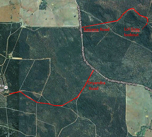
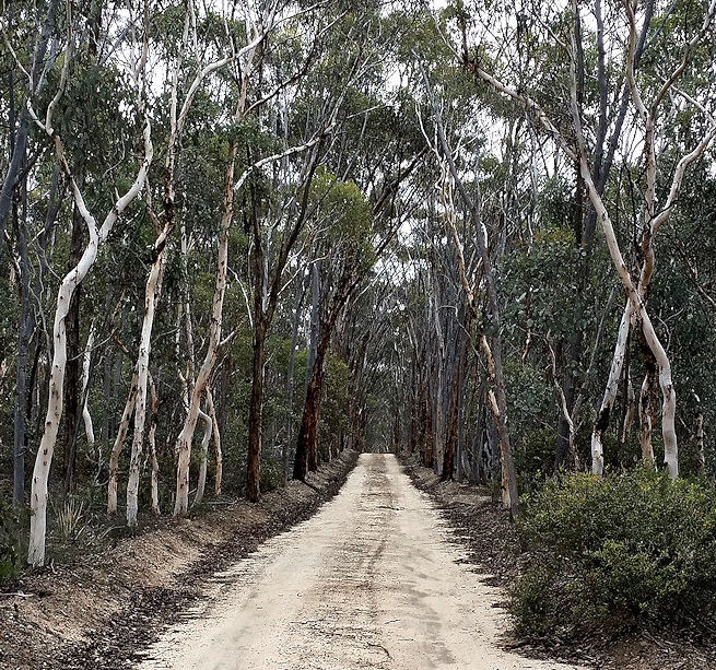
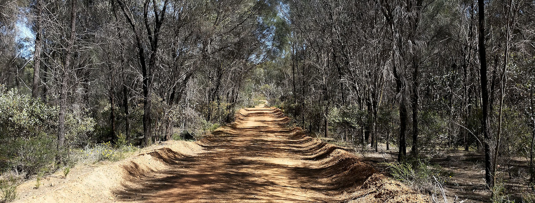
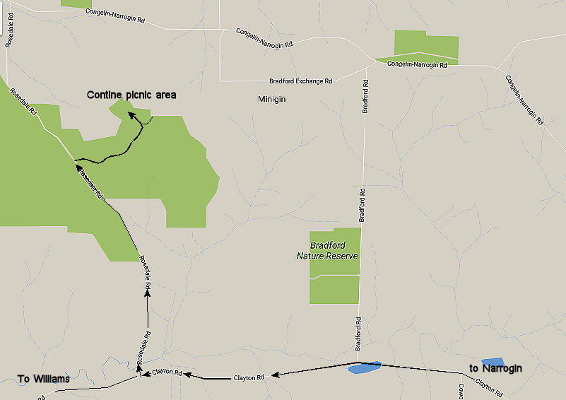
From Narrogin, drive West on Clayton Road for 18km turn right up Rosedale Road (gravel) for 4km, turn right again at the sign to Contine Hill for 2km to the picnic area.
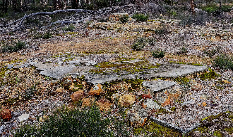
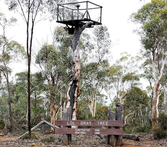
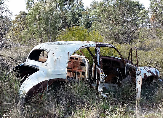
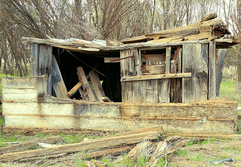
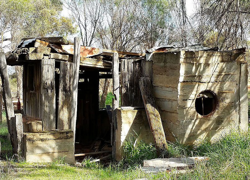
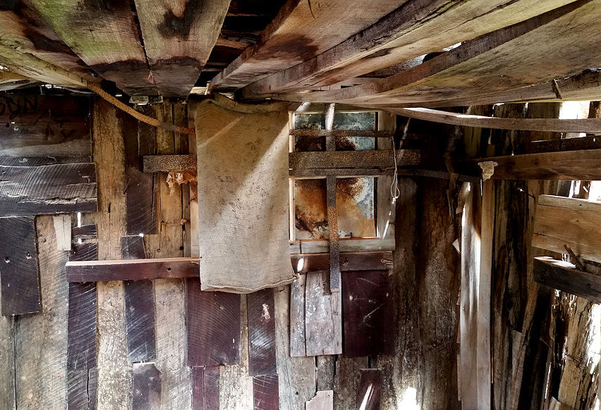
From 1933 to the 1960s Contine Hill was one of series of fire lookout towers in Dryandra Woodland. The overseer and his family lived here in a small house with no facilities. Little remains apart from the dam and some livestock fencing.
From Narrogin, drive West on Clayton Road for 18km turn right up Rosedale Road (gravel) for 4km, turn right again at the sign to Contine Hill for 2km to the picnic area.
From 1933 to the 1960s Contine Hill was one of series of fire lookout towers in Dryandra Woodland. The overseer and his family lived here in a small house with no facilities. Little remains apart from the dam and some livestock fencing.
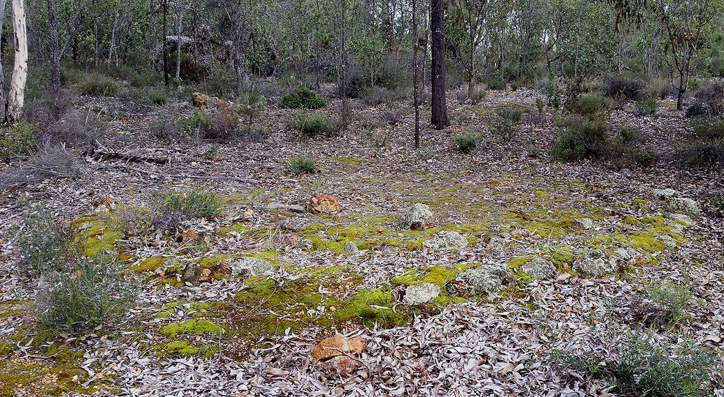
 | 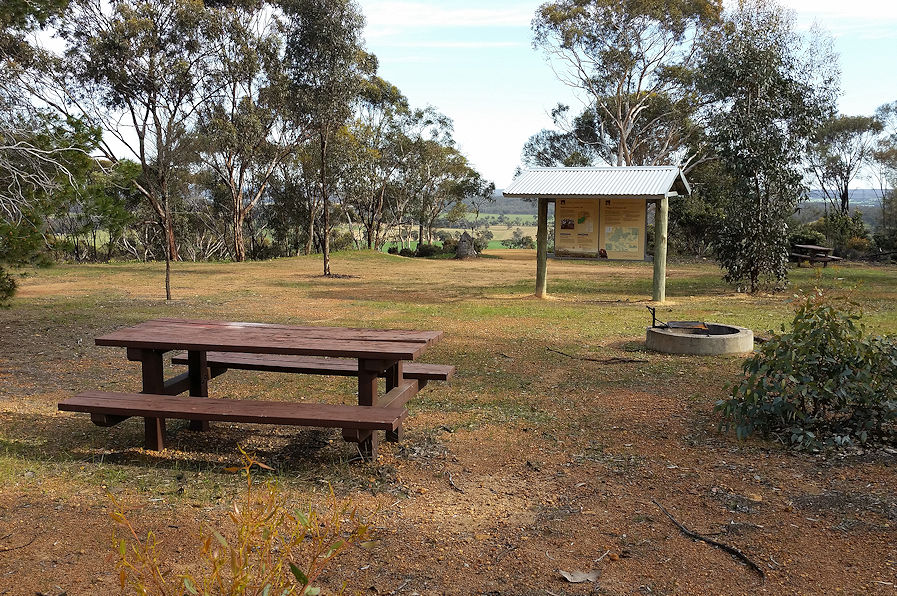 Picnic area ,information panel | 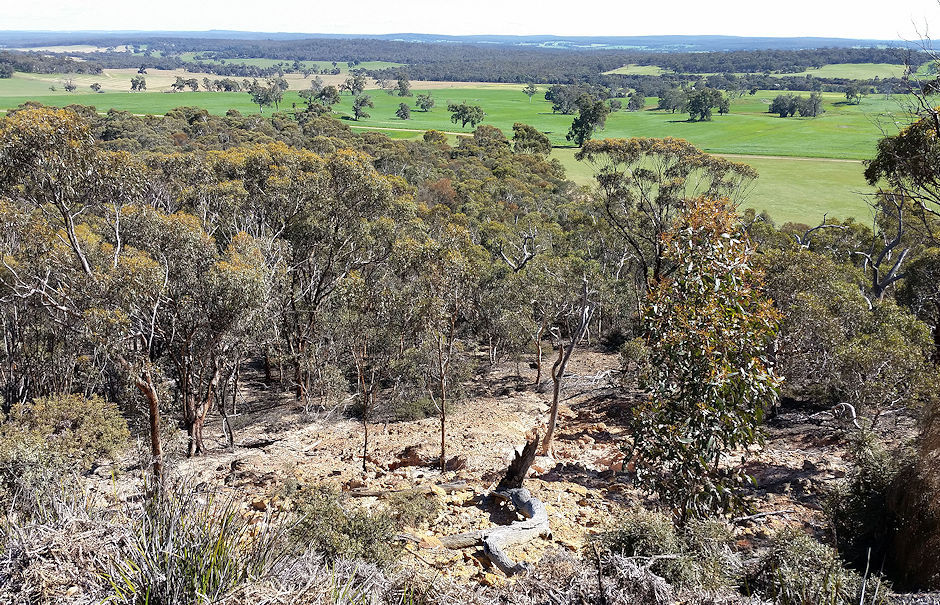 View from lookout |
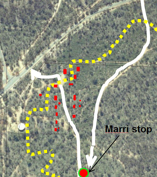
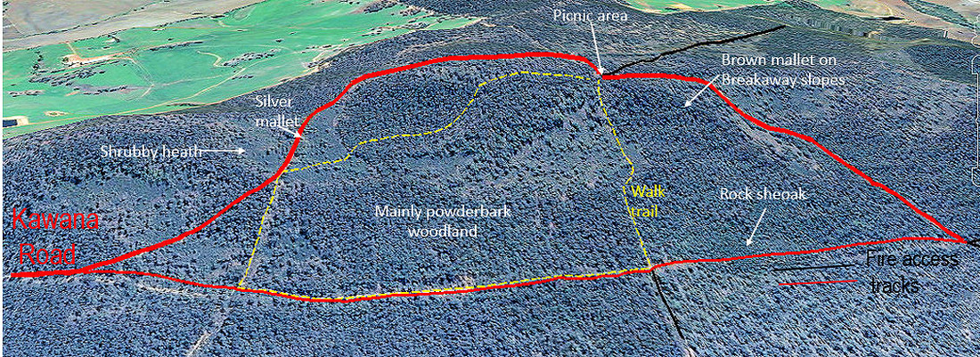
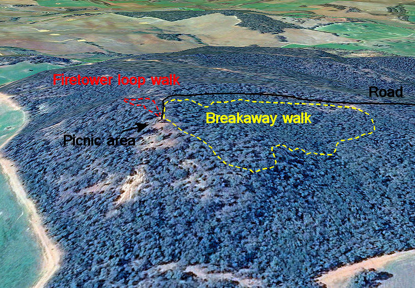
Two walks start at the information bay.
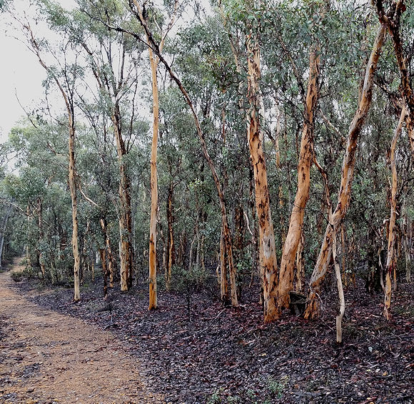
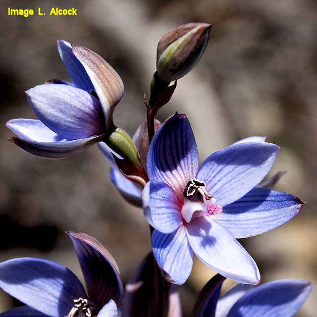
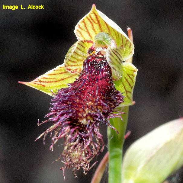
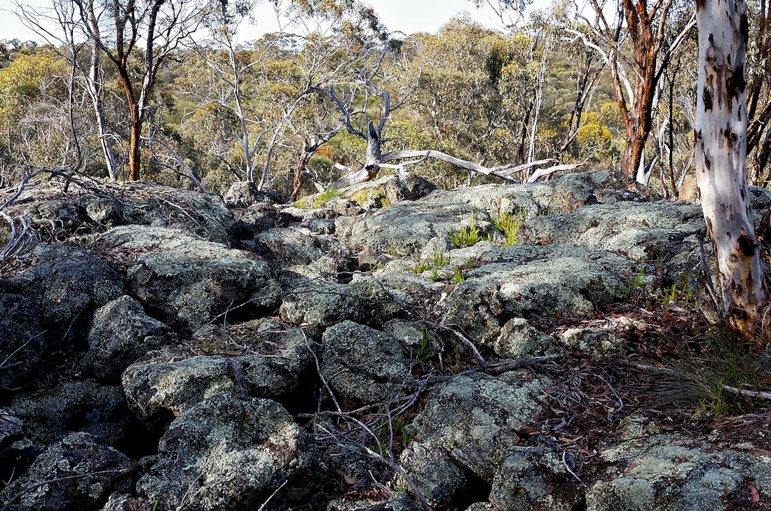
The Firetower Loop walk (450m 15 minutes) is a short meander along the edge of the breakaway to the two fire lookout points. The dense ironstone soil here has similar sparse proteaceae vegetation to breakaways in Foxes Lair with the notable exception of the stunning pink Isopogon crithmifolius, and the secretive King Dryandra Banksia proteoides.
King Dryandra looks like a scrubby prickly shrub until you look underneath the foliage and find the large flowering buds that have attractive flowers enclosed by protea type bracts. These open to reveal the group of flowers inside then close again when they are fertilised. There are only 2 plants in the eastern part of the Foxes Lair Banksia Walk that I had to net to stop parrots nipping off the flowers.
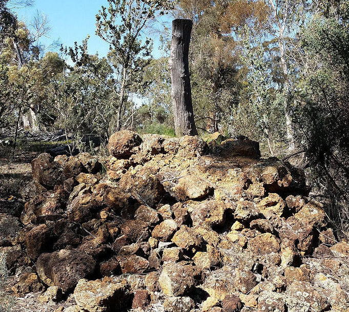 Fire observation point | 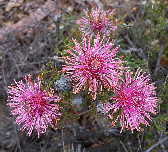 Isopogon crithmifolius | 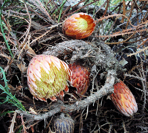 King Dryandra |
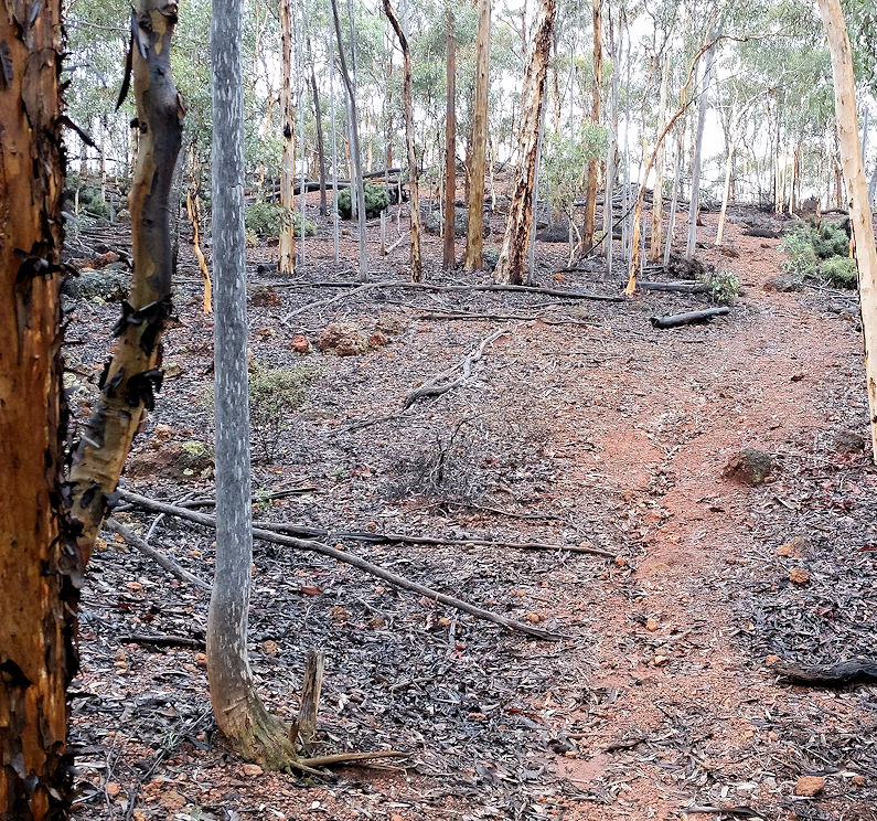
The Breakaway Walk (1km 45 minutes) leads to the western side of the mesa and winds through ironstone pavement soil around the edge of the breakaway, before a moderately steep descent into a cool shady gully in rock sheoak/ wandoo woodland with abundant winter ferns, rushes, cowslip orchids and everlastings. The track goes past the old dam, follows an old fenceline and across a rock where you may find Lemon Scented Sun Orchids, and back to the picnic site.
 Undermined collapsed ironstone pavement | 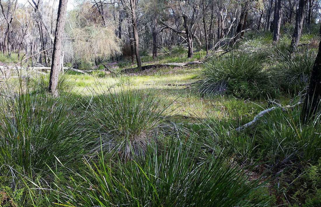 Shady valley |
Download a brochure from this web page
| |