Foxes Lair
  • Home
  • About
    • About Foxes Lair
    • History
    • Landscape and Soils
  • Things To Do
    • Picnic Spots
    • Walk Trails
    • Visit the Arboretum
    • Ride Your Bicycle
    • Scavenger hunt
    • Geocaching and Orienteering
  • Things To See
    • Wildflowers
    • Trees in the Narrogin district
    • Birds
    • Vertebrates
    • Narrogin spiders scorpions ticks
    • Fungi and lichens
  • Foxes Lair seasonal guide
    • December to March
    • April - May
    • June-July
    • August
    • September
    • October
    • November
  • Other great reserves
    • Railway Dam
    • Yilliminning Rock
    • Old Mill Dam
    • Yornaning Dam
    • Contine Hill
    • Highbury Reserve
    • Boyagin Rock
    • Barna Mia
    • Toolibin Lake
    • Newman Block
    • Harrismith Nature Reserve
    • Candy Block
    • Tutanning Nature Reserve
  • 1Foxypress
    • Foxypress
    • Vanishing Farms
  • Contact

Piesseville Jaloran Reserve 14459

26/12/2025

0 Comments

 
This 470 hectare reserve 8km from Piesseville on the Piesseville Jaloran Road is wonderfully diverse bush on a high ridge between the Arthur and Buchanan rivers. It stands as a lone remnant of an ancient gently sloping upland lateritic upland, which is shown in green and black colours on the radiometics image. Waterways leading away from it in all directions have eroded the surrounding landscape away, often down to more fertile soils formed from the underlying granite and dolerite bedrock.
Picture
Picture
There are no trails in the reserve apart from a short dead end road and a boundary track,which is suitable for 4 wheel drive vehicles. I can drive my 2 wheel drive ute on the boundary south of the main road, and for much of the northern side but am stopped by a steep breakaway on the western side and deep white sand on the east. It is a long walk to Wagin or Narrogin if you get stuck
It is a wonderfully diverse reserve, which reflects the immense age of our lateritic landscape where different plants have adapted to changes in soil type that may not be noticeable at the surface.These adaptations are so specific that I can predict the soil type as I walk through the bush. There is no sudden flush of wildflowers. One sees a scattering of different species, which change from place to place and month to month from July to November.  A  moderately fit person can experience these changes by walking along the boundary track.
To fully appreciate the landscape I walked through the reserve about every 3 weeks using Google Maps as a guide.
The underlying geology is  reflected in landscapes and native vegetation in the reserve. There are several mafic stony/loamy laterite areas, which have eroded into steep breakaways and valleys covered in Brown, Blue, and Silver Mallet, dense mallee thickets, and Red Morrel trees. These starky beautiful areas with almost no understorey plants are particularly common on the west side of the reserve and the northern side of the road.
The following image shows them dominating the ridge which runs in an arc on the north side of the Jaloran Piesseville Road. They correspond with brown shaded bush areas.

Picture
A small stony mesa in the southeast corner has a grove of  Labichea lanceolata, which I have only seen before in Tutanning Nature Reserve and interesting lichen covered niches amongst the ironstone.
Picture
Mesa face
Picture
Lichen in between the blocks
Picture
Labichea lanceolata,
The northeastern edge is a good spot to see vegetation changes where a breakaway has cut into the lateritic upland. You can drive around the edge with a robust vehicle. The following landscape image shows a typical bowl-shaped lateritic breakaway, which has cut back into a sandy and stony gravel upland. 
Picture
Picture1 on the landscape image shows the edge of a breakaway, which has formed from erosion of a sandy gravel plain to the right of the image to form a kwongan gravel slope that changes in plant species as the soil becomes sandier downslope. In the background one can see a mallet thicket where the breakaway has entered a mafic ironstone/ loamy gravel area.
Picture
Pic 1 Granitic gravel breakway that merges into mafic gravel in the background
Pictures 2 and 3 show vegetation on the gravelly upland area.
Picture
Pic 2. Ironstone gravel upland plain
Picture
Pic 3. Sandier gravel with Eucalyptus albida mallee
The slope on the top most edge of the breakaway has a grove of mallees on sand over clay soil.
Picture
Pic 4. Prickly kwongan changes to mallee grove below breakaway.
Picture
Pic 5. Eucalyptus thamnoides grove with breakaway in background
PicturePic 6. Brown Mallet and Broom Bush
The breakaway bowl valley has cut into the mafic bedrock to form red brown loams and loamy gravels that support Brown, Blue and Silver Mallet, Red Morrel, mallee woodland with little shub cover apart from patches of Melaleuca broombush.

Picture
Pic 7. Red Morrel and mallees
Picture
Pic 8.Silver Mallet, Red Morrel, mallees
The breakaway bowl ends mid slope and a narrow Wandoo covered waterway passes in a narrow channel down a gravelly slope, and then widens to an attractive mixed vegetation spot adjoining the road. 
Picture
Pic 9. wandoo scrub valley floor
Picture
Pic 10. Valley floor on right changes rapidly to a Wandoo prickly gravel scrub on either side.
This area is a good Spring wildflower spot.
Picture
Picture
Picture
The western side of the reserve consists of a north-south lateritic ridge, which has been eroded on its western edge by Newman Brook to expose the underlying bedrock. A track from the road leading north on the western edge  is a bit rough but is accessable for most vehicles up to the edge of a steep breakaway. A side track near the entrance leads to a parking spot in pleasant woodland. After  passing this turnoff the track passes through sandy, loamy and rocky soils formed from granites and dolerite with attractive orchids and other spring wildflowers - particularly where the track enters Jam-Rock Sheoak bush and turns left.
​ (Pic X)

Picture
Picture
Pic X landscape
I drive to one of my favourite spots by continuing uphill and parking in the corner where the track turns left again. A walk east into the reserve reveals an ancient lateritic landscape, which is shown on the following oblique image.This is a wonderful remnant of a subdued landscape of a North-South  gravelly ridge merging into a sandy gravel and sand side slope, an ancient shallow waterway to the west, then another ironstone ridge.  Distinct vegetation types, which can be seen on the map resemble a  native garden as one walks through the bush.
Picture
The steep breakaway is part of a stony gravel rise with open Wandoo, Brown Mallet, Silver Mallet, mallee woodland, which is beautiful to walk through on a misty July morning.
Picture
Pic B Stony gravel woodland
Picture
Pic C Wandoo prickly scrub gravel adjoining the woodland
After weaving through the prickly scrub, you come to a faint hollow of an old waterway bounded to the east by a gentle prickly gravel slope at the base of a stony gravel ridge. The waterway meanders downhill before merging into Wandoo-Rock Sheoak sandy patch, which has Cowslip and Green Spider orchids in September
Picture
Pic D. Barely visible Wandoo waterway separating sandy gravel on the left from stony gravel on the right
Picture
Pic E. Downslope the waterway merges into stunted mallee scrub then Wandoo rock Sheoak sand
Picture
Pic F. Wandoo Rock Sheoak sandplain with orchids in growing season
To the east the sandy woodland opens up into a gentle kwongan sandplain slope containing a range of shrub and herb species and the occasional Rock Sheoak, Nuytsia florabunda and Banksia attenuata trees. To the south the sandplain ends abruptly at a breakaway down to woodland below.
Picture
Pic G. Lateritic grey sandplain, which has many flowering species including Caladenia varians.
Picture
Pic H.Trees lining a breakaway at rear of sandplain
Picture
Stirlingia latifolia
Picture
Pic I. Sandplain on the left terminates in a breakaway with Wandoo, Brown Mallet woodland below
Going upslope to the north a circular Eucalyptus adesmophloia patch stands out from the sandplain vegetation which changes to prickly Dryandra kwongan gravel.
Picture
Hibbertia sp.
Picture
Sandplain Styphelia sp.
Picture
Eucalyptus adesmophloia patch on the edge of grey sandy kwongan
A north-south ridge upslope to the east from the mallee thicket is the oldest land surface of gravel with circular patches of Silver Mallet.
Picture
Silver mallet thicket surrounded by a range of vegetation types.
I was stunned to find a large mallet, which had toppled over recently to reveal a root system that grew almost entirely in 40cm of soil over a dense ironstone pavement. See more information on this amazing plant in this Foxypress.
Picture
Silver Mallet Wandoo and Callitris Pine
Picture
Dense root disc on fallen Silver Mallet
The reserve on the south side of the Piesseville Jaloran Road consists of a patchwork of lower slope, and sudued upland lateritic soils. Much of it is easy to walk through and attractive woodland or kwongan, which is good birdwatching and mixed wildflower country. The reserve has not been burnt for many decades, and has retained rare sights like coral lichen growing below local sedges on sandplain. 
Picture
Picture
Coral lichen growing under sedge
Picture
Wandoo kwongan mosaic
Picture
Granite outcrop
Picture
Mixed sandplain. I found purple enamel orchids in late October
0 Comments

Ochre

28/12/2023

0 Comments

 
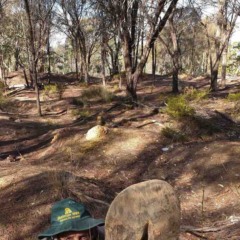
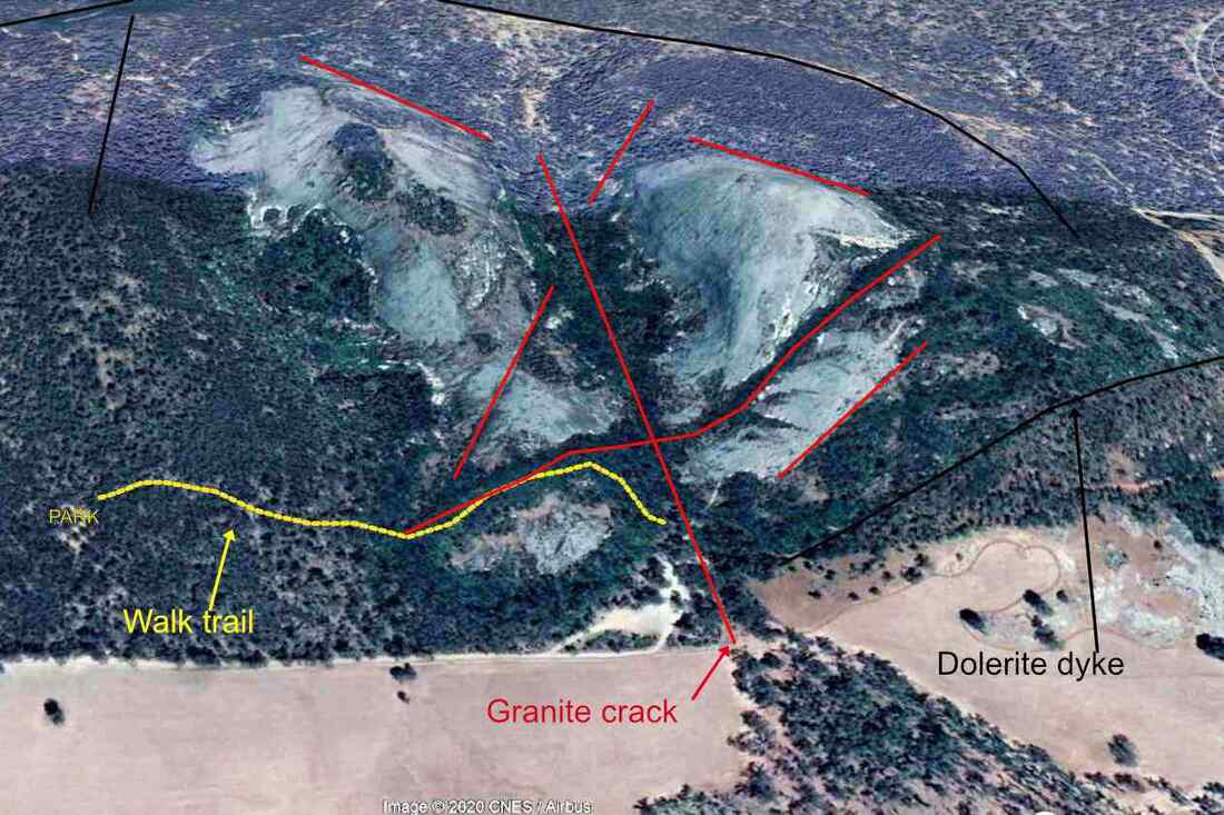
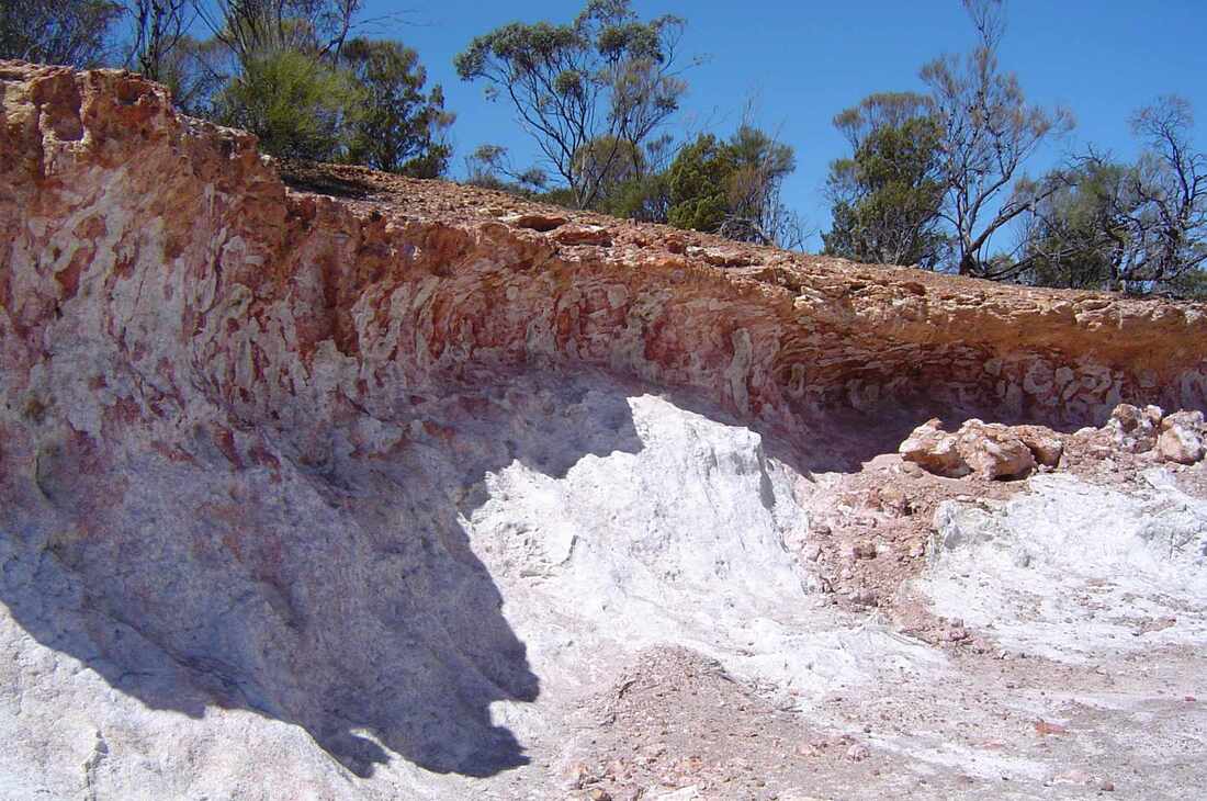
My interest in ochre was rekindled recently, when I explored the Claypit Nature Reserve near Wickepin. Years ago as part of a mining lease there, the side of a mesa was excavated to get adjoining white and red ochre clays for brickmaking. The white section formed over granite, and red over a dolerite dyke.
Picture
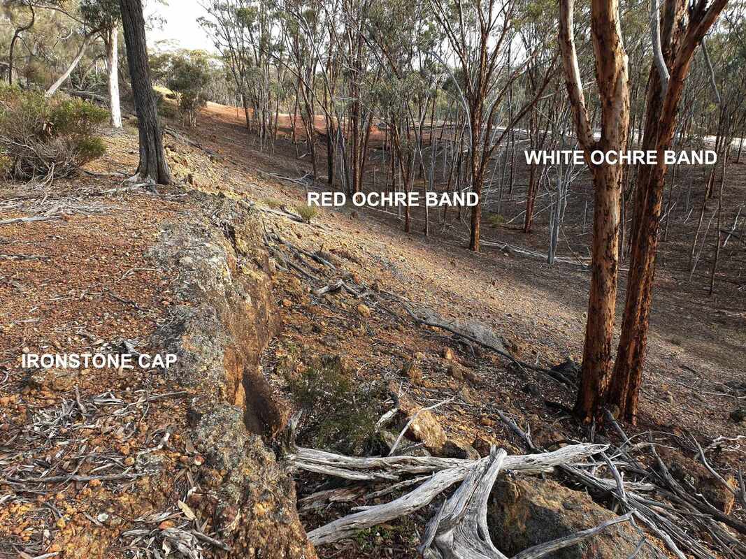
Side view. dolerite dyke under red ochre band
Picture
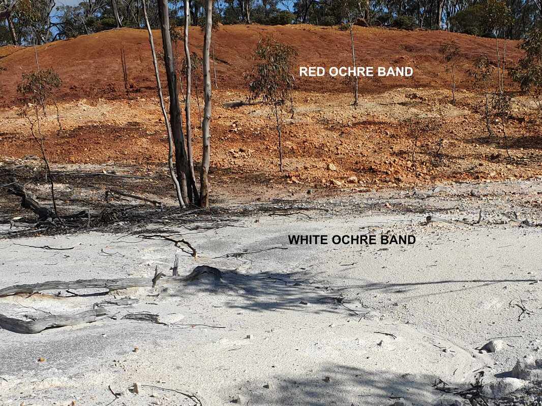
Front view facing south
​The importance of ochre for first nations people is summarised in this article on the ancient Weld Ranges Ochre mine.

An ochre pit at Dryandra National Park is one of over 440 recorded around Australia. For a nation this large, it is a small number, hence the value of ochre as an item of trade.
What is ochre and where is it found?
Charcoal and in some areas coal was the basis of black ochre, which was crushed and mixed with a fluids such as water, saliva, blood or fat as a sticking agent.
Other ochres are mineral oxides attached to a white non-cracking clay called kaolinite, particularly in subsoils in the wheatbelt and rangeland uplands. In Australia this clay has formed as a deep layer underneath mesas, which are   ancient remnants of ancient lateritic land surfaces. ​
A good local example is the Uellelling Hill kaolinite mine east of Wickepin. The image below of a cutting in the exploration phase displays typical layers of an old laterite profile.
  • ​The gravel layer contains most of the plant roots.
  • The mottled zone layer is a transition to the pallid zone layer, which is stained by iron leaking down from the gravel layer.
  • The pallid zone layer is decomposed bedrock, which has been weathered to clay and sand, and infilled with extra clay 
Picture
Uelling Hill exploration pit
​The clay is a type of kaolinite called halloysite, which has many uses ranging from fine porcelain, paint additive, medicine and dentistry. Unlike other clays halloysite consists of microtubes rather than sheets.
​Electron microscope images of halloysite forming around bacteria lead on to a great story of soil development where plants lift minerals up from the depth in soil water, and microbes and fungi convert them to lateritic gravels, bauxite or clays.
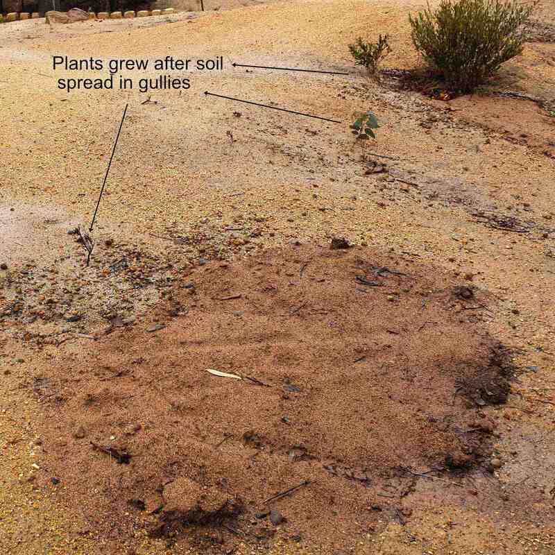
​Pallid zone clay is also packed with salt, which was uplifted with soil water by native trees. When land was cleared, this salt washed down into rising groundwater and created our severe wheatbelt salinity problem.
Picture
Lake Taarblin was a freshwater lake before widespread agricultural land clearing
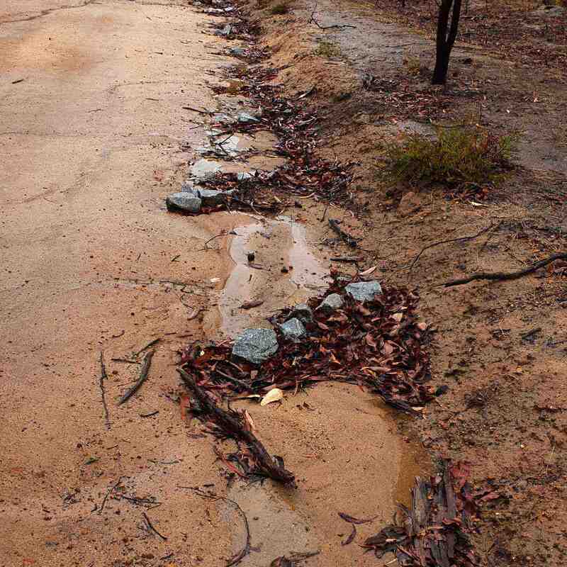
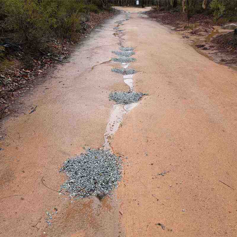
White dams dotted around our landscape show the widely distributed pallid clay. If early Noongars had bulldozers, ochre would have been easy to get!
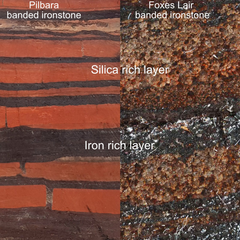
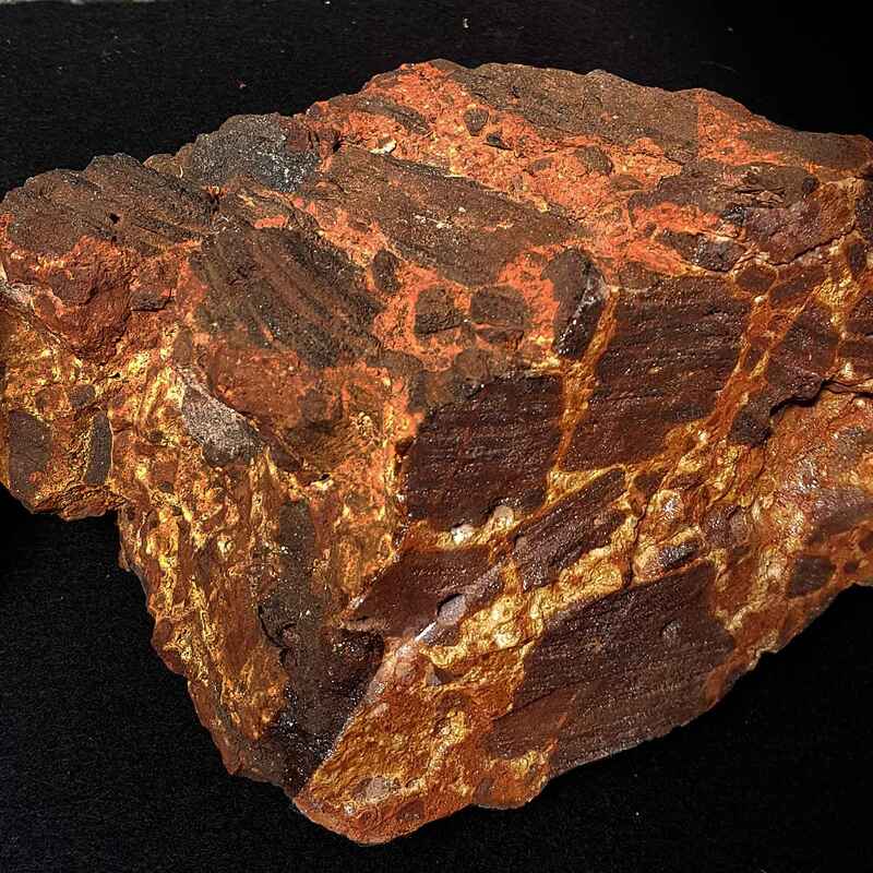
However, ochre only outcrops naturally on breakaway slopes. Granitic breakaways contain white ochre and less commonly yellow ochre (which contains an iron oxide called limonite). Red ochre contains an iron oxide called haematite which is mostly found on steep red-brown breakaways, which have formed off very iron-rich rocks such as dolerite.  Green ochre (containing a nickel oxide) is rare, only being found on ultramafic rock breakaway areas such as the Goldfields.
Good ochre contains very little sand.
Picture
Granitic breakaway at Hyden
Picture
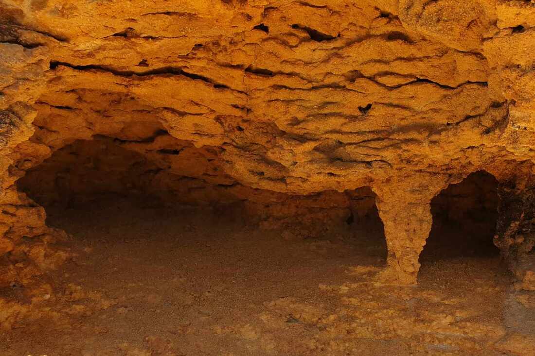
Cave in Tutanning Nature Reserve dolerite breakaway
​To see a jaw dropping breakaway, visit Buckley's Breakaway 70km east of Kulin
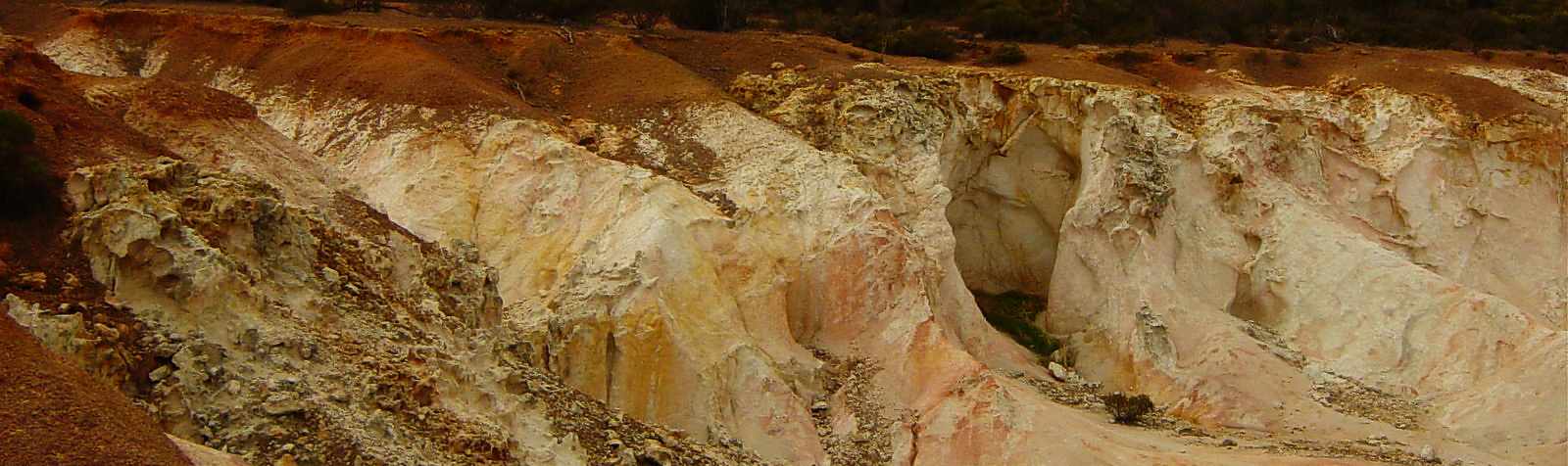
Picture
Buckley's Breakaway
Picture
I found an easy way to make good ochre.
  • Put the ochre sample in a bucket and add enough water to make liquid
  • Swirl the liquid vigourously, then pour clay and water slurry off into another bucket leaving sand behind
  • Leave the water and clay for a couple of days until the clay settles out leaving water above. Adding salt may help.
  • Pour off the water leaving the clay slurry behind to evaporate to a creamy consistency
I take some samples in jars when I talk to visitors. The kids love it and as shown by the Foxyochrefoot image, even some adults indulge. it washes off easily. 

Further reading
  • ​Ochre is of the Earth
  • Exploring the biological dimension to pedogenesis with emphasis of the ecosoystems, soils and landscapes of southwestern Australia W. Verboom and J.F. Pate
  • Why are plants and soils in the Narrogin area so diverse?
0 Comments

Foxes Lair Dougosaurus

12/5/2022

0 Comments

 
Greetings fellow foxies
Yesterday my wife Aileen and I were happily inspecting the effectiveness of erosion control and water spreading measures while rain was falling in in Foxes Lair. Aileen suggested that I should write down my reclamation tips for my successor (any offers?)
As in most small reserves, wildlife and plants in Foxes Lair have suffered greatly from European settlement. This blog showed that most of our soils are very water repellent but many native plants had exploited it to direct water to their roots. However water repellence greatly reduces seed germination. For regeneration, plants relied on periodic fires to reduce surface repellence, and the wealth of native burrowing animals such as bilbies, quendas and woylies to trap surface water. Early accounts mention that some areas of bush resembled ploughed paddocks. Alas most native animals have gone and water runs away. 
PictureBelow ground roads become waterways
Access roads are another problem. They are too narrow for modern road graders to form roads up properly with two passes. Each time a road is graded, the road level is lowered,  and  water, which normally flows down a slope is diverted by the lowered road and the spoil bank. This starves slopes of water and causes excess stream flow. Narrogin shire has imported road making material to build up some eroded roads.
More sensitive road maintenance, burrowing animals and periodic burns are required. Feral pigs and rabbit cause great soil disturbance, but at great cost to agriculture and the environment.


Picture
​Narrogin's solution was to introduce a Dougosaurus. Considered by some to be a primitive tool-using hominid, he is an active digger and harmless unless provoked. He can even quite friendly if approached carefully! The digging is a cardio activity to increase lifespan, but he may forage for worms and witchetty grubs.

Can you spot him?

Here are some examples  of Dougosaurus activity, which can reduce the time between road grading.
​Frequent road drains reduce road erosion and return water to slopes
Picture
As many drains as possible on clay roads
Picture
Lots of water returned to slope
Picture
Through spoil bank to water seedlings
Where roads are too far below the road surface to use drains, rock barriers can be used to reduce water flow and trap silt.
Corrugations are best prevented by reducing traffic speed.
​Potholes tend to form on flat road sections. Without a compactor clay, sand or gravel fill is splashed out by tyres in wet weather. Experience has has shown that angular blue metal is the best material for drainage while staying in place.
Sand which accumulates in road side spur drains is not water repellent and often contain seeds. Seedling readily establish there, and the sand fast-racks seedling establishment when spread on bare areas.
Picture
Stone groups reduce water flow and erosion
Picture
Blue metal reduces gully erosion
Picture
rapid regeneration with sand cover
Areas which have been bare for years are difficult to revegetate. Images below show how random Dougosaurus shovel scoops trap water, ground litter and seeds, which often enable new plants to establish. The process can take years.
Picture
1. Fresh digging traps water
Picture
2. litter forms a mulch
Picture
3. box poison germinates
0 Comments

Geophytes

11/3/2022

0 Comments

 
PictureIntense fire damage
Greetings fellow Foxies,

I have been reflecting on the recent fire, which severely burnt sections of North Yilliminning and Birdwhistle reserves.
Most plants in our bush are adapted to fire, but both reserves had been unburnt for about 50 years and were littered with dead material, which fuelled a very hot fire.
Annual plant seeds on the surface or seeds retained on plants were obliterated. Survival of seed in the soil varies with depth of burial.
Woody root plants which regrow from soil lignotubers (most eucalypts) and root suckers should survive well and resprout in the next few months.

Geophytes are fire tolerant perennial monocotyledons, which resprout from dormant underground storage organs each growing season - rhizomes, bulbs, corms and tubers.
The ability of geophytes to resprout at the break of the season enables them to outcompete annuals, and they survive hot and frequent fires. Unfortunately, many invasive weeds are geophytes, and some also have contractile roots, which draw them deeper into the soil. Introduced Guildford grass has spread through most loam and duplex soils at the expense of native annuals.
​Rhizomes are swollen underground stems, which are very common in sedges, rushes, Haemodoraceae (kangaroo paws), and  some native lilies. Depending on depth,  rhizomes provide fire resistance, however in the absence of fire, rhizomatous plants can take over from plants that depend on fire for seed germination. The image below shows the effect of a hot fire in Foxes Lair after a decade. The left side (unburnt for decades) has mainly mature rock sheoaks with a dense sedge understorey. To the right, fire has stimulated a range of shrubs to grow  from  buried seed, and has reduced sedge density.
Picture
Foxes Lair. Sedge dominant unburnt land on right , dense germination of mixed shrubs ten years after fire on left
Bulbs have a thickened stem base of modified leaves, which store nutrients. Examples include onions and introduced lilies such as daffodils, hyacinths, tulips, and Easter lily. Some Haemodorum species (bloodroots) are bulbaceous.
Picture
Haemodorum spicatum (bloodroot) bulb
Corms are swollen stem bases filled with starch, which sit on the root base. These are very common in native and introduced geophytes. Natives include many lilies, sundews, and triggerplants. Some of our most aggressive introduced weeds (oxalis, freesias, watsonia) are cormous.
Picture
Easter lily weed bulb
Picture
Freesia weed corms
Picture
Watsonia weed corms
Tubers (swollen storage organs which form on roots and underground stems) are present on all our orchids and many native lilies, and many are bush tucker foods.
​Grass trees and zamias have above ground, fire resistant growing points called caudexes.
Picture
Chamaescilla corymbosa lily tubers
Picture
Potato tuber
Picture
New growth from caudex inside top of grass tree stem
I will peg some spots in these reserves and see what comes up
0 Comments

Our Ancient Granites

6/11/2020

1 Comment

 
PictureGranite formation during subduction
Some years ago, a visiting Scot remarked that our granite rocks looked old and tired compared with the ones at his homeland. I had to agree. Unlike Scotland, our Yilgarn craton bedrock has been stable for millions of years. No geologically recent volcanism or mountain building events. And best of all no haggis!
 Granite is mostly created when geological plates collide and one slips under the other (subduction, see this blog).
WA granites formed over 2 billion years ago

The bedrock has fractured many times as the craton was compressed and cracked during supercontinent cycles. Intact solid rock outcrops like Yilliminning rock are less frequent in the district. Most granite outcrops have horizontal and vertical cracks (called joints), which weather to large boulder heaps and cracked rock outcrops.

Picture
Aerial view of Boyagin Rock
Picture
Highlighted cracks on Lizard Rock
PictureCracks in a 2 metre square area of exposed pallid clay on a ridge
The vertical joints are obvious on an aerial photo, as ridges and valleys that often trend east/west, northeast/ southwest, north/south or northwest/southeast, and make right angle turns. 
Locally, the most obvious area is southwest of Narrogin, where much of the old laterite cover has been removed and soil has formed on basement rock.
Newman Block is a great example. Lines of vegetation reflect changes in the granite ‘grain’ as well as faults and dykes. The image on the left of pallid zone clay on a ridge displays an amazing number of joints that are in the underlying bedrock.
Eager to learn why the joints follow particular directions I started reading on and on and on…… It is a long and fascinating story. 

​Our local bedrock has a northwest/southeast trend or ‘grain’ from the formation of the Yilgarn Craton as ‘islands’ of continental rock collided about 2.8 billion years ago. The red lines between the domaines/ and terranes show subduction zones where one slid under the other as they collided. These zones are called orogens.
The orogens on the north, northeast and southwest sides formed when the Yilgarn Craton collided with other land masses as the Australian continent was being built up. The Pinjarra orogen on the west side has had at least three collisions with other land masses including the Zimbabwe craton and India.
Picture
Assembly of the Yilgarn Craton from southwest to northeast
Picture
Red lines are orogens where Yilgarn Craton has collided with other land masses
During this time, the craton has joined and separated from at least three supercontinents as it has drifted over the globe.
The images below show the position the WA in three supercontinents before they split apart. I have taken the liberty of rotating the supercontinents so that WA is in its present north/south orientation. 
The radiating multi-coloured lines on the Nuna supercontinent are joints caused by pressure from mantle hotspots that have filled with intrusive rock to form dykes (see this blog). These also affect the direction of joints in continental rocks.
Picture
Nuna about 1.4 billion years ago
Picture
Rodinia 750 million years ago
Picture
Gondwana 520 million years ago
After India separated from WA, reduction of weight from the combined continents on the underlying mantle created an upward pressure that caused the Darling Range to slowly rise on the west coast accompanied by parallel faults inland. Antatrctica's separation caused a line of uplift parallel to the south coast (Jarrahwood Axis) and east/west trending faults. Formerly south-flowing rivers to reversed flow and now eventually join the Swan River. On the south side of this uplift the coast slumped forming a slope down to the ocean.
The Australian plate is inexorably drifting north and is subducting underneath the Eurasian Plate. In a couple of hundred million years Darwin could be a suburb underneath Bali, or possibly a ski resort! This subduction is extremely slowly causing the Northern Australian coastline to sink, and the south coastline to rise (unfortunately not as fast a sea level rise from climate warming).
Stress from tilting of the Australian Plate is a cause of earthquakes like the Meckering quake.
About 300 million years ago glaciers flattened the landscape. For hundreds of millions of years the top of our granite bedrock has been very slowly breaking down to soil that has been washed or blown away. Overall, long term erosion has lowered the ground level by up to 5 km in this area.
​From about 100 million years ago, laterite has formed a layer over the landscape. Subsequent climate cycles and land movements have  created our present pattern of riges and waterways. More resistant laterites formed from mafic rock tend to coincide with uplands, and the very angular waterway patterns are following ancient cracks in the underlying bedrock.
This is shown on the relief map of the district below. Note the north/morthwest south/southwest cracks to the west, which formed with the Darling Range uplift.
Picture
It is no wonder that our granites look old and tired, but they create interesting landscape patterns.
1 Comment
<<Previous

    Author

    Doug Sawkins is a friend of Foxes Lair 

    Categories

    All
    Animals Other
    Birds
    Disorders Plant Animal
    Fungi Lichens
    History
    Insects Bugs Other Arthropods
    Landscapes Soils
    Other Reserves And Places
    Reptiles
    Spiders Other Arachnids
    Tree
    Walks Other Facilities
    Wasp
    Wildflowers Orchids
    Wildflowers Other Summer Autumn
    Wildflowers Other Winter Spring
    Wildflowers Parasitic

    Archives

    February 2026
    December 2025
    November 2025
    October 2025
    September 2025
    June 2025
    May 2025
    April 2025
    February 2025
    January 2025
    December 2024
    November 2024
    May 2024
    April 2024
    December 2023
    November 2023
    September 2023
    August 2023
    July 2023
    June 2023
    May 2023
    April 2023
    March 2023
    February 2023
    January 2023
    December 2022
    October 2022
    July 2022
    June 2022
    May 2022
    April 2022
    March 2022
    January 2022
    November 2021
    October 2021
    September 2021
    August 2021
    July 2021
    June 2021
    May 2021
    April 2021
    March 2021
    February 2021
    January 2021
    December 2020
    November 2020
    October 2020
    September 2020
    August 2020
    July 2020
    June 2020
    May 2020
    April 2020
    March 2020
    February 2020
    January 2020
    November 2019
    October 2019
    July 2019
    April 2019
    March 2019
    February 2019
    January 2019
    December 2018
    November 2018
    September 2018
    July 2018
    May 2018
    April 2018
    March 2018
    February 2018
    January 2018
    December 2017
    November 2017
    October 2017
    September 2017
    July 2017
    May 2017
    April 2017
    February 2017
    January 2017
    December 2016
    November 2016
    October 2016
    September 2016
    August 2016
    July 2016
    June 2016
    May 2016
    April 2016
    March 2016
    February 2016
    January 2016
    December 2015
    November 2015
    October 2015
    September 2015
    August 2015
    July 2015
    May 2015
    April 2015
    March 2015
    February 2015
    January 2015
    September 2014
    August 2014
    April 2014
    March 2014
    February 2014
    May 2012
    March 2012
    October 2011
    September 2011
    August 2011
    April 2011

© 2015 All Rights Reserved. Doug Sawkins, Australia.