North Yilliminning reserve is 22 kilometres from Narrogin on the Narrogin-Kulin Road. The road roughly follows the ancient Binneringie dyke, which has been the catchment divide between the Hotham and Blackwood rivers for hundreds of millions of years.
Coming from Narrogin prepare to turn off into a rest bay under trees on the right, soon after passing Taylor Road. Armstrong road marks the eastern side of the reserve.
Coming from Narrogin prepare to turn off into a rest bay under trees on the right, soon after passing Taylor Road. Armstrong road marks the eastern side of the reserve.
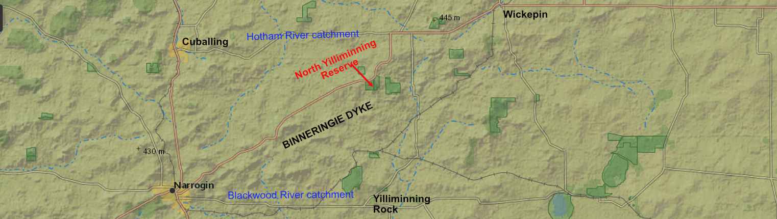
The Binneringie dyke is the catchment divide between the Hotham and Blackwood river catchments
I didn't explore this reserve for years because initial forays showed a landscape that hadn't been burnt for decades. I saw areas littered by dead sheoaks, and bare areas because fire dependant plants had died out.
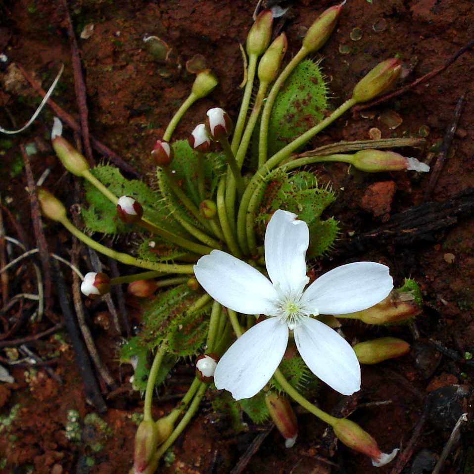
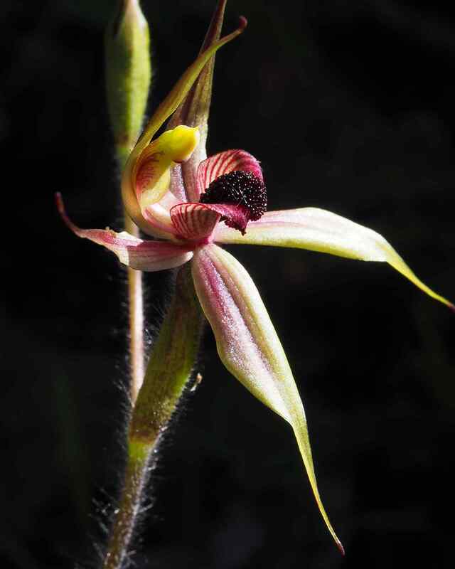
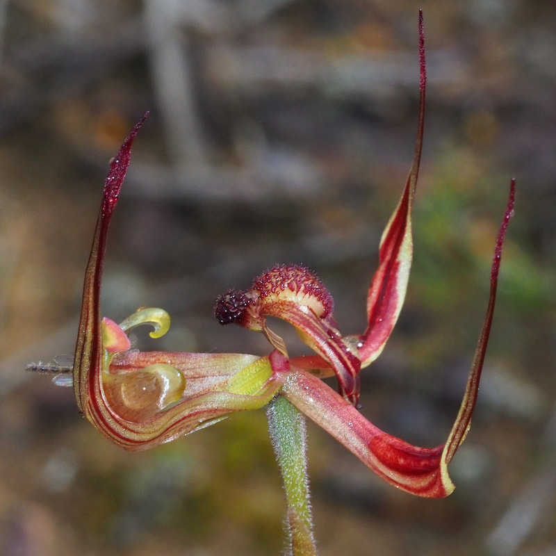
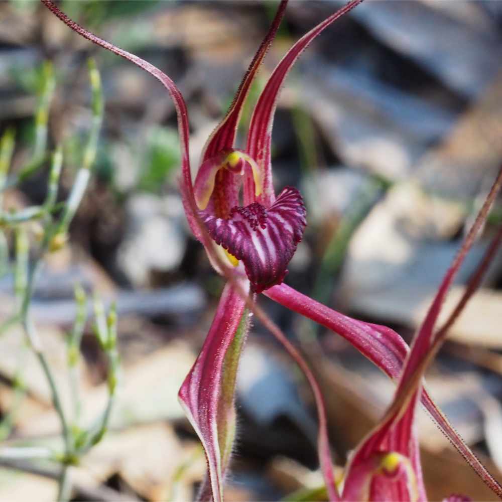
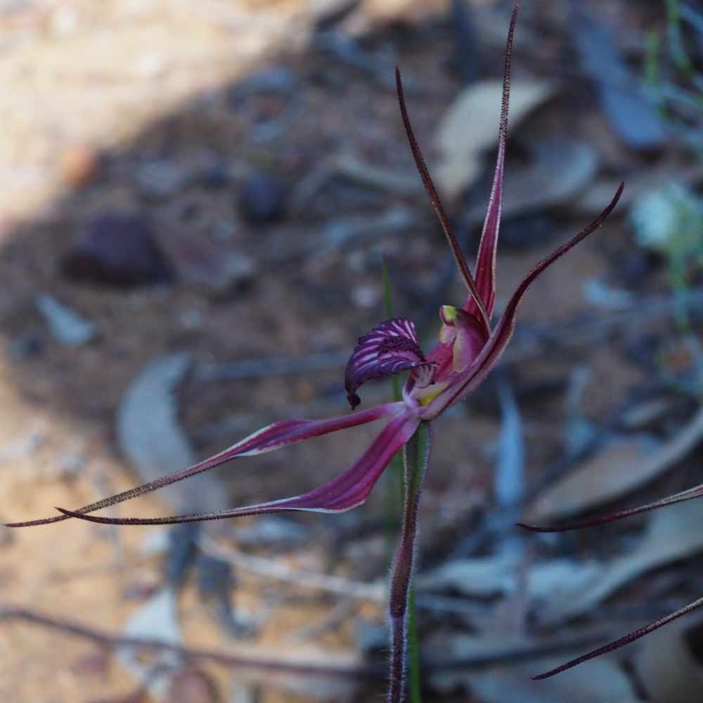
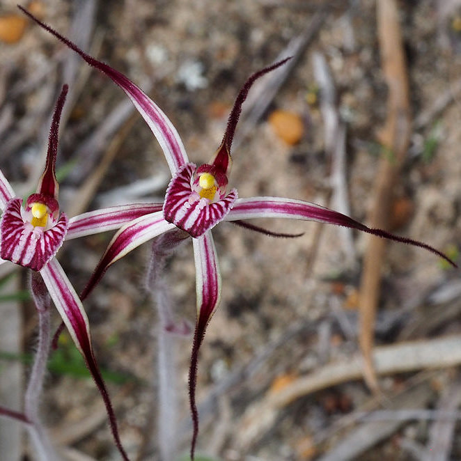
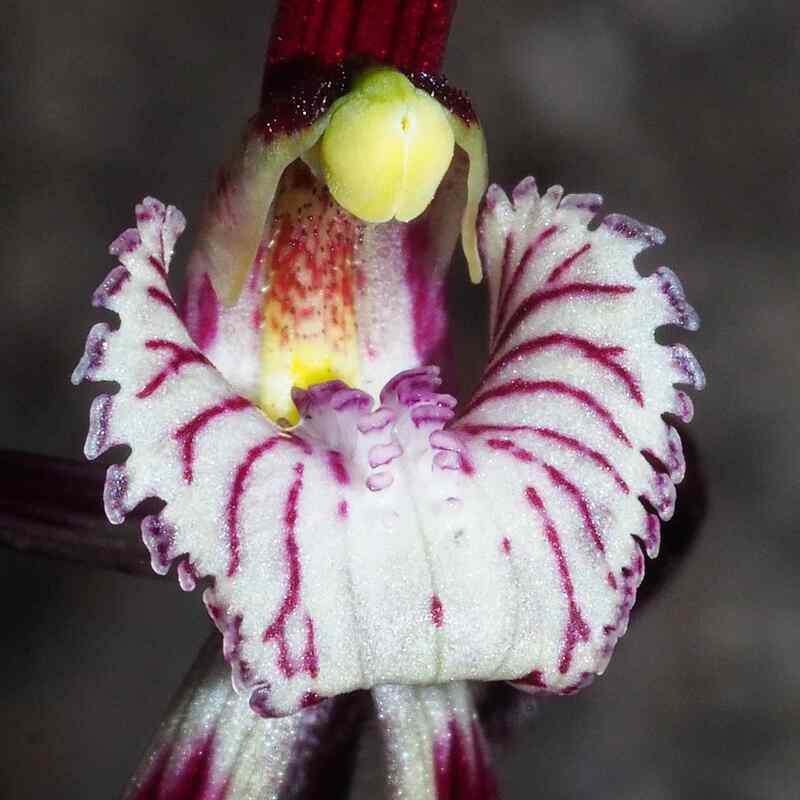
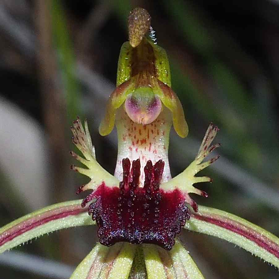
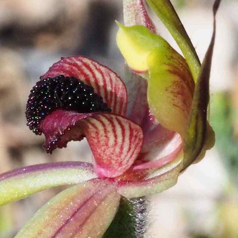
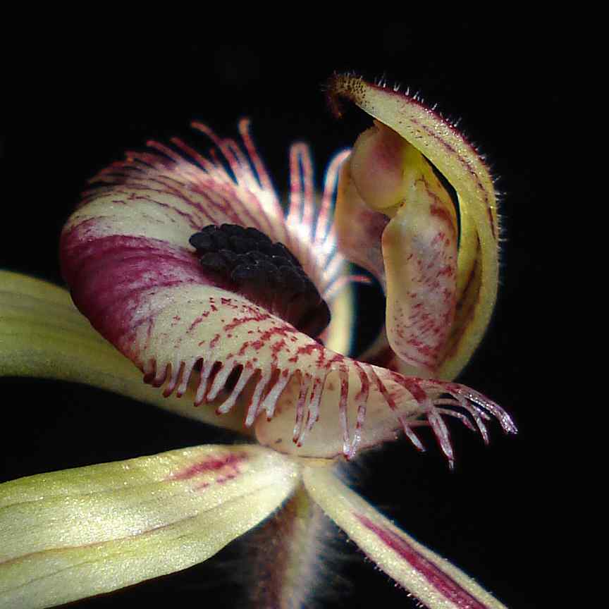
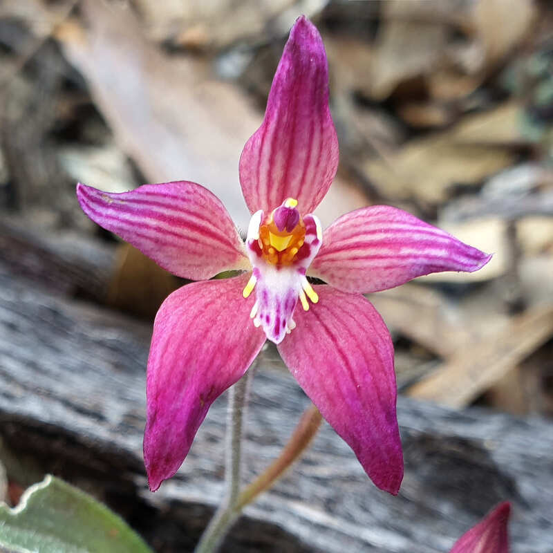
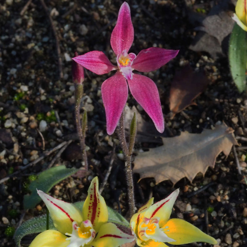
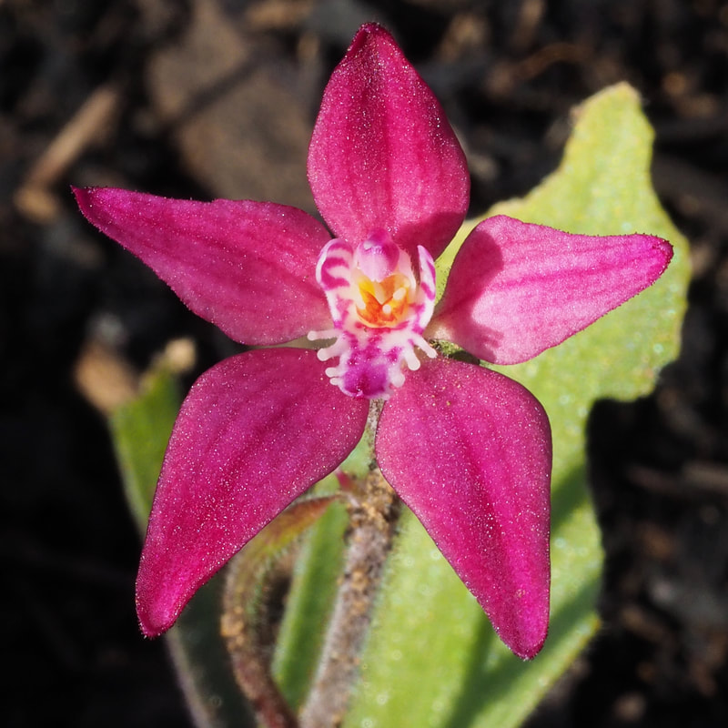
This changed in 2021 when I discovered the wide range of Cowslip /Little Pink Fairy orchids, which have multiple forms and colours. There was a devastating bushfire in 2022, and it is well worth visiting the reserve to see the amazing wildflower regeneration.
This blog shows the large number and range of hybrids at this reserve.
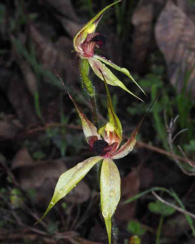
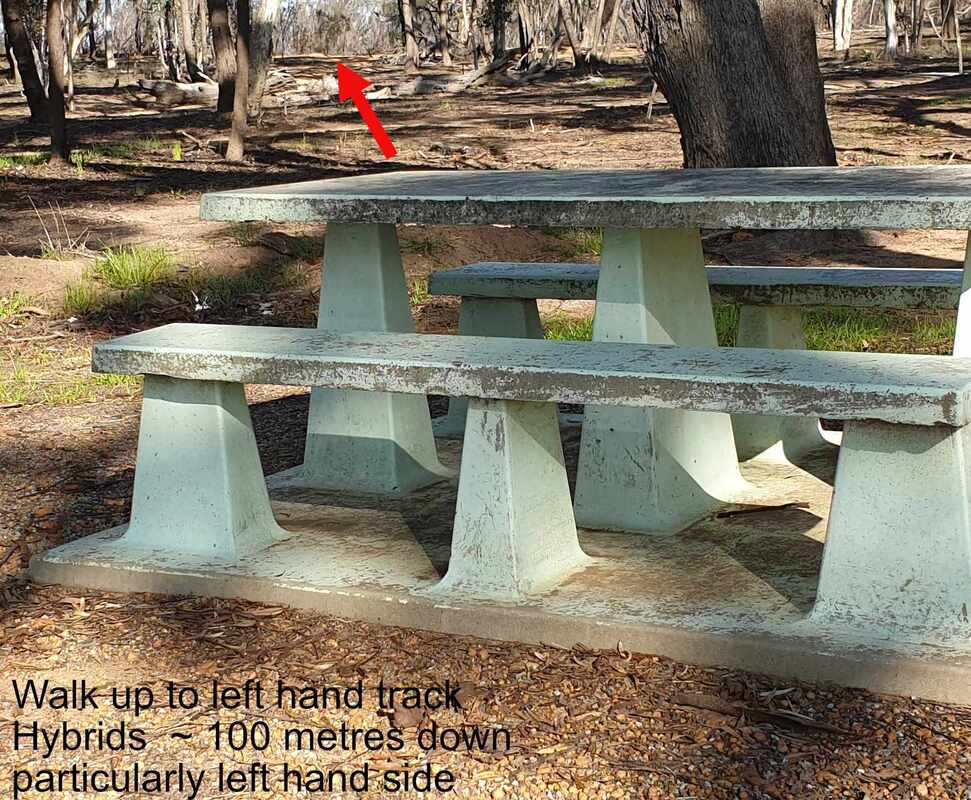 Arrow shows track to hybrid location from picnic area
 The best time to see the hybrids is about the third week of August and early September depending on the season. Interior track have been blocked following the March 2022 severe fire.
To see them park in the parking bay and walk up the hill from the picnic table to the closed road on the left (eastern) side. The hybrids begin over the ridge on a gentle sandy gravel slope.
Elsewhere these hybrids are uncommon (only two groups in Foxes Lair).
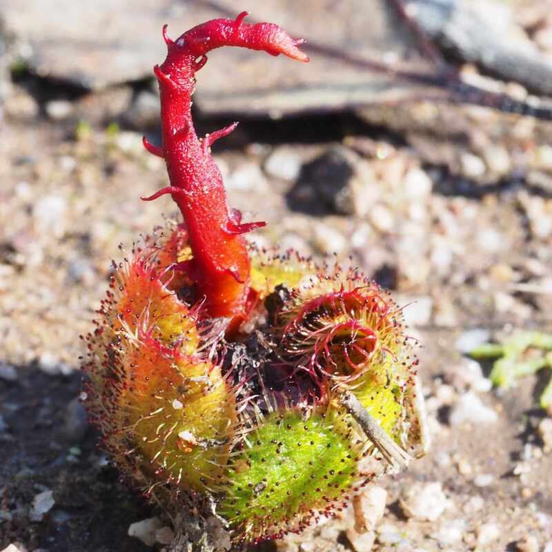
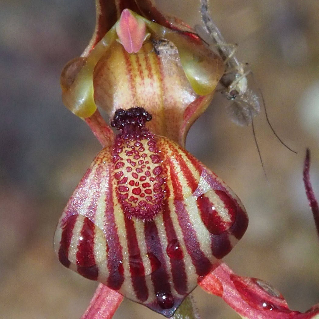
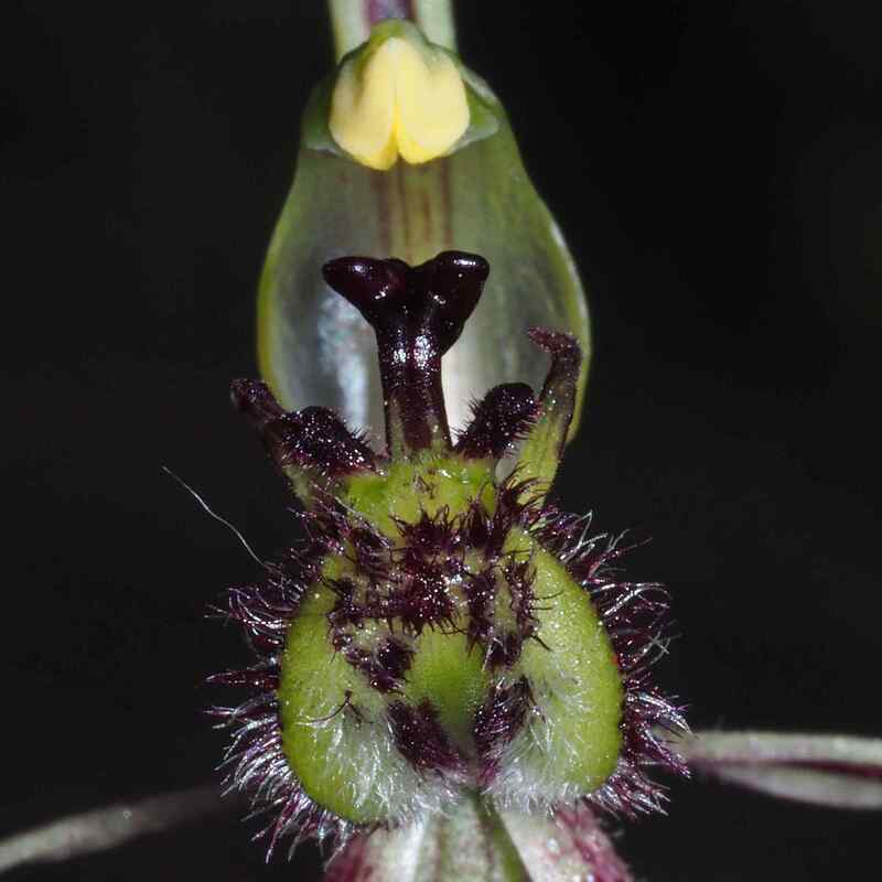
Orchid hybrids tend to be more common in spots where there are lots of one parent and fewer of another. Here cowslip orchids greatly outnumber little pink fairy orchids, and normally flower for much longer. I noticed that hybrids are much more common on shallow sandy gravel slopes, where soils hold less water than deep sands and sands over clay. I think that hybidisation is enhanced by periodic water shortages. which reduce the flowering period in these soils. In drier seasons, the flowering period for the cowslips on these soils is shortened to that of earlier flowering little pink fairy orchids. Here pollinators are more likely to visit both species together and create hybids.
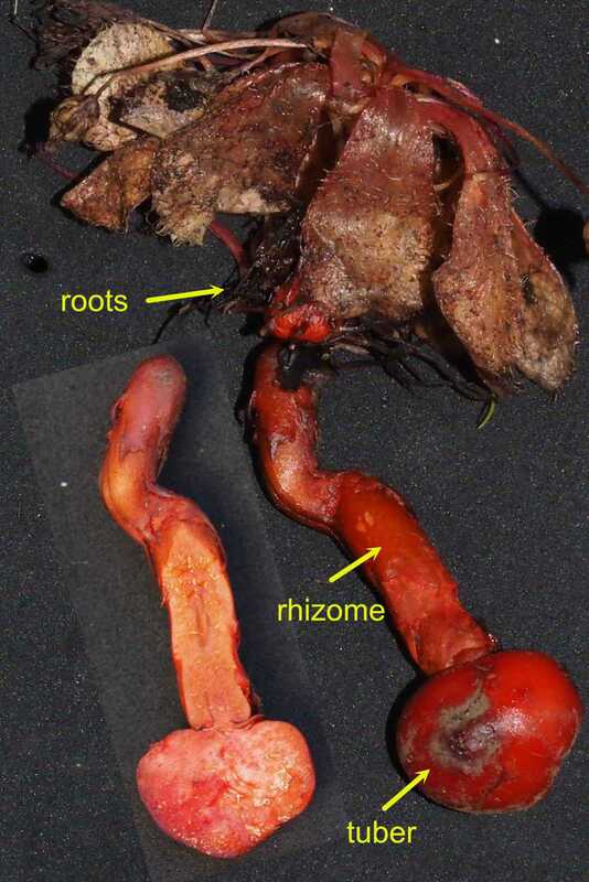
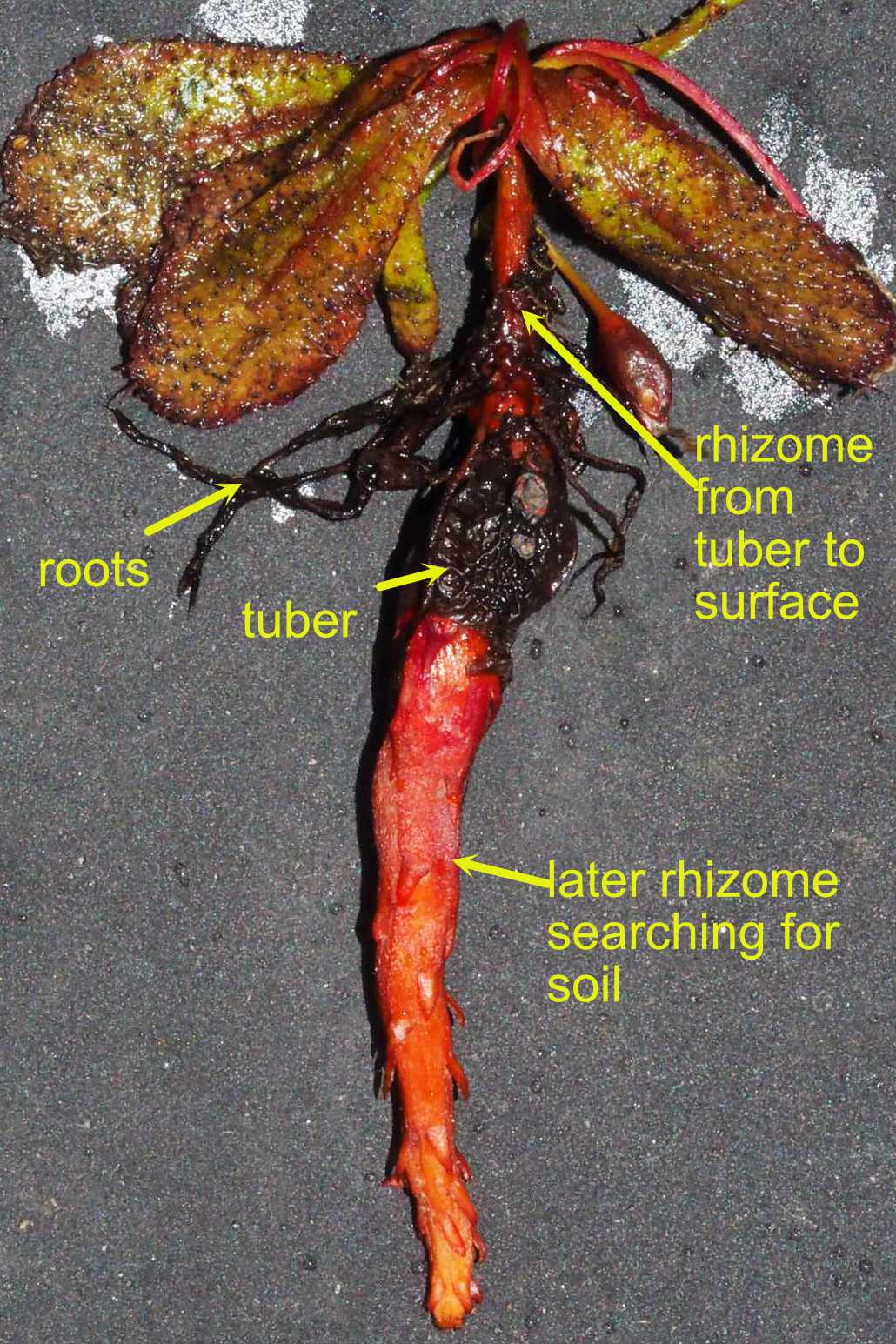
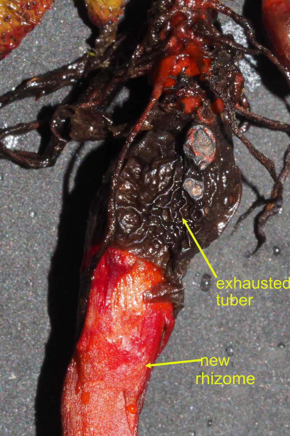
Hybrids are generally sterile, but expand asexually from root tubers into clumps.
To see them park in the parking bay and walk up the hill from the picnic table to the closed road on the left (eastern) side. The hybrids begin over the ridge on a gentle sandy gravel slope.
Elsewhere these hybrids are uncommon (only two groups in Foxes Lair).
Orchid hybrids tend to be more common in spots where there are lots of one parent and fewer of another. Here cowslip orchids greatly outnumber little pink fairy orchids, and normally flower for much longer. I noticed that hybrids are much more common on shallow sandy gravel slopes, where soils hold less water than deep sands and sands over clay. I think that hybidisation is enhanced by periodic water shortages. which reduce the flowering period in these soils. In drier seasons, the flowering period for the cowslips on these soils is shortened to that of earlier flowering little pink fairy orchids. Here pollinators are more likely to visit both species together and create hybids.
Hybrids are generally sterile, but expand asexually from root tubers into clumps.
 |  |  |
I have a good sense of direction and love wandering through observing different patterns of regrowth and associated wildflowers and can use Google maps to find my position (Telstra phone), but some may get lost and stony gravel areas can be a bit hard on the ankles.
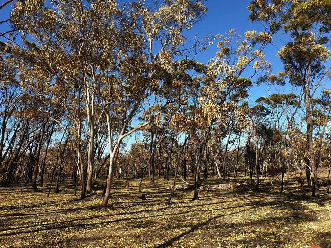
The reserve is underlain by granite bedrock, mostly hidden under pale sandy, gravelly, and ironstone soils. Most of the reserve is a gently sloping upland with old and infertile soils. Topsoils on the ridges are stony and shallow, with white sandy topsoil on lower slopes and valleys. An old vegetation map of the reserve had colourful descriptions, such as 'poor wandoo' and 'useless plants and dryandra'.
Radiometric imagery has produced colours on the coloured photo, which show general soil types. Orange-brown indicates brownish fertile York gum, jam and rock sheoak soils. Green indicates gravels. Darker colours indicate paler and deeper sand.
A breakaway following the highway on the northern edge of the reserve is a contact zone between dolerite to the north (fertile york gum farm land), and granite (sandy soils) to the south. The breakaway originally has brown mallet and red morrel woodland with sparse understorey at its base and patchy lateritic woodland at the top.
Now, the woodland is a mass of dead trees and vigourous regrowth.
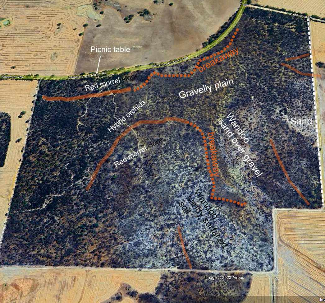 Image of bare soil after fire. Pale = sandy surfaced soil | 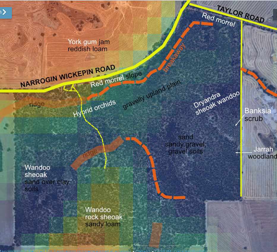 red orange=loam, green=gravel, dark=sand sandy gravel |
 October 2021 | 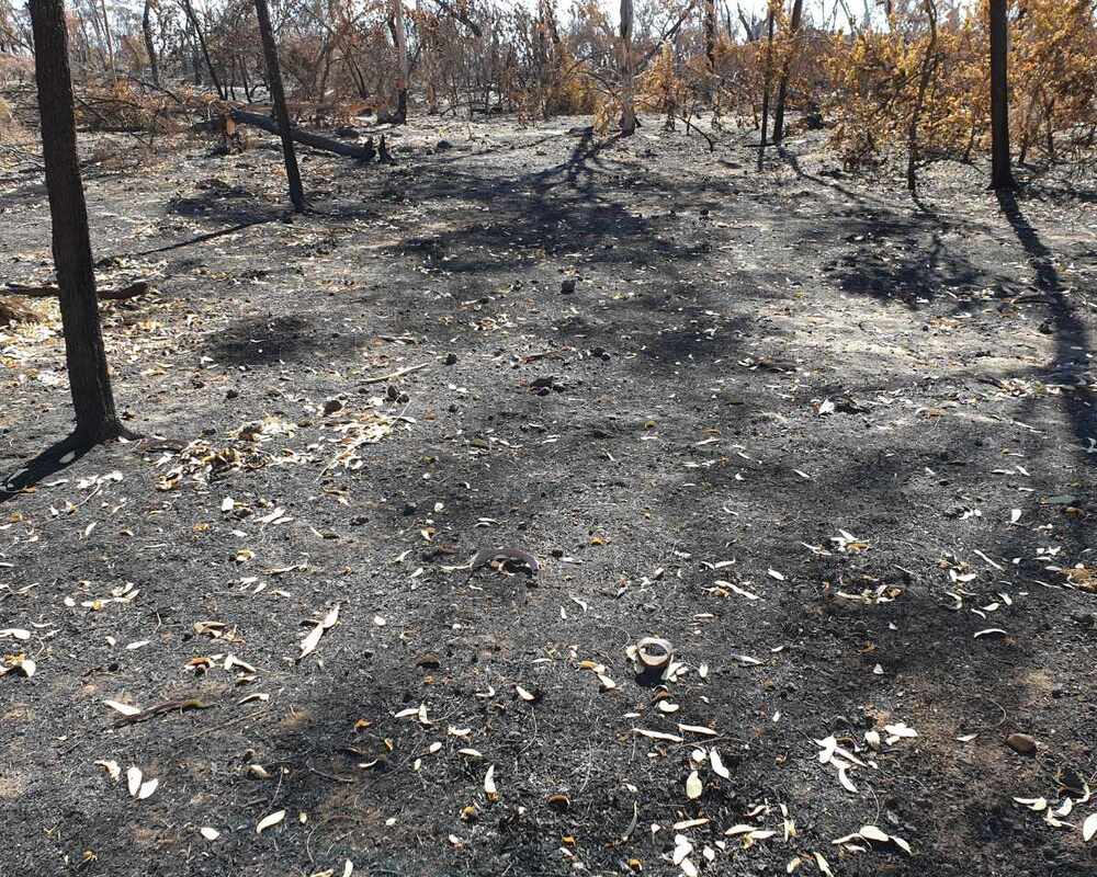 2022 | 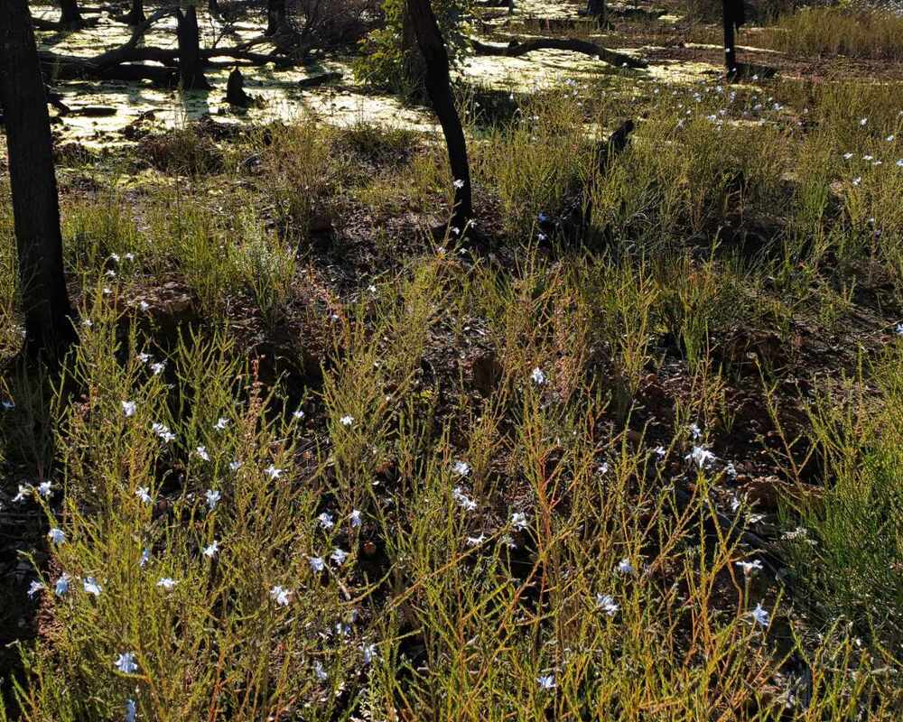 2023 |
There hadn't been a fire here for decades. In some areas before the fire, fallen trees (mostly sheoaks) made walking difficult, and plant diversity was reduced as fire dependant seeders have died out. Wow thing have changed now
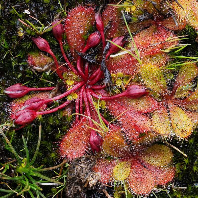
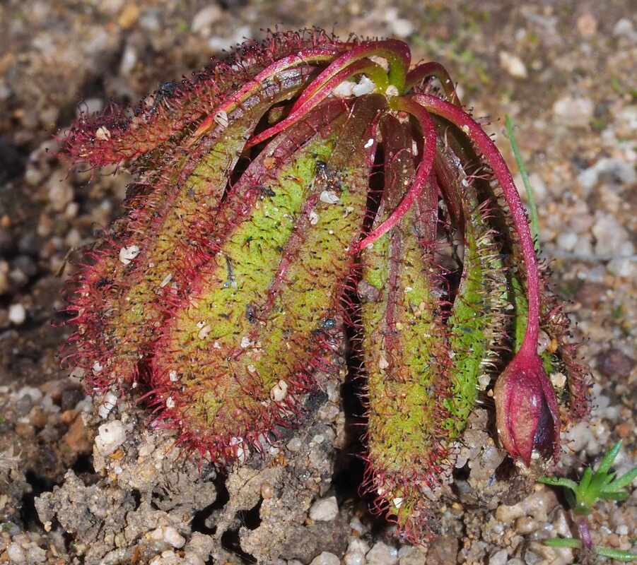
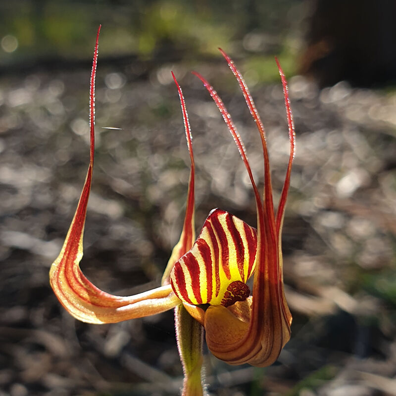
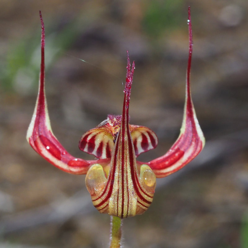
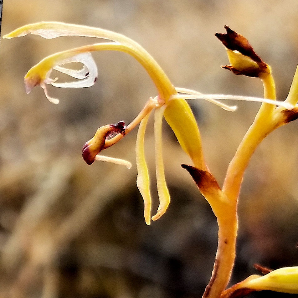
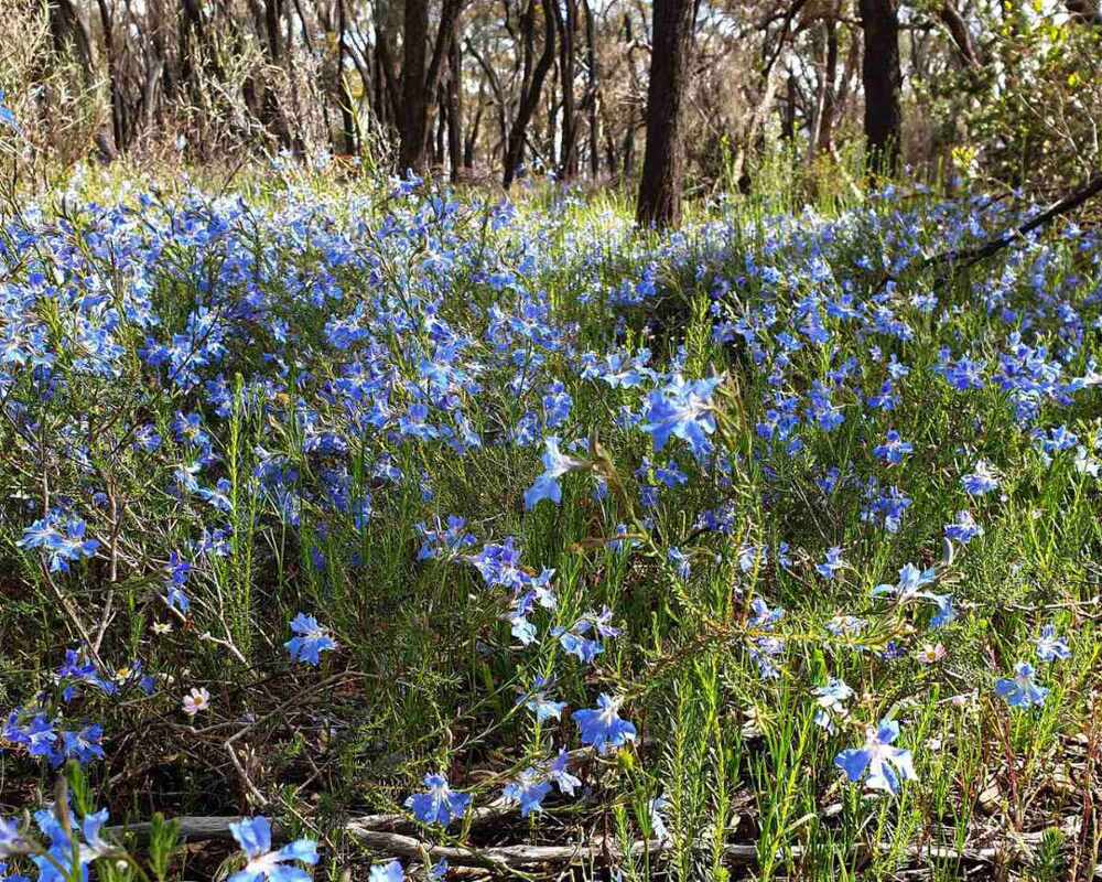
There is attractive bushwalking country. Being a sandy block, there is a multitude of cowslip orchids. Litttle pink fairy orchids also occur with sugar, snail, greenhood, jug, and donkey orchids, and a patch of purple enamel orchids. Unlike many surrounding reserves there are very few spider orchids.
Following images show regeneration in part of the reserve
1on a stony sandy gravel slope on the northen side of the reserves where hybrids are most common.
2 The fire was not so severe in the red morrell valley, which had almost no understorey. It burnt the base of the trees and caused a leaf drop. Many trees have resprouted from the base and understorey seedlings are growing.
 2022 burnt leaves in tree canopy | 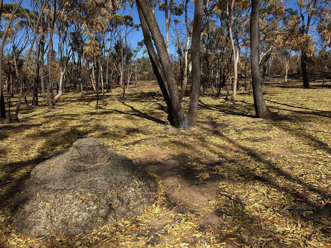 Fallen leaves in April 2022 | 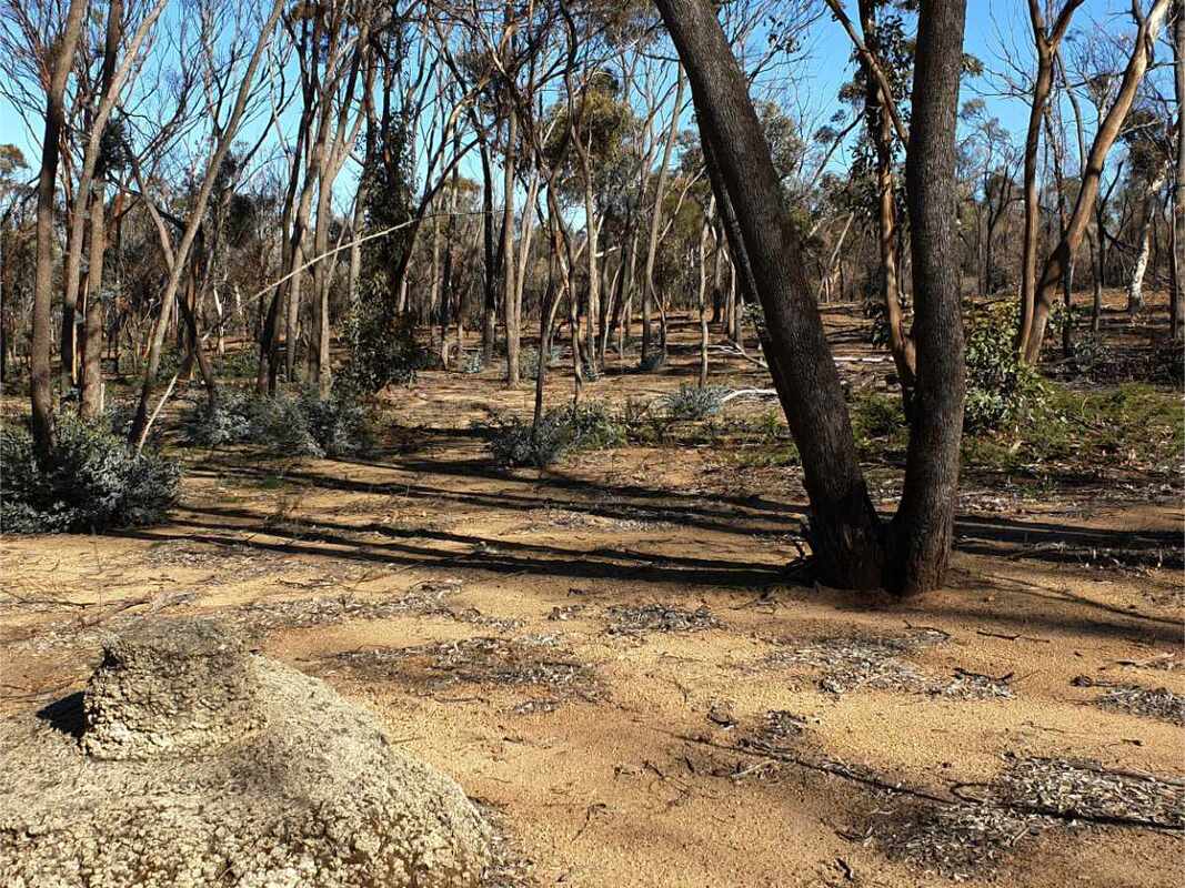 2023 |
3 Wandoo - sheoak woodland on a north-south upland stony, sandy gravel plain bouded by a breakaway to the west was completely incinerated. many burnt wandoos are resprouting and there is a germination of seedlings, which will provide a rejuvenated understorey in a few years.
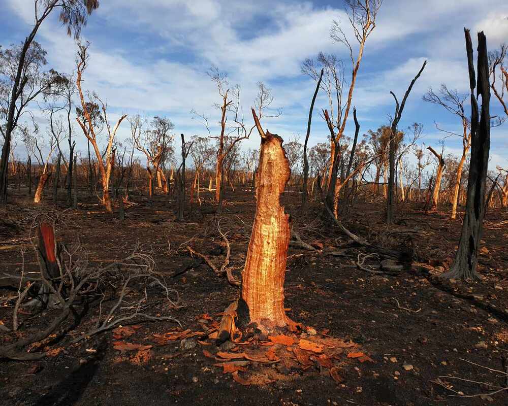 Mesa upland plain devastated 2022 | 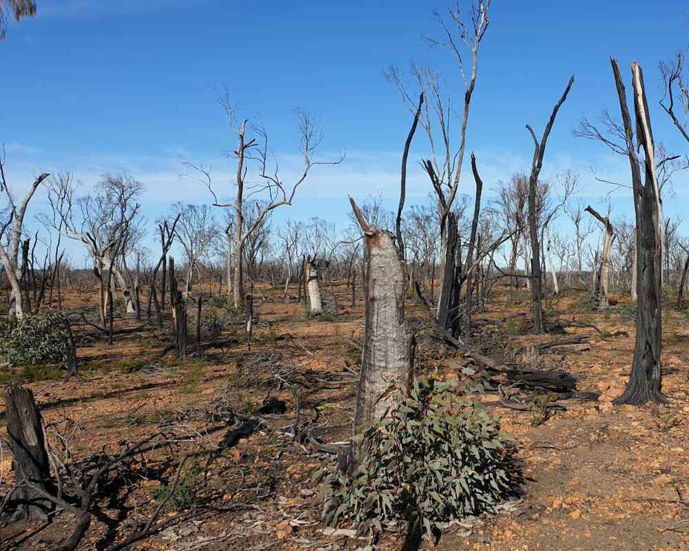 Mesa upland plain regrowth 2023 |
The eastern edge of the reserve has pockets of deep white sandy soil, which supports remnants of more westerly occurring plants. Of particular note are Jarrah, Candlestick Banksia Banksia attenuata, and Christmas Tree Nuytsia florabunda.The understorey containe some lovely plants;- Purple enamel orchids (October), stilit walker triggerplant Stylidium araeophyllum, Eremea pauciflora, and Calytrix flava.
The fire devastated the Jarrah and Banksia woodland, but the understorey is strongly regenerating (unfortunately including some weeds)
The fire devastated the Jarrah and Banksia woodland, but the understorey is strongly regenerating (unfortunately including some weeds)
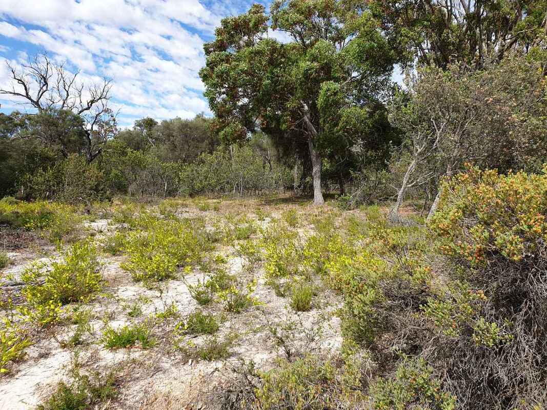 Jarrah grove 2021 | 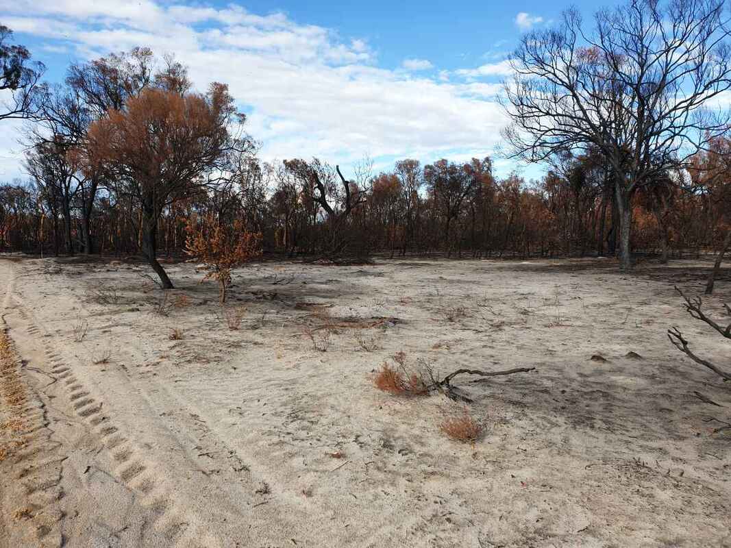 Jarrah grove 2022 | 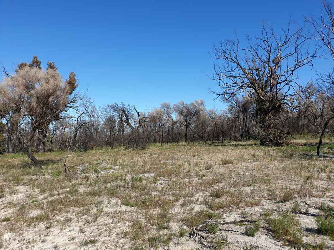 Jarrah grove 2023 |
| |