Greetings fellow Foxies,
This reserve near Tarwonga is not named on any map. The reserve is named after Michael Quinn, one of the pioneering pastoralists in the district, and whose name is preserved in the adjoining Quinn’s Pool.
It is a great area for wildflowers, bushwalking and birds because of so many pristine and varied land and vegetation types, including lovely riverside flats that have mostly been cleared for agriculture. It also contains part of an old bullock wagon trail from Wagin to Williams via camping spots at pools on the way.
About half was surveyed and fenced for agriculture but luckily not cleared. A small block was subsequently designated as a mallet reserve.
Now for the bad news. Most of the entry tracks and some internal ones cross waterways that are too deep and boggy for all but experienced four-wheel drive owners. I found a way in from Tarwonga Road, but one needs to drive on to a fairly steep road cutting to enter. OK if you have confidence and a car like my 2WD-ute that can handle the odd scratch from track-side vegetation. I also take an extra jack and recovery tracks in case I get bogged. Mobile phone reception is poor on the flats. It is a long walk to neighbouring farms, and 27kms to Narrogin.
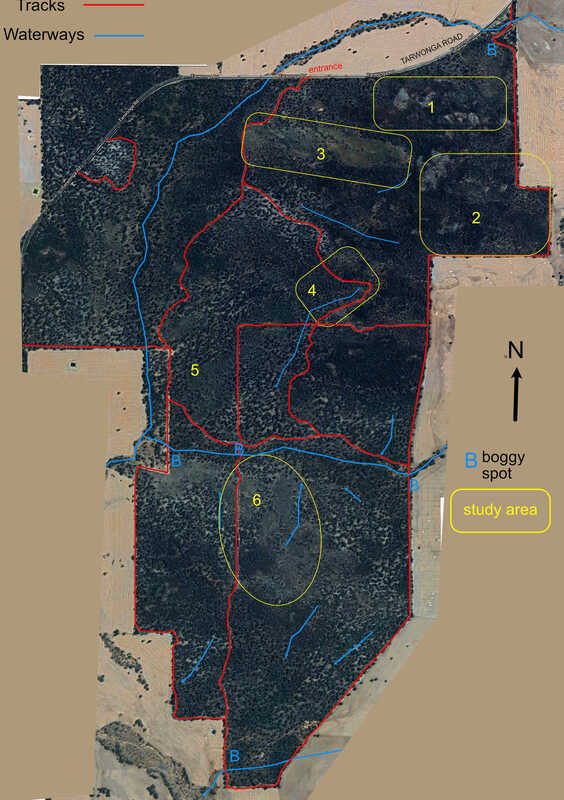
There is a lot more to see that can be managed in one trip. I really enjoyed the frequent changes in landscape, views and vegetation while wandering through the bush. Numbers below indicate my favourite spots so far. Definitely returning next spring.
This reserve near Tarwonga is not named on any map. The reserve is named after Michael Quinn, one of the pioneering pastoralists in the district, and whose name is preserved in the adjoining Quinn’s Pool.
It is a great area for wildflowers, bushwalking and birds because of so many pristine and varied land and vegetation types, including lovely riverside flats that have mostly been cleared for agriculture. It also contains part of an old bullock wagon trail from Wagin to Williams via camping spots at pools on the way.
About half was surveyed and fenced for agriculture but luckily not cleared. A small block was subsequently designated as a mallet reserve.
Now for the bad news. Most of the entry tracks and some internal ones cross waterways that are too deep and boggy for all but experienced four-wheel drive owners. I found a way in from Tarwonga Road, but one needs to drive on to a fairly steep road cutting to enter. OK if you have confidence and a car like my 2WD-ute that can handle the odd scratch from track-side vegetation. I also take an extra jack and recovery tracks in case I get bogged. Mobile phone reception is poor on the flats. It is a long walk to neighbouring farms, and 27kms to Narrogin.
There is a lot more to see that can be managed in one trip. I really enjoyed the frequent changes in landscape, views and vegetation while wandering through the bush. Numbers below indicate my favourite spots so far. Definitely returning next spring.
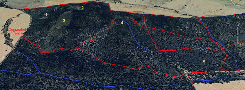
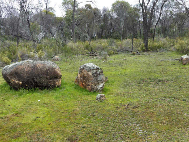
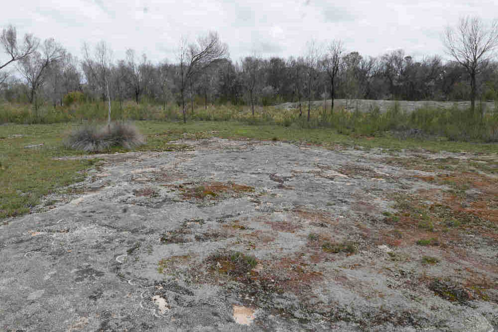
Area 1 can be accessed by a short walk through sheoak woodland to clear “islands” of shallow granite.
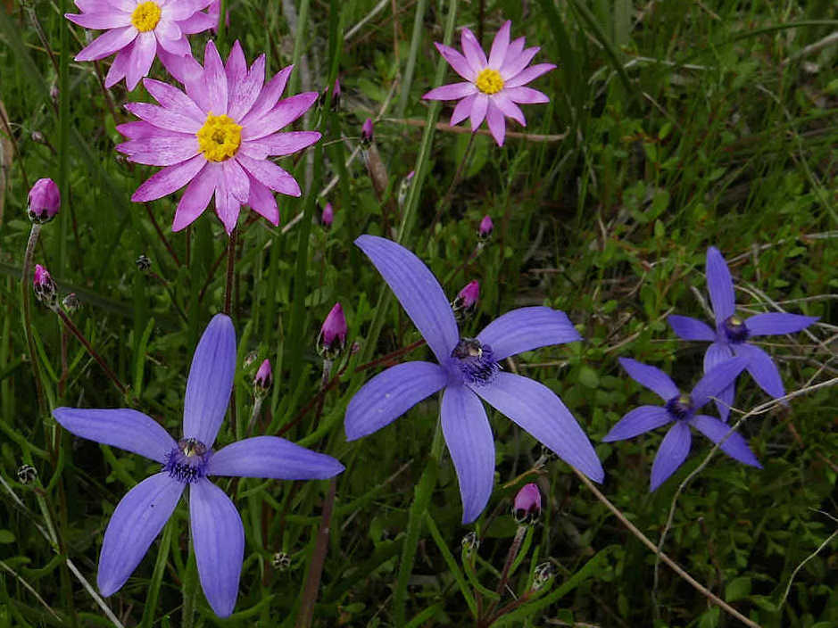
This is a delightful area in August/September. I found blue fairy orchids, lemon scented sun orchids growing amongst wetland plants and everlastings.
This is a delightful area in August/September. I found blue fairy orchids, lemon scented sun orchids growing amongst wetland plants and everlastings.
 |  |
Area 2 comprises the granite outcrops and mallet ridges further up on the crest of the hill. Walking up to it from area 1 can be a challenge due to dense regrowth of Acacia celastrifolia (great flowers in August). If you are tempted to drive directly up from the eastern boundary, there is a creek crossing that I won’t attempt in my ute in winter. Either walk up the firebreak or take a circuitous route from the (hidden) entrance on a road cutting bank further down.The walk in from the firebreak is a bit challenging via mallet ridges and dense growth, but it is worth it. I also found feral pig diggings on red soil here below a line of granite that marked an ancient fault line
 Area 2 upland granite outcrops | 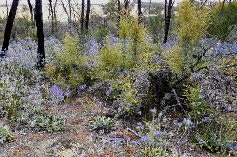 Area 2 laterite rise Dampiera eriocephala November |
Area 3 is a long sandy gravel slope that adjoins area 2, with low breakaways on its southern and eastern edges. This is species-rich kwongan scrub with diverse new growth from a recent fire. Nice view from here, and interesting plants.
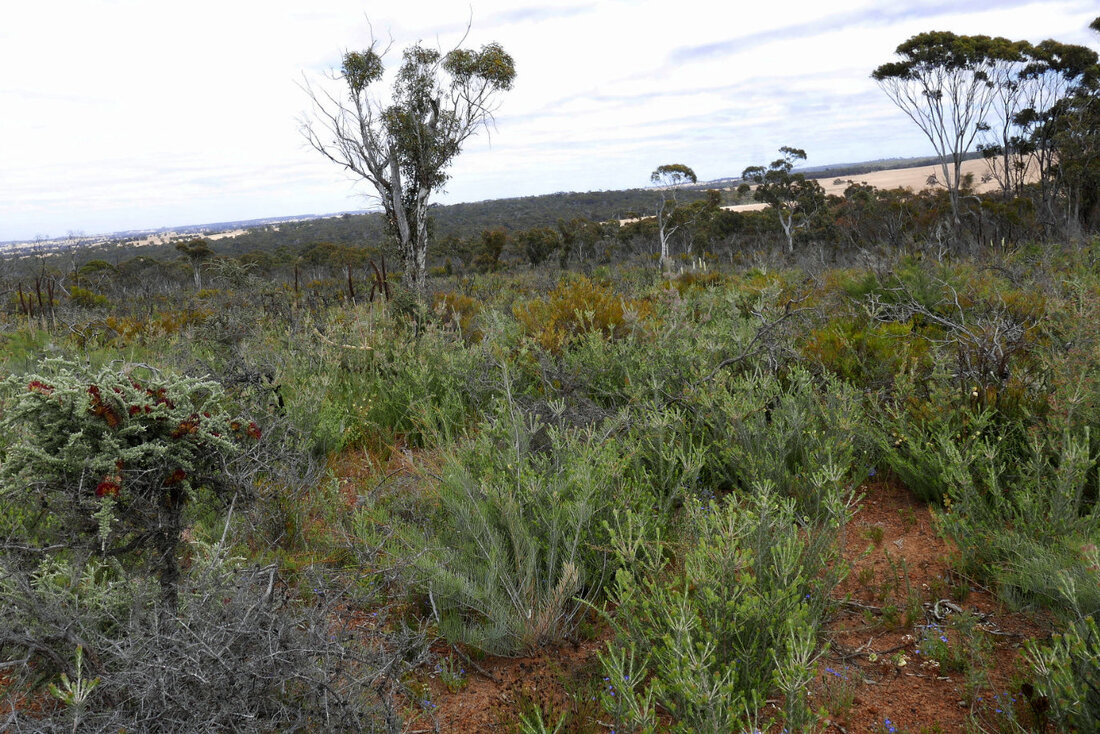 Area 3 sandy gravel slope | 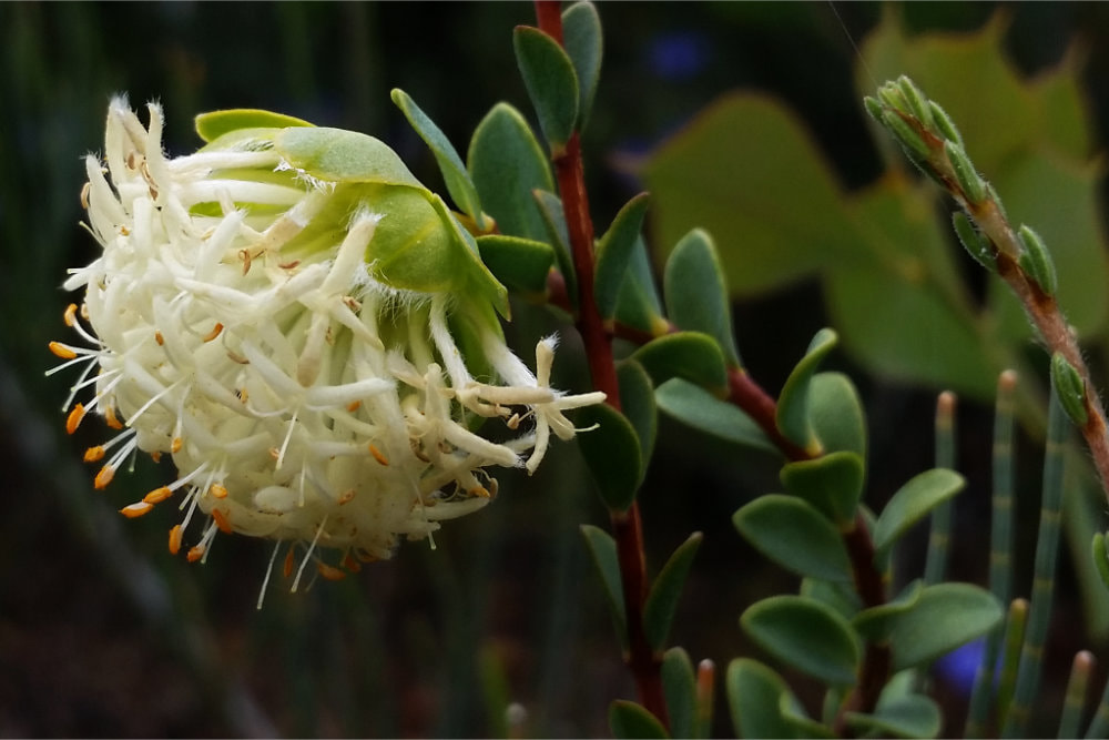 Pimelea sulphurea |
Area 4 is a waterway with shallow rocky soil nestled below mallet breakaways. The track up to it is eroded and a bit rough. Vegetation here is very attractive Calothamnus quadrifidus scrub dotted with Grevillea pinnatifida and Isopogon dubious shrubs. It is a lovely spot to wander around and explore
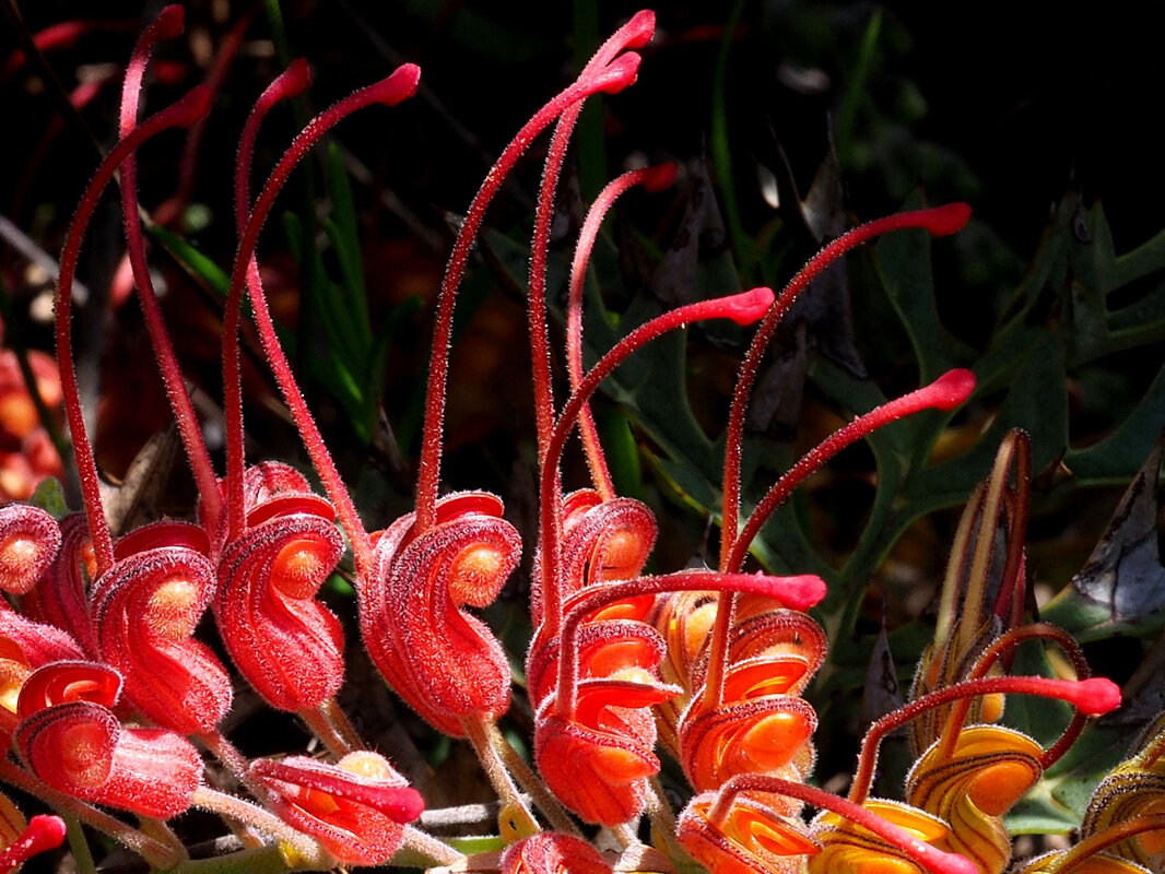 Grevillea bipinnatifida | 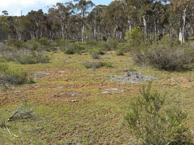 Area 4 open shrubland in waterway |
Area 5 comprises gentle slopes and flats surrounding the two major waterways. This varies from orchid-rich shrubby sheoak and wandoo woodland, open wandoo woodland on sandy duplex soils to sand over gravel over clay open kwongan with patches of mallee. Pleasant country to have a picnic and walk around looking for orchids
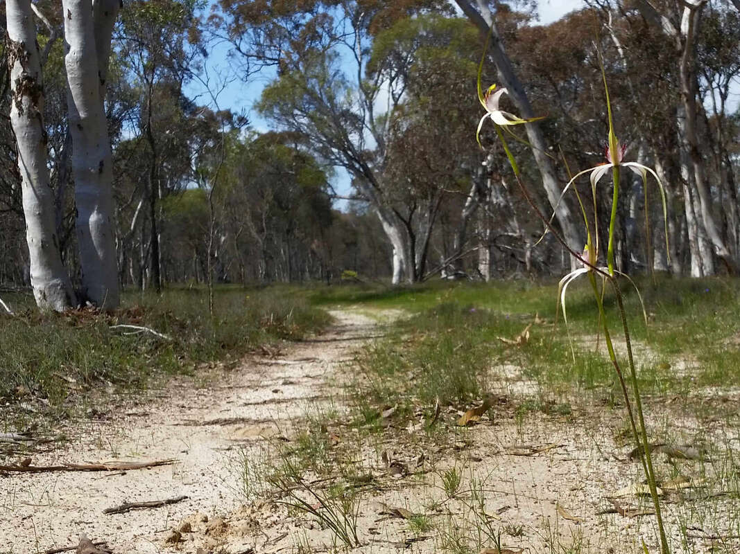 Caladenia longicauda Stark white spider orchid | 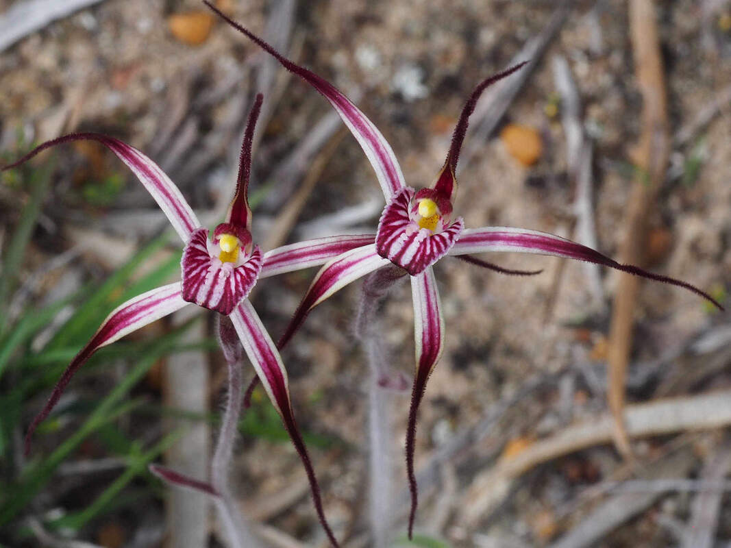 Caladenia polychroma Joseph's spider orchid |
| Area 6 is the south road up the hill and surrounds, south of the east/west waterway. The waterway crossing is deep and flows in winter. Its best to walk from here in the growing season. The open rush-covered area is a water gaining plain that curves roughly around the slope to the east. As there is no waterway it probably indicates underlying quartz rich granite. Despite the rushes the deep sandy duplex soil doesn’t seem to get waterlogged, making it ideal for the route of the old bullock cart trail. From Quinns Pool, sandalwood cutters on the Williams-Dumbleyung trail probably went to Ballagin Pool to water stock and camp. | 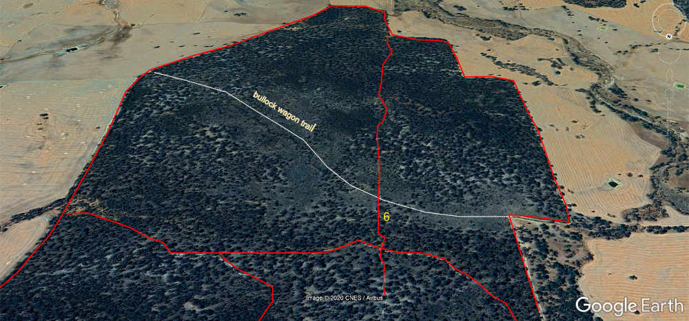 Southern end of reserve showing Area 6 |
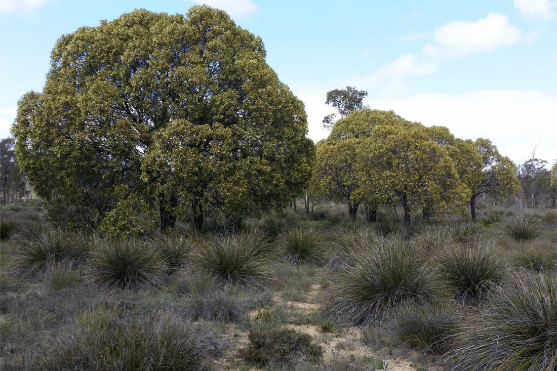
isolated quandongs on area 6 sandy plain