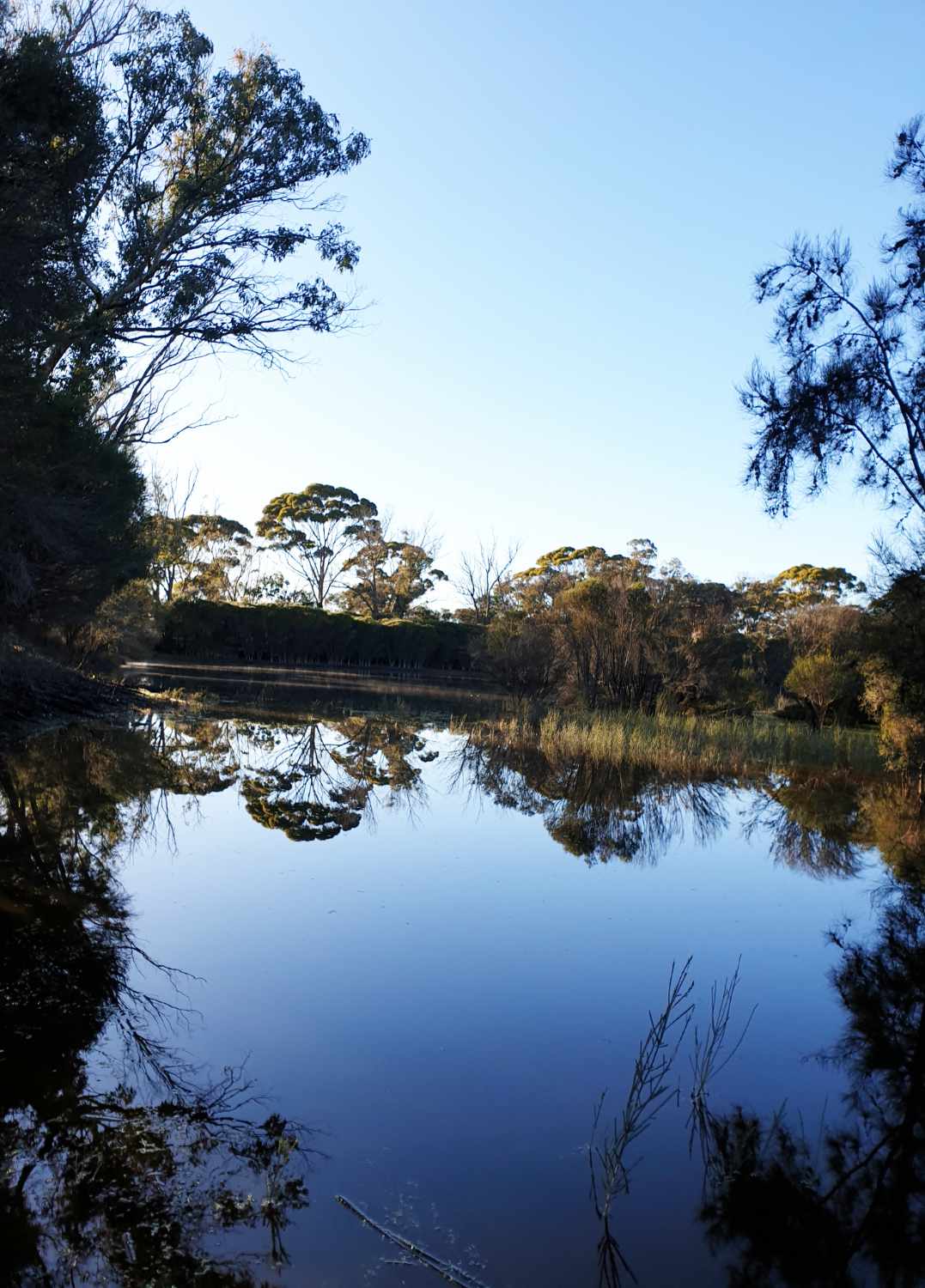
- This dam is the best picnic spot in summer
- 24 kilometres north of Narrogin
- Gas BBQ, picnic tables,toilet
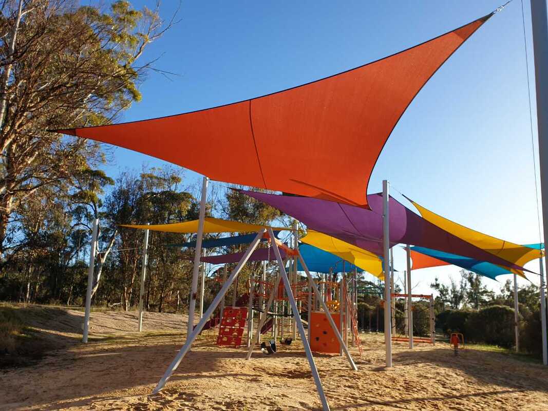
- Children's playground
- 2 Walk trails, mountain bike, cycling trails
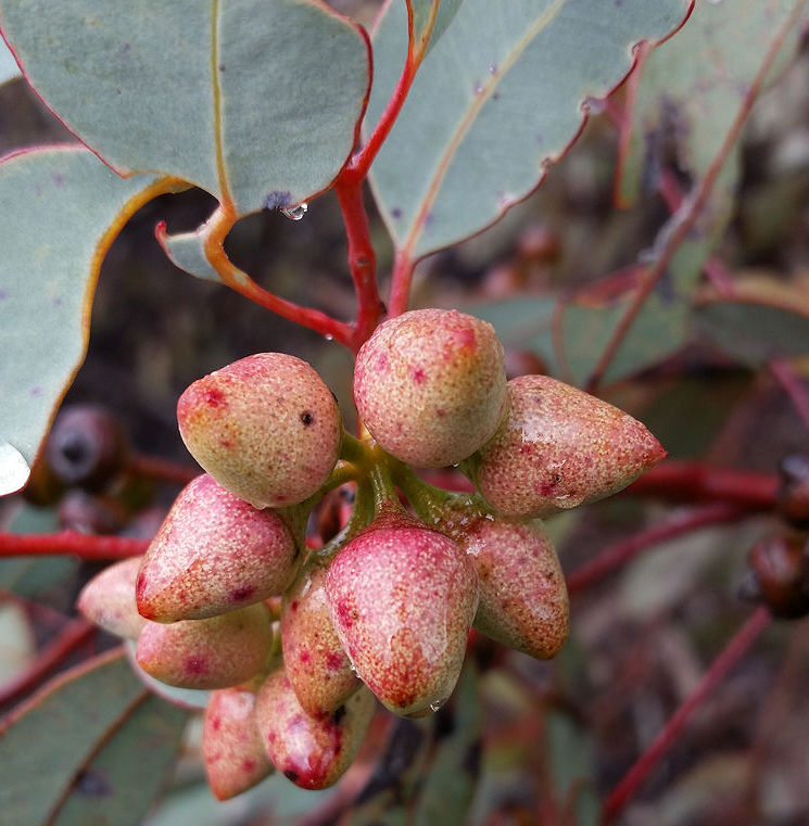
- Wildflowers, birds, wildlife
- Trail bikes, camping and fires are not permitted
- Dogs on leash
Yornaning Dam is on the Yornaning West Road between Cuballing and Popanyinning (20kms from Narrogin on the Great Southern Highway)
Yornaning dam reserve is a great ecotourist stop. With picnic tables, gas BBQ and playground beside the scenic Yornaning dam, this is the best spot for a picnic in hotter months. This is an excellent place for easy bushwalking, cycling, wildlife and bird watching, and winter/spring wildflowers.
This YouTube blog shows the beauty of this spot.
.History
Yornaning was originally one of the most important railway sidings along the Great Southern Railway, as a major water taking stop for the steam engines. On average, 30 passenger and freight trains once passed through Yornaning per week and stations were built to cater for this. Maintenance crew were encouraged to take up land in the township and surveyors named streets in the town after those who did. Yornaning town boasted a school, a post office/ general store, and a railway station with refreshment rooms. You can see the site of the Yornaning school on the right as you drive from the highway turnoff to the dam. Sadly due to faster and more efficient means of transport the decline of the railway was imminent. Many buildings were removed.
Yornaning is a Noongar word meaning ‘many waters’, and the dam has been an important resource in the district. It was built in 1896 to provide water for steam locomotives on the Albany/Perth railway.
When the water became brackish, local farmer Robert Henderson used dynamite from his mining days to blast a diversion bank that diverted salty Cuballing creek water from the dam. Up until 1958 the dam was one of the most reliable and freshest regional water sources, and up to 3 trainloads of water went to Narrogin daily for domestic use in dry seasons.
When diesels replaced steam locomotives and Wellington dam water was piped to Narrogin in 1954, the dam fell into disuse and gradually became polluted and saline.
In a Cuballing Land Conservation District initiative, The Cuballing shire and local farmers with technical assistance from Murdoch University completely renovated the dam and installed facilities.
In recent years volunteers and the shire have done a great deal of work upgrading facilities and planting trees.
This brochure provides a concise summary of features and attractions for visitors
| yornaning_dam_brochure_2024.pdf |
The dam is situated on the north east of excellent uncleared bushland. The section south of Yornaning Road is predominantly a gentle valley of open wandoo woodland with some kwongan sandy gravel heath patches at the eastern end.
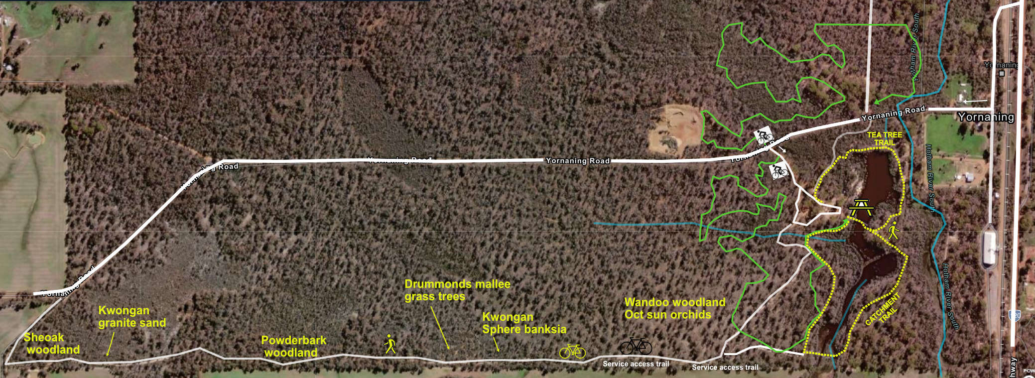
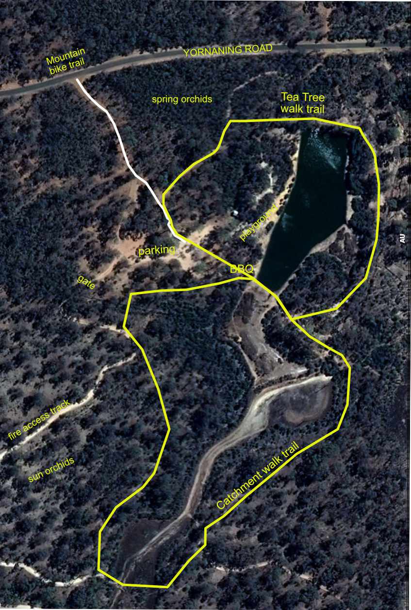
WalkTrails
Two grade 2 walk trails begin and end at the BBQ.
• Tea Tree trail
A 500-metre easy walk around the dam, which gives a view of the dam and its resident birds and turtles in the water and fringing tea tree bush shrubs. Look for wildflowers in the wandoo-rock sheoak woodland from July to October.
• Catchment Trail
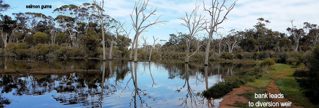
A 1.2km walk, which passes the diversion dam that separates fresh and saline water and tall Salmon Gum Forest before entering Wandoo / Rock Sheoak woodland. Salmon gums can be confused with large wandoos, but differ in having shiny leaves (wandoos are dull), and layered foliage (wandoos bunchy).
Wandoo woodland is good country for spotting Rufous Tree Creepers.
In late September- Early October look for beautiful yellow Custard Orchid and pink Verticordia flowers.
Two grade 2 walk trails begin and end at the BBQ.
• Tea Tree trail
A 500-metre easy walk around the dam, which gives a view of the dam and its resident birds and turtles in the water and fringing tea tree bush shrubs. Look for wildflowers in the wandoo-rock sheoak woodland from July to October.
• Catchment Trail
A 1.2km walk, which passes the diversion dam that separates fresh and saline water and tall Salmon Gum Forest before entering Wandoo / Rock Sheoak woodland. Salmon gums can be confused with large wandoos, but differ in having shiny leaves (wandoos are dull), and layered foliage (wandoos bunchy).
Wandoo woodland is good country for spotting Rufous Tree Creepers.
In late September- Early October look for beautiful yellow Custard Orchid and pink Verticordia flowers.
Diversion lagoon on the Catchment Walk. A pipe at the end of this lagoon removes low water flows that tend to be more saline and polluted. When the water level rises it flows over a weir on the right into the dam. This is an excellent water bird watching spot in winter/spring.
| A service access road (5.6km return), which starts at the gate at the parking enables walkers and bike riders to see changes in vegetation type and associated wildflowers on the reserve’s southern boundary. Distance from gate 1.2km Trees have given way to a patch of kwongan shrubland featuring Sphere Banksia Banksia sphaerocarpa. 1.5km Drummonds mallee (Eucalyptus drummondii) and towering Balgas Xanthorrhoea preissii. Do not damage the Balgas as it has taken up to 100 years for the dead needle skirts to form. Check for other flowering proteaceae in spring. 1.6km Note the paler green leaves of the Stalked Mistletoe Anyema miqueli in the powderbark foliage ahead. If you look closely you can see the club shaped attachments where the mistletoe is attached. Bright red flowers in February/March turn into sticky sweet berries. 1.7km Powderbark (Eucalyptus accedens) woodland at the top of the slope on water repellent gravel and drooping bitter quandong bushes. Note the powderbark on the fenceline that was ringbarked many decades ago and has produced five new stems from the base. | 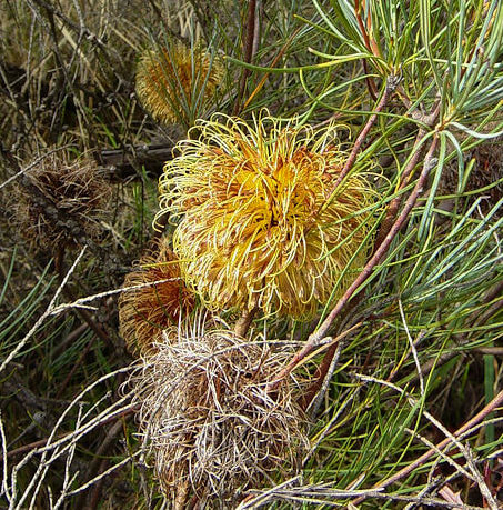 Banksia sphaerocarpa 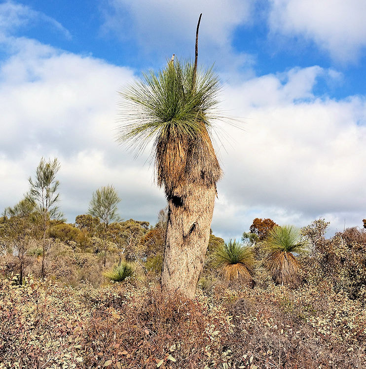 Balga over dwarf Drummonds Mallee  Mistletoe on powderbark |
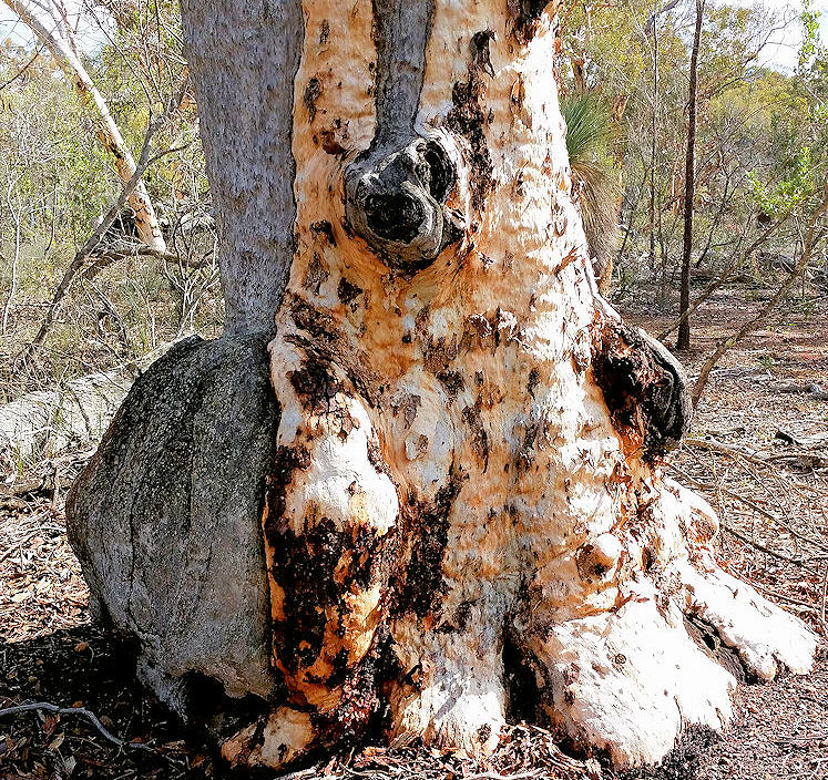 ancient powderbark trunk | 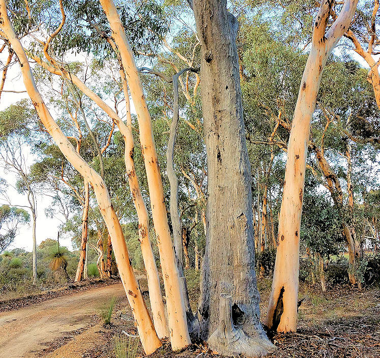 note axe marks on ringbarked dead trunk |
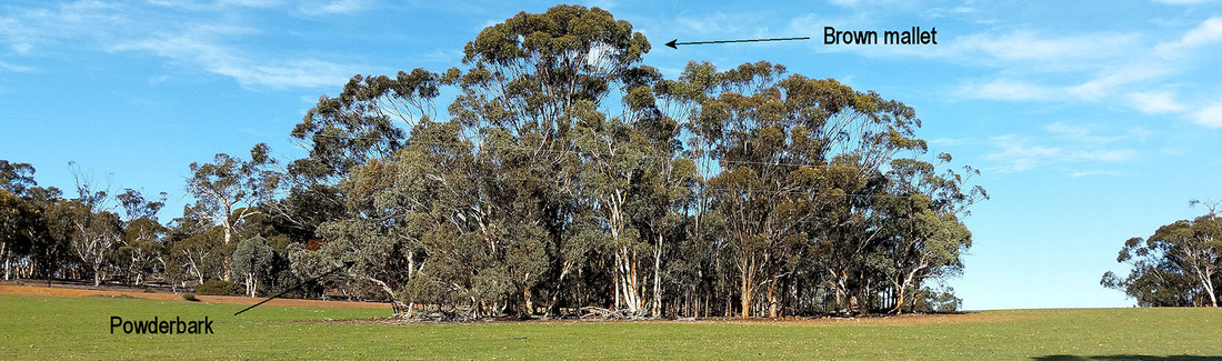
2.1 km. Remnant vegetation patch in the paddock on the left. You can see the shiny leaves and distinctive Y-shaped branches of the brown mallet Eucalyptus astringens that is common on breakaway slopes. Powderbarks have bunchy branches with dull leaves like wandoos.
2.5km Granitic sandy ridge with attractive low shrubs and scattered rock sheoak plants. Red flowering Calothamnus quadrifidus in October/November
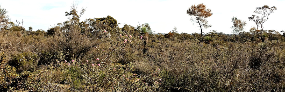
As you move further downslope, note the line of balgas as the soil changes to wandoo woodland. Check here for orchids.
2.9km Turn right at T-junction to walk back via the Yornaning West Road or return the way you came.
2.9km Turn right at T-junction to walk back via the Yornaning West Road or return the way you came.
 Drummonds mallee buds | 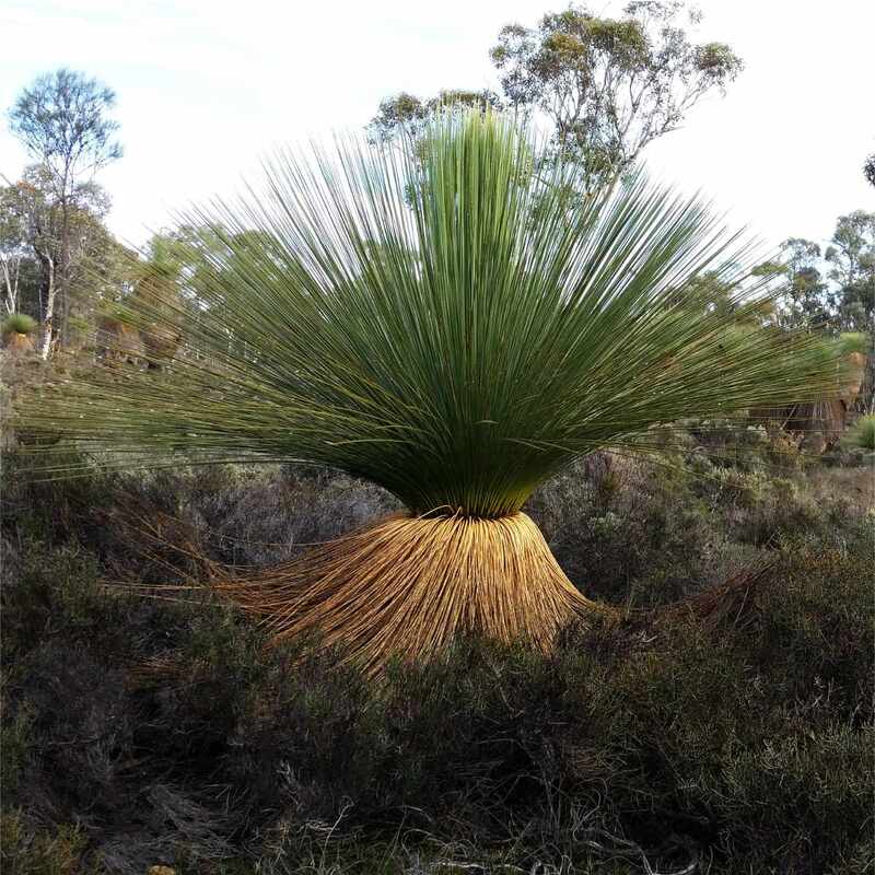 Balga |
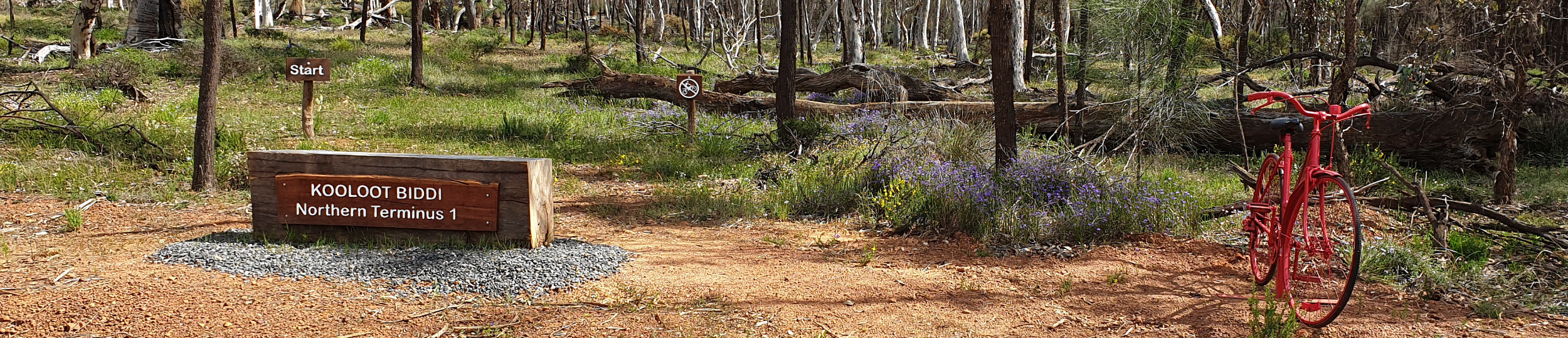
Mountain Bike Trails
3.7km northern and 890 metre southern mountain bike trials start near the turnoff from Yornaning Road to the dam
These one-way trails are not a typical manicured track. Do not expect to follow a well-defined track, riders need to adjust and follow white markers.
3.7km northern and 890 metre southern mountain bike trials start near the turnoff from Yornaning Road to the dam
These one-way trails are not a typical manicured track. Do not expect to follow a well-defined track, riders need to adjust and follow white markers.